Arkiv - dato
Arkiv - aktivitet
-
Annen tur (3)
- Kajakkpadling (3)
- Fottur (1735)
-
Kjøretur (9)
- Biltur (9)
-
Skitur (109)
- Fjellskitur (65)
- Langrennstur (44)
-
Sykkeltur (106)
- Blandet sykling (25)
- Gatesykling (81)
Lister jeg samler etter
-
Utvalgte topper og turmål i Bergen
(330/331)
 99%
99% -
Alle topper i Bergen
(378/385)
98%
-
Kvam ≥ 100m pf.
(41/44)
93%
-
Opptur Hordaland
(143/159)
89%
-
Voss ≥ 100m pf.
(84/98)
85%
-
Stasjoner på Bergensbanen
(28/36)
77%
-
Hordaland ≥ 100m pf.
(585/863)
67%
-
Ulvik ≥ 100m pf.
(24/38)
63%
-
Dagsturhyttene i Vestland
(33/61)
54%
-
Sunnhordland PF >= 100m
(99/186)
53%
-
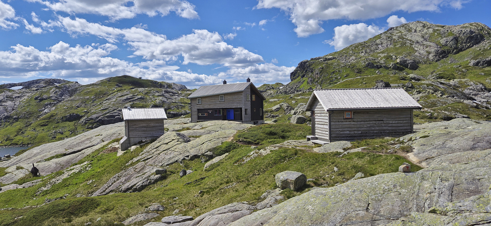
DNT-hytter i Hordaland
(22/45)
48%
-
Jondal ≥ 100m pf.
(11/23)
47%
-
Hordaland: Hardanger PF>=100m
(162/359)
45%
-
Kvinnherad ≥ 100m pf.
(35/79)
44%
-
Sogndal ≥ 100m pf.
(23/81)
28%
-
DNT-hytter i Sogn og Fjordane
(8/47)
17%
-
Eidfjord ≥ 100m pf.
(6/42)
14%
-
Etne ≥ 100m pf.
(7/51)
13%
-
Ullensvang ≥ 100m pf.
(15/153)
9%
-
Opptur-topper i Sogn og Fjordane
(17/177)
9%

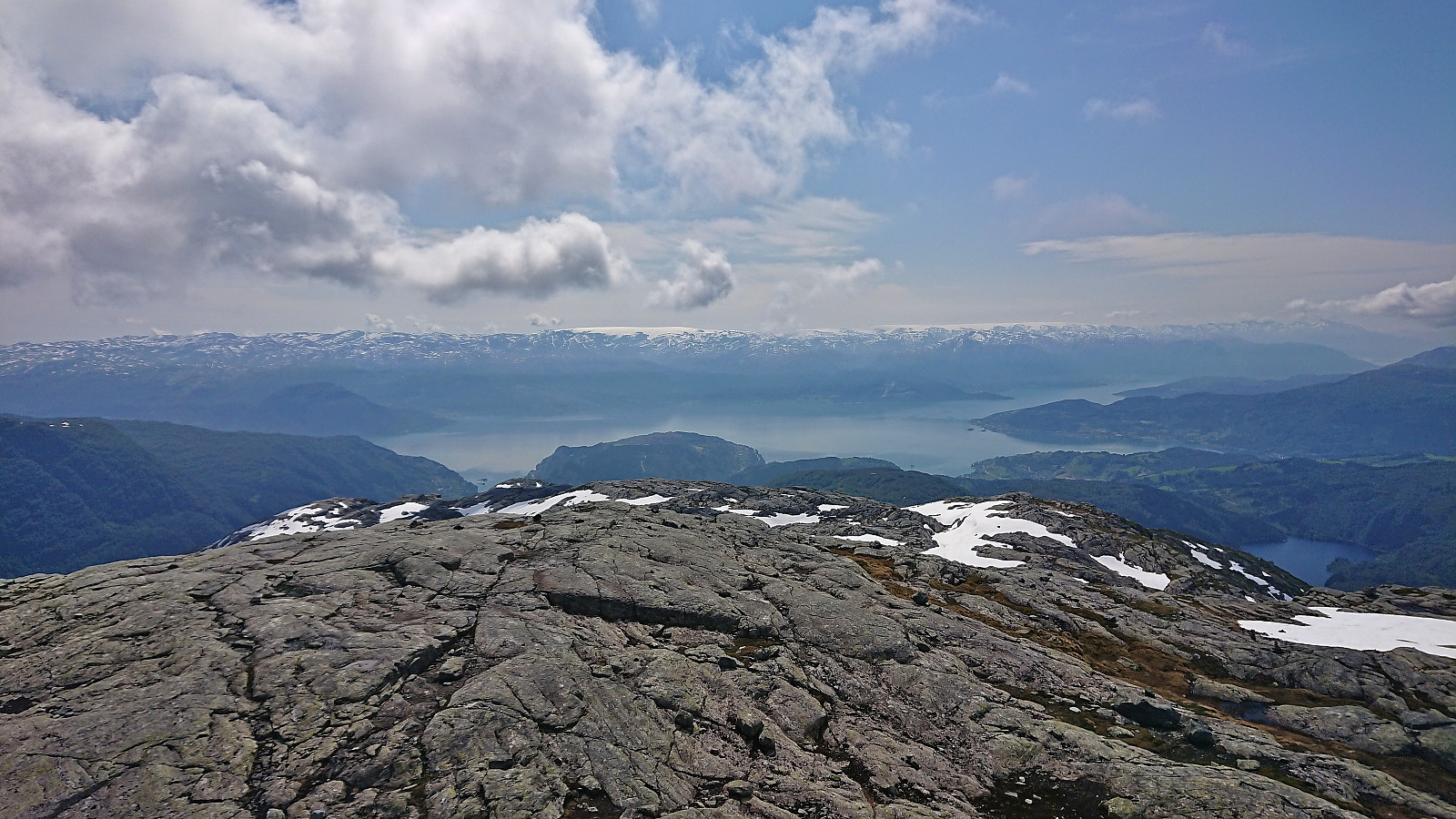
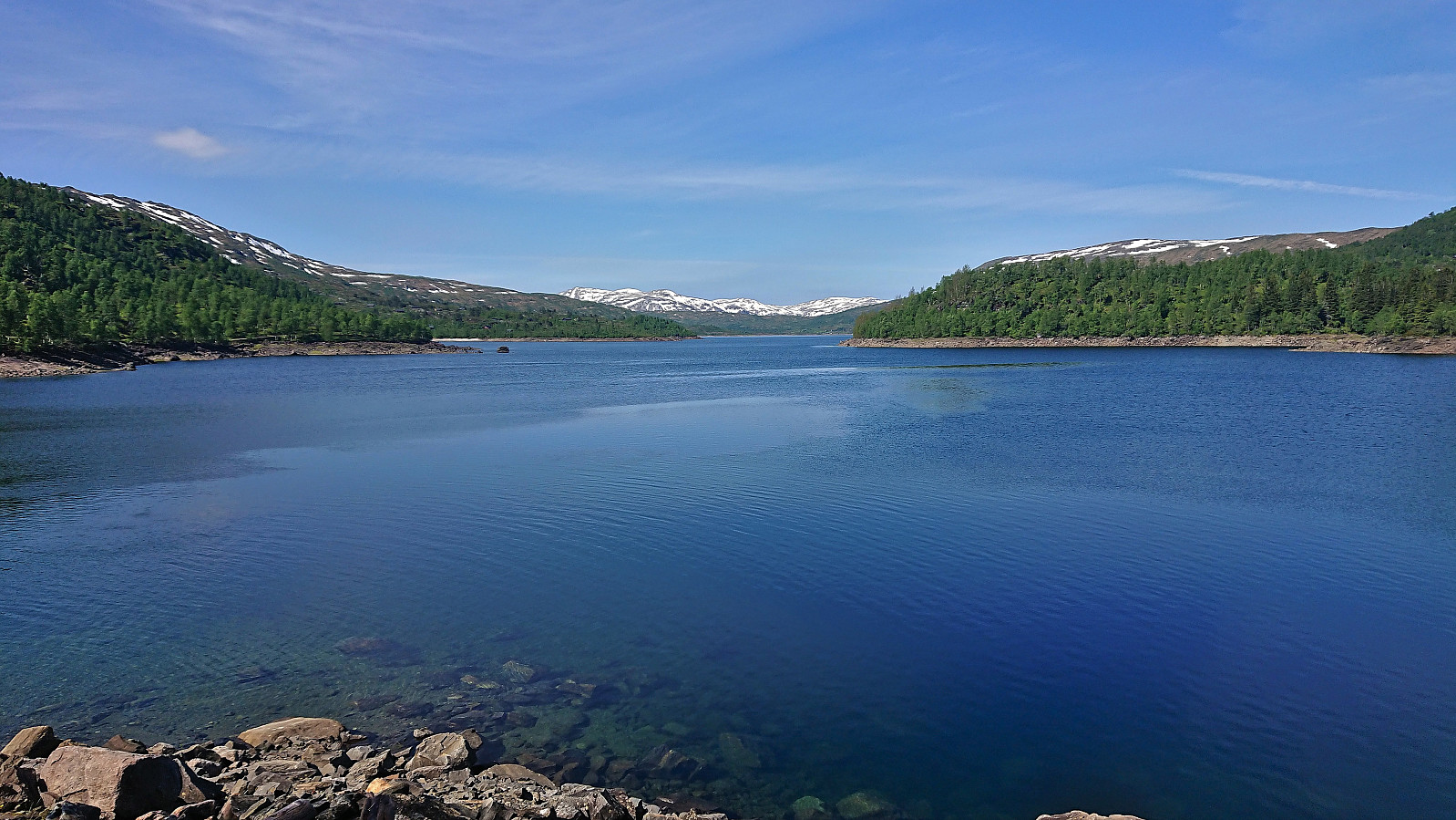
Hyvingen, Grånakken and Giljafjell from Ålvik
- Dato:
- 27.07.2025
- Turtype:
- Fjelltur
- Turlengde:
- 7:48t
- Distanse:
- 24,4km
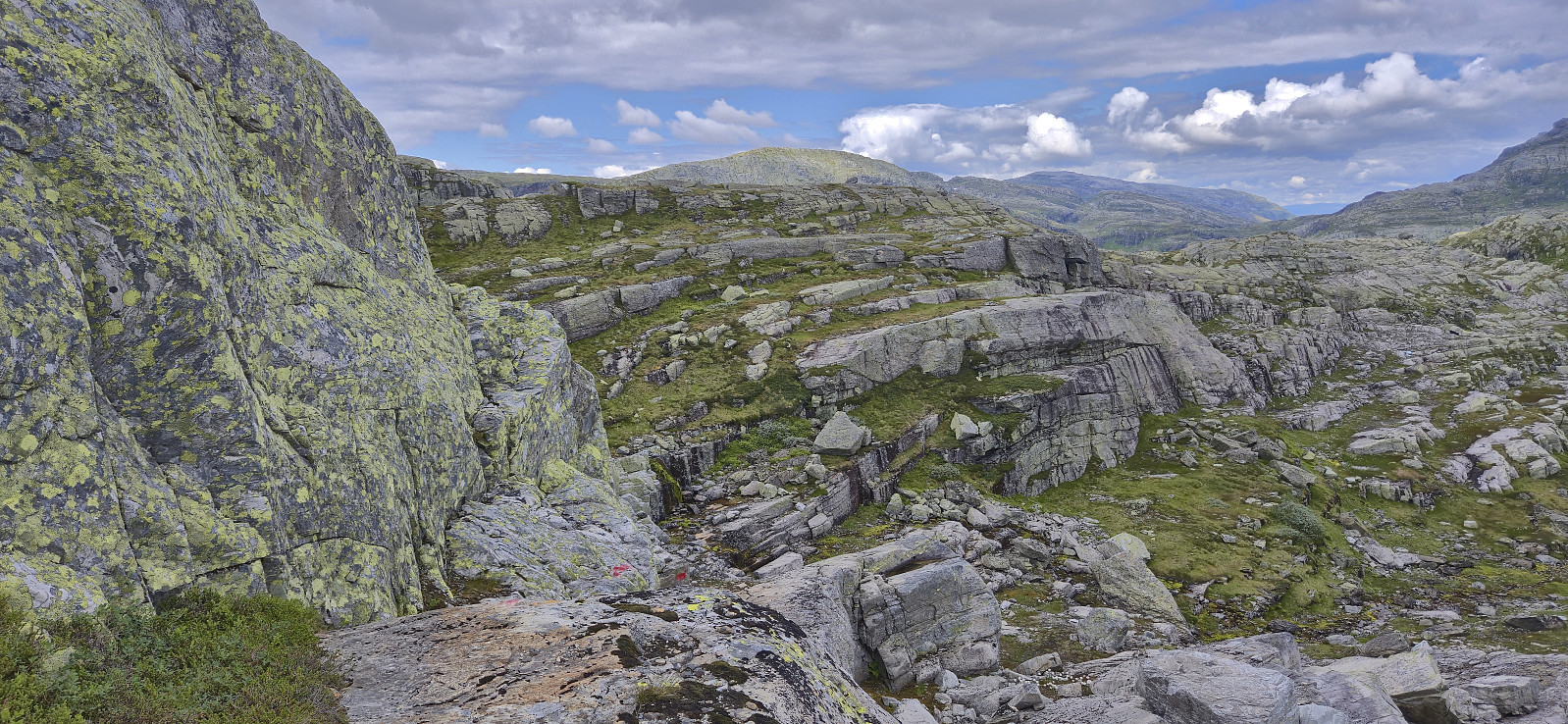 Started by taking the train to Voss and from there continued by bus to Ålvik. Here I easily located the marked trailhead and proceeded to follow the marked trail towards Roaldsdalen. The first part was quite steep and potentially difficult if wet or icy, although there were rope-based railings for extra safety. No need for these today though. As I continued north at the first forking of the trail at Krossfuru, the terrain turned much less steep and I could enjoy a nice walk along Dalselvi until the trail forked again and began winding its way up to Oskarborg and Toppen.
The trail to Oskarborg was often rather weak, especially at this time of the year when partially hidden by the tall grasses, however, with a few exceptions, the red markers were easy to follow. For extra safety, given that the trail >>>
Started by taking the train to Voss and from there continued by bus to Ålvik. Here I easily located the marked trailhead and proceeded to follow the marked trail towards Roaldsdalen. The first part was quite steep and potentially difficult if wet or icy, although there were rope-based railings for extra safety. No need for these today though. As I continued north at the first forking of the trail at Krossfuru, the terrain turned much less steep and I could enjoy a nice walk along Dalselvi until the trail forked again and began winding its way up to Oskarborg and Toppen.
The trail to Oskarborg was often rather weak, especially at this time of the year when partially hidden by the tall grasses, however, with a few exceptions, the red markers were easy to follow. For extra safety, given that the trail >>>
Storegreggen, Simlenuten, Pyttafjellet and Gråeggi
- Dato:
- 02.07.2025
- Turtype:
- Fjelltur
- Turlengde:
- 12:17t
- Distanse:
- 28,0km
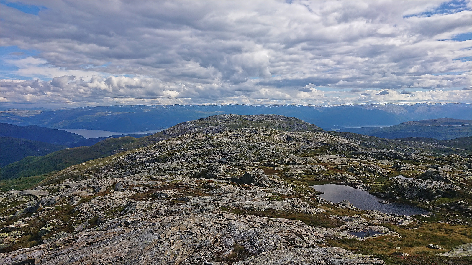
 When a single day of great weather showed up in the middle of the week, with what seemed like a rather wet weekend to come, I decided to take the day off and easily managed to convince Endre to do the same. He picked me up at my place shortly after seven and together we drove towards Ålvik to have a go at a hike we had been talking about for some time, namely a single hike that included all of the four summits neatly lined up east of Fyksesund.
After paying the 60 kr for the toll road we continued up to the parking lot at the end of the winding gravel road, which to our surprise was almost full but thankfully had room for one more car. The great weather we had been hoping for was however late to the party and a low-hanging cloud cover hid most of the views as we left the parking lot. The night before >>>
When a single day of great weather showed up in the middle of the week, with what seemed like a rather wet weekend to come, I decided to take the day off and easily managed to convince Endre to do the same. He picked me up at my place shortly after seven and together we drove towards Ålvik to have a go at a hike we had been talking about for some time, namely a single hike that included all of the four summits neatly lined up east of Fyksesund.
After paying the 60 kr for the toll road we continued up to the parking lot at the end of the winding gravel road, which to our surprise was almost full but thankfully had room for one more car. The great weather we had been hoping for was however late to the party and a low-hanging cloud cover hid most of the views as we left the parking lot. The night before >>>
Bergsdalen to Eikedalen
- Dato:
- 13.07.2024
- Turtype:
- Fjelltur
- Turlengde:
- 9:11t
- Distanse:
- 29,2km
 For the second Saturday in a row I took the train to Dale and the bus to Bergsdalen, but where I last week walked north to Evanger , this time I was heading south to Eikedalen. I got off the bus at the start of the road to Raunehaugen where I soon located the unmarked trailhead for Kjerringafjellet . The trail quality varied quite a lot and except for small cairns (mainly) towards the end it was unmarked. At several points I therefore had to check the GPS to make sure I was heading the right way. Near the summit there was also a boulder obstacle course that had to be traversed. The summit provided great views and a nice location for a short lunch break.
In order to next go to Storliknausen I first returned north towards Såta before carefully navigating my way down to the valley between Kjerringafjellet and Storliknausen. This was overall straightforward, >>>
For the second Saturday in a row I took the train to Dale and the bus to Bergsdalen, but where I last week walked north to Evanger , this time I was heading south to Eikedalen. I got off the bus at the start of the road to Raunehaugen where I soon located the unmarked trailhead for Kjerringafjellet . The trail quality varied quite a lot and except for small cairns (mainly) towards the end it was unmarked. At several points I therefore had to check the GPS to make sure I was heading the right way. Near the summit there was also a boulder obstacle course that had to be traversed. The summit provided great views and a nice location for a short lunch break.
In order to next go to Storliknausen I first returned north towards Såta before carefully navigating my way down to the valley between Kjerringafjellet and Storliknausen. This was overall straightforward, >>>
Karaldenuten roundtrip from Rong
- Dato:
- 30.06.2024
- Turtype:
- Fjelltur
- Turlengde:
- 6:07t
- Distanse:
- 12,5km
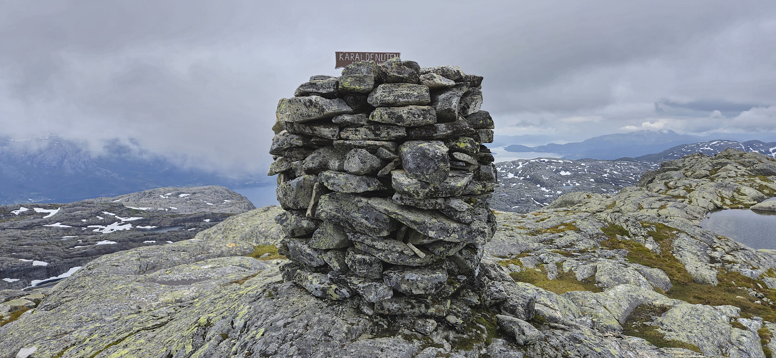 Sunday hike to Karaldenuten organized by Voss Utferdslag . I started by taking the train to Voss where I met up with the others for the short carpool to Rong. Here we parked next to the road south of Rongastovo just after the road forked for Haugamoen. This was also where we met up with the local guide and after a quick overview of the hike we began our ascent along the gravel road towards Grungavatnet.
The gravel road turned into a wet trail before we arrived at the northern end of the lake for the first (and the only real) river crossing of the day. A rope had been put up to simplify the crossing and thus we all made it to the other side almost without getting wet.
A steep but relatively short section followed before the terrain turned less steep. There was a marked trail all the way to the summit, although the markers, a combination >>>
Sunday hike to Karaldenuten organized by Voss Utferdslag . I started by taking the train to Voss where I met up with the others for the short carpool to Rong. Here we parked next to the road south of Rongastovo just after the road forked for Haugamoen. This was also where we met up with the local guide and after a quick overview of the hike we began our ascent along the gravel road towards Grungavatnet.
The gravel road turned into a wet trail before we arrived at the northern end of the lake for the first (and the only real) river crossing of the day. A rope had been put up to simplify the crossing and thus we all made it to the other side almost without getting wet.
A steep but relatively short section followed before the terrain turned less steep. There was a marked trail all the way to the summit, although the markers, a combination >>>
Hamlagrøvatnet to Norheimsund
- Dato:
- 18.08.2023
- Turtype:
- Fjelltur
- Turlengde:
- 8:37t
- Distanse:
- 29,6km
 Given the excellent weather forecast I took the Friday off to try one of my more ambitious hiking plans: walking from Hamlagrøvatnet in Bergsdalen to Steinsdalsfossen in Norheimsund. The main goal was to visit the three remaining summits I had left along this route.
I started by taking the train to Dale and the bus to the western end of Hamlagrøvatnet. Officially the last bus stop was at Rødland/Røydland, but given that the bus driver had plenty of time before the return journey to Dale he was kind enough to drive me all the way to the lake, saving me about half an hour of walking along the road.
From Hamlagrøosen I basically followed the marked trail to Vending . However, when the trail entered Langagjelet, and was about to ascend the final small hill before descending to the cabin, I turned northwest >>>
Given the excellent weather forecast I took the Friday off to try one of my more ambitious hiking plans: walking from Hamlagrøvatnet in Bergsdalen to Steinsdalsfossen in Norheimsund. The main goal was to visit the three remaining summits I had left along this route.
I started by taking the train to Dale and the bus to the western end of Hamlagrøvatnet. Officially the last bus stop was at Rødland/Røydland, but given that the bus driver had plenty of time before the return journey to Dale he was kind enough to drive me all the way to the lake, saving me about half an hour of walking along the road.
From Hamlagrøosen I basically followed the marked trail to Vending . However, when the trail entered Langagjelet, and was about to ascend the final small hill before descending to the cabin, I turned northwest >>>
Manfjellet and Kjetilsnuten
- Dato:
- 24.06.2023
- Turtype:
- Fjelltur
- Turlengde:
- 8:49t
- Distanse:
- 19,7km
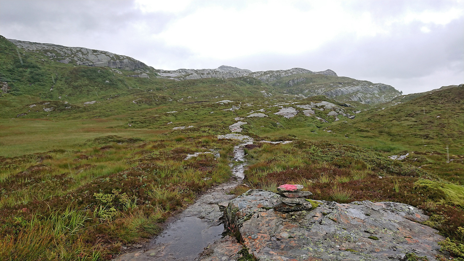
 A return to Fitjadalen to visit the two summits me and Fjellsamleren (Endre Myrdal Olsen) had to skip during our last visit due to there simply being too much snow. Once more we parked at Fitjadalen p-plass , but instead of starting north on the trail to Skrott and Breidablikk we returned around 400 meters southeast along the road and from there followed the marked trail to Laupsaflyane . The trail was a bit weak at times, and the trail markers not the most consistent, but overall this initial ascent was straightforward.
At Laupsaflyane the trail disappeared so we headed off-trail towards the southeast in order to connect with the trail to Manfjellet from this trip suggestion at ut.no . At first we struggled to locate the mentioned trail, especially as it was not indicated on the map, however we soon spotted the first red/pink trail markers that would lead us all the way to the summit. We did lose the markers once or twice, but never had >>>
A return to Fitjadalen to visit the two summits me and Fjellsamleren (Endre Myrdal Olsen) had to skip during our last visit due to there simply being too much snow. Once more we parked at Fitjadalen p-plass , but instead of starting north on the trail to Skrott and Breidablikk we returned around 400 meters southeast along the road and from there followed the marked trail to Laupsaflyane . The trail was a bit weak at times, and the trail markers not the most consistent, but overall this initial ascent was straightforward.
At Laupsaflyane the trail disappeared so we headed off-trail towards the southeast in order to connect with the trail to Manfjellet from this trip suggestion at ut.no . At first we struggled to locate the mentioned trail, especially as it was not indicated on the map, however we soon spotted the first red/pink trail markers that would lead us all the way to the summit. We did lose the markers once or twice, but never had >>>
Torefjell from Steinsdalsfossen via Raudnos
- Dato:
- 19.11.2022
- Turtype:
- Fjelltur
- Turlengde:
- 5:24t
- Distanse:
- 15,6km
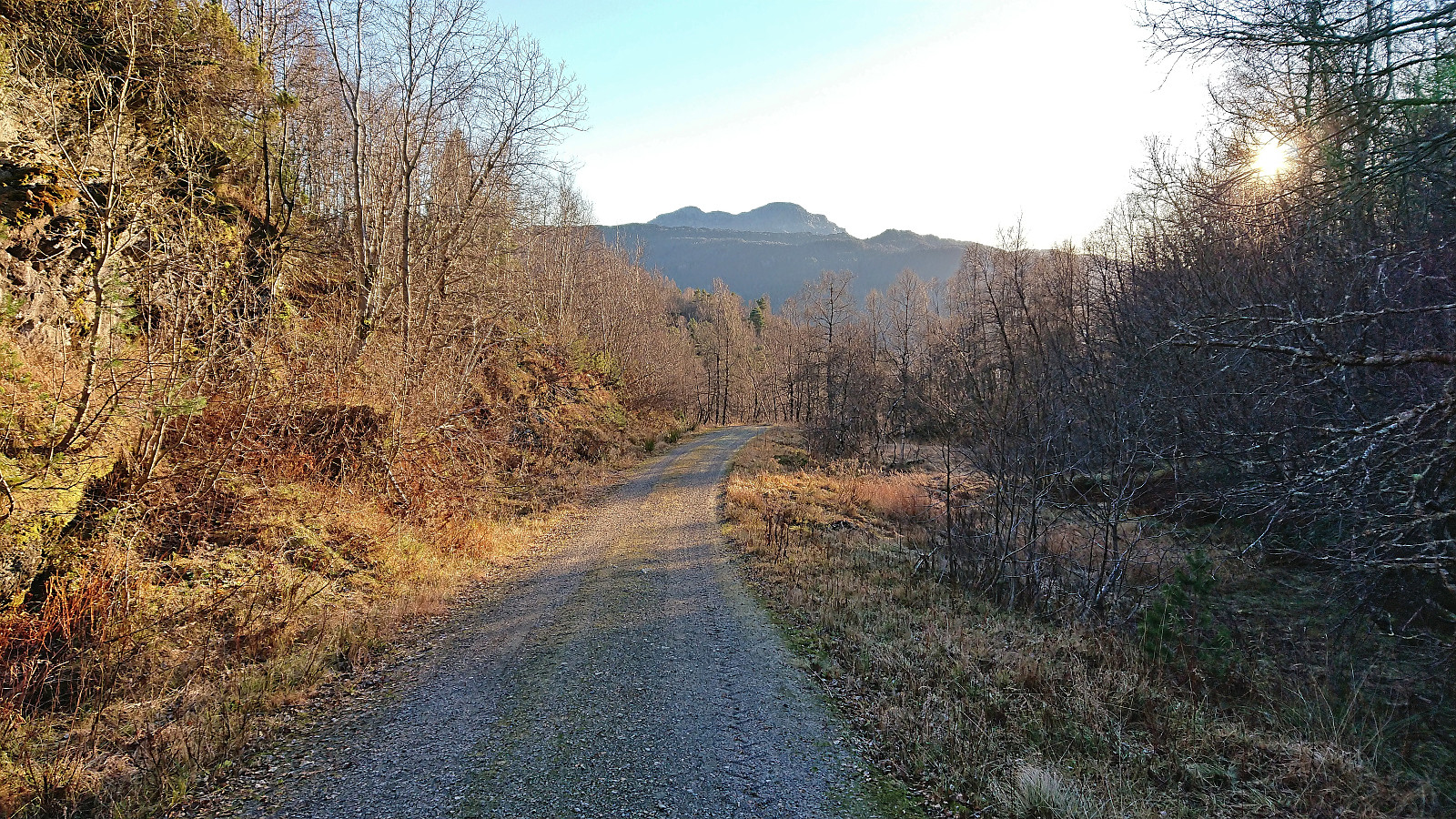 Most, if not all, of the previous visits of Torefjell seemed to have started from Sjusete. Getting to Sjusete without a car would however require a rather boring walk along the roads up from Norheimsund. When looking for other options, I came across this suggested hike from Steinsdalsfossen to Raudnos , which also indicated that it was possible to get to Raudnos via trails from the northeast. This would only leave the short distance from the gravel road south of Alkleiv up to Forsete and I would be on the standard trail to Torefjell. The map did not indicate any trail there, but I was pretty confident that one would turn up.
With the plan decided upon, I took the bus to Øvsthus and got off at the stop named after the popular waterfall of Steinsdalsfossen . Similar to my visit of Steinsdalsfossen at the start of April , the famous walk behind the waterfall was closed due to ice, and I instead followed the paved road up towards >>>
Most, if not all, of the previous visits of Torefjell seemed to have started from Sjusete. Getting to Sjusete without a car would however require a rather boring walk along the roads up from Norheimsund. When looking for other options, I came across this suggested hike from Steinsdalsfossen to Raudnos , which also indicated that it was possible to get to Raudnos via trails from the northeast. This would only leave the short distance from the gravel road south of Alkleiv up to Forsete and I would be on the standard trail to Torefjell. The map did not indicate any trail there, but I was pretty confident that one would turn up.
With the plan decided upon, I took the bus to Øvsthus and got off at the stop named after the popular waterfall of Steinsdalsfossen . Similar to my visit of Steinsdalsfossen at the start of April , the famous walk behind the waterfall was closed due to ice, and I instead followed the paved road up towards >>>
Storåsen/Ljonesåsen from Innstrandavegen
- Dato:
- 05.08.2022
- Turtype:
- Fottur
- Turlengde:
- 1:04t
- Distanse:
- 4,8km
 After visiting Daurmålsegga , I took a short bus ride to Ljones for a quick visit of Storåsen/Ljonesåsen . Previous reports talk about having to bypass a fox fur farm to get to the summit, see for example elbow (Vegard Magnussen) 's report here . The fox farm was however apparently shut down in 2020 and I therefore hoped that I could simply follow the road all the way to the summit, which turned out to be the case. After passing a couple of houses, including green houses, I arrived at the opened gates to the empty fox farm and could simply pass through, out the open gates at the other side, and continue south and then north on the tractor road.
The road split just before reaching the summit from where a smaller road and later trail could be followed south towards the summit. Only a final few meters off-trail was then required to reach the highest point. >>>
After visiting Daurmålsegga , I took a short bus ride to Ljones for a quick visit of Storåsen/Ljonesåsen . Previous reports talk about having to bypass a fox fur farm to get to the summit, see for example elbow (Vegard Magnussen) 's report here . The fox farm was however apparently shut down in 2020 and I therefore hoped that I could simply follow the road all the way to the summit, which turned out to be the case. After passing a couple of houses, including green houses, I arrived at the opened gates to the empty fox farm and could simply pass through, out the open gates at the other side, and continue south and then north on the tractor road.
The road split just before reaching the summit from where a smaller road and later trail could be followed south towards the summit. Only a final few meters off-trail was then required to reach the highest point. >>>
Daurmålsegga from Oma via Raudkleiv
- Dato:
- 05.08.2022
- Turtype:
- Fjelltur
- Turlengde:
- 3:42t
- Distanse:
- 13,2km
 After two unsuccessful attempts at joining a DNT -organized hike across Daurmålsegga from Bolstad to Mundheimsdalen, once cancelled due to bad weather and once COVID restrictions got in the way, I decided to not wait any longer and go ahead on my own. Following the whole ridge would however not be possible and I would instead simply start from Oma and return the same way.
I started by taking the bus to Oma and following the road up to the trailhead at Halvgjenge p-plass , from where I followed the standard marked route via Raudkleiv to the summit of Daurmålsegga. Tractor road almost all the way to Raudkleiv and an easy to follow trail from there all the way to the top, with only a small bit of easy scrambling to reach the summit cairn.
As got to the summit a dense fog had appeared and thus there were next to no views. I decided to wait >>>
After two unsuccessful attempts at joining a DNT -organized hike across Daurmålsegga from Bolstad to Mundheimsdalen, once cancelled due to bad weather and once COVID restrictions got in the way, I decided to not wait any longer and go ahead on my own. Following the whole ridge would however not be possible and I would instead simply start from Oma and return the same way.
I started by taking the bus to Oma and following the road up to the trailhead at Halvgjenge p-plass , from where I followed the standard marked route via Raudkleiv to the summit of Daurmålsegga. Tractor road almost all the way to Raudkleiv and an easy to follow trail from there all the way to the top, with only a small bit of easy scrambling to reach the summit cairn.
As got to the summit a dense fog had appeared and thus there were next to no views. I decided to wait >>>
Sveindalsnuten, Blåkoll, Flatafjellet and Kiellandbu
- Dato:
- 24.06.2022
- Turtype:
- Fjelltur
- Turlengde:
- 6:55t
- Distanse:
- 20,0km
 After spending all of the previous Saturday at work, it was in easy choice to take the following Friday off when the weather forecast for Bergen predicted blue skies and close to 30 degrees. Three other colleagues were quickly convinced to join and we settled on ascending to Kiellandbu from Hodnaberg, with my own goal of also visiting at least a couple of new summits in the area.
We parked next to the power station at Hodnaberg and started by following the gravel road south. After a short steep incline, we left the gravel road and continued on the marked trail to Kiellandbu, enjoying the excellent views along the river. Before reaching Nedre Kvålsdalstjørni, we decided to split into two pairs, given that it was only me and one other colleague that were interested in a slightly longer hike that also >>>
After spending all of the previous Saturday at work, it was in easy choice to take the following Friday off when the weather forecast for Bergen predicted blue skies and close to 30 degrees. Three other colleagues were quickly convinced to join and we settled on ascending to Kiellandbu from Hodnaberg, with my own goal of also visiting at least a couple of new summits in the area.
We parked next to the power station at Hodnaberg and started by following the gravel road south. After a short steep incline, we left the gravel road and continued on the marked trail to Kiellandbu, enjoying the excellent views along the river. Before reaching Nedre Kvålsdalstjørni, we decided to split into two pairs, given that it was only me and one other colleague that were interested in a slightly longer hike that also >>>
