Arkiv - dato
Arkiv - aktivitet
-
Annen tur (3)
- Kajakkpadling (3)
- Fottur (1897)
-
Kjøretur (9)
- Biltur (9)
-
Skitur (116)
- Fjellskitur (69)
- Langrennstur (47)
-
Sykkeltur (111)
- Blandet sykling (25)
- Gatesykling (86)
Lister jeg samler etter
-
Utvalgte topper og turmål i Bergen
(349/351)
 99%
99% -
Alle topper i Bergen
(393/400)
98%
-
Voss ≥ 100m pf.
(96/98)
97%
-
Opptur Hordaland
(144/159)
90%
-
Stasjoner på Bergensbanen
(33/40)
82%
-
Ulvik ≥ 100m pf.
(30/38)
78%
-
Hordaland ≥ 100m pf.
(624/863)
72%
-
Mjølfjell PF > 100m
(21/31)
67%
-
Jondal ≥ 100m pf.
(15/23)
65%
-
Dagsturhyttene i Vestland
(36/61)
59%
-
Sunnhordland PF >= 100m
(105/186)
56%
-
Hordaland: Hardanger PF>=100m
(196/359)
54%
-
DNT-hytter i Hordaland
(23/45)
51%
-
Kvinnherad ≥ 100m pf.
(40/79)
50%
-
Eidfjord ≥ 100m pf.
(13/42)
30%
-
Sogndal ≥ 100m pf.
(23/81)
28%
-
Gulen ≥ 100m pf.
(15/54)
27%
-
Vik i Sogn ≥ 100m pf.
(10/46)
21%
-
Sogn - Sør for Sognefjorden PF>=100m
(31/159)
19%
-
DNT-hytter i Sogn og Fjordane
(8/47)
17%

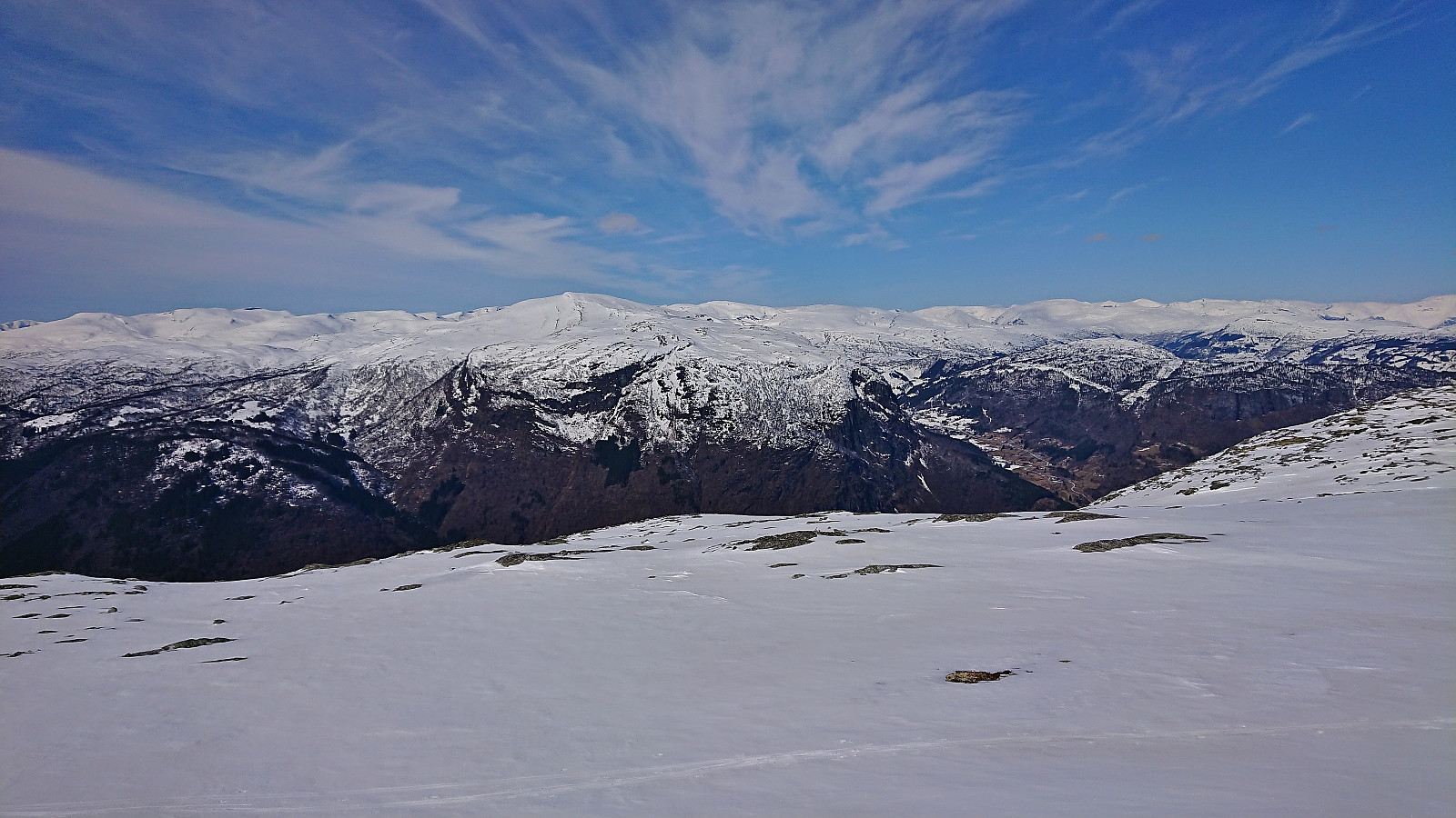
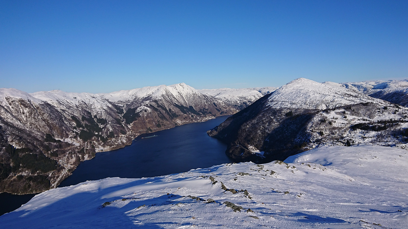
Dueskardhøgdi and Lingesetfjellet from Haukåsen
- Dato:
- 16.04.2022
- Turtype:
- Fjellskitur
- Turlengde:
- 3:53t
- Distanse:
- 15,7km
 The small free parking lot at the start of the ski trail was full. Hence we had to park at the larger parking lot next to the airport. (Note that if installing an app it is apparently possible to get a discount on the parking fee when going hiking or skiing. We however did not notice this until it was too late. See the small poster when entering the parking lot for more details.)
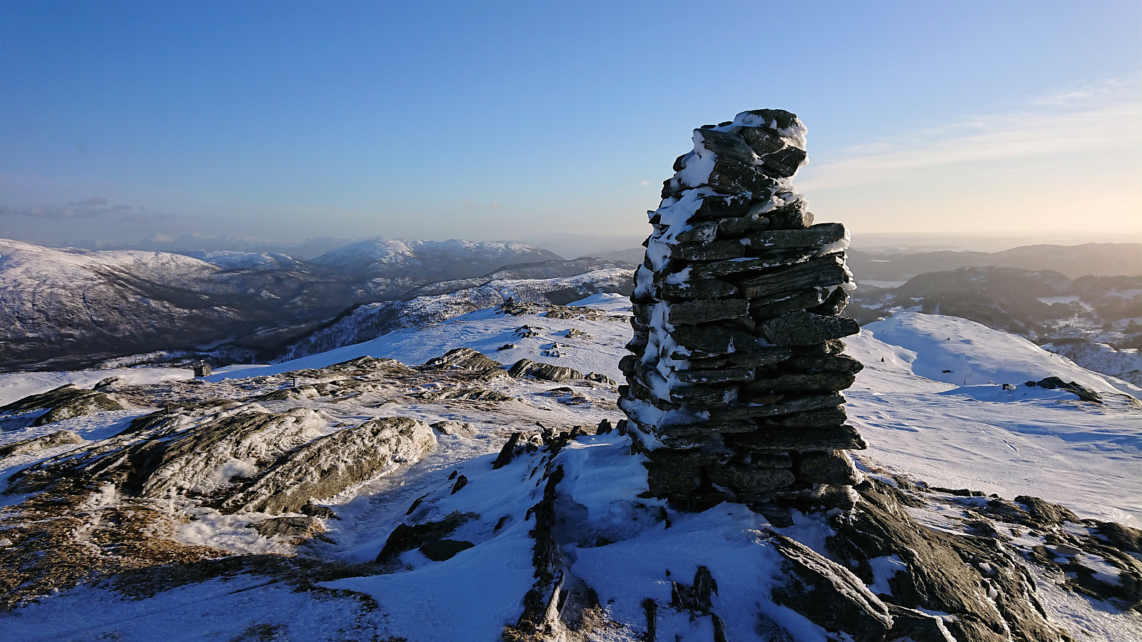
From the parking lot we walked the short distance to the trailhead where we put on the skis and followed the snow-covered gravel road up to Lingesete . The road continued beyond Lingesete, but as we passed south of Lingesetfjellet it started to feel a lot more like backcountry skiing. There should be a trail all the way to the summit in the summer time though. The summit provided spectacular panoramic views and, with next to no wind, a very >>>
The small free parking lot at the start of the ski trail was full. Hence we had to park at the larger parking lot next to the airport. (Note that if installing an app it is apparently possible to get a discount on the parking fee when going hiking or skiing. We however did not notice this until it was too late. See the small poster when entering the parking lot for more details.)
From the parking lot we walked the short distance to the trailhead where we put on the skis and followed the snow-covered gravel road up to Lingesete . The road continued beyond Lingesete, but as we passed south of Lingesetfjellet it started to feel a lot more like backcountry skiing. There should be a trail all the way to the summit in the summer time though. The summit provided spectacular panoramic views and, with next to no wind, a very >>>
Skiing in Hodlekve
- Dato:
- 15.04.2022
- Turtype:
- Fjellskitur
- Turlengde:
- 2:38t
- Distanse:
- 7,3km
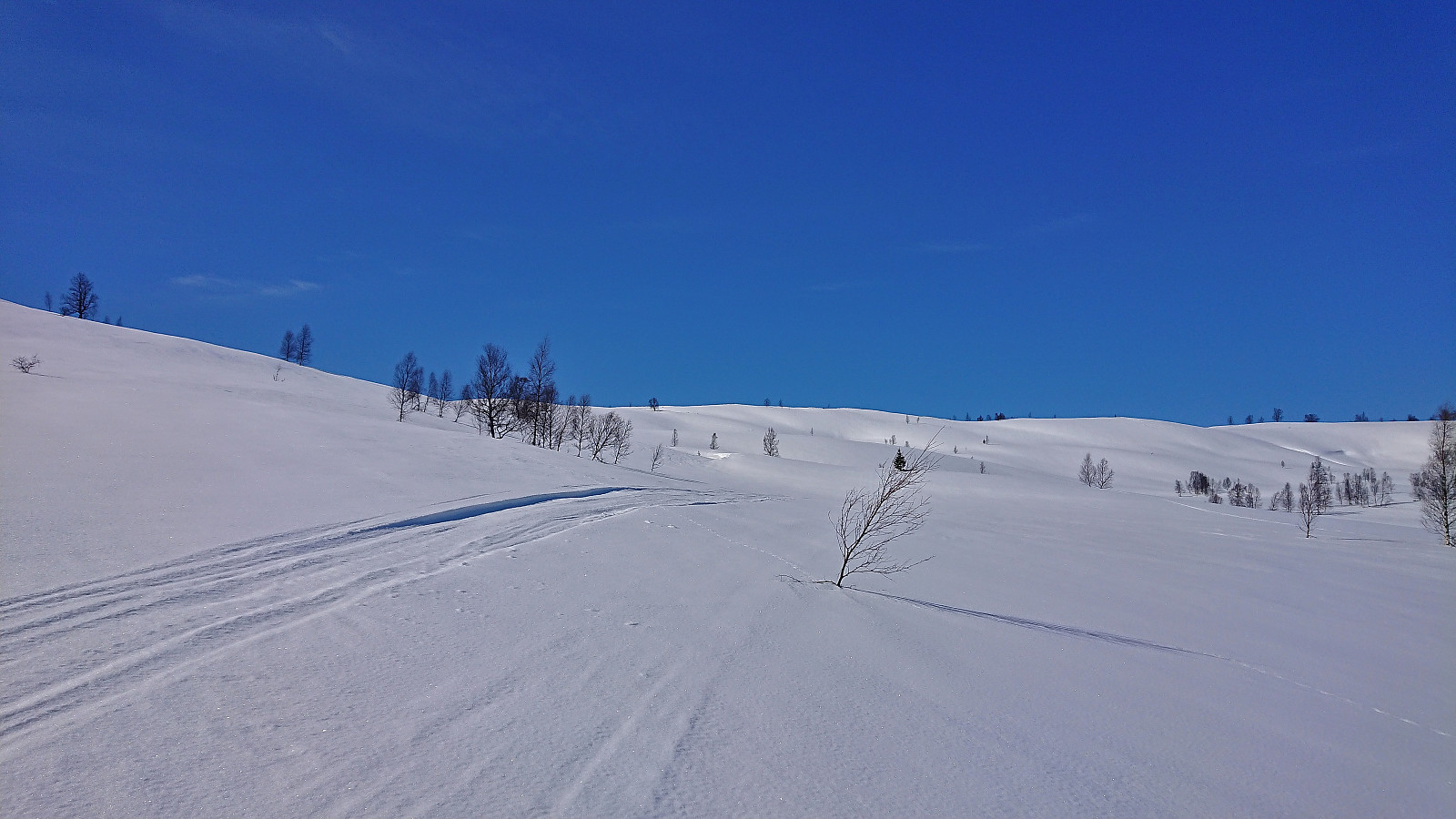 Short skiing trip in Hodlekve. First with my young nephew in the area around the skiing trails, before some of us took a short off-trail ascent towards Faggreggi and later returning to Rindabotn.
Vardafjellet, Bjørnafjellet and Storanosi
- Dato:
- 20.03.2022
- Turtype:
- Fjellskitur
- Turlengde:
- 5:23t
- Distanse:
- 21,5km
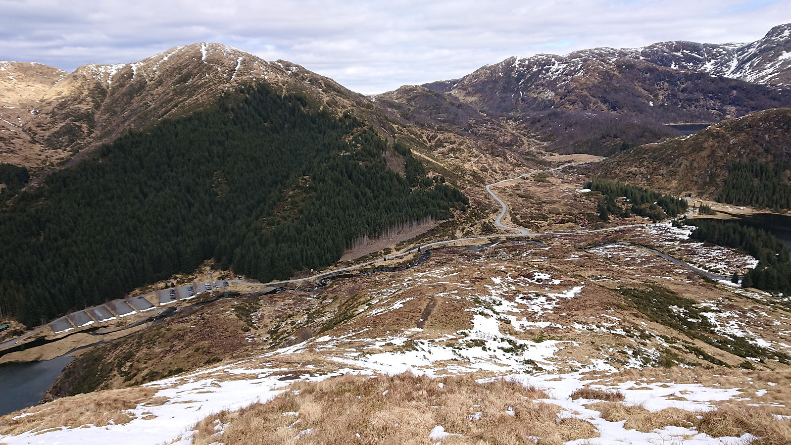
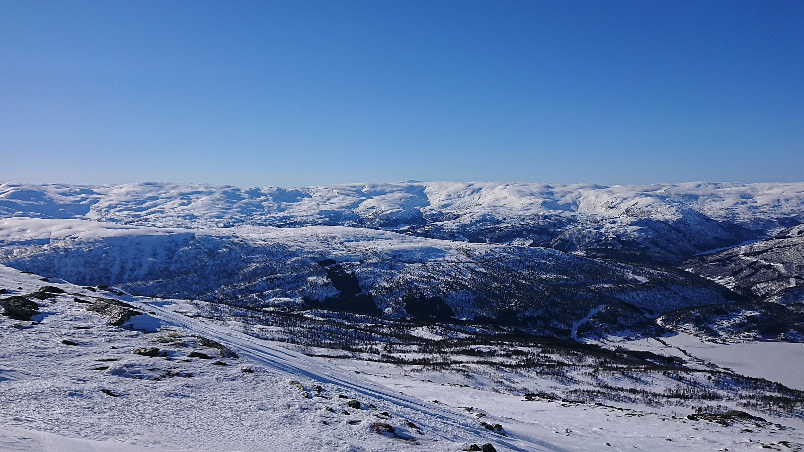 Skiing trip organized by The Norwegian Trekking Association (DNT) , or more specifically Voss Utferdslag , with bus transportation from Voss to the parking lot in Brandset and later back to Voss from Ospehaugen p-plass . We started out in excellent sunny weather that was bordering on too warm, but as we ascended towards Vardafjellet the wind started to pick up, so much that we had to delay the lunch break.
Initially we were going to pass just north of the summit of Vardafjellet, but after asking nicely, I was allowed to shortly leave the group for a short detour on my own to visit the summit. I quickly returned to the group and we descended to Prinsabotnskaret for a late lunch break in shelter of the strongest wind. Just as we got ready for the ascent to Bjørnafjellet , one of the participants lost her sit pad to the wind and we saw it tumbling over the ridge to the north and disappearing.
After a visit of the summit of >>>
Skiing trip organized by The Norwegian Trekking Association (DNT) , or more specifically Voss Utferdslag , with bus transportation from Voss to the parking lot in Brandset and later back to Voss from Ospehaugen p-plass . We started out in excellent sunny weather that was bordering on too warm, but as we ascended towards Vardafjellet the wind started to pick up, so much that we had to delay the lunch break.
Initially we were going to pass just north of the summit of Vardafjellet, but after asking nicely, I was allowed to shortly leave the group for a short detour on my own to visit the summit. I quickly returned to the group and we descended to Prinsabotnskaret for a late lunch break in shelter of the strongest wind. Just as we got ready for the ascent to Bjørnafjellet , one of the participants lost her sit pad to the wind and we saw it tumbling over the ridge to the north and disappearing.
After a visit of the summit of >>>
Småbrekkebukken from Småbrekkene
- Dato:
- 06.03.2022
- Turtype:
- Fjellskitur
- Turlengde:
- 5:42t
- Distanse:
- 16,9km
 For more than a year, Småbrekkebukken had been my last remaining summit on the Samnanger ≥ 100m pf. list . So when The Norwegian Trekking Association (DNT) , or more specifically Voss Utferdslag , organized a guided skiing trip, I was of course among the first to sign up.
After taking the train to Voss, I joined the others at Holbergsplass, from where we carpooled to Småbrekkene to start the real trip. We initially followed the marked trail/road towards Gullhorgabu , but after a short break northeast of Småbrekkebukken, we had left the marked trail and instead continued up the valley northwest of the summit.
Here we came across an area where most of the snow had been removed by strong winds, and we therefore had to backtrack a bit to find a slightly different route than planned. This however did not present any real issues and after a large U-turn to avoid the steepest areas we soon arrived at the summit, which >>>
For more than a year, Småbrekkebukken had been my last remaining summit on the Samnanger ≥ 100m pf. list . So when The Norwegian Trekking Association (DNT) , or more specifically Voss Utferdslag , organized a guided skiing trip, I was of course among the first to sign up.
After taking the train to Voss, I joined the others at Holbergsplass, from where we carpooled to Småbrekkene to start the real trip. We initially followed the marked trail/road towards Gullhorgabu , but after a short break northeast of Småbrekkebukken, we had left the marked trail and instead continued up the valley northwest of the summit.
Here we came across an area where most of the snow had been removed by strong winds, and we therefore had to backtrack a bit to find a slightly different route than planned. This however did not present any real issues and after a large U-turn to avoid the steepest areas we soon arrived at the summit, which >>>
Livarden from Frotveit via Rambjørgvatnet
- Dato:
- 25.02.2022
- Turtype:
- Fjellskitur
- Turlengde:
- 4:00t
- Distanse:
- 17,8km
 Initial plans to ski across Vidden with a colleague was changed at the last minute due to strong northerly winds and we instead headed for Frotveit and Livarden . This turned out to be a good choice, as except for the final ascent to the summit we pretty much avoided the cold wind. The snow conditions were highly variable. Excellent along the ski tracks, icy in the areas northeast and south of the summit, and everything in between for the descent. Overall, a very nice roundtrip that can be highly recommended.
Skiing across Vidden
- Dato:
- 19.02.2022
- Turtype:
- Fjellskitur
- Turlengde:
- 5:31t
- Distanse:
- 21,5km
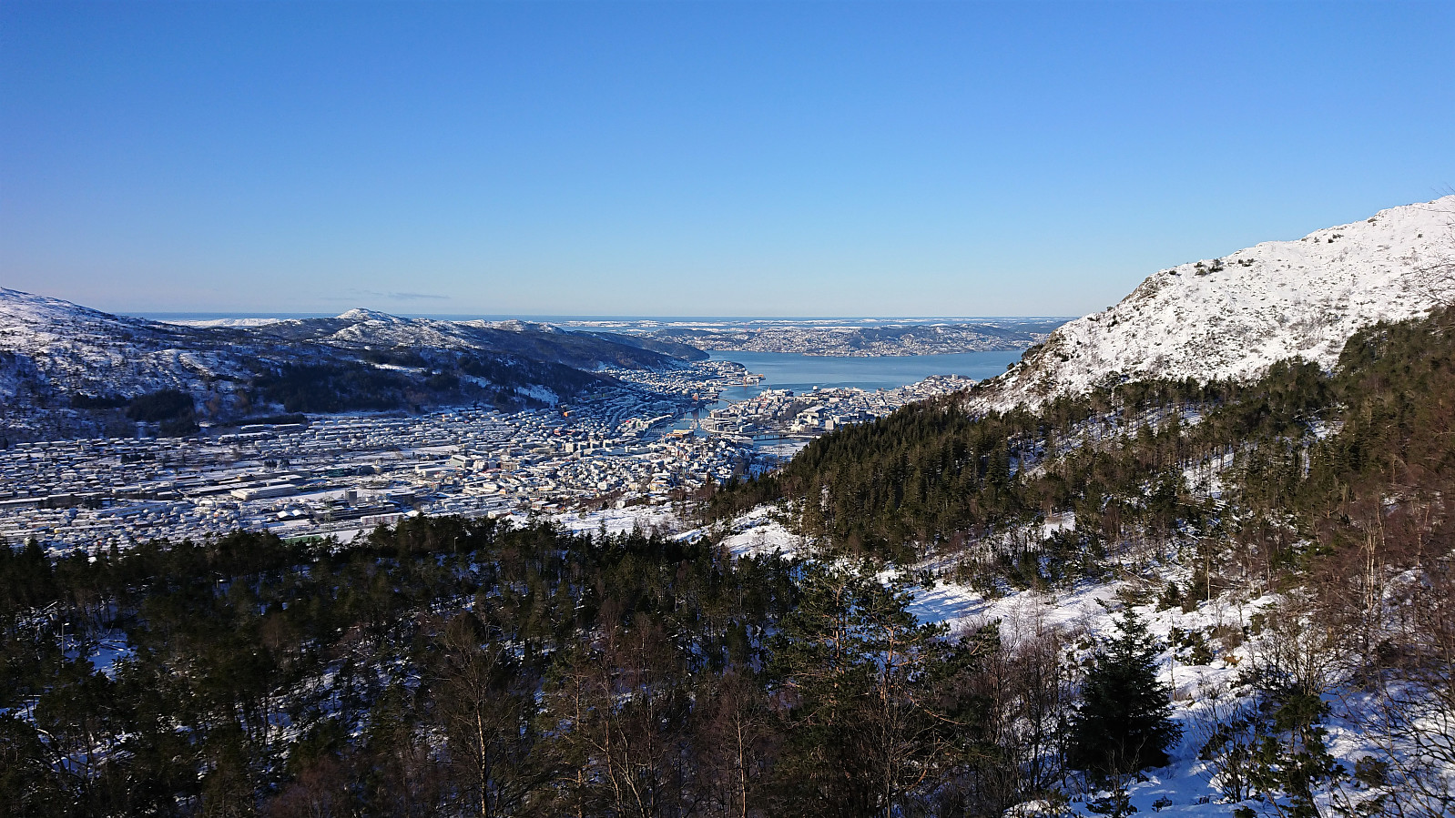
 With reports of excellent skiing conditions at Byfjellene in the local newspaper we decided on the usual skiing trip across Vidden. Thanks to Ulriksbanen (195 kr per person), we easily arrived at the upper station of the cable car where we could confirm that the conditions were in fact excellent! After a short detour via Turnerhytten and Byfjellenes høyeste punkt , we followed the standard skiing route across Vidden. The only real challenge being the dense fog accompanied by a snow shower occurring just as we started our ascent from Borgaskaret to Vardegga . But thankfully it did not last long and we could soon again enjoy the excellent condition when skiing down to Øvre Jordalsvatnet. The skis stayed on until the small dam north of Storevatnet. We could probably have continued a bit further, but the increasing number of small rocks sticking out of the snow made this less appealing. Overall, a close to perfect skiing trip at Byfjellene!
Gullbotn to Espeland via Gullfjelltoppen
- Dato:
- 24.04.2021
- Turtype:
- Fjellskitur
- Turlengde:
- 6:10t
- Distanse:
- 20,4km
 I was dropped off at the parking lot at Gullbotn , from where I carried the skis up to the actual Gullbotn where I could finally put them on. The conditions for skiing were not the best though, with at times more ice than snow, and along the ridge southeast of the summit of Gullfjelltoppen there were also short stretches without any snow at all.
My initial plan had been to descend north via Gullfjellhalsen , Vossavardane and Hotten , but given the limited amount of snow covering the mentioned peaks, combined with a strong cold northerly wind, I instead turned south and followed the normal descent route to Redningshytten , only making a short detour to Hausdalsgullbotntoppen on the way.
Note that Korketrekkeren already had several areas without any snow at all. I could however still keep the skis on until getting to Redningshytten. Here I decided to take a detour via Austefjellet , mainly as I was told by a fellow skier >>>
I was dropped off at the parking lot at Gullbotn , from where I carried the skis up to the actual Gullbotn where I could finally put them on. The conditions for skiing were not the best though, with at times more ice than snow, and along the ridge southeast of the summit of Gullfjelltoppen there were also short stretches without any snow at all.
My initial plan had been to descend north via Gullfjellhalsen , Vossavardane and Hotten , but given the limited amount of snow covering the mentioned peaks, combined with a strong cold northerly wind, I instead turned south and followed the normal descent route to Redningshytten , only making a short detour to Hausdalsgullbotntoppen on the way.
Note that Korketrekkeren already had several areas without any snow at all. I could however still keep the skis on until getting to Redningshytten. Here I decided to take a detour via Austefjellet , mainly as I was told by a fellow skier >>>
Skiing: Steinskvanndalen
- Dato:
- 11.04.2021
- Turtype:
- Fjellskitur
- Turlengde:
- 4:04t
- Distanse:
- 14,6km
 More or less a repeat of our skiing trip in Steinskvanndalen just over a year ago . (Although this time struggling much less with trying to find out where to start skiing from.) Overall excellent conditions for skiing, with freshly made ski trails that could be followed all the way to Øvre Kvanndalsvatnet. Before starting our descent, we made a short off-trail detour in relatively deep snow to the summit of Rundehaugen (the only reason why this trip is labeled backcountry skiing and not cross-country skiing), which provided great views towards the bigger surrounding mountains and a good place to enjoy our lunch. In summary, once again an excellent trip in an area that can be highly recommended for skiing!
Trengereidhotten
- Dato:
- 13.02.2021
- Turtype:
- Fjellskitur
- Turlengde:
- 2:40t
- Distanse:
- 9,7km
 After initially failing to find any free parking spaces at Gullbotn (on either side of the main road), we ended up parking next to the road only a couple hundred meters to the south where there was room for maybe a dozen cars. We then returned on foot to Gullbotn and from there followed the skiing trail west. In order to stay in the sun, we ditched the option of ascending to Kråfjellet and rather headed north to Trengereidhotten , enjoying excellent skiing conditions and next to no wind. The wind however picked up a bit at the summit and we therefore did not stay long before starting our descent and rather taking our short lunch break about halfway back down to Gullbotn. To shorten the walk along the main road we did not return to the main parking lot, but instead passed by Kløverhytten on our way back to the car. Overall, an excellent >>>
Skiing across Vidden
- Dato:
- 06.02.2021
- Turtype:
- Fjellskitur
- Turlengde:
- 4:32t
- Distanse:
- 23,8km
 A repeat of my earlier skiing trip across Vidden from Montana, but this time with a (for me) new winter ascent route which basically consisted of carrying the skis along the hiking trail until almost reaching Vassdalsvatnet. From there I connected with the normal route across Vidden before taking a quick detour to the highest point at Byfjellene . Generally there were almost as many hikers as skiers. I therefore tried to stay away from the main trail as much as possible in order to achieve the best skiing conditions. The skis stayed on all the way until getting to the start of Hellemyrstien, where I figured it was as quick to carry the skis the rest of the way.
