Arkiv - dato
Arkiv - aktivitet
-
Annen tur (3)
- Kajakkpadling (3)
- Fottur (1870)
-
Kjøretur (9)
- Biltur (9)
-
Skitur (115)
- Fjellskitur (68)
- Langrennstur (47)
-
Sykkeltur (108)
- Blandet sykling (25)
- Gatesykling (83)
Lister jeg samler etter
-
Utvalgte topper og turmål i Bergen
(346/347)
 99%
99% -
Alle topper i Bergen
(391/398)
98%
-
Voss ≥ 100m pf.
(96/98)
97%
-
Opptur Hordaland
(144/159)
90%
-
Stasjoner på Bergensbanen
(31/40)
77%
-
Ulvik ≥ 100m pf.
(28/38)
73%
-
Hordaland ≥ 100m pf.
(619/863)
71%
-
Mjølfjell PF > 100m
(21/31)
67%
-
Jondal ≥ 100m pf.
(15/23)
65%
-
Dagsturhyttene i Vestland
(36/61)
59%
-
Sunnhordland PF >= 100m
(105/186)
56%
-
Hordaland: Hardanger PF>=100m
(191/359)
53%
-
DNT-hytter i Hordaland
(23/45)
51%
-
Kvinnherad ≥ 100m pf.
(40/79)
50%
-
Sogndal ≥ 100m pf.
(23/81)
28%
-
Gulen ≥ 100m pf.
(14/54)
25%
-
Eidfjord ≥ 100m pf.
(10/42)
23%
-
Vik i Sogn ≥ 100m pf.
(10/46)
21%
-
Sogn - Sør for Sognefjorden PF>=100m
(30/159)
18%
-
DNT-hytter i Sogn og Fjordane
(8/47)
17%

Øyanovi, Storafjellet and Gløvret (Storfossen to Vaksdal)
- Dato:
- 27.06.2019
- Turtype:
- Fjelltur
- Turlengde:
- 9:15t
- Distanse:
- 21,3km
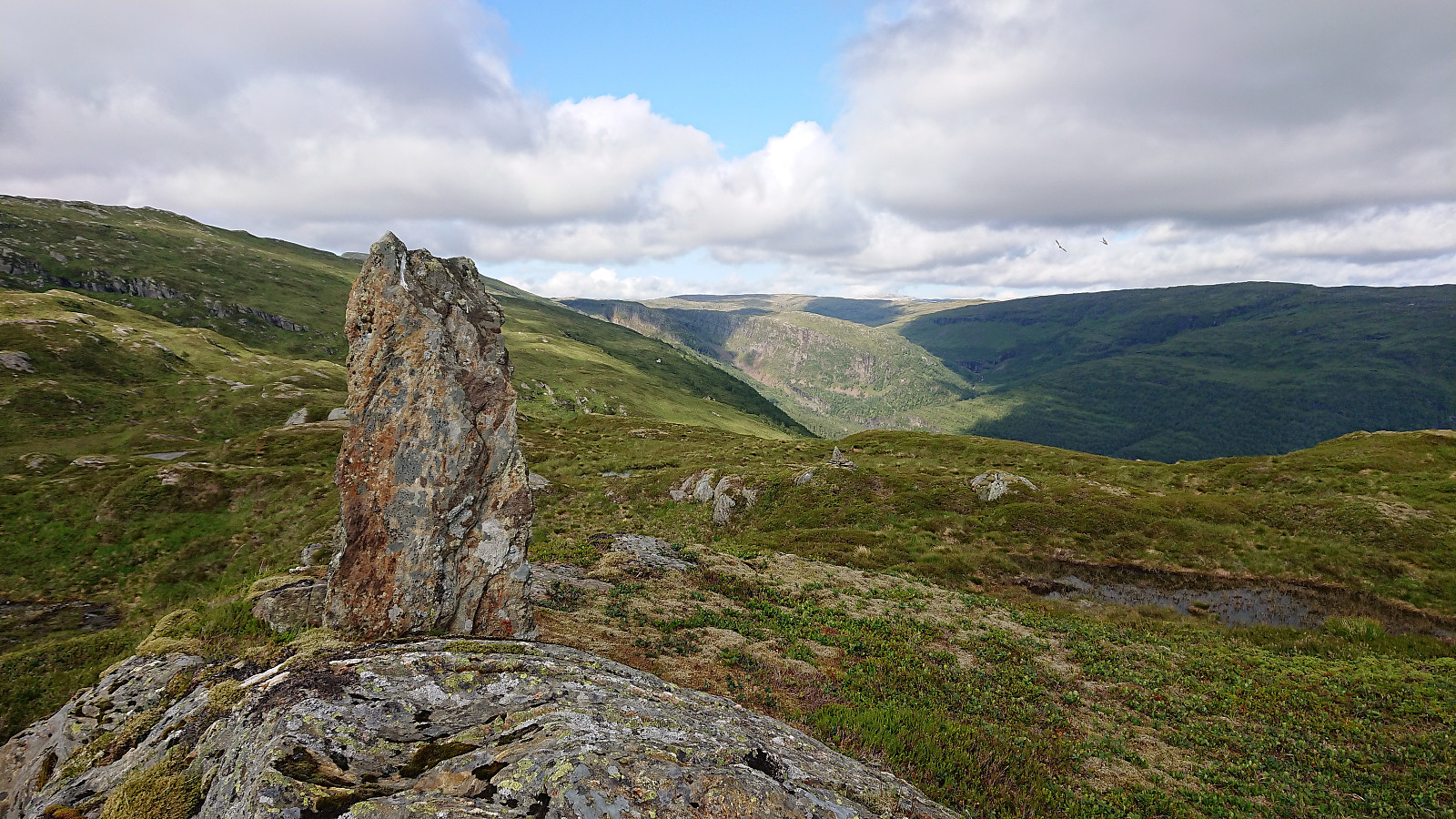 We started by taking the train to Dale and from there the connecting bus up to Storfossen/Storfossdammen. After crossing along the top of the dam, we followed the marked (but clearly not very heavily used) trail up Øyaskaret. Did not see any trails in the direction of Øyanovi , but when reaching the top of Øyaskaret it was straightforward to make progress towards the summit.
Note that the best views from Øyanovi were not obtained at the summit itself, but rather 100 meters further north (now added as a separate PB element ). For our return to the marked trail, we made a shortcut heading more directly south, but it would probably have been just as fast, due to the terrain, to rather retrace our steps to where we left the trail earlier on.
We then followed the marked trail towards Møyadalsnubben , but missed our exit and had to turn back >>>
We started by taking the train to Dale and from there the connecting bus up to Storfossen/Storfossdammen. After crossing along the top of the dam, we followed the marked (but clearly not very heavily used) trail up Øyaskaret. Did not see any trails in the direction of Øyanovi , but when reaching the top of Øyaskaret it was straightforward to make progress towards the summit.
Note that the best views from Øyanovi were not obtained at the summit itself, but rather 100 meters further north (now added as a separate PB element ). For our return to the marked trail, we made a shortcut heading more directly south, but it would probably have been just as fast, due to the terrain, to rather retrace our steps to where we left the trail earlier on.
We then followed the marked trail towards Møyadalsnubben , but missed our exit and had to turn back >>>
Våkendalen
- Dato:
- 23.06.2019
- Turtype:
- Fjelltur
- Turlengde:
- 3:57t
- Distanse:
- 17,9km
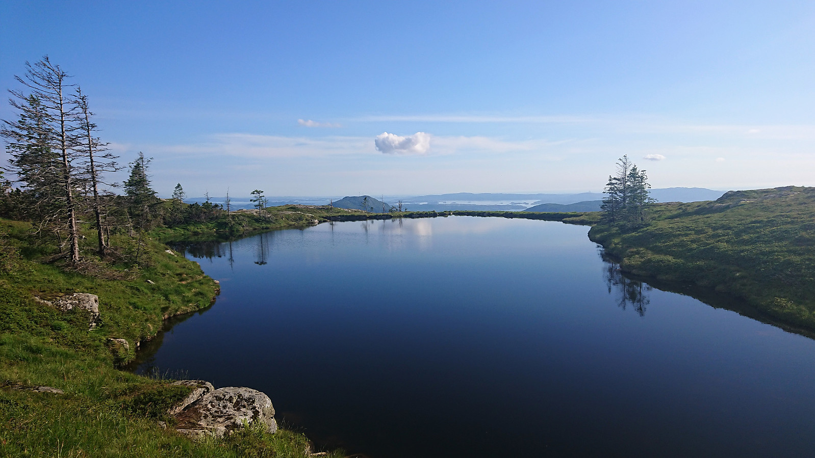 It was already late afternoon when it finally stopped raining and too late to visit any new peaks. I therefore settled on a new trail instead and hopped on a bus to Årstadveien. Upon reaching the northern end of Svartediket I left the main road and followed the trail up to Hardbakkedalen. Just before the trail enters the upper part of Hardbakkedalen, I turned left (north) for the new trail of the day: Buføringsvegen. My hope was that I would discover a new route up to Langelivatnet, or if this did not work out, end up somewhere below Tarlebøvatnet.
The trailhead was marked, but the trail itself did not seem very frequently used. It was however overall easy to follow and I soon arrived at the ruins at Hardbakkhaugen , where an information sign, mainly about the small farm, also mentioned that there used >>>
It was already late afternoon when it finally stopped raining and too late to visit any new peaks. I therefore settled on a new trail instead and hopped on a bus to Årstadveien. Upon reaching the northern end of Svartediket I left the main road and followed the trail up to Hardbakkedalen. Just before the trail enters the upper part of Hardbakkedalen, I turned left (north) for the new trail of the day: Buføringsvegen. My hope was that I would discover a new route up to Langelivatnet, or if this did not work out, end up somewhere below Tarlebøvatnet.
The trailhead was marked, but the trail itself did not seem very frequently used. It was however overall easy to follow and I soon arrived at the ruins at Hardbakkhaugen , where an information sign, mainly about the small farm, also mentioned that there used >>>
Kvigedalsegga, Knutstignova, Høgenipa, Fylenipa and Beitelen
- Dato:
- 15.06.2019
- Turtype:
- Fjelltur
- Turlengde:
- 9:21t
- Distanse:
- 22,0km
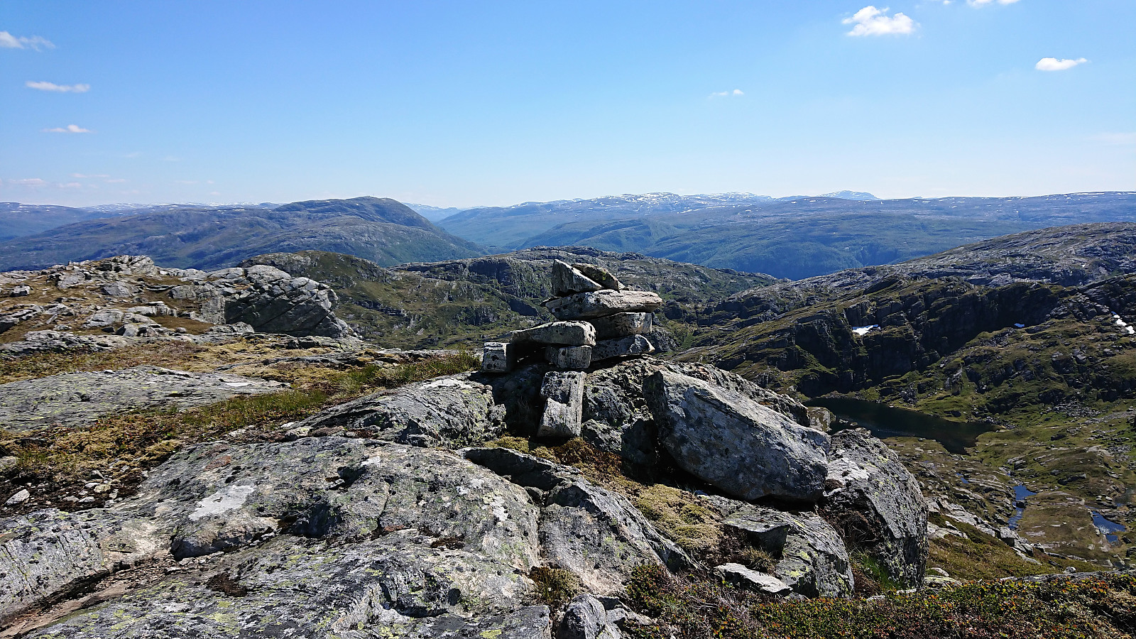 Started by taking the train to Dale and from there the bus to Tretteneset, where the bus driver provided a bit of extra service by dropping me off just where the tractor road starts (the official bus stop is a couple of hundred meters further up the road). The tractor road made the initial progress straightforward and I soon arrived at the end of the road. Here a trail to Dalseidstølen is shown on the map, but the weak trail I found did not really follow what was indicated on the map. It did however take me to Dalseidstølen, although there may a better trail that I missed.
From Dalseidstølen I first turned north, following various deer tracks, before turning southwest on a more direct route to Kvigedalsegga . Note that I did come across a weak trail just after leaving the cabin, but I quickly lost it. So while my route >>>
Started by taking the train to Dale and from there the bus to Tretteneset, where the bus driver provided a bit of extra service by dropping me off just where the tractor road starts (the official bus stop is a couple of hundred meters further up the road). The tractor road made the initial progress straightforward and I soon arrived at the end of the road. Here a trail to Dalseidstølen is shown on the map, but the weak trail I found did not really follow what was indicated on the map. It did however take me to Dalseidstølen, although there may a better trail that I missed.
From Dalseidstølen I first turned north, following various deer tracks, before turning southwest on a more direct route to Kvigedalsegga . Note that I did come across a weak trail just after leaving the cabin, but I quickly lost it. So while my route >>>
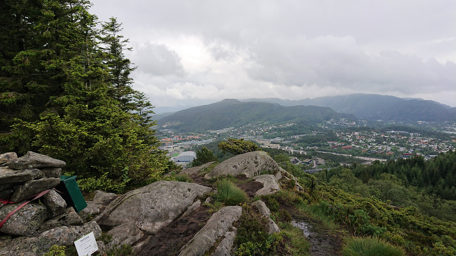
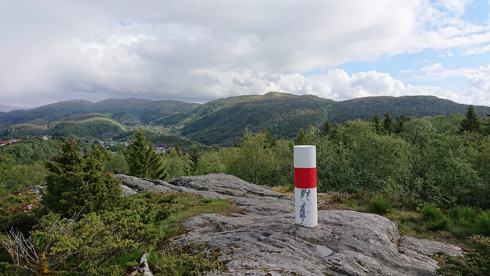
Ørneberget and Rognåsen
- Dato:
- 13.06.2019
- Turtype:
- Fjelltur
- Turlengde:
- 1:34t
- Distanse:
- 6,7km
 Local evening hike after work.
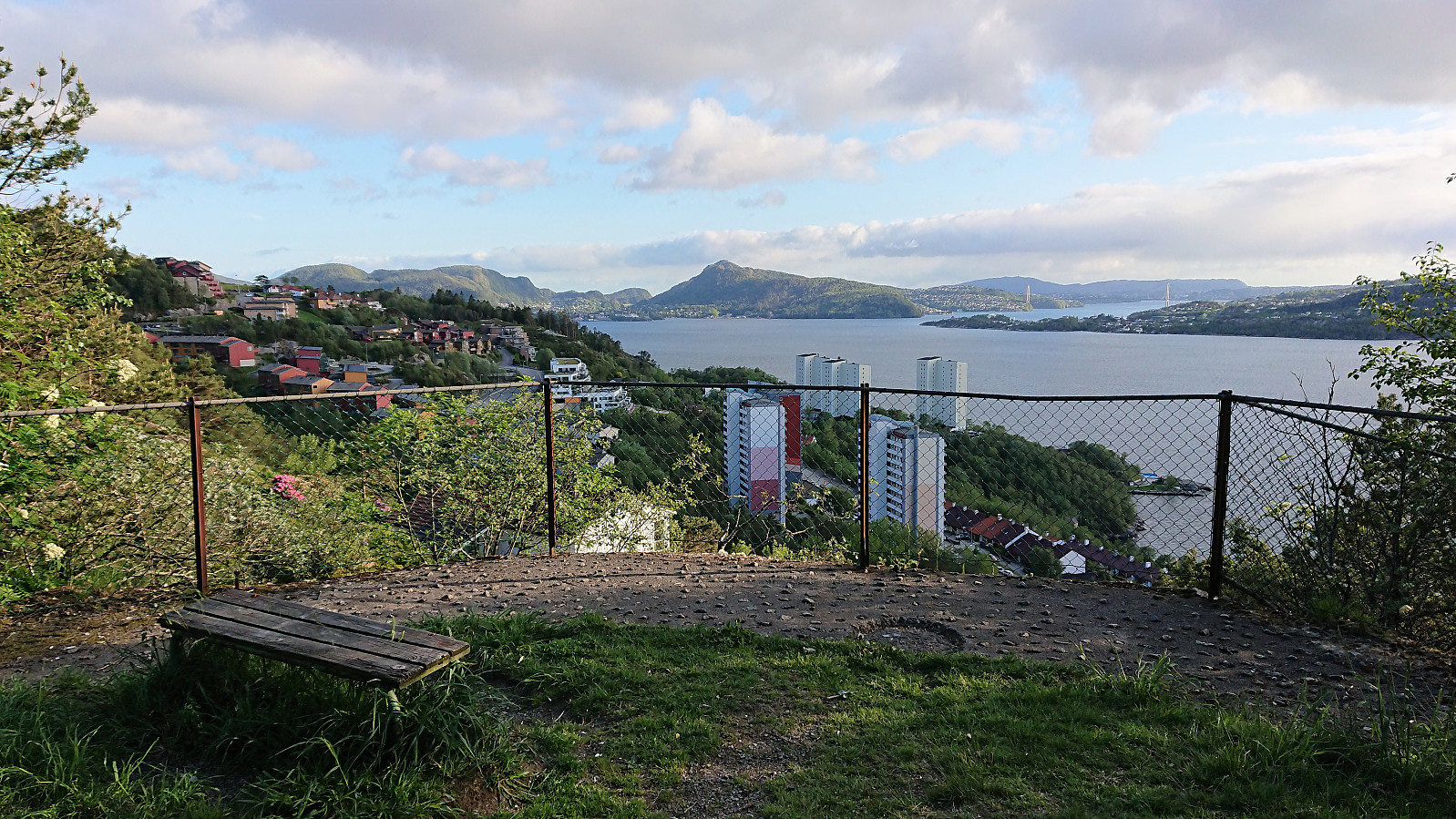
Ulsetvarden and Geitanuken
- Dato:
- 10.06.2019
- Turtype:
- Fjelltur
- Turlengde:
- 2:04t
- Distanse:
- 8,7km
 A revisit of Ulsetvarden . This time ascending from Myrdal. The trailhead was easy to locate, but the trail itself was overall wet, muddy and slippery. Also passed by Geitanuken before starting the descent.
Løtane, Myrbærstøfjellet, Nonkletten, Sørkletten and Klubben
- Dato:
- 07.06.2019
- Turtype:
- Fjelltur
- Turlengde:
- 4:58t
- Distanse:
- 15,3km
 Given the poor weather forecast for the upcoming extended weekend, and with excellent hiking conditions on the Friday, I decided to take Friday off and work during the rainy weekend instead. To take full advantage of the increased number of buses available on a normal weekday, I hopped on a bus to Tysse (or rather bus + bus + ferry + bus) where I arrived around two hours later.
My first goals were Løtane and Myrbærstøfjellet , so I continued northeast along the road until locating the marked trailhead for Løtane. The trail itself was marked with blue plastic markers, making it straightforward to reach the summit of Løtane, which provided very nice views.
I did not stay long before heading for Myrbærstøfjellet. First along the blue trail, and later on a weaker trail following the ridge. The trail more or less disappeared, >>>
Given the poor weather forecast for the upcoming extended weekend, and with excellent hiking conditions on the Friday, I decided to take Friday off and work during the rainy weekend instead. To take full advantage of the increased number of buses available on a normal weekday, I hopped on a bus to Tysse (or rather bus + bus + ferry + bus) where I arrived around two hours later.
My first goals were Løtane and Myrbærstøfjellet , so I continued northeast along the road until locating the marked trailhead for Løtane. The trail itself was marked with blue plastic markers, making it straightforward to reach the summit of Løtane, which provided very nice views.
I did not stay long before heading for Myrbærstøfjellet. First along the blue trail, and later on a weaker trail following the ridge. The trail more or less disappeared, >>>
Håmanen
- Dato:
- 02.06.2019
- Turtype:
- Fjelltur
- Turlengde:
- 1:26t
- Distanse:
- 6,1km
 Short local hike in the rain.
Flatafjellet (from Fossmark to Dale)
- Dato:
- 31.05.2019
- Turtype:
- Fjelltur
- Turlengde:
- 5:43t
- Distanse:
- 15,6km
 I started by taking the bus to Fossmark, and after putting on my full raingear at the bus stop, continued another 100 meters or so along the main road to the marked trailhead. The trail was overall easy to follow as it climbed steeply up the mountainside, although very slippery due to all the rain, and within not too long I arrived at Fossmarksætra . The visibility was not the best, so I was happy to follow the fairly new trail markers onwards to Flatavasshaugen . I did lose the trail just as I was passing north of Kraksåvatnet though, but it was easily relocated.
Due to the fog, I first followed the trail to Flatavasshaugen, before (re-)turning southeast for a quick visit to the slightly higher summit of Flatafjellet . No trails in this direction that I could see, and while Flatafjellet was not as flat as its name would indicate, it >>>
I started by taking the bus to Fossmark, and after putting on my full raingear at the bus stop, continued another 100 meters or so along the main road to the marked trailhead. The trail was overall easy to follow as it climbed steeply up the mountainside, although very slippery due to all the rain, and within not too long I arrived at Fossmarksætra . The visibility was not the best, so I was happy to follow the fairly new trail markers onwards to Flatavasshaugen . I did lose the trail just as I was passing north of Kraksåvatnet though, but it was easily relocated.
Due to the fog, I first followed the trail to Flatavasshaugen, before (re-)turning southeast for a quick visit to the slightly higher summit of Flatafjellet . No trails in this direction that I could see, and while Flatafjellet was not as flat as its name would indicate, it >>>
Nonhøyen from Flaktveit
- Dato:
- 30.05.2019
- Turtype:
- Fjelltur
- Turlengde:
- 1:18t
- Distanse:
- 5,6km
 A revisit of Nonhøyen . This time starting from the final bus stop at Flaktveit. The trailhead was unmarked but easy to locate, even though at first I was a bit unsure whether I was starting on a trail or entering someone's backyard. The trail followed the ridge and was overall easy to follow. From Nonhøyen I continued west to Jonsokhaugen, where the plan was to follow the trail indicated on the map all the way to Liavatnet. But shortly after leaving Jonsokhaugen the trail disappeared. I therefore turned back and instead followed the trail down to Liastølen. The hike was finished off by walking along the roads back to Åsane terminal for the bus home.
Fagerdalsfjellet
- Dato:
- 27.05.2019
- Turtype:
- Fjelltur
- Turlengde:
- 0:24t
- Distanse:
- 1,9km
 Short local hike across Fagerdalsfjellet.
