Arkiv - dato
Arkiv - aktivitet
-
Annen tur (3)
- Kajakkpadling (3)
- Fottur (1884)
-
Kjøretur (9)
- Biltur (9)
-
Skitur (116)
- Fjellskitur (69)
- Langrennstur (47)
-
Sykkeltur (110)
- Blandet sykling (25)
- Gatesykling (85)
Lister jeg samler etter
-
Utvalgte topper og turmål i Bergen
(348/349)
 99%
99% -
Alle topper i Bergen
(391/398)
98%
-
Voss ≥ 100m pf.
(96/98)
97%
-
Opptur Hordaland
(144/159)
90%
-
Stasjoner på Bergensbanen
(33/40)
82%
-
Ulvik ≥ 100m pf.
(28/38)
73%
-
Hordaland ≥ 100m pf.
(622/863)
72%
-
Mjølfjell PF > 100m
(21/31)
67%
-
Jondal ≥ 100m pf.
(15/23)
65%
-
Dagsturhyttene i Vestland
(36/61)
59%
-
Sunnhordland PF >= 100m
(105/186)
56%
-
Hordaland: Hardanger PF>=100m
(194/359)
54%
-
DNT-hytter i Hordaland
(23/45)
51%
-
Kvinnherad ≥ 100m pf.
(40/79)
50%
-
Eidfjord ≥ 100m pf.
(13/42)
30%
-
Sogndal ≥ 100m pf.
(23/81)
28%
-
Gulen ≥ 100m pf.
(15/54)
27%
-
Vik i Sogn ≥ 100m pf.
(10/46)
21%
-
Sogn - Sør for Sognefjorden PF>=100m
(31/159)
19%
-
DNT-hytter i Sogn og Fjordane
(8/47)
17%

Café Knatten
- Dato:
- 14.06.2020
- Turtype:
- Fjelltur
- Turlengde:
- 3:51t
- Distanse:
- 16,0km
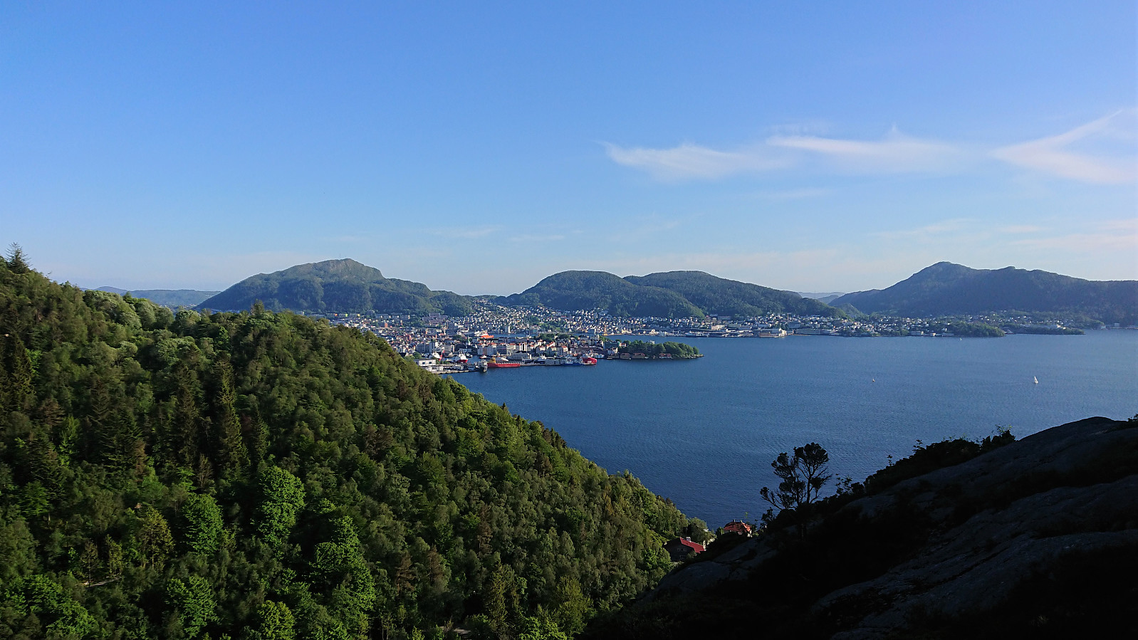
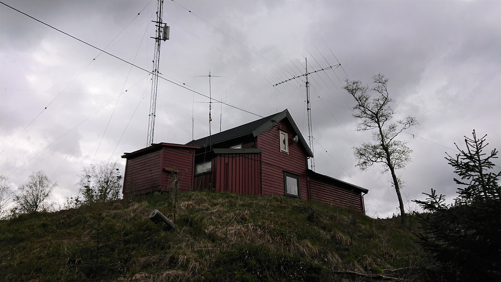
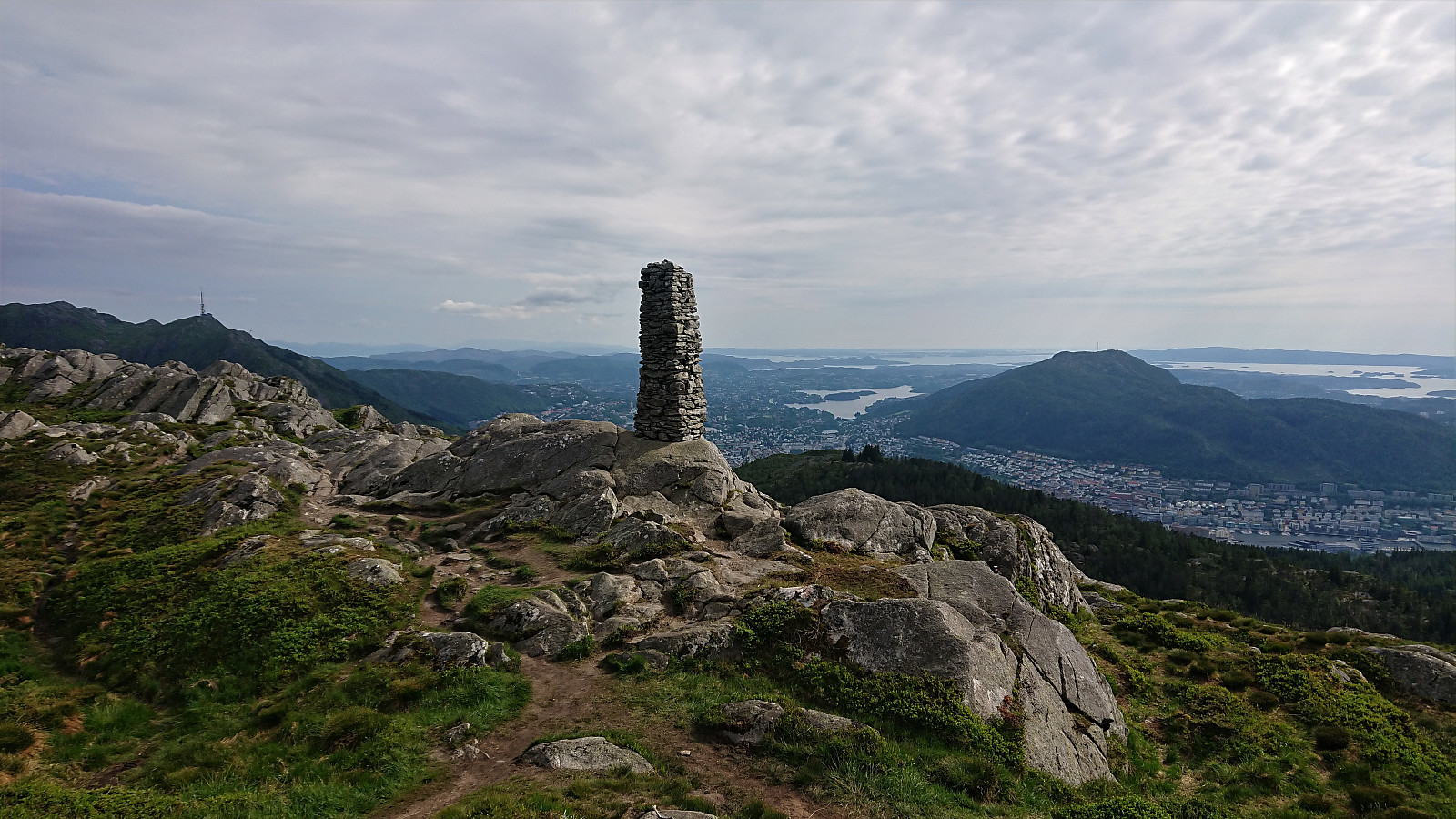 As part of the research for locating the cabins and cabins ruins mentioned in Bergensernes Fjellverden II, I also came across a location I had passed many times before but did not know the history of, namely Café Knatten . A new visit was therefore in order to take a closer look. The views are now of course more limited than what can be seen in the old pictures , especially towards Svartediket and Hardbakkedalen, but the views to the south are still pretty much intact. For an overview of the history of Café Knatten please see this excellent article in Årstadposten .
Knuskedalsfjellet, Sædalshesten and Bjørnsnipa
- Dato:
- 13.06.2020
- Turtype:
- Fjelltur
- Turlengde:
- 6:49t
- Distanse:
- 24,2km
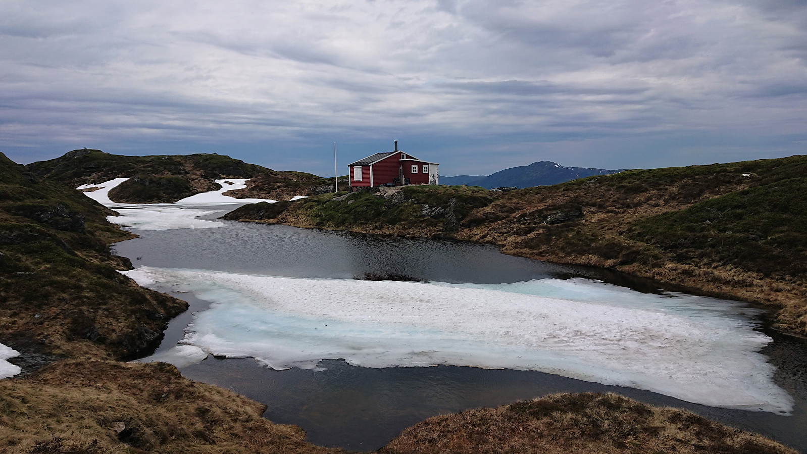 I was lucky to hitch a ride to the parking lot in Ardalen and therefore started my hike on the winding gravel road up to Herfindal. Note that while it is possible to drive further, i.e. all the way up to the parking lot at Herfindal, the narrow winding road with its limited spots for passing cars coming in the opposite direction may not be to everyone's liking.
Upon reaching Budalen the wind picked up, and even though the weather was still very warm, I had to put on my jacket in order not to get cold. The snow also started appearing, and soon it was impossible to avoid. At Vardatjørnane the trail was crossing a small stream, which during the summer can probably be done without getting wet. Today that was not an option though due to all the melting snow.
After crossing the stream, I left the >>>
I was lucky to hitch a ride to the parking lot in Ardalen and therefore started my hike on the winding gravel road up to Herfindal. Note that while it is possible to drive further, i.e. all the way up to the parking lot at Herfindal, the narrow winding road with its limited spots for passing cars coming in the opposite direction may not be to everyone's liking.
Upon reaching Budalen the wind picked up, and even though the weather was still very warm, I had to put on my jacket in order not to get cold. The snow also started appearing, and soon it was impossible to avoid. At Vardatjørnane the trail was crossing a small stream, which during the summer can probably be done without getting wet. Today that was not an option though due to all the melting snow.
After crossing the stream, I left the >>>
Ørneberget, Rognåsen and Håmanen
- Dato:
- 12.06.2020
- Turtype:
- Fjelltur
- Turlengde:
- 1:42t
- Distanse:
- 7,2km
 Short local evening hike.
Ørneberget
- Dato:
- 10.06.2020
- Turtype:
- Fjelltur
- Turlengde:
- 0:48t
- Distanse:
- 3,9km
 Short local evening hike.
Håmanen and Ørneberget
- Dato:
- 08.06.2020
- Turtype:
- Fjelltur
- Turlengde:
- 1:55t
- Distanse:
- 7,6km
 Local hike after work.
Øvredalen and Litlefjellet
- Dato:
- 07.06.2020
- Turtype:
- Fjelltur
- Turlengde:
- 3:00t
- Distanse:
- 12,3km
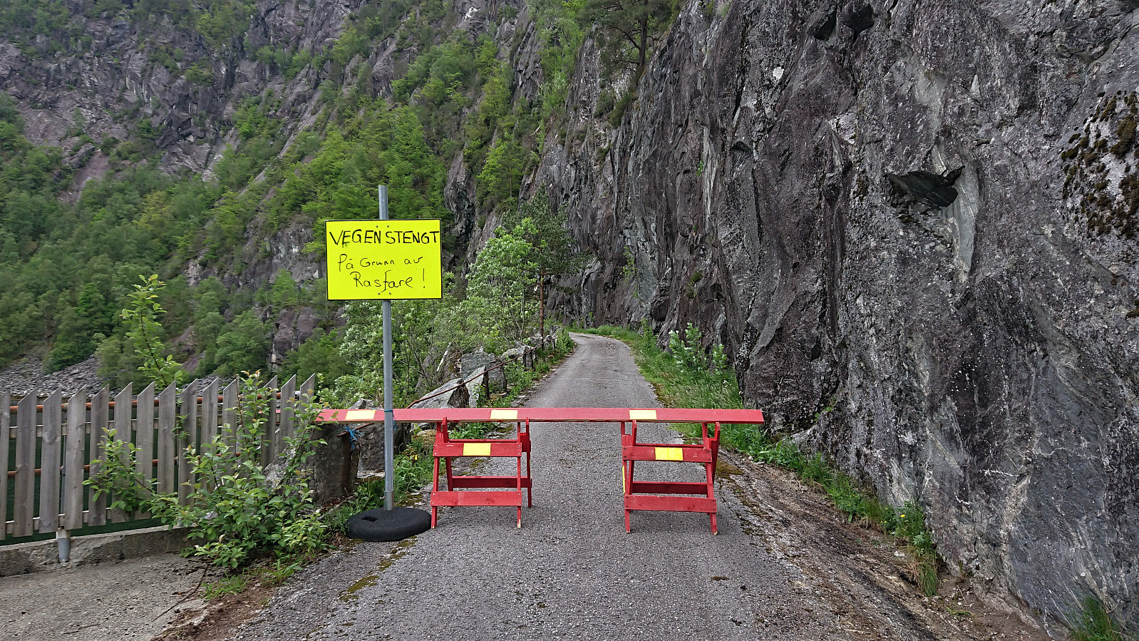 My plan for this Sunday afternoon was to take the bus to Matre and from there walk west along the old road called Sognevegen, finally arriving at the trailhead for Nipa . However, when I got to the start of Sognevegen I was welcomed by a sign indicating that the road was closed due to the risk of landslides. Given that this was my only possible route to Nipa , there was nothing to do but to leave Nipa for a future hike.
I still had more than 2.5 hours until the next (and final) bus back to Bergen though. After talking to some locals (that could inform me that Sognevegen had been closed just one week earlier - although it had always been prone to landslides), I settled on Øvredalen and a potential visit of Gråsida . Most likely a long shot, but there were really no other options to be found.
The gravel road up Øvredalen made >>>
My plan for this Sunday afternoon was to take the bus to Matre and from there walk west along the old road called Sognevegen, finally arriving at the trailhead for Nipa . However, when I got to the start of Sognevegen I was welcomed by a sign indicating that the road was closed due to the risk of landslides. Given that this was my only possible route to Nipa , there was nothing to do but to leave Nipa for a future hike.
I still had more than 2.5 hours until the next (and final) bus back to Bergen though. After talking to some locals (that could inform me that Sognevegen had been closed just one week earlier - although it had always been prone to landslides), I settled on Øvredalen and a potential visit of Gråsida . Most likely a long shot, but there were really no other options to be found.
The gravel road up Øvredalen made >>>
Ørneberget, Rognåsen and Håmanen
- Dato:
- 06.06.2020
- Turtype:
- Fjelltur
- Turlengde:
- 1:52t
- Distanse:
- 7,2km
 Local hike in much better weather than expected.
Handfjellsåta, Beintjørnvarden and Kinno from Sandvikvåg
- Dato:
- 30.05.2020
- Turtype:
- Fjelltur
- Turlengde:
- 8:51t
- Distanse:
- 32,7km
 Started by taking the bus to Halhjem and ferry to Sandvikvåg, from where I followed a small side road to the marked trailhead at Sandvikvågvegen. Besides a point where it was blocked by a falling tree, the trail could be easily followed all the way to Landasåto . Did not meet any people, but I did come across a deer on the way (see the third picture).
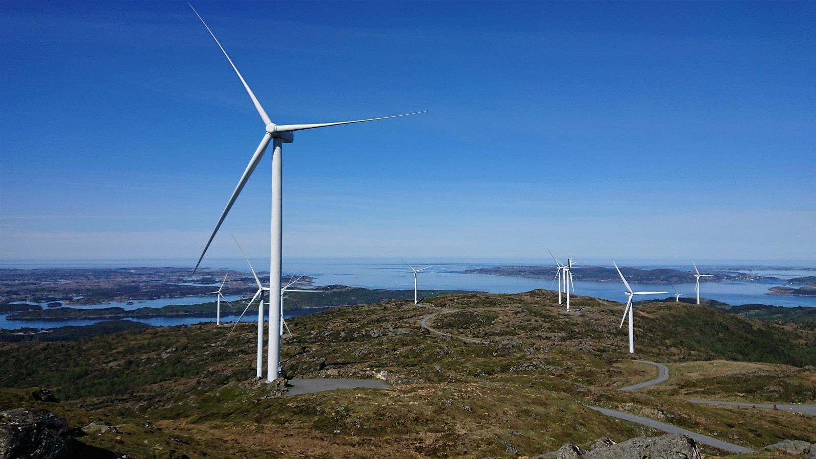
From Landasåto I connected with the gravel road going in between all of the large windmills, which I partly followed on my way to Handfjellsåta . There was a hiking sign for Handfjellsåta to the northwest, but I quickly lost the trail and ended up finding my own way to the summit. Seems like it would perhaps have been easier to follow the gravel road a bit further and ascended from the north.
There was also a trail going south back to the road, but again I lost it, >>>
Started by taking the bus to Halhjem and ferry to Sandvikvåg, from where I followed a small side road to the marked trailhead at Sandvikvågvegen. Besides a point where it was blocked by a falling tree, the trail could be easily followed all the way to Landasåto . Did not meet any people, but I did come across a deer on the way (see the third picture).
From Landasåto I connected with the gravel road going in between all of the large windmills, which I partly followed on my way to Handfjellsåta . There was a hiking sign for Handfjellsåta to the northwest, but I quickly lost the trail and ended up finding my own way to the summit. Seems like it would perhaps have been easier to follow the gravel road a bit further and ascended from the north.
There was also a trail going south back to the road, but again I lost it, >>>
Cabins and cabin ruins at Totland
- Dato:
- 27.05.2020
- Turtype:
- Fjelltur
- Turlengde:
- 3:25t
- Distanse:
- 10,7km
 Another hike to visit cabins mentioned in Bergensernes Fjellverden II (BF II), this time at Totland. We parked at Totland parkeringsplass and after figuring out how to pay for the parking, made quick visits to Hardyhytten , Linken and Fanahytten . The former now only a ruin, while the latter two seemed to be in good condition. Døvehytten/ Birkehaug was also located (Totlandsvegen 556), which looked like it had been turned into a permanent residence.
Next on the list was Maihaugen , which I had failed to even notice on my previous trips to the area. Note that of the road indicated on the map heading just north of Maihaugen, there are only weak traces, much like the cabin itself it had clearly also seen better days.
From Maihaugen we shortly headed north along the gravel road, before leaving the road and following a rather wet trail up to Laksevåg Røde Kors Hjelpekorps' hytte . Another cabin that had >>>
Another hike to visit cabins mentioned in Bergensernes Fjellverden II (BF II), this time at Totland. We parked at Totland parkeringsplass and after figuring out how to pay for the parking, made quick visits to Hardyhytten , Linken and Fanahytten . The former now only a ruin, while the latter two seemed to be in good condition. Døvehytten/ Birkehaug was also located (Totlandsvegen 556), which looked like it had been turned into a permanent residence.
Next on the list was Maihaugen , which I had failed to even notice on my previous trips to the area. Note that of the road indicated on the map heading just north of Maihaugen, there are only weak traces, much like the cabin itself it had clearly also seen better days.
From Maihaugen we shortly headed north along the gravel road, before leaving the road and following a rather wet trail up to Laksevåg Røde Kors Hjelpekorps' hytte . Another cabin that had >>>
Kviturhytten
- Dato:
- 24.05.2020
- Turtype:
- Fjelltur
- Turlengde:
- 2:17t
- Distanse:
- 7,3km
 Warning: This hike includes off-trail scrambling in steep terrain. Consider the track with care!
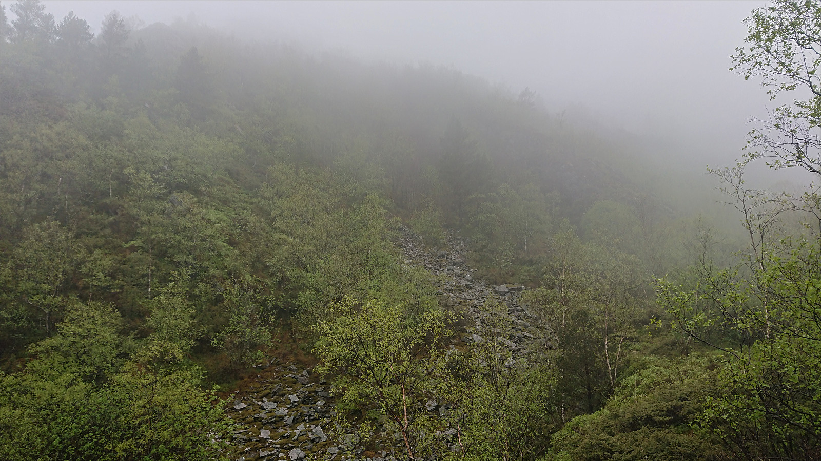
The last cabin ruin in Bergensernes Fjellverden II (BF II) in the area from Sandviksfjellet to Ulriken was what the book refers to as Kviturhytten . After finally locating it on the map, I set out from Årstadveien and followed the road along Svartediket until reaching Kviturbekken. Here I left the road on what almost looked like a trail, following the stream north.
Soon the trail however pretty much disappeared and I was left finding my own way up the steep ascent, with only some deer tracks for guidance. More scrambling than hiking, and with lots of loose small to medium size rocks. There was no real problem making progress though, as long as one was careful.
There was a lot more left of the cabin than expected, >>>
Warning: This hike includes off-trail scrambling in steep terrain. Consider the track with care!
The last cabin ruin in Bergensernes Fjellverden II (BF II) in the area from Sandviksfjellet to Ulriken was what the book refers to as Kviturhytten . After finally locating it on the map, I set out from Årstadveien and followed the road along Svartediket until reaching Kviturbekken. Here I left the road on what almost looked like a trail, following the stream north.
Soon the trail however pretty much disappeared and I was left finding my own way up the steep ascent, with only some deer tracks for guidance. More scrambling than hiking, and with lots of loose small to medium size rocks. There was no real problem making progress though, as long as one was careful.
There was a lot more left of the cabin than expected, >>>
