Arkiv - dato
Arkiv - aktivitet
-
Annen tur (3)
- Kajakkpadling (3)
- Fottur (1834)
-
Kjøretur (9)
- Biltur (9)
-
Skitur (112)
- Fjellskitur (66)
- Langrennstur (46)
-
Sykkeltur (108)
- Blandet sykling (25)
- Gatesykling (83)
Lister jeg samler etter
- Utvalgte topper og turmål i Bergen
- Alle topper i Bergen
- Voss ≥ 100m pf.
- Opptur Hordaland
- Stasjoner på Bergensbanen
- Ulvik ≥ 100m pf.
- Hordaland ≥ 100m pf.
- Mjølfjell PF > 100m
- Jondal ≥ 100m pf.
- Sunnhordland PF >= 100m
- Dagsturhyttene i Vestland
- Hordaland: Hardanger PF>=100m
- DNT-hytter i Hordaland
- Kvinnherad ≥ 100m pf.
- Sogndal ≥ 100m pf.
- Vik i Sogn ≥ 100m pf.
- Gulen ≥ 100m pf.
- DNT-hytter i Sogn og Fjordane
- Eidfjord ≥ 100m pf.
- Sogn - Sør for Sognefjorden PF>=100m
Øykjafjellet from Flakkavågen
- Dato:
- 06.06.2021
- Turtype:
- Fjelltur
- Turlengde:
- 1:14t
- Distanse:
- 2,8km
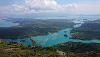 After arriving at the marked trailhead for Øykjafjellet at Flakkavågen, I left my bike at the start of the trail and continued on foot towards the summit. Note that while the sign at the trailhead was easy to locate, the start of the trail was a bit more hidden due to the uncut grass. It started out as a short tractor road, but quickly turned into an initially unmarked trail that, with the exception of it splitting once or twice early on, could be followed all the way to the summit without any difficulties. When getting to the valley northeast of the summit, a came across the first sign for Øykjafjellet, and from there on there were even some trail markers. The summit itself provided excellent views, however they were a bit limited by the low-hanging clouds not yet having lifted completely.
At the summit there were hiking signs for >>>
Geitanuken from Saudalen
- Dato:
- 05.06.2021
- Turtype:
- Fjelltur
- Turlengde:
- 2:09t
- Distanse:
- 8,3km
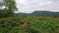 A revisit of Geitanuken from Saudalen in order to explore three new candidates for the Alle topper i Bergen list. The result was two new peaks: Olderhaug and Novvarden . Morvikavarden was also considered (32V 296251 6709540, vertical separation of about 13 meters), but I was not allowed to add it given its close proximity to Geitanuken, and instead added a new element called Morvikavarden utsiktspunkt .
Olderhaug could be reached via a short detour from the main trail and provided excellent views and even had its own trig marker. Novvarden and Morvikavarden however did not present the cairns indicated by their names. Novvarden provided very nice views into the valley south of Toppenipa and Toppefjellet and the summit could be reached by a minor detour along a weak trail. Finally, the views from Morvikavarden were rather limited and there was no clear highest point, however excellent views >>>
Fagerdalsskaret and Ørneberget NV
- Dato:
- 04.06.2021
- Turtype:
- Fjelltur
- Turlengde:
- 2:08t
- Distanse:
- 3,9km
Munkebotn and Ørneberget
- Dato:
- 03.06.2021
- Turtype:
- Fjelltur
- Turlengde:
- 1:45t
- Distanse:
- 8,5km
Ørneberget, Rognåsen and Håmanen
- Dato:
- 02.06.2021
- Turtype:
- Fjelltur
- Turlengde:
- 2:27t
- Distanse:
- 7,6km
Ørneberget and Ørneberget NV
- Dato:
- 27.05.2021
- Turtype:
- Fjelltur
- Turlengde:
- 0:56t
- Distanse:
- 4,1km
Ørneberget and Rognåsen
- Dato:
- 26.05.2021
- Turtype:
- Fjelltur
- Turlengde:
- 1:53t
- Distanse:
- 5,9km
Ørneberget and Ørneberget NV
- Dato:
- 25.05.2021
- Turtype:
- Fjelltur
- Turlengde:
- 1:28t
- Distanse:
- 3,6km
 Short local late evening hike with a longer break at Ørneberget NV to catch the sunset.
Træshovden and Svartaberget
- Dato:
- 20.05.2021
- Turtype:
- Fjelltur
- Turlengde:
- 1:31t
- Distanse:
- 4,5km
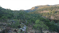 Short evening hike with the main goal of visiting Træshovden . Instead of taking the most direct route to the summit, I first followed a trail along the ridge west of Ravnestølen, which later connected with the main trail to the summit. Overall relatively limited views from this minor detour, except for at the start when one could look back at Svartaberget and Lyderhorn . There was also one spot with good views towards the west, which is more than can be said of the summit of Træshovden.
After returning to Ravnestølen, I made a revisit of Svartaberget, given that the views on my previous visit had been far from optimal. Today there were close to no clouds and I could fully enjoy the spectacular panoramic views! From the summit, I followed a trail towards the northern starting point of Knappetunnelen, passing by two of the >>>
Svelihovden and Såbotshaugen
- Dato:
- 18.05.2021
- Turtype:
- Fjelltur
- Turlengde:
- 2:44t
- Distanse:
- 7,9km
 We parked at Kvamsvegen P-plass and from there followed the gravel road up to Kvamsstølen. Here we passed through a gate and continued northwest on what was most likely the old road to Kvamsstølen. At Høgaleitet, southeast of the unnamed 243 hill, we turned west and followed a tractor road northwest towards the trail to Norhytten . However, we got fooled by the trail indicated on the map and continued too far along the tractor road. Instead of retracing our steps to locate the missed exit, we went for a shortcut following a deer track through the semi-dense vegetation, and had to climb a fence.
When walking south along the fence we soon came across the gate we should have passed through, with clear trails in both directions. I took the short detour back through the gate to figure out where we had missed our exit. The >>>


