Arkiv - dato
Arkiv - aktivitet
-
Annen tur (3)
- Kajakkpadling (3)
- Fottur (1897)
-
Kjøretur (9)
- Biltur (9)
-
Skitur (116)
- Fjellskitur (69)
- Langrennstur (47)
-
Sykkeltur (111)
- Blandet sykling (25)
- Gatesykling (86)
Lister jeg samler etter
-
Utvalgte topper og turmål i Bergen
(349/351)
 99%
99% -
Alle topper i Bergen
(393/400)
98%
-
Voss ≥ 100m pf.
(96/98)
97%
-
Opptur Hordaland
(144/159)
90%
-
Stasjoner på Bergensbanen
(33/40)
82%
-
Ulvik ≥ 100m pf.
(30/38)
78%
-
Hordaland ≥ 100m pf.
(624/863)
72%
-
Mjølfjell PF > 100m
(21/31)
67%
-
Jondal ≥ 100m pf.
(15/23)
65%
-
Dagsturhyttene i Vestland
(36/61)
59%
-
Sunnhordland PF >= 100m
(105/186)
56%
-
Hordaland: Hardanger PF>=100m
(196/359)
54%
-
DNT-hytter i Hordaland
(23/45)
51%
-
Kvinnherad ≥ 100m pf.
(40/79)
50%
-
Eidfjord ≥ 100m pf.
(13/42)
30%
-
Sogndal ≥ 100m pf.
(23/81)
28%
-
Gulen ≥ 100m pf.
(15/54)
27%
-
Vik i Sogn ≥ 100m pf.
(10/46)
21%
-
Sogn - Sør for Sognefjorden PF>=100m
(31/159)
19%
-
DNT-hytter i Sogn og Fjordane
(8/47)
17%

Storetunga and Vetle Hansbunuten from Finse
- Dato:
- 17.07.2025
- Turtype:
- Fjelltur
- Turlengde:
- 5:49t
- Distanse:
- 20,0km
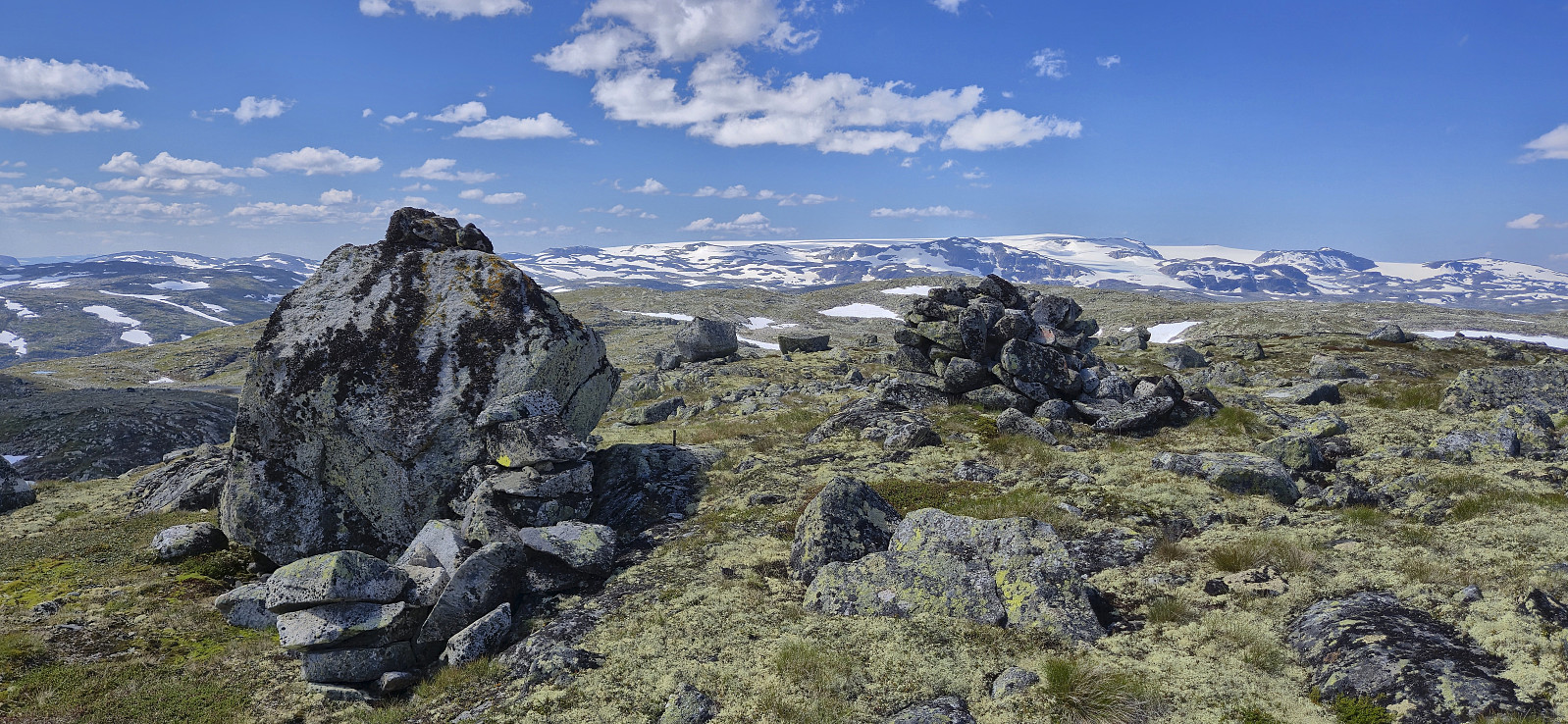 On yet another very warm day, I decided to escape some of the heat by heading up to Finse to visit two relatively recent additions to the Hordaland ≥ 100m pf. list , both of which had been upgraded due to more accurate LiDAR data . First up was Storetunga . After getting off the train at Finse, I headed southeast along Rallarvegen before later leaving the gravel road and heading off-trail towards the summit. Besides some annoying undergrowth early on, the terrain was generally easy to travers and the summit was reached without any difficulties.
After a break next to the summit cairn to take in the excellent views, I returned along the same route to Rallarvegen before crossing the river along a small bridge underneath the larger railroad bridge and started my ascent of Vetle Hansbunuten . There were a couple of small cairns in the area around the bridge but I quickly lost >>>
On yet another very warm day, I decided to escape some of the heat by heading up to Finse to visit two relatively recent additions to the Hordaland ≥ 100m pf. list , both of which had been upgraded due to more accurate LiDAR data . First up was Storetunga . After getting off the train at Finse, I headed southeast along Rallarvegen before later leaving the gravel road and heading off-trail towards the summit. Besides some annoying undergrowth early on, the terrain was generally easy to travers and the summit was reached without any difficulties.
After a break next to the summit cairn to take in the excellent views, I returned along the same route to Rallarvegen before crossing the river along a small bridge underneath the larger railroad bridge and started my ascent of Vetle Hansbunuten . There were a couple of small cairns in the area around the bridge but I quickly lost >>>
Ørneberget and Rognåsen
- Dato:
- 16.07.2025
- Turtype:
- Fjelltur
- Turlengde:
- 1:29t
- Distanse:
- 6,2km
 Short local hike on a very warm summer day.
Vardafjellet from Rindabotn
- Dato:
- 13.07.2025
- Turtype:
- Fjelltur
- Turlengde:
- 3:04t
- Distanse:
- 7,6km
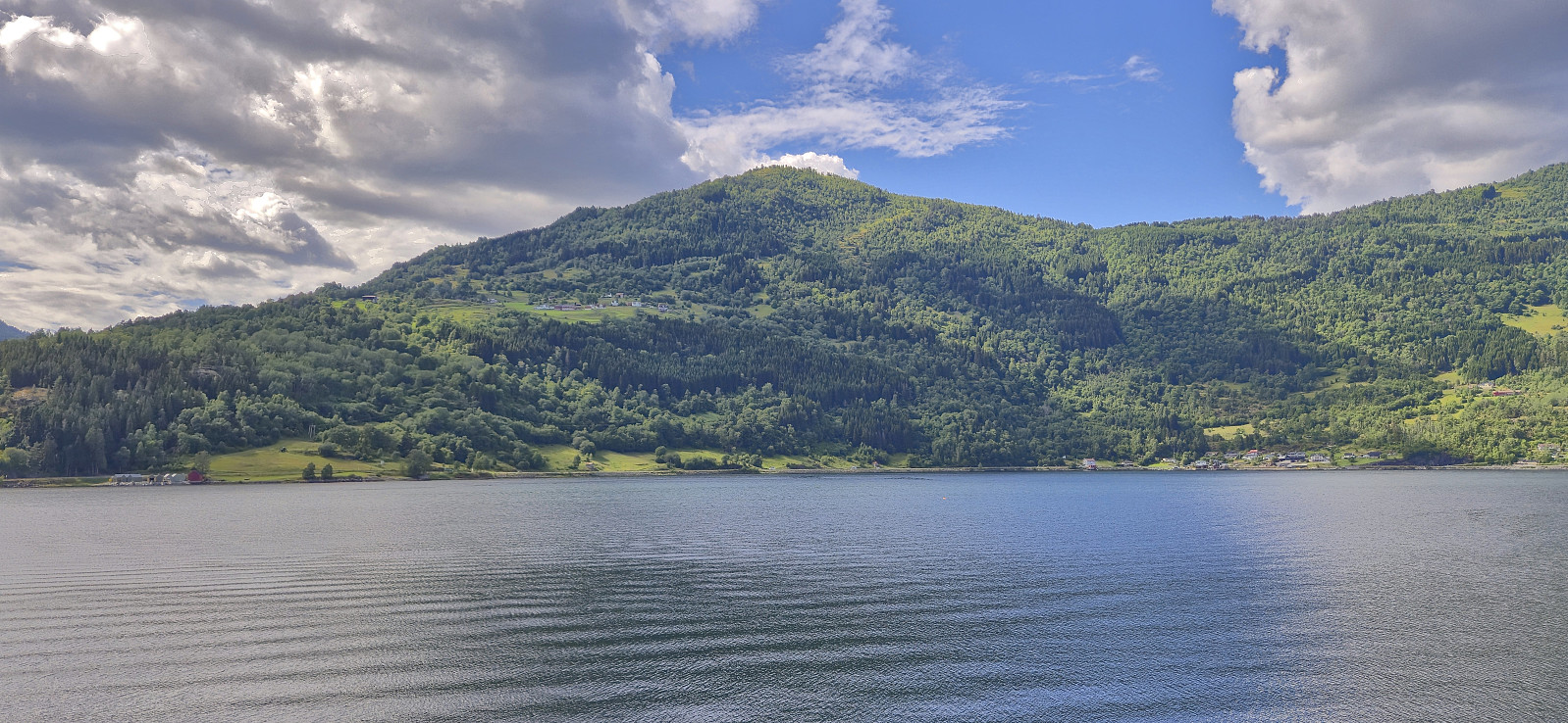
 We found parking next to the road above Rindabotn and from there continued up the gravel road. It would probably have been possible to drive further but then the parking options were less certain. We later left the gravel road and followed a marked trail heading north towards Kokkstadfjellet , however we did not head all the way there before turning west to Vardafjellet . On our way there, we had the best views of the day. Most notably north in the direction of Anestølsvatnet. At Vardafjellet, my niece continued on her own to Kambafjellet while my parents and I headed more directly south to the car. First along a marked trail and then along the winding gravel road. As a results, my niece got to Rindabotn long before us and we later picked her along Hodlekvevegen.
Helleberget from Rindabotn
- Dato:
- 11.07.2025
- Turtype:
- Fjelltur
- Turlengde:
- 2:55t
- Distanse:
- 7,6km
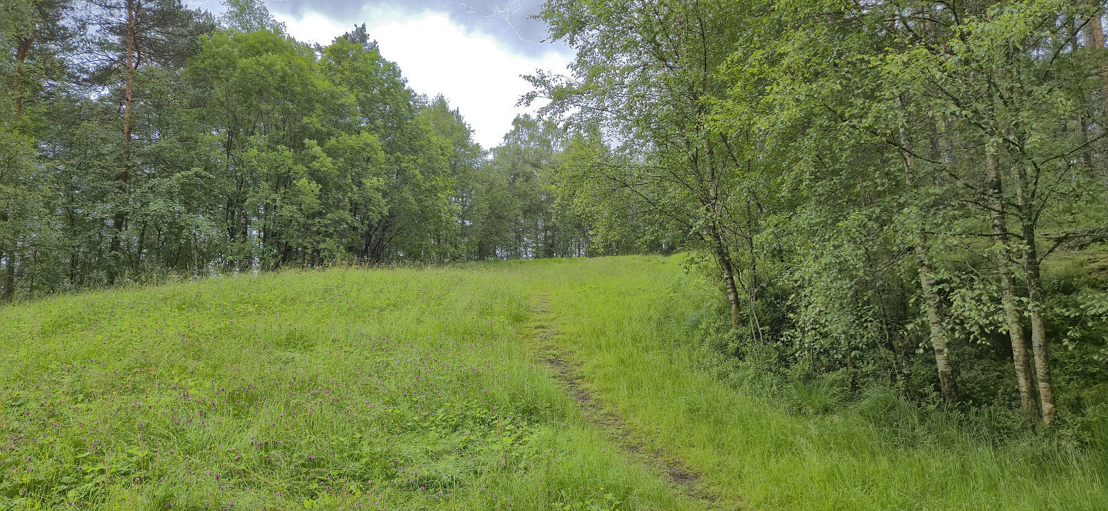
 We parked at the large parking lot at Rindabotn and from there followed the marked route to Fagereggi. First along a gravel path, then across a wooden bridge, and finally along a nice trail. We briefly lost the trail east of Fagreggjevatnet but easily picked it up again when rounding the lake on the southern side and then followed it to reconnect with our ascent route. Before this I however made a short off-trail detour on my own to the top of Helleberget .
Nuken, Hølsete, Skjeggen and Kjørrdalsselet
- Dato:
- 08.07.2025
- Turtype:
- Fjelltur
- Turlengde:
- 4:58t
- Distanse:
- 17,5km
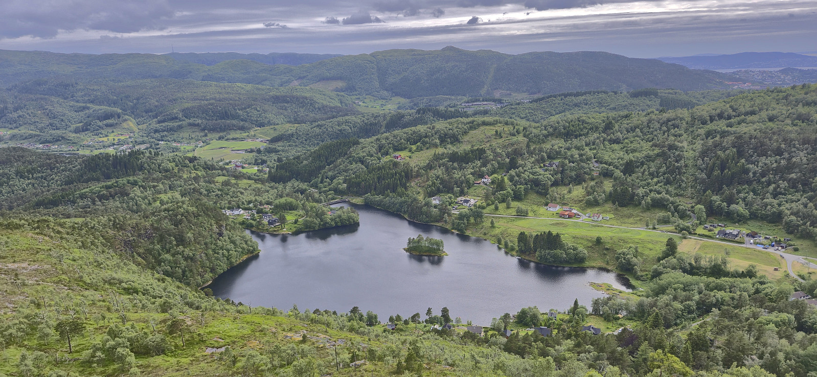
 My niece and I were dropped off at the trailhead at Åsen and followed the standard route to Nuken before descending to Hølsete and then heading up to Skjeggen via a marked trail. The summit of Skjeggen was easily reached by a short off-trail detour but was rather uninteresting. The vantage point to the southeast however provided an excellent overview and was well worth a visit. Next, we descended along a marked trail via Kjørrdalsselet to Åberget before taking a shortcut via Røvhaugane on our way to Sogndalsfjøra. Here we split ways and I completed the rest of the journey to Barsnes on my own.
Storegreggen, Simlenuten, Pyttafjellet and Gråeggi
- Dato:
- 02.07.2025
- Turtype:
- Fjelltur
- Turlengde:
- 12:17t
- Distanse:
- 28,0km
 When a single day of great weather showed up in the middle of the week, with what seemed like a rather wet weekend to come, I decided to take the day off and easily managed to convince Endre to do the same. He picked me up at my place shortly after seven and together we drove towards Ålvik to have a go at a hike we had been talking about for some time, namely a single hike that included all of the four summits neatly lined up east of Fyksesund.
After paying the 60 kr for the toll road we continued up to the parking lot at the end of the winding gravel road, which to our surprise was almost full but thankfully had room for one more car. The great weather we had been hoping for was however late to the party and a low-hanging cloud cover hid most of the views as we left the parking lot. The night before >>>
When a single day of great weather showed up in the middle of the week, with what seemed like a rather wet weekend to come, I decided to take the day off and easily managed to convince Endre to do the same. He picked me up at my place shortly after seven and together we drove towards Ålvik to have a go at a hike we had been talking about for some time, namely a single hike that included all of the four summits neatly lined up east of Fyksesund.
After paying the 60 kr for the toll road we continued up to the parking lot at the end of the winding gravel road, which to our surprise was almost full but thankfully had room for one more car. The great weather we had been hoping for was however late to the party and a low-hanging cloud cover hid most of the views as we left the parking lot. The night before >>>
Stemhaugen and Langaberget
- Dato:
- 29.06.2025
- Turtype:
- Fjelltur
- Turlengde:
- 0:44t
- Distanse:
- 2,2km
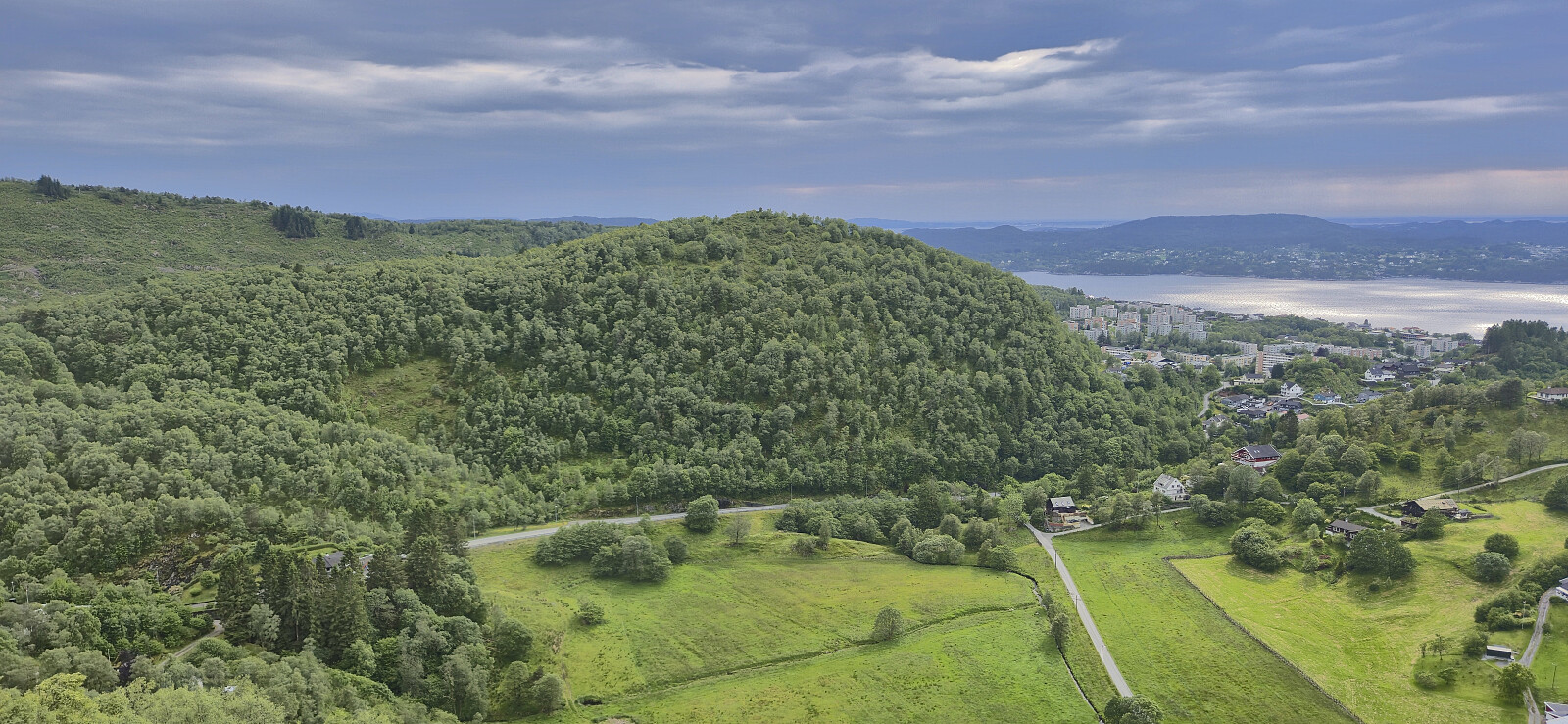
 A wet and windy start of the Sunday was used to visit yet another recent addition to the Alle topper i Bergen list , namely Langaberget . But given that I was already in the area I decided to first make a quick ascent of Stemhaugen . The latter was easily reached via a trail from the north/northeast and provided better views than expected (and has now been added as its own PB element).
For Langaberget I went for an off-trail ascent from the west. This included one short steepish section but other otherwise did not present any real challenges besides a fence that had to be climbed before getting to the summit plateau. Here there were lots of trails that could be followed to the highest point.
I returned the same way and hopped on a bus to the city center that arrived almost at the same time as I got to the bus stop northwest of the summit.
A wet and windy start of the Sunday was used to visit yet another recent addition to the Alle topper i Bergen list , namely Langaberget . But given that I was already in the area I decided to first make a quick ascent of Stemhaugen . The latter was easily reached via a trail from the north/northeast and provided better views than expected (and has now been added as its own PB element).
For Langaberget I went for an off-trail ascent from the west. This included one short steepish section but other otherwise did not present any real challenges besides a fence that had to be climbed before getting to the summit plateau. Here there were lots of trails that could be followed to the highest point.
I returned the same way and hopped on a bus to the city center that arrived almost at the same time as I got to the bus stop northwest of the summit.
Kvamsfjellet and Svarthamrane
- Dato:
- 28.06.2025
- Turtype:
- Fjelltur
- Turlengde:
- 2:26t
- Distanse:
- 10,0km
 A return to Kvamsfjellet in Lindås given that I was not 100% sure that I had visited the highest point during my first ascent back in 2017 . I largely followed the same route as last time, but skipped Vassberget this time around and instead headed directly for Kvamsfjellet, first along a gravel road and then via a rather wet marked trail.
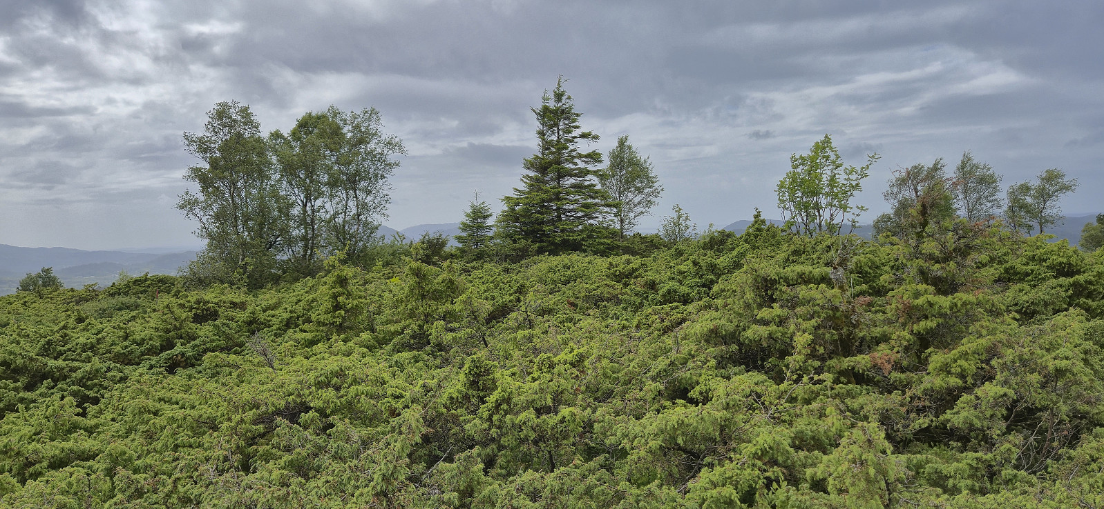
As it turned out, my revisit was not in vain, as the real summit was a bit less than 40 meters east/southeast from what I at my first visit had thought was the summit cairn. The real summit was in the middle of a dense juniper thicket making it tricky to locate the exact highest point. But thankfully the distance was only around seven meters from the trail heading south towards Svarthamrane .
Satisfied that I had finally visited the highest point at Kvamsfjellet, I continued south to Svarthamrane and then onwards to Erstadvegen, >>>
A return to Kvamsfjellet in Lindås given that I was not 100% sure that I had visited the highest point during my first ascent back in 2017 . I largely followed the same route as last time, but skipped Vassberget this time around and instead headed directly for Kvamsfjellet, first along a gravel road and then via a rather wet marked trail.
As it turned out, my revisit was not in vain, as the real summit was a bit less than 40 meters east/southeast from what I at my first visit had thought was the summit cairn. The real summit was in the middle of a dense juniper thicket making it tricky to locate the exact highest point. But thankfully the distance was only around seven meters from the trail heading south towards Svarthamrane .
Satisfied that I had finally visited the highest point at Kvamsfjellet, I continued south to Svarthamrane and then onwards to Erstadvegen, >>>
Hetlebakksåta, Svartafjellet, Kletten and Eika
- Dato:
- 27.06.2025
- Turtype:
- Fjelltur
- Turlengde:
- 2:17t
- Distanse:
- 6,8km
 A revisit of Hetlebakksåta with the main objective of also ascending a recent addition to the Alle topper i Bergen list : Eika . After following the usual trail from the north along the ridge to the top of Hetlebakksåta, I continued on the trail towards Svartafjellet . Here I had a short break before descending off-trail to Eika, making a short detour on the way to ascend Kletten - a slightly higher hill a bit further north. I then headed west to the southern end of Hetlebakkstemma where I connected with a weak trail that also had a couple of wooden bridges seemingly built for mountain biking. After passing by the houses at the end of the street, the hike was concluded by following the road to Blindheim from where I took the bus home to Lønborg.
Huseberget from Støbotn
- Dato:
- 22.06.2025
- Turtype:
- Fjelltur
- Turlengde:
- 0:49t
- Distanse:
- 3,3km
 Short Sunday hike to Huseberget , a very recent addition to the Alle topper i Bergen list . I started from the bus stop at Støbotn and after following the paved road up to the trailhead I pretty much followed Kjell 's route to the summit. Excellent views of Hitland and Toppe from near the highest point. As I had not seen much of the weak track that Kjell mentioned in his trip report , I simply made a more direct shortcut north from the summit to reconnect with the trail. Upon getting to the road I increased my speed to a light jog such that I could catch an earlier bus home from Støbotn.
