Arkiv - dato
Arkiv - aktivitet
-
Annen tur (3)
- Kajakkpadling (3)
- Fottur (1844)
-
Kjøretur (9)
- Biltur (9)
-
Skitur (113)
- Fjellskitur (67)
- Langrennstur (46)
-
Sykkeltur (108)
- Blandet sykling (25)
- Gatesykling (83)
Lister jeg samler etter
-
Utvalgte topper og turmål i Bergen
(343/344)
 99%
99% -
Alle topper i Bergen
(390/397)
98%
-
Voss ≥ 100m pf.
(96/98)
97%
-
Opptur Hordaland
(144/159)
90%
-
Stasjoner på Bergensbanen
(31/40)
77%
-
Ulvik ≥ 100m pf.
(28/38)
73%
-
Hordaland ≥ 100m pf.
(617/863)
71%
-
Mjølfjell PF > 100m
(21/31)
67%
-
Jondal ≥ 100m pf.
(15/23)
65%
-
Sunnhordland PF >= 100m
(105/186)
56%
-
Dagsturhyttene i Vestland
(33/61)
54%
-
Hordaland: Hardanger PF>=100m
(189/359)
52%
-
DNT-hytter i Hordaland
(23/45)
51%
-
Kvinnherad ≥ 100m pf.
(40/79)
50%
-
Sogndal ≥ 100m pf.
(23/81)
28%
-
Eidfjord ≥ 100m pf.
(10/42)
23%
-
Vik i Sogn ≥ 100m pf.
(10/46)
21%
-
Gulen ≥ 100m pf.
(10/54)
18%
-
DNT-hytter i Sogn og Fjordane
(8/47)
17%
-
Sogn - Sør for Sognefjorden PF>=100m
(26/159)
16%

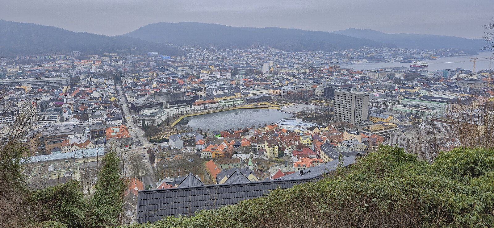
Fjellveien, Sandviksbatteriet and Håmanen
- Dato:
- 15.03.2026
- Turtype:
- Fjelltur
- Turlengde:
- 2:16t
- Distanse:
- 8,8km
 Local Sunday hike.
Ørneberget, Furukammen and Hellen festning
- Dato:
- 14.03.2026
- Turtype:
- Fjelltur
- Turlengde:
- 1:03t
- Distanse:
- 4,0km
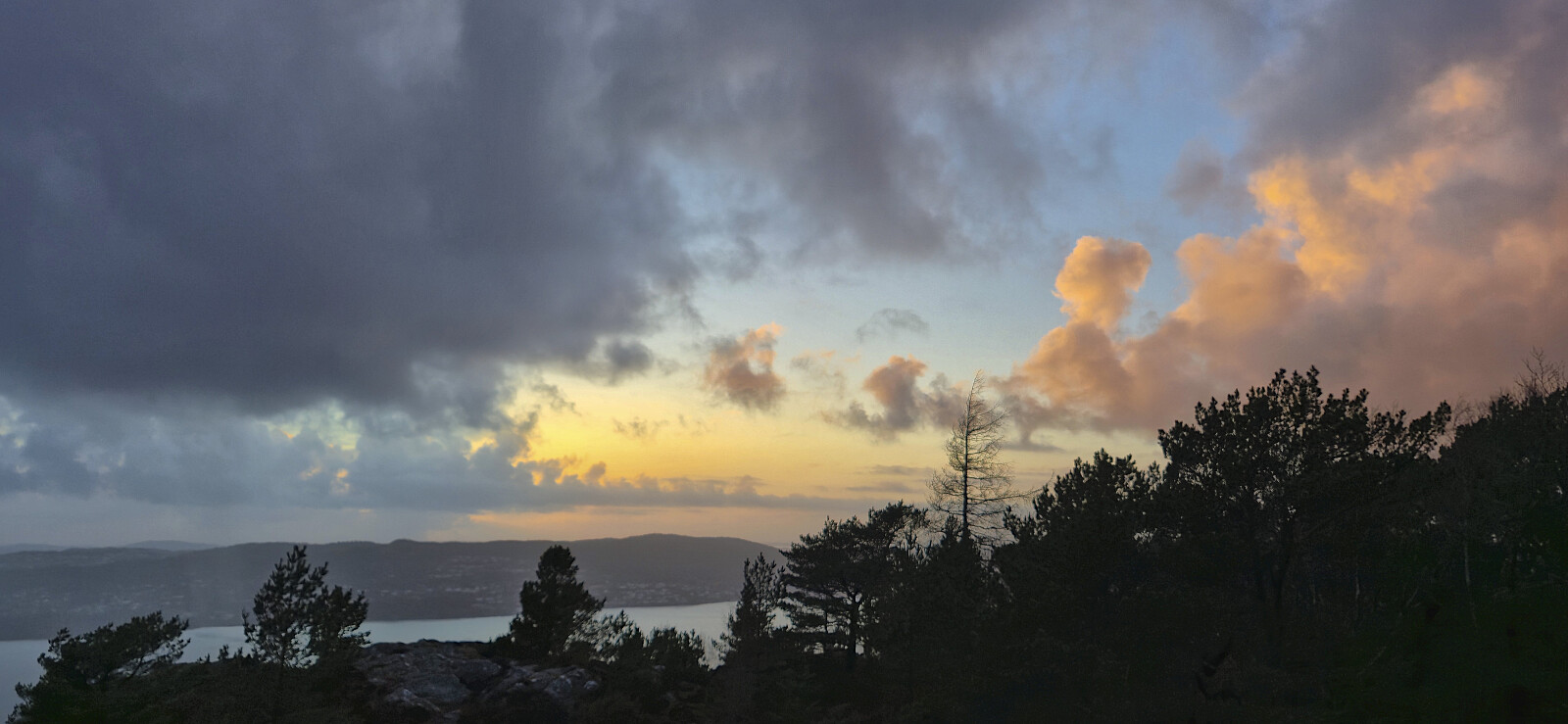 Short local Saturday hike around sunset.
Across Hellen festning
- Dato:
- 10.03.2026
- Turtype:
- Fottur
- Turlengde:
- 0:36t
- Distanse:
- 3,2km
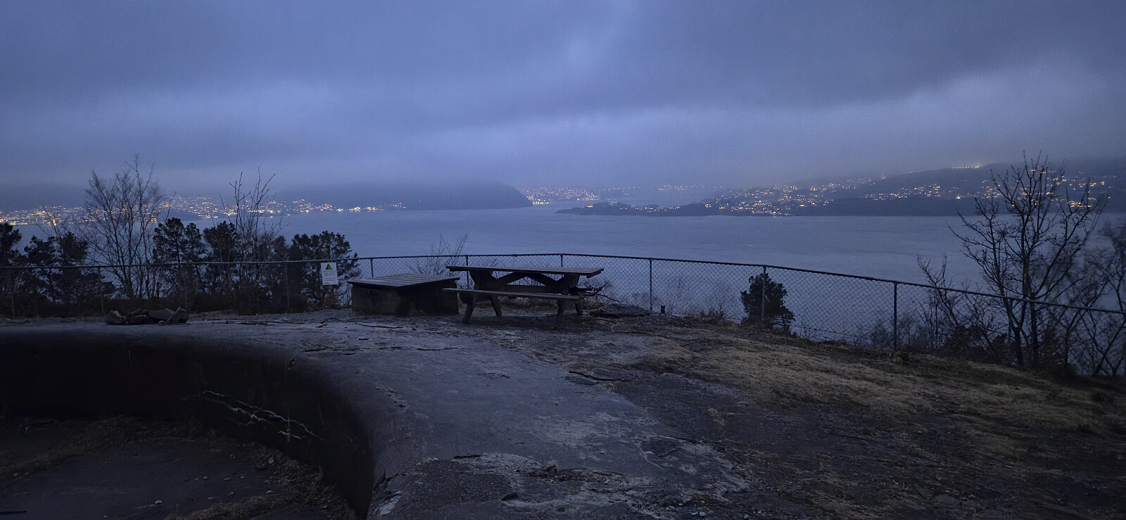 Short local hike after work.
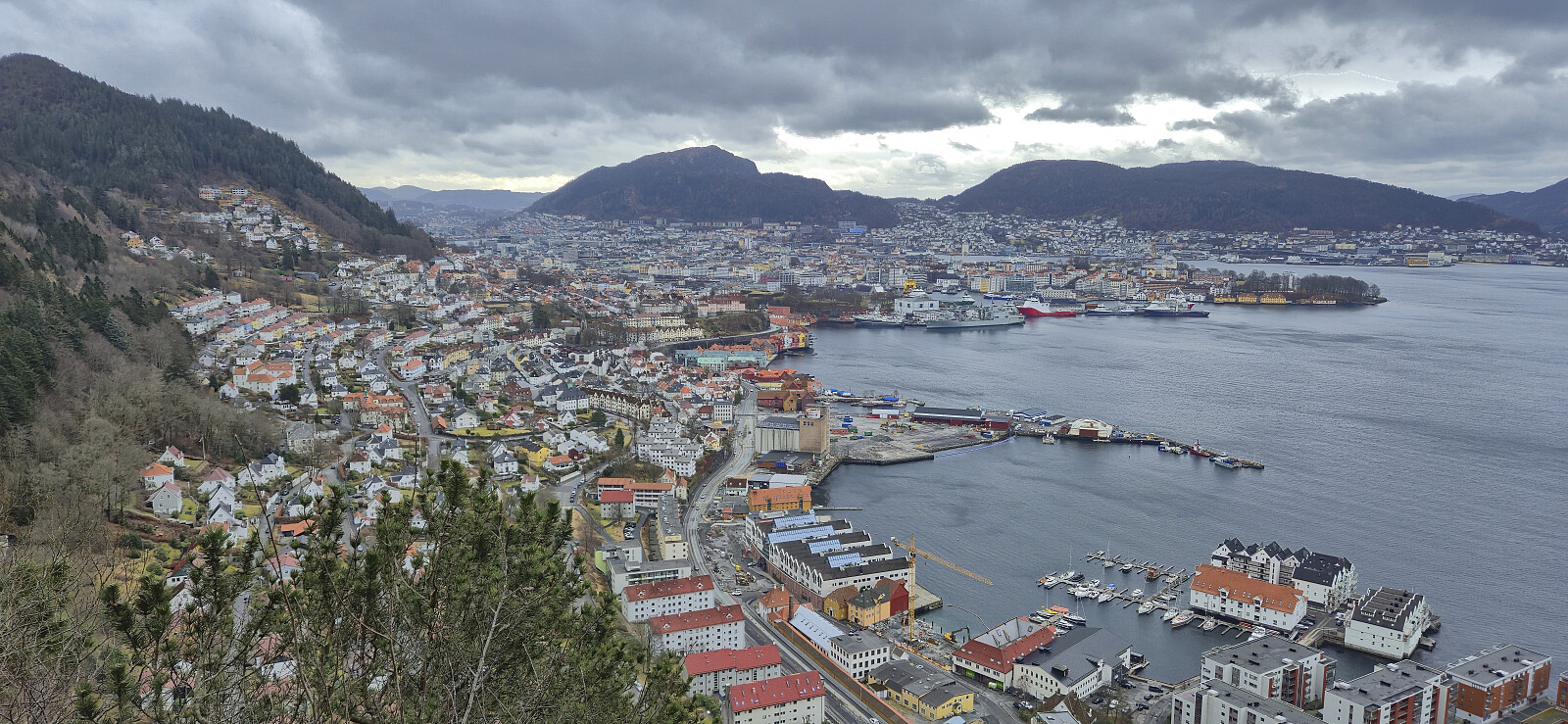
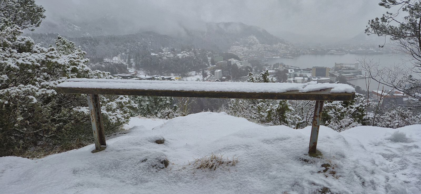
Fjellveien
- Dato:
- 08.03.2026
- Turtype:
- Fottur
- Turlengde:
- 2:10t
- Distanse:
- 8,6km
 Short hike on a gray Sunday.
Oppstemten, Ulriken and Landåseggen
- Dato:
- 04.03.2026
- Turtype:
- Fjelltur
- Turlengde:
- 1:57t
- Distanse:
- 6,8km
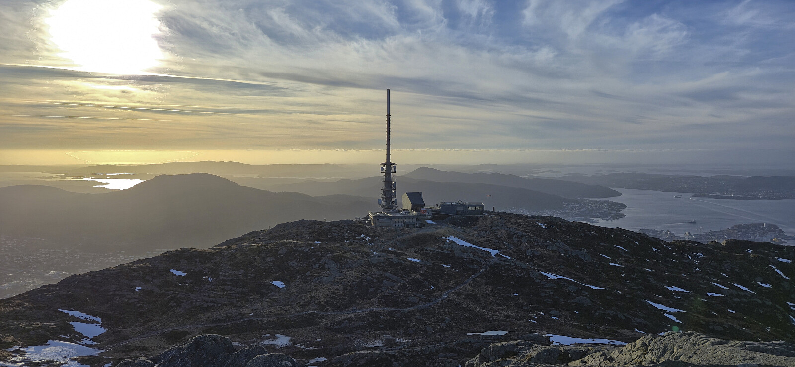 Short hike before heading home from work. Sunny, but cold wind at the top.
Hanøyna and Ramsøyna
- Dato:
- 01.03.2026
- Turtype:
- Fjelltur
- Turlengde:
- 3:02t
- Distanse:
- 9,3km
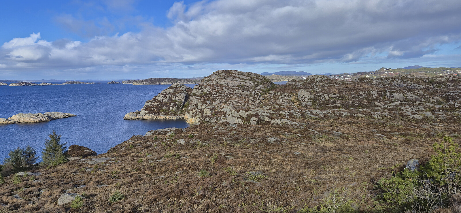 Inspired by Kjell 's trip to Ramsøyna almost exactly one year ago, we drove to Hanøyna were we parked at the almost empty parking lot outside Hanøy Skole (it was Sunday after all). From there we followed the main road southwest to Ramsøyna for a visit of Ramsøy Fort and Nordvestre Ramsøytangen. On the way back to the car we made quick stops at Stora Lauvøyna and Hanøyklubben , both accessible via ok trails. Note that the latter is part of Hanøyklubben naturreservat and is off limits for hikers between April 15th and July 31st due to the seabird nesting season.
Bratland Camping to Midtun via Ørnatua and Dyngelandsåsen
- Dato:
- 28.02.2026
- Turtype:
- Fjelltur
- Turlengde:
- 3:10t
- Distanse:
- 11,0km
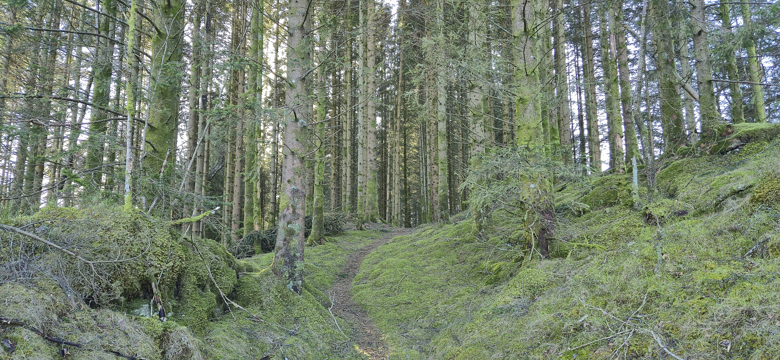 A return to Bratland Camping to explore a new trail I had discovered during last weekend's hike from Sædalen to Bratland Camping via Hauggjelsvarden . In the process I also visited a new minor peak now added to the Alle topper i Bergen list , namely Ørnatua . The start of the trail from Bratland Camping is marked and easy to follow, while for the rest of the route southwest to Grimeneset the trail was weaker and unmarked but still overall easy to follow.
After reconnecting with the paved road I continued southwest with the plan to ascend Dyngelandsåsen from the east, however I failed to locate any trailheads and ended up rounding the hill and instead ascending via Tårnnebben from the southwest.
The hike was concluded by a quick visit of Midtun holdeplass , a stop at Gamle Vossebanen , before getting on a bus back to the city center.
A return to Bratland Camping to explore a new trail I had discovered during last weekend's hike from Sædalen to Bratland Camping via Hauggjelsvarden . In the process I also visited a new minor peak now added to the Alle topper i Bergen list , namely Ørnatua . The start of the trail from Bratland Camping is marked and easy to follow, while for the rest of the route southwest to Grimeneset the trail was weaker and unmarked but still overall easy to follow.
After reconnecting with the paved road I continued southwest with the plan to ascend Dyngelandsåsen from the east, however I failed to locate any trailheads and ended up rounding the hill and instead ascending via Tårnnebben from the southwest.
The hike was concluded by a quick visit of Midtun holdeplass , a stop at Gamle Vossebanen , before getting on a bus back to the city center.
Across Hellen festning
- Dato:
- 24.02.2026
- Turtype:
- Fottur
- Turlengde:
- 0:39t
- Distanse:
- 3,2km
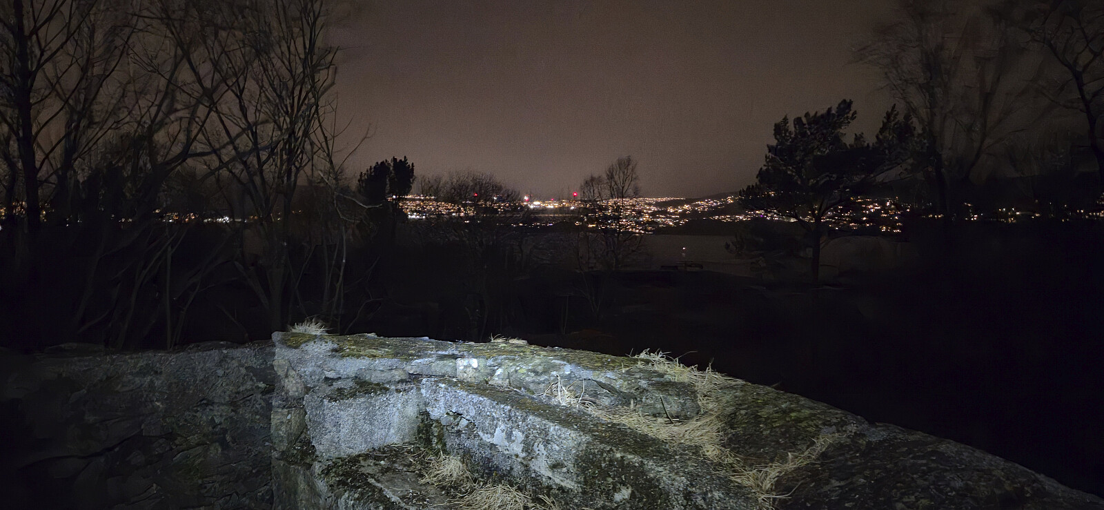 Short local evening hike.
Hellen festning and Furukammen
- Dato:
- 22.02.2026
- Turtype:
- Fottur
- Turlengde:
- 2:26t
- Distanse:
- 4,6km
 Short local Sunday hike during a light snow shower that would later turned into rain.
Sædalen to Bratland Camping via Hauggjelsvarden
- Dato:
- 21.02.2026
- Turtype:
- Fjelltur
- Turlengde:
- 4:09t
- Distanse:
- 10,5km
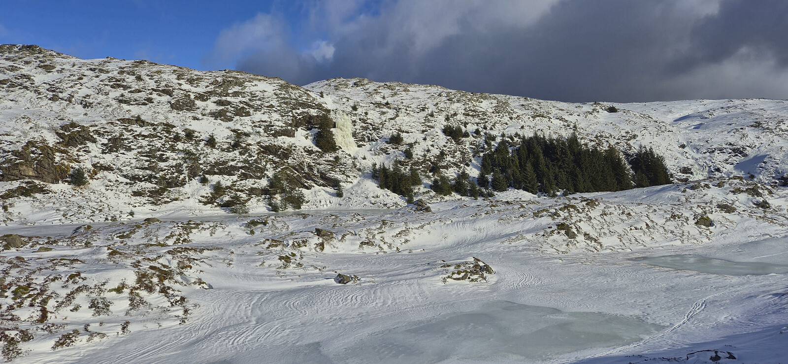 A return to Hauggjelsvarden for the second Saturday in a row. I had initially considered skiing across Vidden but a quick look at the web camera at Ulriken changed my mind. Instead I opted for exploring a new route from Sædalen to Bratland Camping via Hauggjelsvarden, which was overall a success.
