Arkiv - dato
Arkiv - aktivitet
-
Annen tur (3)
- Kajakkpadling (3)
- Fottur (1768)
-
Kjøretur (9)
- Biltur (9)
-
Skitur (109)
- Fjellskitur (65)
- Langrennstur (44)
-
Sykkeltur (108)
- Blandet sykling (25)
- Gatesykling (83)
Lister jeg samler etter
- Voss ≥ 100m pf.
- Kvam ≥ 100m pf.
- Opptur Hordaland
- Stasjoner på Bergensbanen
- Ulvik ≥ 100m pf.
- Hordaland ≥ 100m pf.
- Mjølfjell PF > 100m
- Jondal ≥ 100m pf.
- Sunnhordland PF >= 100m
- Dagsturhyttene i Vestland
- Kvinnherad ≥ 100m pf.
- Hordaland: Hardanger PF>=100m
- DNT-hytter i Hordaland
- Sogndal ≥ 100m pf.
- Vik i Sogn ≥ 100m pf.
- DNT-hytter i Sogn og Fjordane
- Eidfjord ≥ 100m pf.
- Etne ≥ 100m pf.
- Ullensvang ≥ 100m pf.
- Sogn - Sør for Sognefjorden PF>=100m
Ørneberget
- Dato:
- 05.11.2016
- Turtype:
- Fjelltur
Skagen and Veten from Vikaleitet
- Dato:
- 29.10.2016
- Turtype:
- Fjelltur
- Turlengde:
- 3:43t
- Distanse:
- 12,7km
 Started by taking the bus to Vikaleitet and walking up Sæterstølsvegen (note that the GPS tracking was not turned on until 10-15 min into the hike). From Sæterstøl I easily located the trail towards Veten and followed it until I found a smaller trail in the direction of Skagen . Even though it is not a very high peak, it did provide some nice views.
From Skagen I continued onwards to Veten and after a short break at the top, I decided to go via Storsåta (a smaller peak to the west of Veten). I did not locate a trail to the summit of Storsåta, but it was not too difficult to reach. However, it was not really worth it as the views were pretty poor. It got a bit better when walking 50 meters or so northeast through the trees at the summit, but still not a summit I can really recommend.
I returned to the trail >>>
Borga from Hardbakkedalen
- Dato:
- 16.10.2016
- Turtype:
- Fjelltur
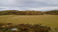 Started from Svartediket and from there hiked up Hardbakkedalen to get to Borgaskaret. There I followed the trail towards Grønetua , but before reaching Grønetua I turned east on a trail towards Borga . But as far as I could tell, the trail did not head to the summit of Borga, so after a while I decided to rather try the quickest route to the top, entering the Borga plateau at the northwest corner. From there I could easily follow an unmarked trail to the summit. From the summit I followed more or less the same route back to Grønteua and from there passed by Vikinghytten , before crossing Rundemanen on the way to the city center.
Knappenfjellet to Nipedalen
- Dato:
- 15.10.2016
- Turtype:
- Fjelltur
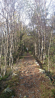 Started by taking the bus to Straume Bro and from there walking towards Hesthaugen for the real start of the hike. I followed the trail across Knappenfjellet and continued down to Gjeddevatnet and onwards along the main road to the end of Bjørndalsvatnet, where I found a trail taking me through the forest via Svartatjørna and Tennebekktjørna to Nipedalen, and finally down to Lyngbø for the bus back to the city center.
See this hike for a GPS track of the same route.
Ulriken
- Dato:
- 12.10.2016
- Turtype:
- Fjelltur
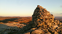 Short evening hike to the summit of Ulriken , with a short detour to Turnerhytten on the ascent.
Hauggjelsvarden from Isdalen
- Dato:
- 09.10.2016
- Turtype:
- Fjelltur
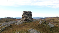 Started from Svartediket and walked to the start of Isdalen. I then climbed up Isdalen to Hauggjelsvarden and from there followed the standard trail across Vidden, with a minor detour to the top of Storhaugen . (For a GPS track of the trail up Isdalen, see this hike: Isdalen .)
Hausdalshorga from Osavatnet
- Dato:
- 04.10.2016
- Turtype:
- Fjelltur
- Turlengde:
- 5:30t
 A perfect October day for hiking! We started from the parking lot at Osavatnet and from there followed the unmarked trail to Austefjellet . Here we had a short break before continuing to Hausdalshorga . After another short break we took the same route back to Austefjellet and from there followed the trail to Redningshytten , Svartavatnet and finally back to the car.
Birkelandsnipa and Nonhøyen
- Dato:
- 02.10.2016
- Turtype:
- Fjelltur
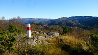 Took the bus to Hetlebakkvegen and walked towards Hetlebakkstemma. Just before Hetlebakkstemma I followed the trail towards Birkelandsnipa . From the summit I continued towards Birkeland. This trail however disappeared, but in the end I reached the main road (E16).
I then walked towards Liavatnet, but decided on a detour to Nonhøyen , following Langarinden almost all the way to the summit. From Nonhøyen I continued to Flaktveit and Kråvatnet, before heading back to Nyborg and the bus back home.
Sjurstonipa, Spåkefjellet and Beitelen
- Dato:
- 25.09.2016
- Turtype:
- Fjelltur
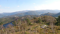 Started by taking the bus to Gamsevegen and walking to the summit of Sjurstonipa . From there I continued south to Stemmevatnet before heading back up Sjurstodalen and across Spåkefjellet , and then down to the bridge at the end of Spåkevatnet. Next, I followed the road towards Gaupås before locating the trail to Beitelen . The views from the summit itself were limited, but there were better views both south and north of the summit.
Reppadalen and Ådnanipa
- Dato:
- 18.09.2016
- Turtype:
- Fjelltur
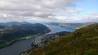 We parked at the parking lot next to Stølsvegen and followed the marked trail to Reppadalen. This started out as a gravel road that turned into a smaller trail when getting closer to Reppadalen. From Reppadalen we followed another trail towards Ådnanipa and from there continued north to Åsheim, before taking a U-turn and following the gravel road back to the car.


