Arkiv - dato
Arkiv - aktivitet
-
Annen tur (3)
- Kajakkpadling (3)
- Fottur (1738)
-
Kjøretur (9)
- Biltur (9)
-
Skitur (109)
- Fjellskitur (65)
- Langrennstur (44)
-
Sykkeltur (106)
- Blandet sykling (25)
- Gatesykling (81)
Lister jeg samler etter
-
Utvalgte topper og turmål i Bergen
(332/333)
 99%
99% -
Alle topper i Bergen
(379/386)
98%
-
Kvam ≥ 100m pf.
(41/44)
93%
-
Opptur Hordaland
(143/159)
89%
-
Voss ≥ 100m pf.
(84/98)
85%
-
Stasjoner på Bergensbanen
(28/36)
77%
-
Hordaland ≥ 100m pf.
(587/863)
68%
-
Ulvik ≥ 100m pf.
(24/38)
63%
-
Jondal ≥ 100m pf.
(13/23)
56%
-
Dagsturhyttene i Vestland
(33/61)
54%
-
Sunnhordland PF >= 100m
(99/186)
53%
-
DNT-hytter i Hordaland
(22/45)
48%
-
Hordaland: Hardanger PF>=100m
(164/359)
45%
-
Kvinnherad ≥ 100m pf.
(35/79)
44%
-
Sogndal ≥ 100m pf.
(23/81)
28%
-
DNT-hytter i Sogn og Fjordane
(8/47)
17%
-
Eidfjord ≥ 100m pf.
(6/42)
14%
-
Etne ≥ 100m pf.
(7/51)
13%
-
Ullensvang ≥ 100m pf.
(17/153)
11%
-
Opptur-topper i Sogn og Fjordane
(17/177)
9%

Fagerdalsfjellet, Ørneberget and Hellen festning
- Dato:
- 28.12.2019
- Turtype:
- Fjelltur
- Turlengde:
- 1:18t
- Distanse:
- 5,4km
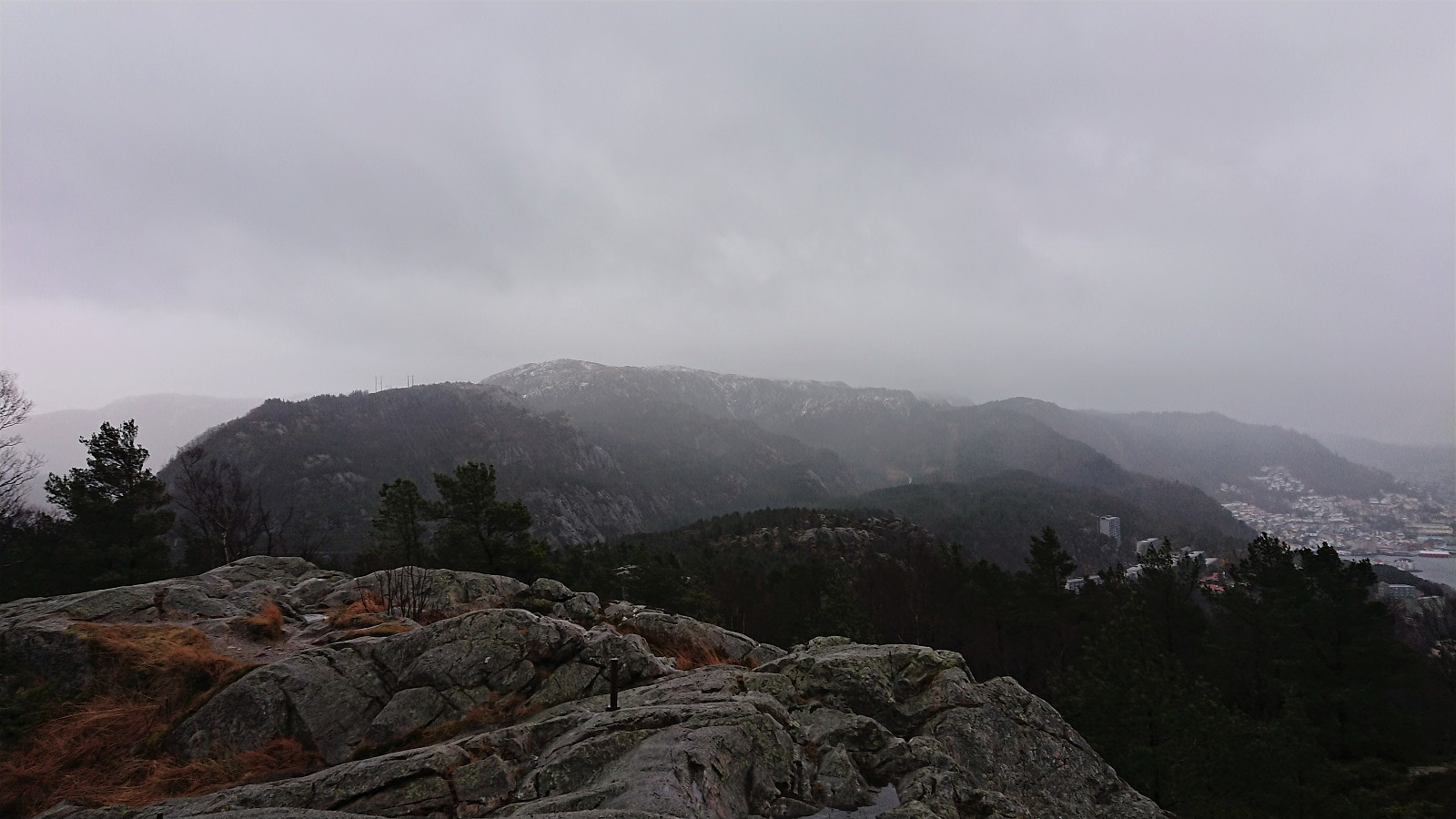 Short local hike on a gray and rainy day.
Tennebekktjernet
- Dato:
- 27.12.2019
- Turtype:
- Fottur
- Turlengde:
- 1:09t
- Distanse:
- 5,9km
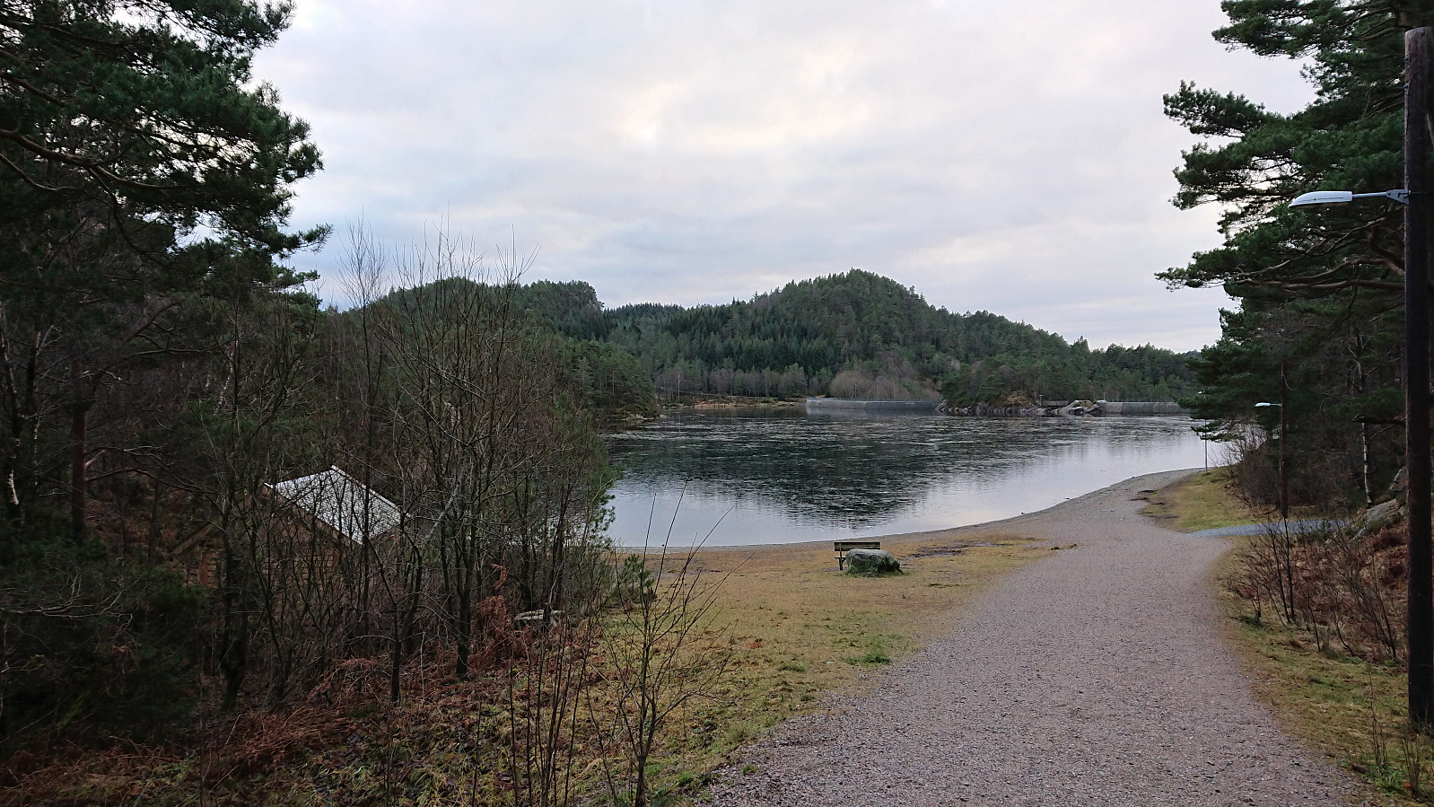 Short hike in the area around Tennebekktjernet including a couple of PB-elements I had not previously visited. Also added a new one for Tjørnagrind .
Stølafjellet and Ilefjellet from Våge
- Dato:
- 26.12.2019
- Turtype:
- Fjelltur
- Turlengde:
- 5:07t
- Distanse:
- 21,9km
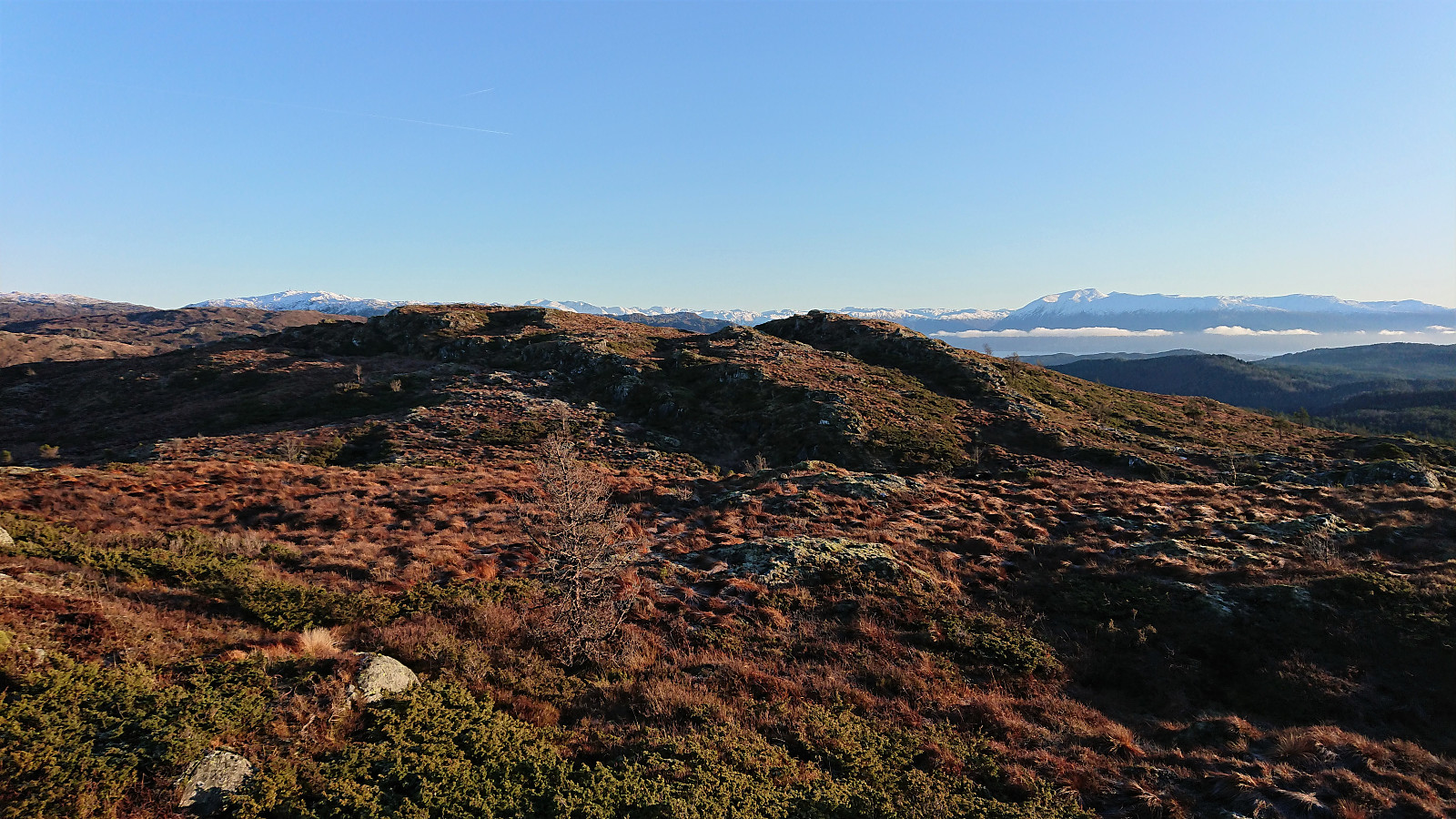 Stølafjellet
I started by taking the bus to Halhjem and the ferry to Våge. From Våge I followed the main road south to Reisa, taking a shortcut next to the school/football field to more quickly get to the main road in Uggdalsdalen, and then the shortest route up to the trailhead for Stølafjellet . The latter pretty much led me through someone's backyard. It is better to take the only slightly longer route to the west in order to avoid feeling like a trespasser.
The trailhead was unmarked, but the tractor road, and later trail, was marked with red paint. I followed the tractor road until it came to an end at a viewpoint with a bench, and from there followed the marked trail all the way to the cairn . The red markings pretty much disappeared towards the end, but by then the large cairn could be spotted anyway.
After >>>
Stølafjellet
I started by taking the bus to Halhjem and the ferry to Våge. From Våge I followed the main road south to Reisa, taking a shortcut next to the school/football field to more quickly get to the main road in Uggdalsdalen, and then the shortest route up to the trailhead for Stølafjellet . The latter pretty much led me through someone's backyard. It is better to take the only slightly longer route to the west in order to avoid feeling like a trespasser.
The trailhead was unmarked, but the tractor road, and later trail, was marked with red paint. I followed the tractor road until it came to an end at a viewpoint with a bench, and from there followed the marked trail all the way to the cairn . The red markings pretty much disappeared towards the end, but by then the large cairn could be spotted anyway.
After >>>
Hellemyrstien and Sandviksbatteriet
- Dato:
- 25.12.2019
- Turtype:
- Fottur
- Turlengde:
- 1:43t
- Distanse:
- 7,0km
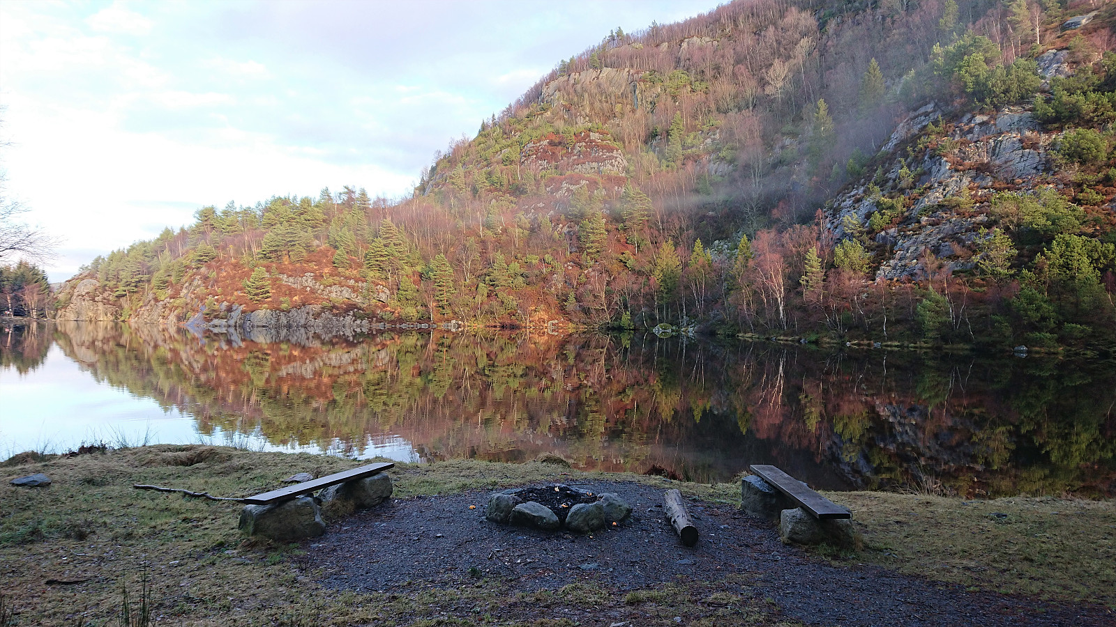 Local hike in between the Christmas family gatherings.
Hellen festning and Furukammen
- Dato:
- 23.12.2019
- Turtype:
- Fottur
- Turlengde:
- 1:23t
- Distanse:
- 5,4km
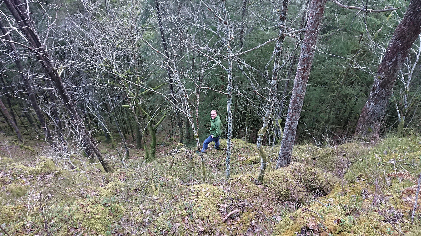
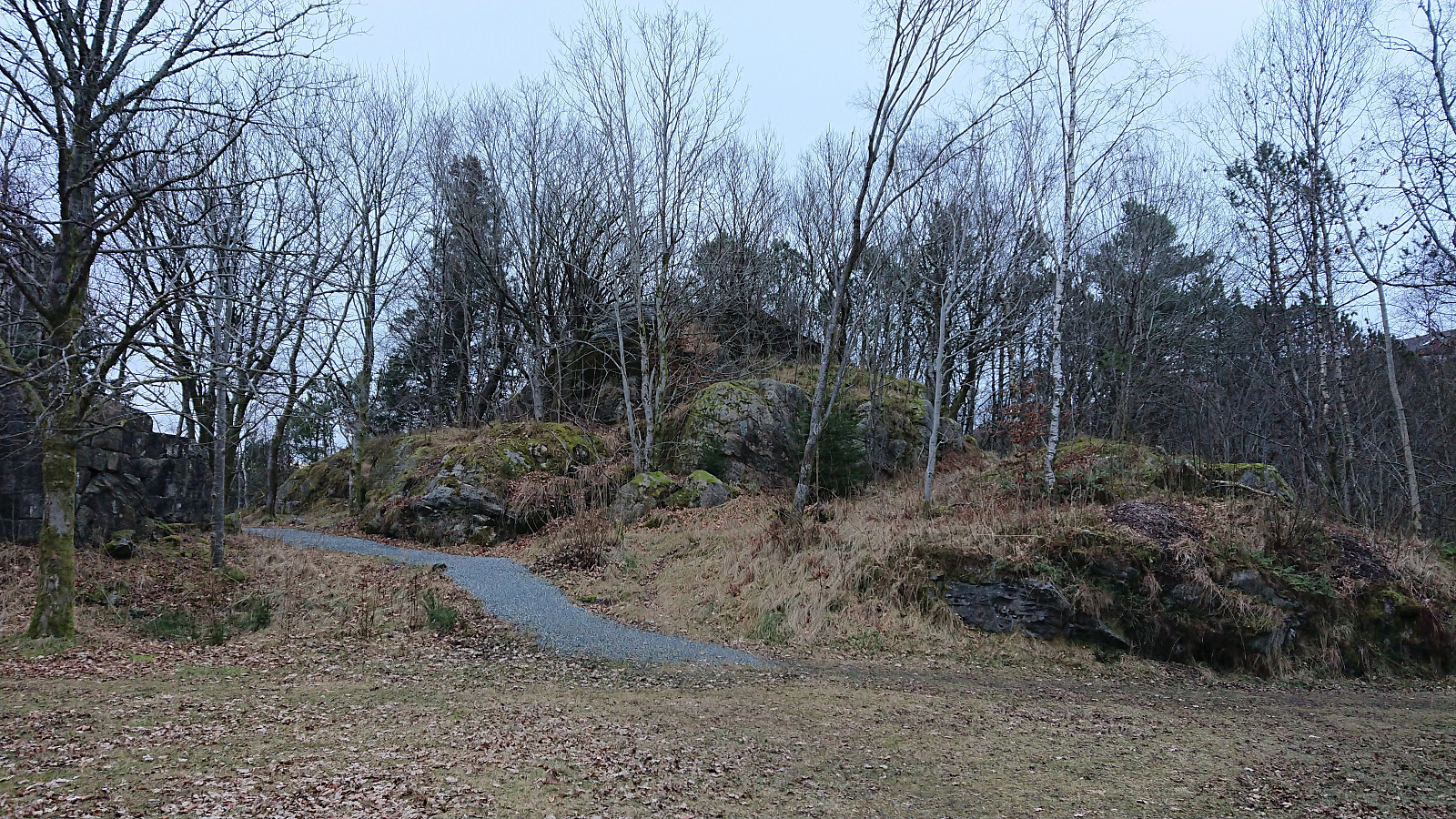 After knutsverre (Knut S. Andersen) recently moved the PB-element at Hellefjellet , I of course had to make a new visit dedicated to confirm if this was correct. And after inspecting the new summit from all sides, I concluded that Knut Sverre was right. The structure/tower I had assumed was mostly man-made, actually consisted of natural rock all the way to the top, at last on the north-northwestern side, and is thus the correct highest point at Hellefjellet . In order to keep the much more frequently visited previous PB-element, which also has significantly better views, I added a new viewpoint called Hellen festning at the old location.
Tysnessåta from Våge
- Dato:
- 22.12.2019
- Turtype:
- Fjelltur
- Turlengde:
- 4:55t
- Distanse:
- 17,4km
 After first taking the bus to Halhjem and the ferry to Våge, I continued on foot along the road to Valla (or Vadla as the locals call it). Upon arriving at Valla, I was surprised to come across two sets of trailhead markers, as I had not been able to find any indications of this when researching this potential route to Tysnessåta .
I decided to go for the newest trailhead (which most likely connects with the old trail later on anyway) and started up a marked tractor road which I soon left for a trail marked with red T's. The start of the trail was relatively steep, but at around 300 meters it flattened out quite a lot, and from there on the ascent was pretty easy. Here I also got the first glimpses of Tysnessåta through the trees.
As expected, the trail could be followed all the way to the summit, even >>>
After first taking the bus to Halhjem and the ferry to Våge, I continued on foot along the road to Valla (or Vadla as the locals call it). Upon arriving at Valla, I was surprised to come across two sets of trailhead markers, as I had not been able to find any indications of this when researching this potential route to Tysnessåta .
I decided to go for the newest trailhead (which most likely connects with the old trail later on anyway) and started up a marked tractor road which I soon left for a trail marked with red T's. The start of the trail was relatively steep, but at around 300 meters it flattened out quite a lot, and from there on the ascent was pretty easy. Here I also got the first glimpses of Tysnessåta through the trees.
As expected, the trail could be followed all the way to the summit, even >>>
Across Hellen festning
- Dato:
- 21.12.2019
- Turtype:
- Fottur
- Turlengde:
- 0:31t
- Distanse:
- 3,2km
 Short local evening hike across Hellen festning.
Husafjellet and Storenipa
- Dato:
- 14.12.2019
- Turtype:
- Fjelltur
- Turlengde:
- 2:25t
- Distanse:
- 9,0km
 After visiting Sverrestuven and Middagshaugen , me and Endre ( Fjellsamleren (Endre Myrdal Olsen) ) concluded our trip by following in the footsteps of elbow (Vegard Magnussen) for our visits to Husafjellet and Storenipa . We started from the small parking lot in Straumsdalen , and from there followed the gravel road south.
Shortly before getting to the U-turn, Endre got bored of following the road and wanted to head more directly towards the summit. We therefore decided to split up and see who would make it to the summit first. Endre climbed up to the east while I continued along the road for another 100 meters or so before starting my own ascent (not requiring any climbing).
I left the road shortly after coming across a warning sign for a shooting range up ahead, and quickly located a deer track that I could more or less follow all the way to the summit, thus making the ascent a lot easier than expected. Endre had of course reached >>>
After visiting Sverrestuven and Middagshaugen , me and Endre ( Fjellsamleren (Endre Myrdal Olsen) ) concluded our trip by following in the footsteps of elbow (Vegard Magnussen) for our visits to Husafjellet and Storenipa . We started from the small parking lot in Straumsdalen , and from there followed the gravel road south.
Shortly before getting to the U-turn, Endre got bored of following the road and wanted to head more directly towards the summit. We therefore decided to split up and see who would make it to the summit first. Endre climbed up to the east while I continued along the road for another 100 meters or so before starting my own ascent (not requiring any climbing).
I left the road shortly after coming across a warning sign for a shooting range up ahead, and quickly located a deer track that I could more or less follow all the way to the summit, thus making the ascent a lot easier than expected. Endre had of course reached >>>
Middagshaugen
- Dato:
- 14.12.2019
- Turtype:
- Fjelltur
- Turlengde:
- 1:06t
- Distanse:
- 3,0km
 After out visit to Sverrestuven , Endre ( Fjellsamleren (Endre Myrdal Olsen) ) and me continued to Middagshaugen , parking next to the road at Bjørkheim and at the start of the marked trail. The trail (first red markers, later blue) could easily be followed all the way to the summit, which was itself unmarked.
Excellent views from the summit, but the views were even better 100 meters to the south , where there was also a visitor register, clearly the main goal for most hikers. For the descent we followed the same trail back down to the car, concluding an excellent short hike that can be highly recommended.
After out visit to Sverrestuven , Endre ( Fjellsamleren (Endre Myrdal Olsen) ) and me continued to Middagshaugen , parking next to the road at Bjørkheim and at the start of the marked trail. The trail (first red markers, later blue) could easily be followed all the way to the summit, which was itself unmarked.
Excellent views from the summit, but the views were even better 100 meters to the south , where there was also a visitor register, clearly the main goal for most hikers. For the descent we followed the same trail back down to the car, concluding an excellent short hike that can be highly recommended.
Sverrestuven
- Dato:
- 14.12.2019
- Turtype:
- Fjelltur
- Turlengde:
- 1:02t
- Distanse:
- 2,0km
 Time for another Saturday of hiking with Endre ( Fjellsamleren (Endre Myrdal Olsen) ), this time to four small peaks in the Stamnes area. First up: Sverrestuven . We parked at Sverrestuven P-lomme øst and made our own way towards the summit. No trails as far as we could tell, but some deer tracks. At first very steep, even requiring some light climbing for the first 100 meters from the road, but from there on reaching the summit was straightforward.
Surprisingly good views from the summit. Most notably down towards Gammersviki and the mountains to the east. But decent views both south and north could be obtained close to the highest point as well. From the summit we followed more or less the same route back down to the car, but I made a small detour at the end to see if there was anything left of the building indicated on the map. I did not find anything, but did >>>
Time for another Saturday of hiking with Endre ( Fjellsamleren (Endre Myrdal Olsen) ), this time to four small peaks in the Stamnes area. First up: Sverrestuven . We parked at Sverrestuven P-lomme øst and made our own way towards the summit. No trails as far as we could tell, but some deer tracks. At first very steep, even requiring some light climbing for the first 100 meters from the road, but from there on reaching the summit was straightforward.
Surprisingly good views from the summit. Most notably down towards Gammersviki and the mountains to the east. But decent views both south and north could be obtained close to the highest point as well. From the summit we followed more or less the same route back down to the car, but I made a small detour at the end to see if there was anything left of the building indicated on the map. I did not find anything, but did >>>
