Arkiv - dato
Arkiv - aktivitet
-
Annen tur (3)
- Kajakkpadling (3)
- Fottur (1887)
-
Kjøretur (9)
- Biltur (9)
-
Skitur (116)
- Fjellskitur (69)
- Langrennstur (47)
-
Sykkeltur (110)
- Blandet sykling (25)
- Gatesykling (85)
Lister jeg samler etter
-
Utvalgte topper og turmål i Bergen
(348/349)
 99%
99% -
Alle topper i Bergen
(391/398)
98%
-
Voss ≥ 100m pf.
(96/98)
97%
-
Opptur Hordaland
(144/159)
90%
-
Stasjoner på Bergensbanen
(33/40)
82%
-
Ulvik ≥ 100m pf.
(28/38)
73%
-
Hordaland ≥ 100m pf.
(622/863)
72%
-
Mjølfjell PF > 100m
(21/31)
67%
-
Jondal ≥ 100m pf.
(15/23)
65%
-
Dagsturhyttene i Vestland
(36/61)
59%
-
Sunnhordland PF >= 100m
(105/186)
56%
-
Hordaland: Hardanger PF>=100m
(194/359)
54%
-
DNT-hytter i Hordaland
(23/45)
51%
-
Kvinnherad ≥ 100m pf.
(40/79)
50%
-
Eidfjord ≥ 100m pf.
(13/42)
30%
-
Sogndal ≥ 100m pf.
(23/81)
28%
-
Gulen ≥ 100m pf.
(15/54)
27%
-
Vik i Sogn ≥ 100m pf.
(10/46)
21%
-
Sogn - Sør for Sognefjorden PF>=100m
(31/159)
19%
-
DNT-hytter i Sogn og Fjordane
(8/47)
17%

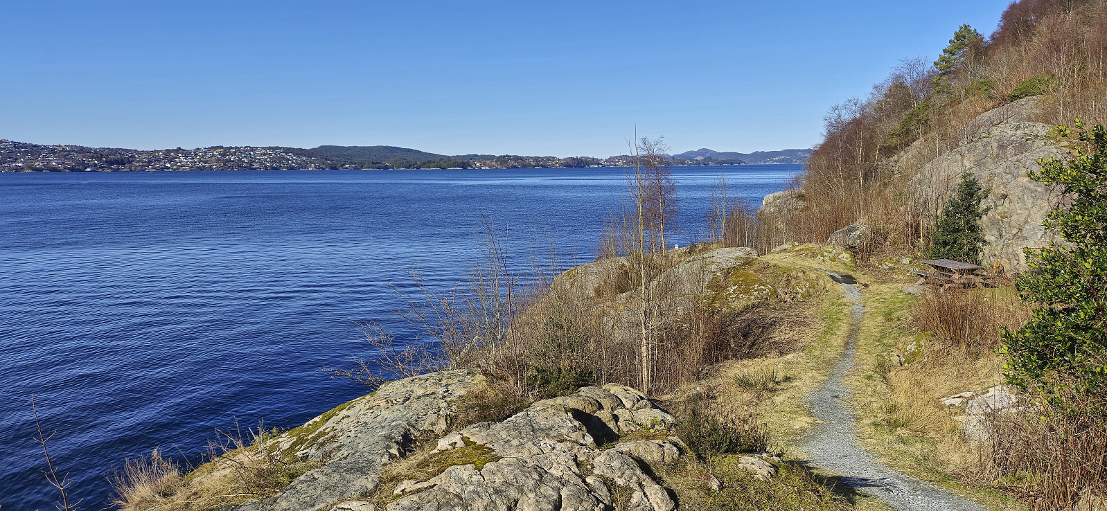
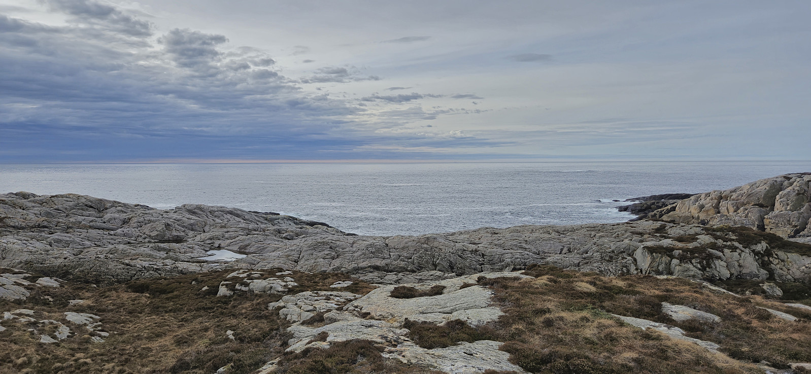
Ørneberget and Hellen festning
- Dato:
- 20.03.2024
- Turtype:
- Fottur
- Turlengde:
- 0:54t
- Distanse:
- 4,0km
 Short local evening hike after work.
Fjellveien
- Dato:
- 17.03.2024
- Turtype:
- Fottur
- Turlengde:
- 1:29t
- Distanse:
- 7,3km
 Local Sunday hike after spending all of Saturday skiing with Endre in Ulvik .
Midtfjell from Sjusete
- Dato:
- 16.03.2024
- Turtype:
- Fjellskitur
- Turlengde:
- 5:00t
- Distanse:
- 13,3km
 Inspired by an external trip report at tinderangel.no describing what looked like a very nice skiing trip from Sjusete to Midtfjell , Endre and I once more drove from Bergen in the direction of Voss but this time headed for Ulvik and the winter parking lot at Sjusete . As we approached the center of Ulvik we left the main road and instead followed a narrow gravel road southwest up from Vambheim. This included passing through an open gate just north of Gjerdet, but whether this gate is always open remains unknown.
Done with this one potential hurdle we continued up to the parking lot at Sjusete, noticing that the gravel road was rather icy towards the end but hoping that this would improve before the descent later in the day. Plenty of space at the parking lot, in fact we were the only car and, expect for coming across a fresh scooter trail during the descent, we did not see any >>>
Inspired by an external trip report at tinderangel.no describing what looked like a very nice skiing trip from Sjusete to Midtfjell , Endre and I once more drove from Bergen in the direction of Voss but this time headed for Ulvik and the winter parking lot at Sjusete . As we approached the center of Ulvik we left the main road and instead followed a narrow gravel road southwest up from Vambheim. This included passing through an open gate just north of Gjerdet, but whether this gate is always open remains unknown.
Done with this one potential hurdle we continued up to the parking lot at Sjusete, noticing that the gravel road was rather icy towards the end but hoping that this would improve before the descent later in the day. Plenty of space at the parking lot, in fact we were the only car and, expect for coming across a fresh scooter trail during the descent, we did not see any >>>
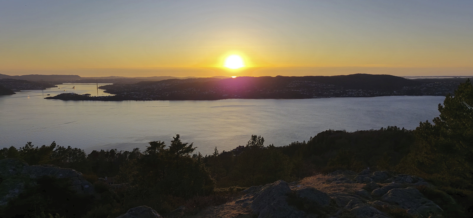
Across Hellen festning
- Dato:
- 14.03.2024
- Turtype:
- Fottur
- Turlengde:
- 0:36t
- Distanse:
- 3,2km
 Short local evening hike.
Helleneset
- Dato:
- 10.03.2024
- Turtype:
- Spasertur
- Turlengde:
- 0:43t
- Distanse:
- 2,6km
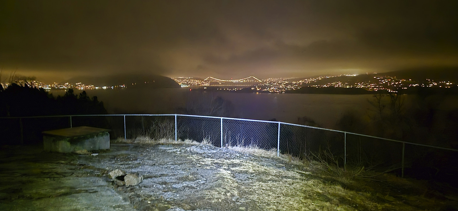
 Short local walk after spending all of yesterday skiing at Voss .
Five summits southeast of Grindaflethytta from Brandset
- Dato:
- 09.03.2024
- Turtype:
- Fjellskitur
- Turlengde:
- 11:29t
- Distanse:
- 41,4km
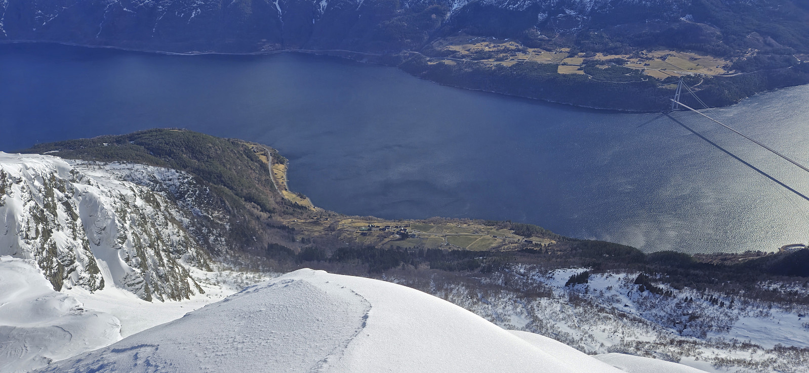
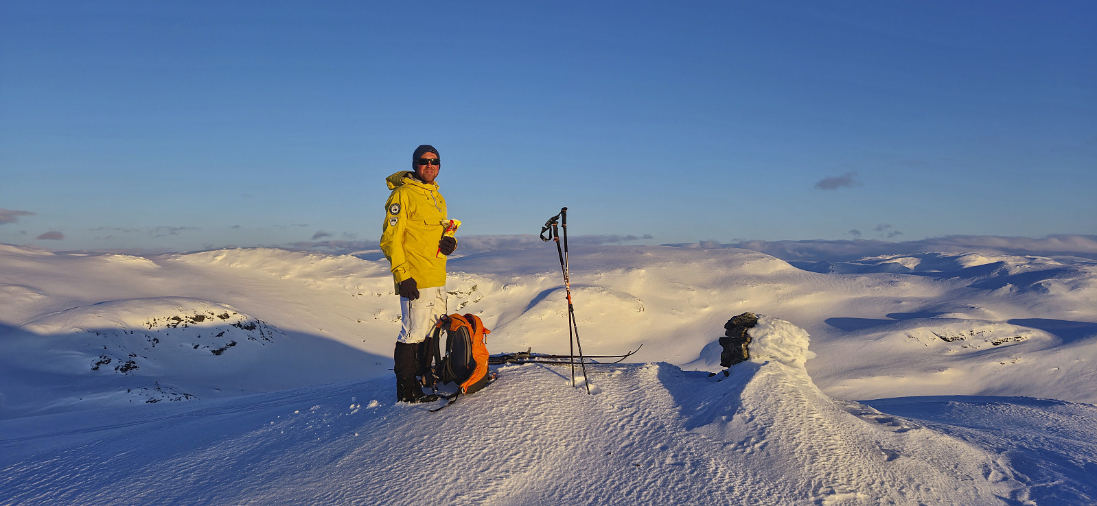 In order to make the most out of the excellent weather, and due to road work at Dalseide, Endre picked me up at my place just before six in the morning and together we drove to Brandset at Voss, only having to wait around ten minutes before we could pass through Dalseidtunnelen at 07:00. We arrived at the parking lot at Brandset around 08:30 and it did not take long before we were ready to start skiing.
We started by following the icy road into Bjørndalen before leaving the scooter trails behind and making our own way up towards Bjørndalsvatnet. Below roughly 1100 meters the snow was very hard, more ice than snow, but higher up the conditions gradually improved and we therefore had pretty good skiing conditions for the majority of the trip.
After a short break west of Bjørndalsvatnet we completed the final ascent to the >>>
In order to make the most out of the excellent weather, and due to road work at Dalseide, Endre picked me up at my place just before six in the morning and together we drove to Brandset at Voss, only having to wait around ten minutes before we could pass through Dalseidtunnelen at 07:00. We arrived at the parking lot at Brandset around 08:30 and it did not take long before we were ready to start skiing.
We started by following the icy road into Bjørndalen before leaving the scooter trails behind and making our own way up towards Bjørndalsvatnet. Below roughly 1100 meters the snow was very hard, more ice than snow, but higher up the conditions gradually improved and we therefore had pretty good skiing conditions for the majority of the trip.
After a short break west of Bjørndalsvatnet we completed the final ascent to the >>>
Totræna Vinterpark
- Dato:
- 08.03.2024
- Turtype:
- Langrennstur
- Turlengde:
- 3:02t
- Distanse:
- 8,0km
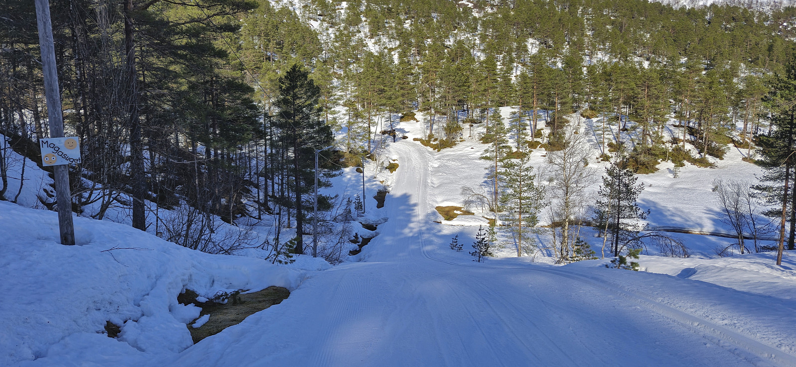 Given the excellent weather I managed to convince three of my colleagues to take the Friday off to go skiing at Totræna Vinterpark . Two of them did not have much experience with cross-country skiing though, hence we initially took it quite slow. After a long lunch break at the skiing jumping hill close to the start of the trails, two of us completed the rest of the groomed ski trails at a slightly higher speed, before we all returned to Bergen.
Ørneberget and Hellen festning
- Dato:
- 05.03.2024
- Turtype:
- Fjelltur
- Turlengde:
- 0:57t
- Distanse:
- 4,2km
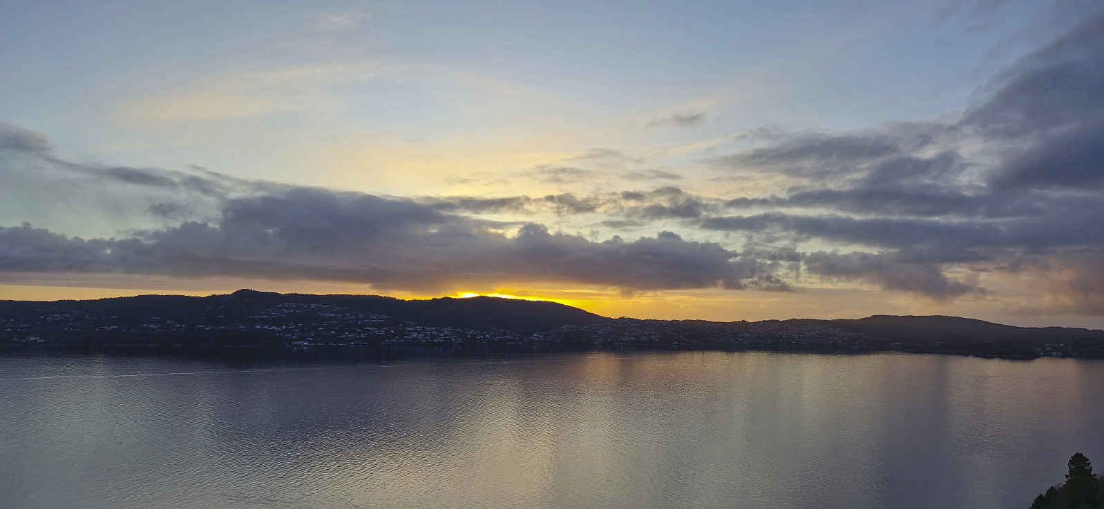
 Short local hike just before sunset.
Såta, Aurihophytta and Fedjebjørnen
- Dato:
- 03.03.2024
- Turtype:
- Fjelltur
- Turlengde:
- 3:31t
- Distanse:
- 10,4km
 A return to Fedje with the main goal of visiting Aurihophytta , which I had not had time for during my first trip to the island back in 2021 . Decided not to repeat the very long cycling trip this time around though and instead arrived by car, which we left at Sævrøy before getting on the ferry. Minor swells but overall a smooth journey.
At Fedje, we followed the roads southwest to the marked trailhead for Aurihophytta. Here we continued on a very nice gravel-covered trail. But just as we started discussing whether it perhaps would be this easy all the way to the cabin, the marked route left the gravel and instead led us along a relatively wet trail.
We passed via Såta and continued southeast to Aurihophytta. Here we had a short lunch break before heading south to the paved road close to Hellisøy fyr . All that remained was then walking along the road back to >>>
A return to Fedje with the main goal of visiting Aurihophytta , which I had not had time for during my first trip to the island back in 2021 . Decided not to repeat the very long cycling trip this time around though and instead arrived by car, which we left at Sævrøy before getting on the ferry. Minor swells but overall a smooth journey.
At Fedje, we followed the roads southwest to the marked trailhead for Aurihophytta. Here we continued on a very nice gravel-covered trail. But just as we started discussing whether it perhaps would be this easy all the way to the cabin, the marked route left the gravel and instead led us along a relatively wet trail.
We passed via Såta and continued southeast to Aurihophytta. Here we had a short lunch break before heading south to the paved road close to Hellisøy fyr . All that remained was then walking along the road back to >>>
Across Hellen festning
- Dato:
- 02.03.2024
- Turtype:
- Fottur
- Turlengde:
- 0:34t
- Distanse:
- 3,1km
 Short local afternoon hike.
