Arkiv - dato
Arkiv - aktivitet
-
Annen tur (3)
- Kajakkpadling (3)
- Fottur (1897)
-
Kjøretur (9)
- Biltur (9)
-
Skitur (116)
- Fjellskitur (69)
- Langrennstur (47)
-
Sykkeltur (111)
- Blandet sykling (25)
- Gatesykling (86)
Lister jeg samler etter
-
Utvalgte topper og turmål i Bergen
(349/351)
 99%
99% -
Alle topper i Bergen
(393/400)
98%
-
Voss ≥ 100m pf.
(96/98)
97%
-
Opptur Hordaland
(144/159)
90%
-
Stasjoner på Bergensbanen
(33/40)
82%
-
Ulvik ≥ 100m pf.
(30/38)
78%
-
Hordaland ≥ 100m pf.
(624/863)
72%
-
Mjølfjell PF > 100m
(21/31)
67%
-
Jondal ≥ 100m pf.
(15/23)
65%
-
Dagsturhyttene i Vestland
(36/61)
59%
-
Sunnhordland PF >= 100m
(105/186)
56%
-
Hordaland: Hardanger PF>=100m
(196/359)
54%
-
DNT-hytter i Hordaland
(23/45)
51%
-
Kvinnherad ≥ 100m pf.
(40/79)
50%
-
Eidfjord ≥ 100m pf.
(13/42)
30%
-
Sogndal ≥ 100m pf.
(23/81)
28%
-
Gulen ≥ 100m pf.
(15/54)
27%
-
Vik i Sogn ≥ 100m pf.
(10/46)
21%
-
Sogn - Sør for Sognefjorden PF>=100m
(31/159)
19%
-
DNT-hytter i Sogn og Fjordane
(8/47)
17%

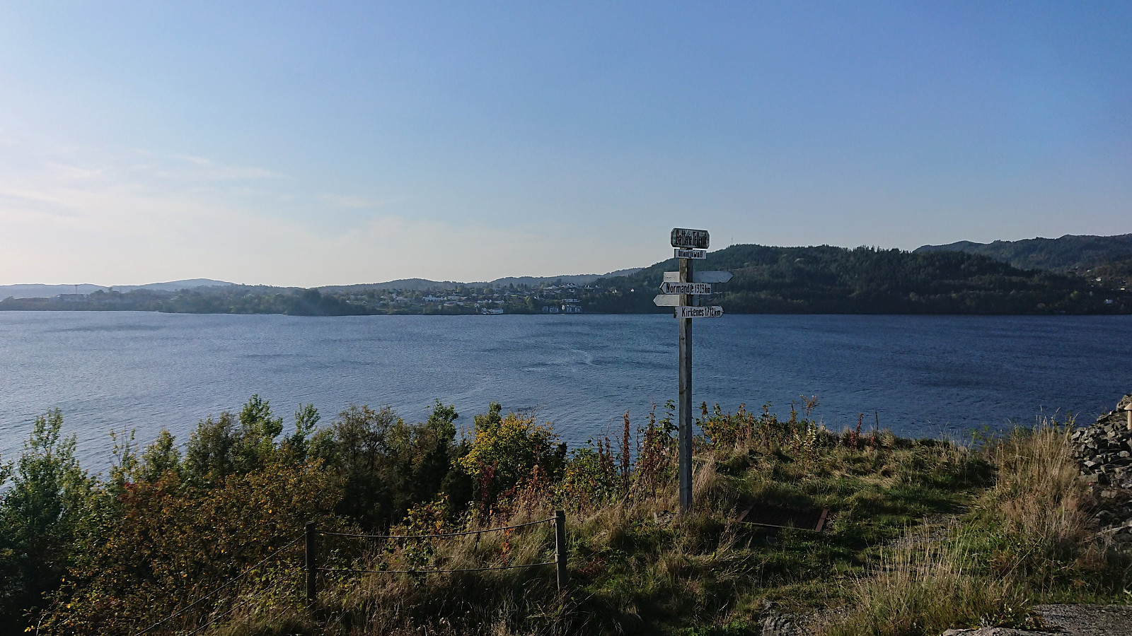
Across Hellen festning
- Dato:
- 07.10.2020
- Turtype:
- Fottur
- Turlengde:
- 0:34t
- Distanse:
- 3,1km
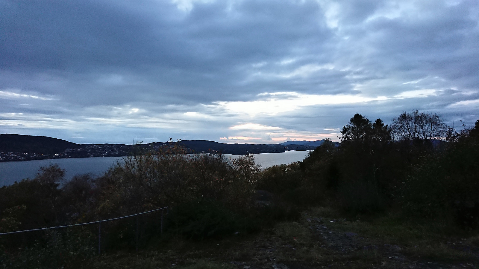 Short local evening hike.
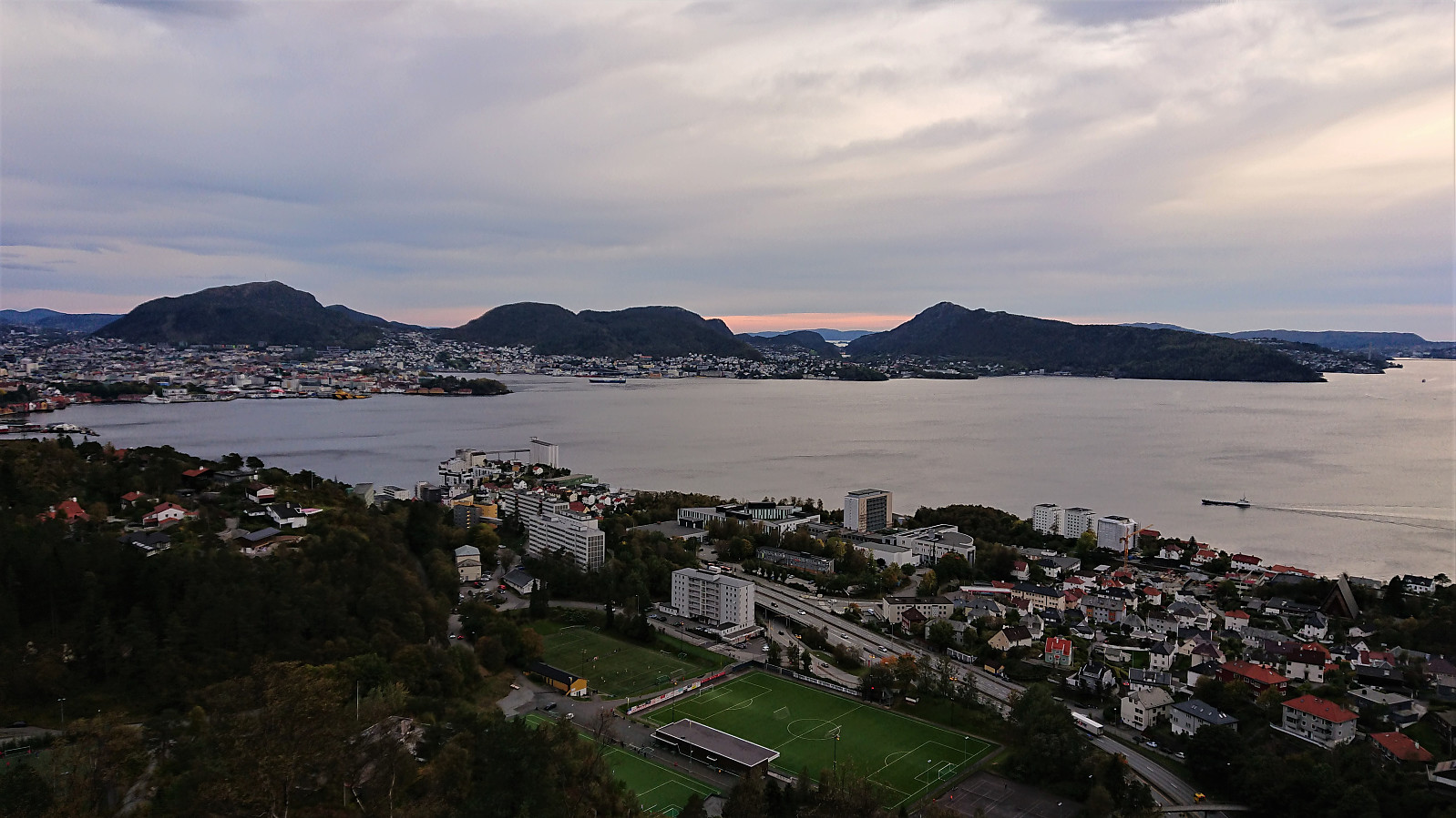
Ulriken
- Dato:
- 06.10.2020
- Turtype:
- Fjelltur
- Turlengde:
- 1:44t
- Distanse:
- 6,7km
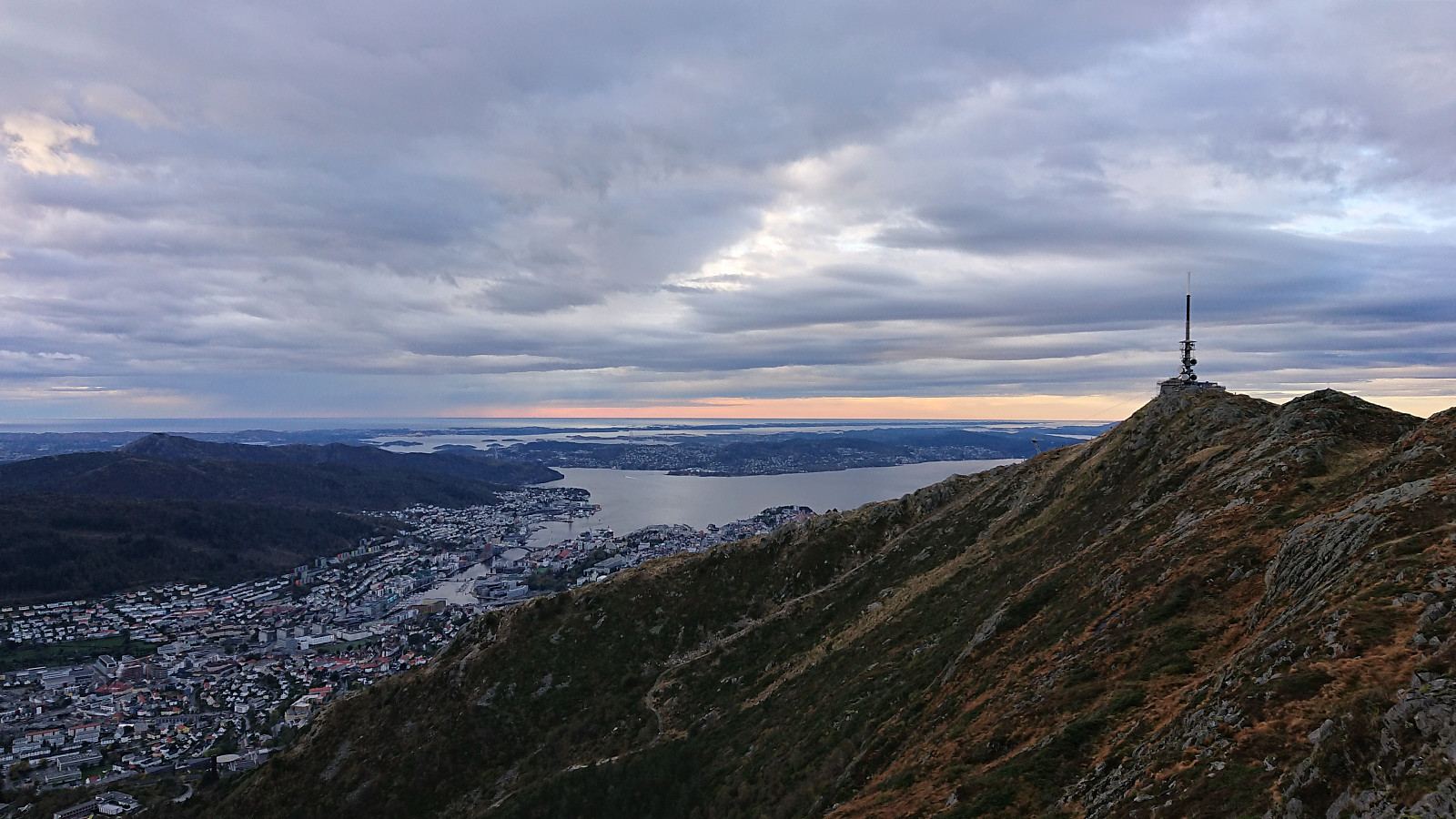 Short hike to Ulriken after work.
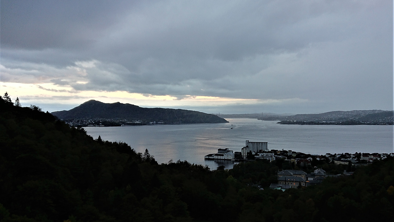
Fjellveien and Sandviksbatteriet
- Dato:
- 04.10.2020
- Turtype:
- Fottur
- Turlengde:
- 1:53t
- Distanse:
- 8,4km
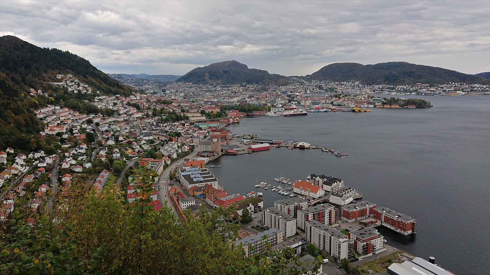 Short local hike.
Hoplandsfjellet
- Dato:
- 03.10.2020
- Turtype:
- Fjelltur
- Turlengde:
- 0:35t
- Distanse:
- 1,1km
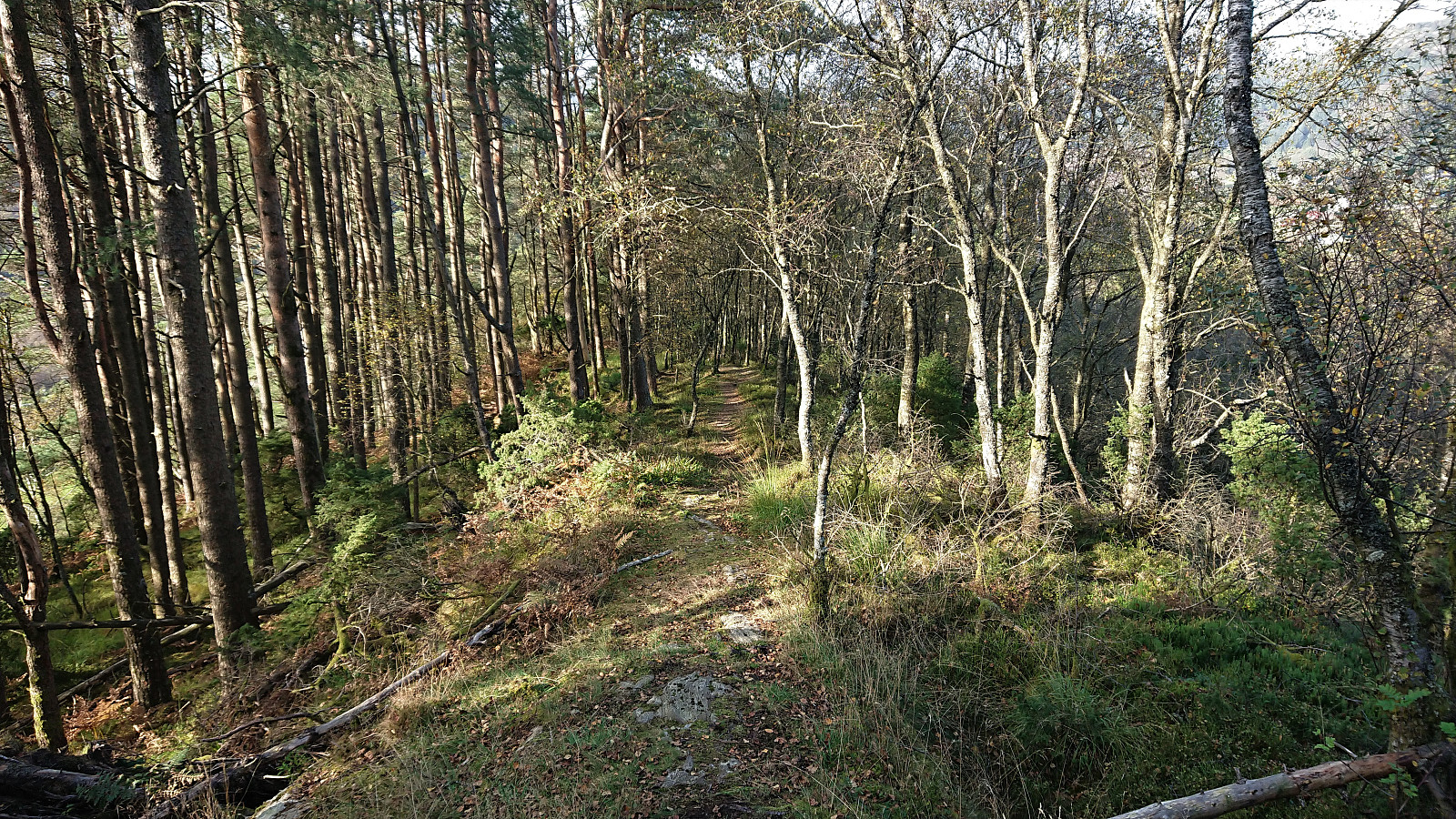 After the trip to Orrsåta , I cycled the short distance from Holsbergstien to the unmarked trailhead for Hoplandsfjellet . Here I again left my bike behind and continued on foot towards the summit.
Note that I had to get pretty close to actually see the trail, even though it starts more or less where the tractor road ended. But the trail soon became much clearer and there were no issues following it all the way to the summit.
The summit provided an almost new bench where I could enjoy both the views and my lunch. By moving slightly away from the bench, I could also get good views towards Hoplandseggena and back towards Orrsåta . I considered continuing east in order to complete the short roundtrip indicated in Kjell 's trip report , but ended up simply returning to my bike to the northwest.
Overall, a nice short hike along a good trail and with excellent views from the summit.
After the trip to Orrsåta , I cycled the short distance from Holsbergstien to the unmarked trailhead for Hoplandsfjellet . Here I again left my bike behind and continued on foot towards the summit.
Note that I had to get pretty close to actually see the trail, even though it starts more or less where the tractor road ended. But the trail soon became much clearer and there were no issues following it all the way to the summit.
The summit provided an almost new bench where I could enjoy both the views and my lunch. By moving slightly away from the bench, I could also get good views towards Hoplandseggena and back towards Orrsåta . I considered continuing east in order to complete the short roundtrip indicated in Kjell 's trip report , but ended up simply returning to my bike to the northwest.
Overall, a nice short hike along a good trail and with excellent views from the summit.
Orrsåta
- Dato:
- 03.10.2020
- Turtype:
- Fjelltur
- Turlengde:
- 0:48t
- Distanse:
- 2,0km
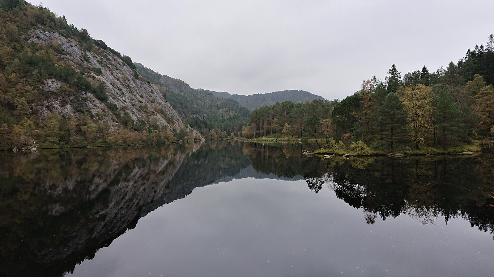
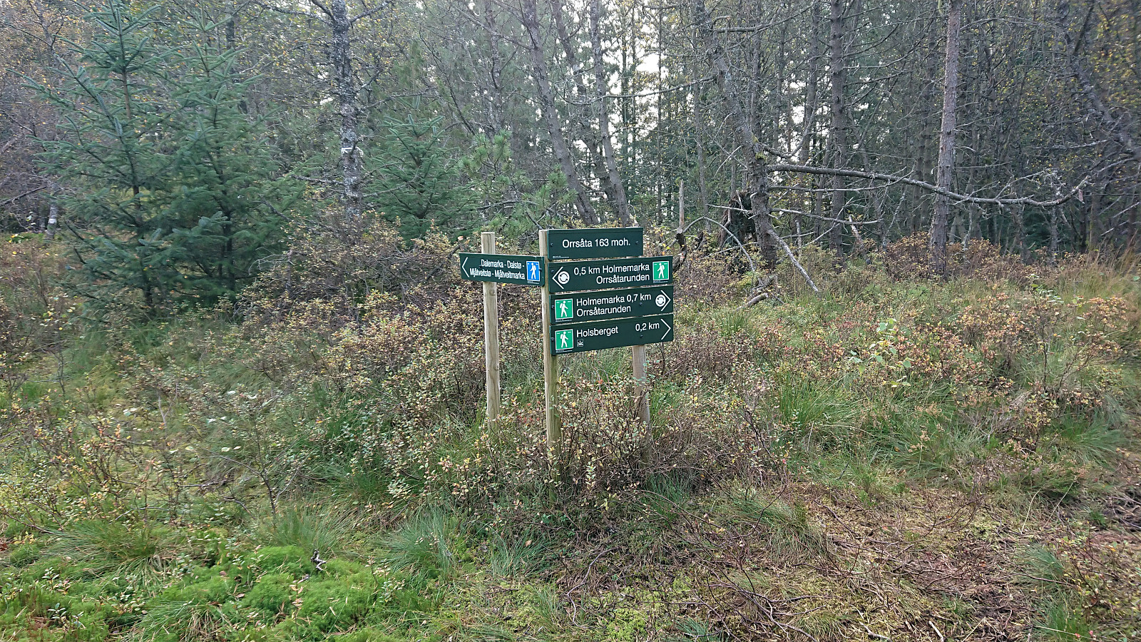 After leaving my bike at the marked northeastern trailhead for Orrsåta , I followed a trail marked with white (and sometimes white and red) plastic ribbons, quickly arriving at the "fake" summit next to the wooden trig marker.
To reach the real summit, a short off-trail hike through the bushes was required. It provided next to no views though and it is highly understandable why most hikes do not feel the need to make this extra detour.
The signs at the "fake" summit however indicated a viewpoint called Holsberget 200 meters to the north. I therefore followed the marked trail in this direction and the views from Holsberget were indeed much better, even if today they were rather limited by a gray haze.
To conclude the hike, I followed the trail to the alternative southwestern trailhead and from there completed >>>
After leaving my bike at the marked northeastern trailhead for Orrsåta , I followed a trail marked with white (and sometimes white and red) plastic ribbons, quickly arriving at the "fake" summit next to the wooden trig marker.
To reach the real summit, a short off-trail hike through the bushes was required. It provided next to no views though and it is highly understandable why most hikes do not feel the need to make this extra detour.
The signs at the "fake" summit however indicated a viewpoint called Holsberget 200 meters to the north. I therefore followed the marked trail in this direction and the views from Holsberget were indeed much better, even if today they were rather limited by a gray haze.
To conclude the hike, I followed the trail to the alternative southwestern trailhead and from there completed >>>
Cycling: Orrsåta and Hoplandsfjellet
- Dato:
- 03.10.2020
- Turtype:
- Gatesykling
- Turlengde:
- 6:01t
- Distanse:
- 61,7km
 With weather forecasts of strong winds at high altitudes on an otherwise unusually warm October day, my initial hiking plans were replaced by a cycling trip to Holsnøy for short visits of Orrsåta and Hoplandsfjellet .
Ørneberget and Rognåsen
- Dato:
- 01.10.2020
- Turtype:
- Fjelltur
- Turlengde:
- 2:18t
- Distanse:
- 5,8km
 Short local evening hike.
Munkebotn and Hellemyrstien
- Dato:
- 30.09.2020
- Turtype:
- Fottur
- Turlengde:
- 1:33t
- Distanse:
- 8,4km
 Short local evening hike.
Hellemyrstien and Furukammen
- Dato:
- 28.09.2020
- Turtype:
- Fottur
- Turlengde:
- 1:21t
- Distanse:
- 7,2km
 Short local evening hike.
Bjørnaknausen and Gråhorga from Kvitingsvatnet
- Dato:
- 27.09.2020
- Turtype:
- Fjelltur
- Turlengde:
- 5:59t
- Distanse:
- 21,1km
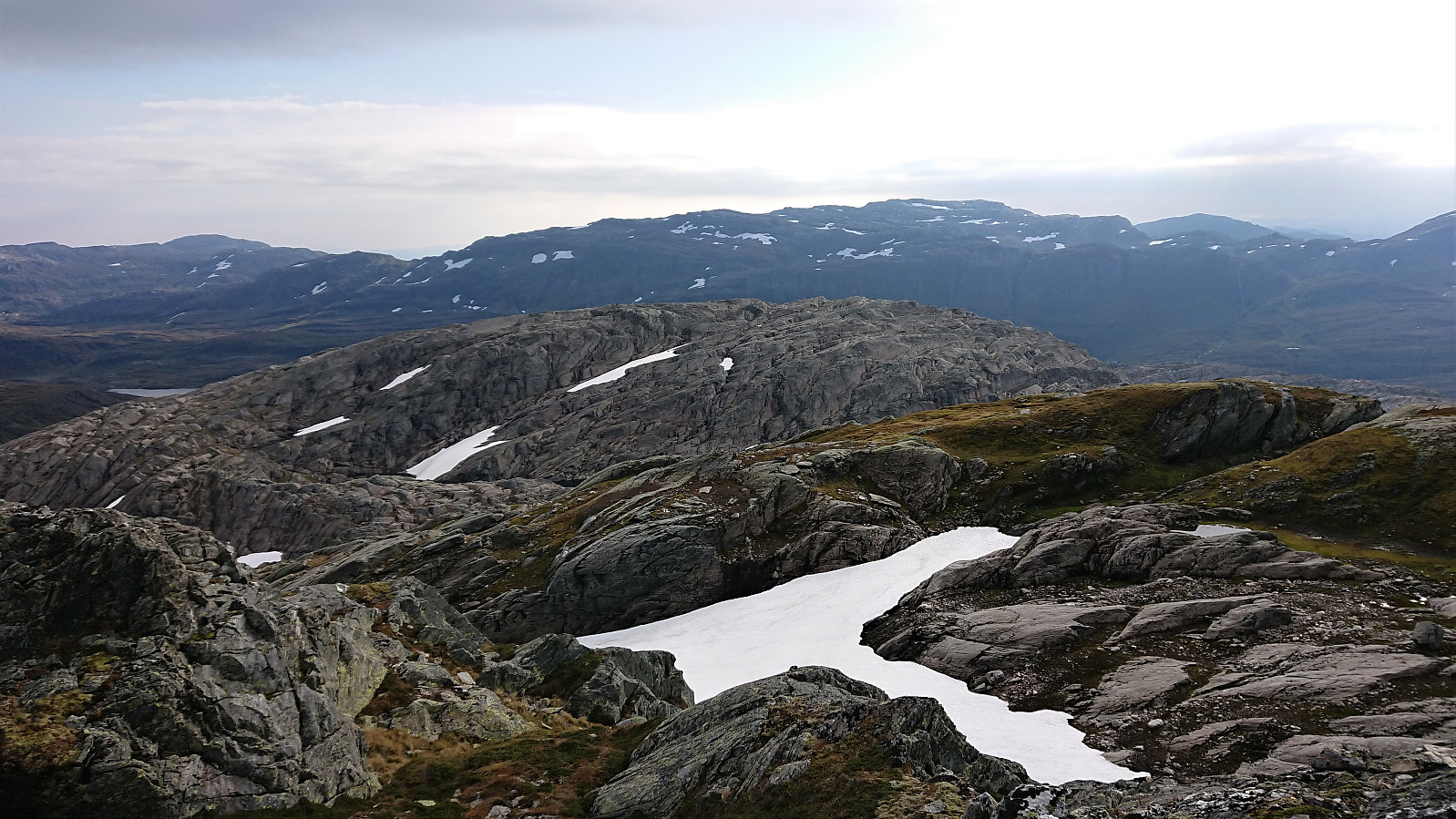 We parked at Kvitingen p-plass and, after paying the 50 kr parking fee, followed the gravel road towards Holmavatnet. When reaching the last bend in the road before the road’s final climb to the large dam at Holmavatnet, we left the road and instead followed the marked trail for Vending , Høgabu and Gullhorgabu . The trail was marked with red T's and overall easy to follow.
Upon reaching Trongasmogtjørna, the trail forked and we continued northeast on the trail to Vending. We did not stay on this trail for very long though, leaving it at the top of Austra Trongasmoget and from there heading off-trail to the summit of Bjørnaknausen . The summit was reached without any difficulties, and after a couple of pictures we returned to the trail along more or less the same route.
After a quick bite, I continued on my own to the summit of the nearby Gråhorga . Given >>>
We parked at Kvitingen p-plass and, after paying the 50 kr parking fee, followed the gravel road towards Holmavatnet. When reaching the last bend in the road before the road’s final climb to the large dam at Holmavatnet, we left the road and instead followed the marked trail for Vending , Høgabu and Gullhorgabu . The trail was marked with red T's and overall easy to follow.
Upon reaching Trongasmogtjørna, the trail forked and we continued northeast on the trail to Vending. We did not stay on this trail for very long though, leaving it at the top of Austra Trongasmoget and from there heading off-trail to the summit of Bjørnaknausen . The summit was reached without any difficulties, and after a couple of pictures we returned to the trail along more or less the same route.
After a quick bite, I continued on my own to the summit of the nearby Gråhorga . Given >>>
