Arkiv - dato
Arkiv - aktivitet
-
Annen tur (3)
- Kajakkpadling (3)
- Fottur (1897)
-
Kjøretur (9)
- Biltur (9)
-
Skitur (116)
- Fjellskitur (69)
- Langrennstur (47)
-
Sykkeltur (111)
- Blandet sykling (25)
- Gatesykling (86)
Lister jeg samler etter
-
Utvalgte topper og turmål i Bergen
(349/351)
 99%
99% -
Alle topper i Bergen
(393/400)
98%
-
Voss ≥ 100m pf.
(96/98)
97%
-
Opptur Hordaland
(144/159)
90%
-
Stasjoner på Bergensbanen
(33/40)
82%
-
Ulvik ≥ 100m pf.
(30/38)
78%
-
Hordaland ≥ 100m pf.
(624/863)
72%
-
Mjølfjell PF > 100m
(21/31)
67%
-
Jondal ≥ 100m pf.
(15/23)
65%
-
Dagsturhyttene i Vestland
(36/61)
59%
-
Sunnhordland PF >= 100m
(105/186)
56%
-
Hordaland: Hardanger PF>=100m
(196/359)
54%
-
DNT-hytter i Hordaland
(23/45)
51%
-
Kvinnherad ≥ 100m pf.
(40/79)
50%
-
Eidfjord ≥ 100m pf.
(13/42)
30%
-
Sogndal ≥ 100m pf.
(23/81)
28%
-
Gulen ≥ 100m pf.
(15/54)
27%
-
Vik i Sogn ≥ 100m pf.
(10/46)
21%
-
Sogn - Sør for Sognefjorden PF>=100m
(31/159)
19%
-
DNT-hytter i Sogn og Fjordane
(8/47)
17%

Fagerdalsfjellet
- Dato:
- 17.07.2019
- Turtype:
- Fjelltur
- Turlengde:
- 0:52t
- Distanse:
- 3,4km
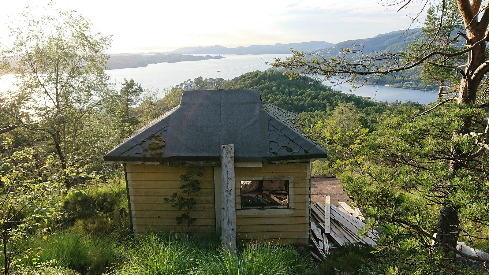 Short local evening hike across Fagerdalsfjellet including the discovery of a small decaying cabin north of Ørneberget NV .
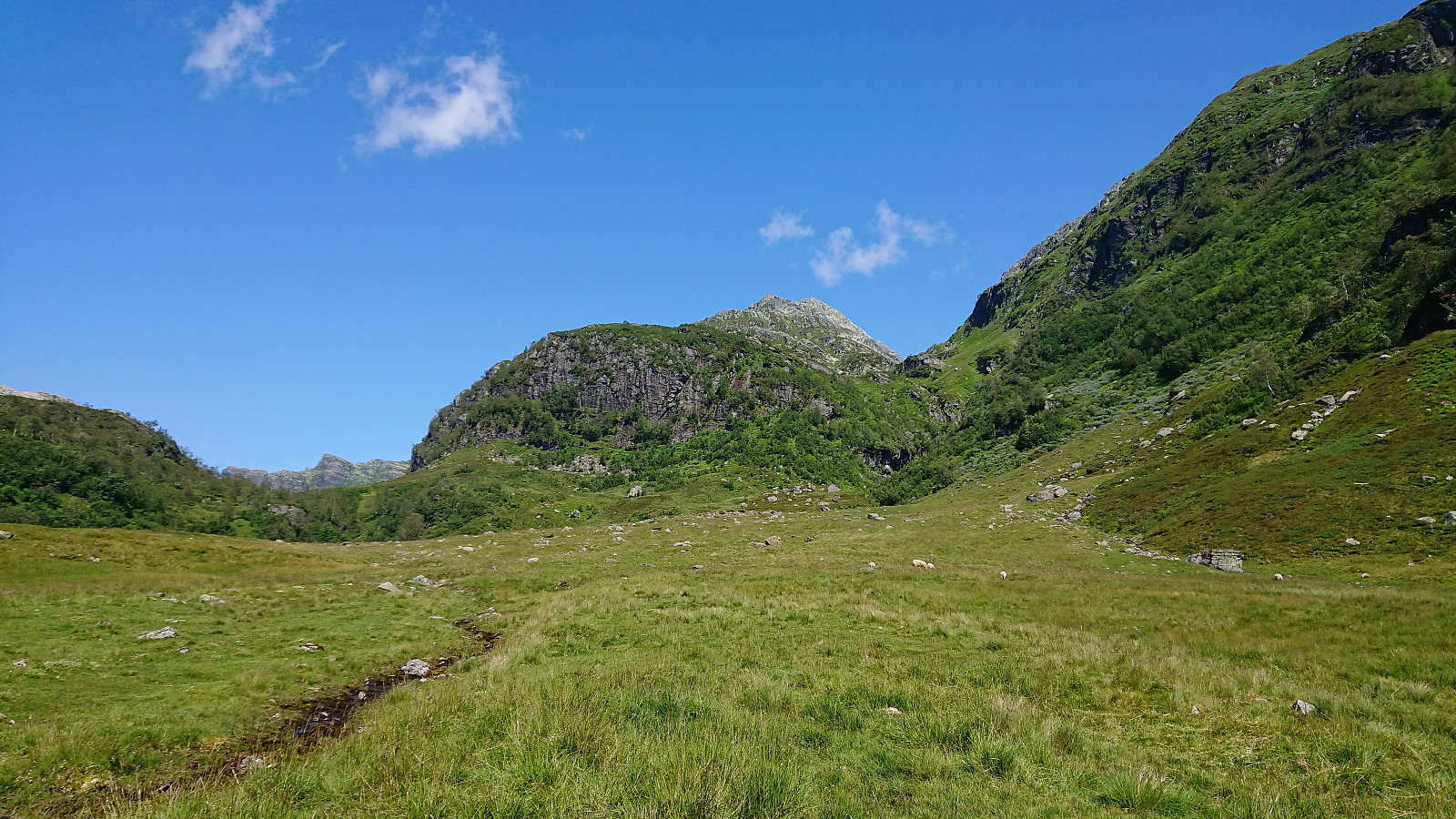
Børdalsfjellet and Huldabottsfjellet
- Dato:
- 16.07.2019
- Turtype:
- Fjelltur
- Turlengde:
- 2:23t
- Distanse:
- 7,9km
 I left work a bit early and hopped on a bus to Eikedalen with the goal to visit both Børdalsfjellet and Huldabottsfjellet . The schedule for the planned return bus was on the tight side, and did not get any better when I managed to get off the bus one stop too early. Thankfully this only required an extra 500 meters walk along the main road (could have been much worse…).
After leaving the main road, I followed an old gravel road up to what I believe is the start of an old ski lift, clearly not used in a long time. It did however provide the trace of an old tractor road that greatly simplified the start of the ascent. When the road ended shortly after crossing the river via an old bridge (I did not see any traces of the road turning south as indicated on the map), I instead turned left (west) and started making my own way >>>
I left work a bit early and hopped on a bus to Eikedalen with the goal to visit both Børdalsfjellet and Huldabottsfjellet . The schedule for the planned return bus was on the tight side, and did not get any better when I managed to get off the bus one stop too early. Thankfully this only required an extra 500 meters walk along the main road (could have been much worse…).
After leaving the main road, I followed an old gravel road up to what I believe is the start of an old ski lift, clearly not used in a long time. It did however provide the trace of an old tractor road that greatly simplified the start of the ascent. When the road ended shortly after crossing the river via an old bridge (I did not see any traces of the road turning south as indicated on the map), I instead turned left (west) and started making my own way >>>
Hellen festning and Furukammen
- Dato:
- 15.07.2019
- Turtype:
- Fottur
- Turlengde:
- 1:01t
- Distanse:
- 4,6km
 Short local evening hike after work.
Cycling: Tertnes
- Dato:
- 14.07.2019
- Turtype:
- Blandet sykling
- Turlengde:
- 2:15t
- Distanse:
- 28,5km
 Exploring Tertnes by bike.
Fotasperrnuten
- Dato:
- 13.07.2019
- Turtype:
- Fjelltur
- Turlengde:
- 5:30t
- Distanse:
- 14,3km
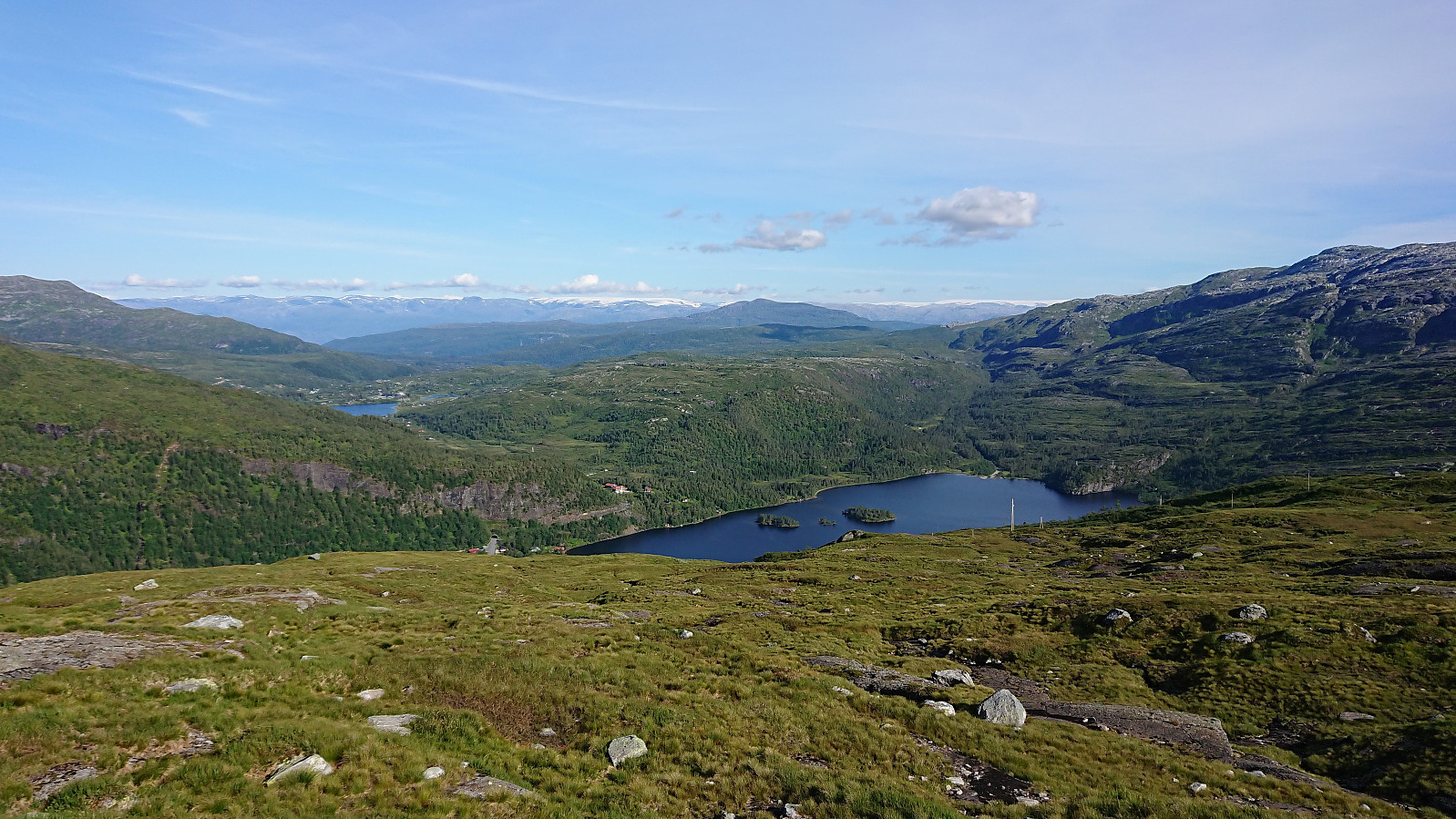
 When the initial plan to drive to Øystese for a visit to Skrott did not work out, we changed plans and instead hopped on a bus to Steinskvanndalen (bus stop called Kvernavollen) for an ascent of Fotasperrnuten . The walk along the gravel road up to the beautiful Steinskvanndalsvatnet was quickly completed and we then started searching for the marked trailhead. We walked a bit too far though and ended up making our own way up the field.
We soon came across the marked trail, which from there on, with some minor exceptions when getting close to the summit, was easy to follow. Note that there were some steep areas when heading up Fotasperrdalen, or more specifically a steep drop on the right-hand side of the trail, so this particular part of the trail may not be to everyone's liking. But as soon as this stretch was >>>
When the initial plan to drive to Øystese for a visit to Skrott did not work out, we changed plans and instead hopped on a bus to Steinskvanndalen (bus stop called Kvernavollen) for an ascent of Fotasperrnuten . The walk along the gravel road up to the beautiful Steinskvanndalsvatnet was quickly completed and we then started searching for the marked trailhead. We walked a bit too far though and ended up making our own way up the field.
We soon came across the marked trail, which from there on, with some minor exceptions when getting close to the summit, was easy to follow. Note that there were some steep areas when heading up Fotasperrdalen, or more specifically a steep drop on the right-hand side of the trail, so this particular part of the trail may not be to everyone's liking. But as soon as this stretch was >>>
Hellen festning and Ørneberget
- Dato:
- 11.07.2019
- Turtype:
- Fjelltur
- Turlengde:
- 1:53t
- Distanse:
- 8,2km
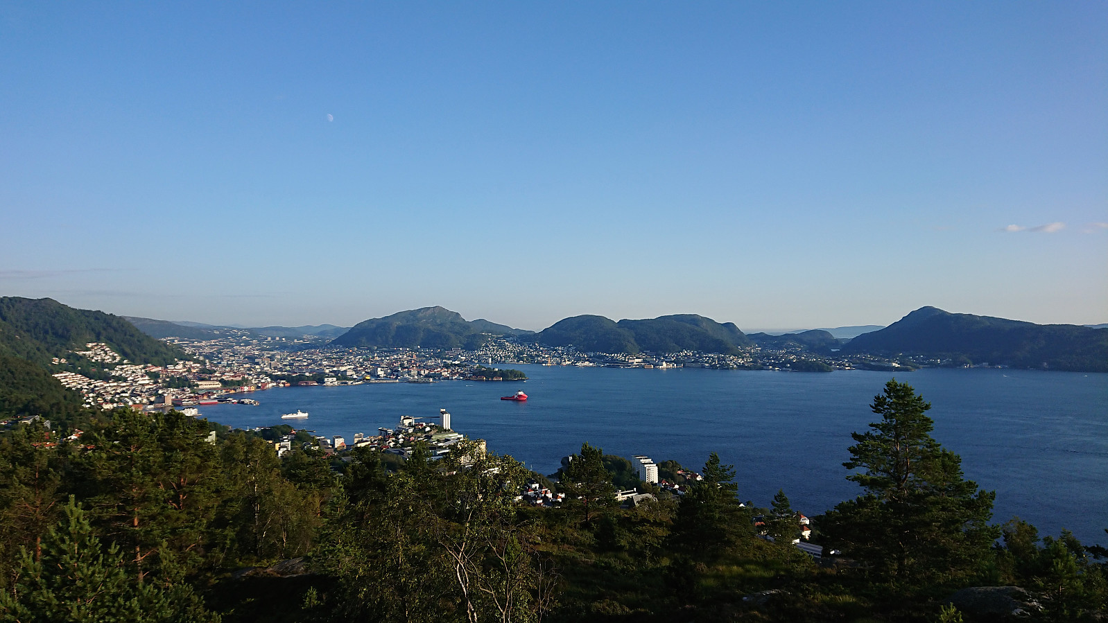 Local evening hike after work.
Totlandsfjellet
- Dato:
- 09.07.2019
- Turtype:
- Fjelltur
- Turlengde:
- 2:20t
- Distanse:
- 6,3km
 I managed to convince two colleagues to go hiking and we decided on Totlandsfjellet in Samnanger. After reading up on previous PB-reports our plan was to drive all the way to the small parking lot next to Svensdalstjørna and start our hike from there. We were therefore rather surprised when coming across a locked gate immediately after turning left (west) into Svensdalen from Høysetetjørna. The gate looked fairly new, so probably it had not been there to stop earlier visitors to Totlandsfjellet?
Luckily it was easy to find alternative parking by the main road at Høysetetjørna, and it was only about 800 meters along a gravel road from there to the planned start of the hike anyway. The gravel road was quickly covered and we shortly arrived at the northwestern end of Svensdalstjørna. After crossing the small stream we located the weak unmarked trail, heading >>>
I managed to convince two colleagues to go hiking and we decided on Totlandsfjellet in Samnanger. After reading up on previous PB-reports our plan was to drive all the way to the small parking lot next to Svensdalstjørna and start our hike from there. We were therefore rather surprised when coming across a locked gate immediately after turning left (west) into Svensdalen from Høysetetjørna. The gate looked fairly new, so probably it had not been there to stop earlier visitors to Totlandsfjellet?
Luckily it was easy to find alternative parking by the main road at Høysetetjørna, and it was only about 800 meters along a gravel road from there to the planned start of the hike anyway. The gravel road was quickly covered and we shortly arrived at the northwestern end of Svensdalstjørna. After crossing the small stream we located the weak unmarked trail, heading >>>
Hellen festning, Furukammen and Hellemyrstien
- Dato:
- 08.07.2019
- Turtype:
- Fottur
- Turlengde:
- 1:13t
- Distanse:
- 7,1km
 Local evening hike after work.
Stoltzekleiven
- Dato:
- 07.07.2019
- Turtype:
- Fjelltur
- Turlengde:
- 1:22t
- Distanse:
- 7,0km
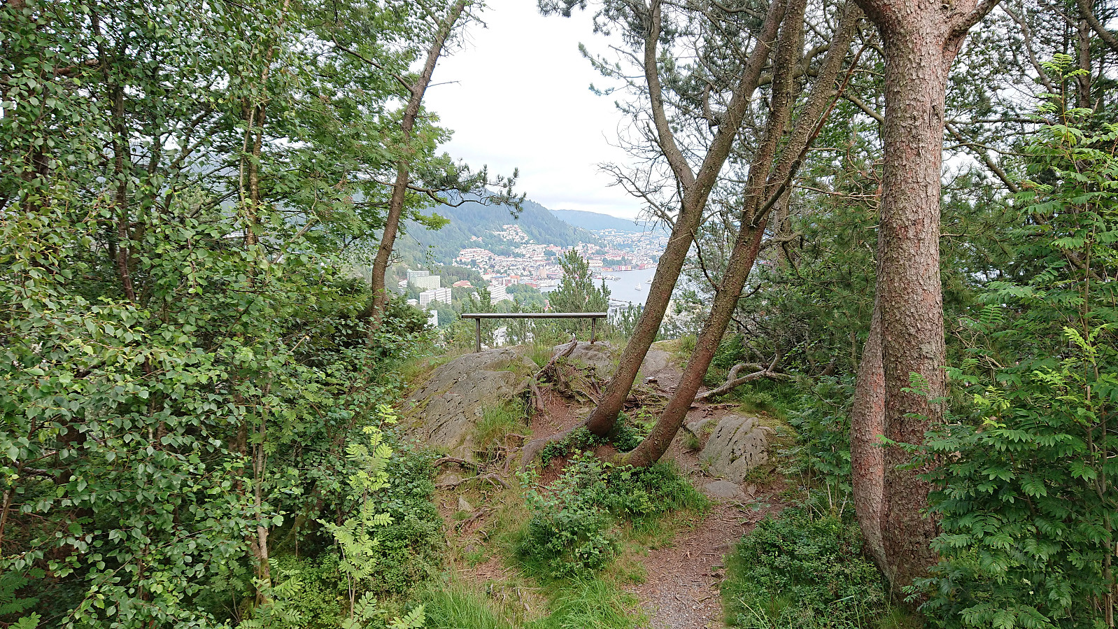
 First time up Stoltzen in a while. Made it to the top in 16 minutes and 28 seconds.
Storlifjellet and Husafjellet - Roundtrip
- Dato:
- 06.07.2019
- Turtype:
- Fjelltur
- Turlengde:
- 3:07t
- Distanse:
- 9,9km
 Today's hike had two goals. The primary being to ascend Storlifjellet from Gamlesæter, and the secondary, if time permitted, to turn the hike into a roundtrip via Eiterdalen . The latter inspired by arntfla (Arnt Flatmo) 's external trip report .
Started by taking the bus to Gamlesæter (see bus tip below) and followed the gravel road up to Nymark. From there I continuing along the tractor road until it came to an end. After reading the previous PB-reports for Storlifjellet, it seemed clear that the terrain from this point onward required that a fairly specific route was followed. So in order to not waste lots of time trying to find my own alternative route, I more or less followed in knutsverre (Knut S. Andersen) 's footsteps (although I guess GeirL (Geir Lie) should get the credit for providing the first GPS tracks along the same route .).
Combined with the numerous deer tracks also showing the way, this made what would probably otherwise have been >>>
Today's hike had two goals. The primary being to ascend Storlifjellet from Gamlesæter, and the secondary, if time permitted, to turn the hike into a roundtrip via Eiterdalen . The latter inspired by arntfla (Arnt Flatmo) 's external trip report .
Started by taking the bus to Gamlesæter (see bus tip below) and followed the gravel road up to Nymark. From there I continuing along the tractor road until it came to an end. After reading the previous PB-reports for Storlifjellet, it seemed clear that the terrain from this point onward required that a fairly specific route was followed. So in order to not waste lots of time trying to find my own alternative route, I more or less followed in knutsverre (Knut S. Andersen) 's footsteps (although I guess GeirL (Geir Lie) should get the credit for providing the first GPS tracks along the same route .).
Combined with the numerous deer tracks also showing the way, this made what would probably otherwise have been >>>
