Arkiv - dato
Arkiv - aktivitet
-
Annen tur (3)
- Kajakkpadling (3)
- Fottur (1897)
-
Kjøretur (9)
- Biltur (9)
-
Skitur (116)
- Fjellskitur (69)
- Langrennstur (47)
-
Sykkeltur (111)
- Blandet sykling (25)
- Gatesykling (86)
Lister jeg samler etter
-
Utvalgte topper og turmål i Bergen
(349/351)
 99%
99% -
Alle topper i Bergen
(393/400)
98%
-
Voss ≥ 100m pf.
(96/98)
97%
-
Opptur Hordaland
(144/159)
90%
-
Stasjoner på Bergensbanen
(33/40)
82%
-
Ulvik ≥ 100m pf.
(30/38)
78%
-
Hordaland ≥ 100m pf.
(624/863)
72%
-
Mjølfjell PF > 100m
(21/31)
67%
-
Jondal ≥ 100m pf.
(15/23)
65%
-
Dagsturhyttene i Vestland
(36/61)
59%
-
Sunnhordland PF >= 100m
(105/186)
56%
-
Hordaland: Hardanger PF>=100m
(196/359)
54%
-
DNT-hytter i Hordaland
(23/45)
51%
-
Kvinnherad ≥ 100m pf.
(40/79)
50%
-
Eidfjord ≥ 100m pf.
(13/42)
30%
-
Sogndal ≥ 100m pf.
(23/81)
28%
-
Gulen ≥ 100m pf.
(15/54)
27%
-
Vik i Sogn ≥ 100m pf.
(10/46)
21%
-
Sogn - Sør for Sognefjorden PF>=100m
(31/159)
19%
-
DNT-hytter i Sogn og Fjordane
(8/47)
17%

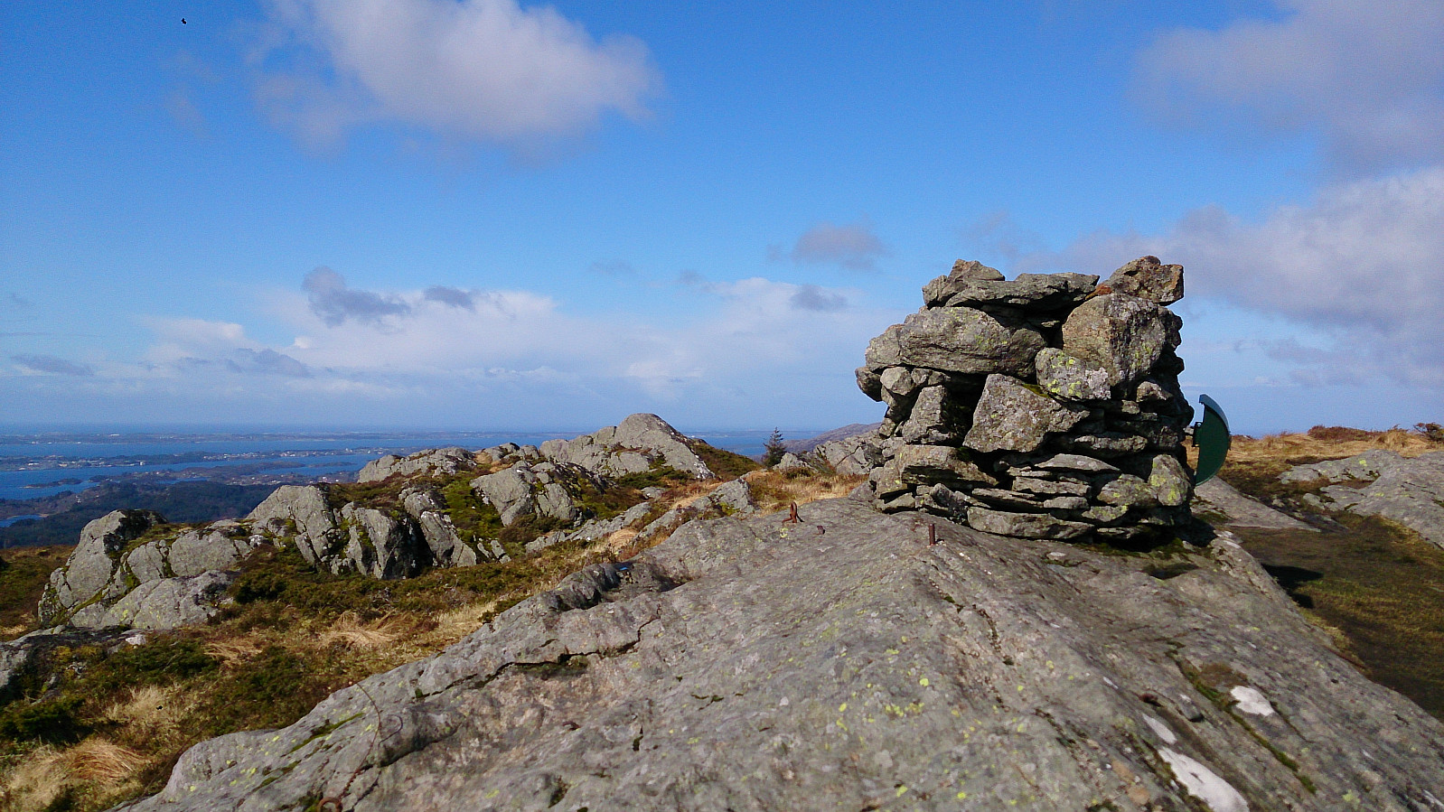
Eldsfjellet, Eldsfjellveten and Storanipa
- Dato:
- 30.04.2017
- Turtype:
- Fjelltur
- Turlengde:
- 3:30t
- Distanse:
- 7,1km
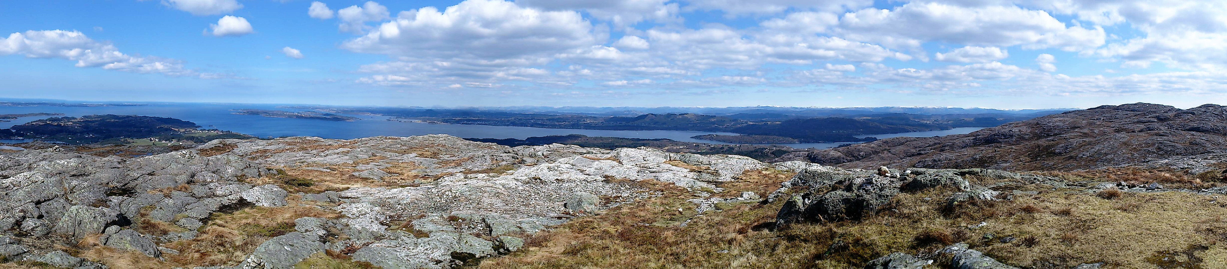 Started from the small parking lot at Skjelangervegen and followed the marked trail to the summit of Eldsfjellet . Then onwards to Eldsfjellveten , before taking the same route back to Eldsfjellet. Here we decided to also visit Storanipa . Could not find any trails so we ended up walking around Kvitstigtjørna and from there found our own way to the summit without too much trouble. The hike was completed by reconnecting with the trail back down to Skjelangervegen.
Overall, a very nice hike with excellent views in all directions!
Started from the small parking lot at Skjelangervegen and followed the marked trail to the summit of Eldsfjellet . Then onwards to Eldsfjellveten , before taking the same route back to Eldsfjellet. Here we decided to also visit Storanipa . Could not find any trails so we ended up walking around Kvitstigtjørna and from there found our own way to the summit without too much trouble. The hike was completed by reconnecting with the trail back down to Skjelangervegen.
Overall, a very nice hike with excellent views in all directions!
Øvsttuntoppen from Skjoldskiftet
- Dato:
- 29.04.2017
- Turtype:
- Fottur
- Turlengde:
- 1:30t
- Distanse:
- 6,7km
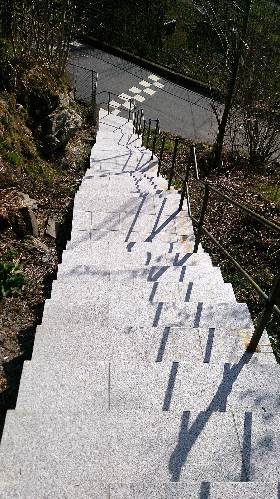 Started by taking Bybanen (i.e. the Bergen tram line) to Skjoldskiftet and walking east to Øvsttunvegen before heading up the newly renovated stairs to Klokkarlia, which I then followed all the way to Øvsttuntoppen . Much better views than expected from the summit, especially towards the east.
From the summit I took the same route back to Øvsttunvegen, but with a minor detour through Klokkarskogen.
Next, I continued towards Nesttun and then along Nesttunvatnet and Hopsvatnet before ending up at Paradis for Bybanen back to the city center. All in all, a trip that was much better than expected, with the theme of the day clearly being animals, as can be seen from the pictures below. :)
Started by taking Bybanen (i.e. the Bergen tram line) to Skjoldskiftet and walking east to Øvsttunvegen before heading up the newly renovated stairs to Klokkarlia, which I then followed all the way to Øvsttuntoppen . Much better views than expected from the summit, especially towards the east.
From the summit I took the same route back to Øvsttunvegen, but with a minor detour through Klokkarskogen.
Next, I continued towards Nesttun and then along Nesttunvatnet and Hopsvatnet before ending up at Paradis for Bybanen back to the city center. All in all, a trip that was much better than expected, with the theme of the day clearly being animals, as can be seen from the pictures below. :)
Lyderhorn from Sildaberget
- Dato:
- 27.04.2017
- Turtype:
- Fjelltur
- Turlengde:
- 3:50t
- Distanse:
- 7,0km
 Started by taking the bus to Bjørndalsbakken and from there walking up to Sildaberget. After locating the start of the trail (just follow the upper road at Sildaberget and look for the hiking sign for Lyderhorn), we followed the stairs (and later trail) to Skarpafjellet , and from there continued onwards to Lyderhorn . From Lyderhorn we followed the trail north, passing over Skjenafjellet and Ørnafjellet , before following a very muddy trail down to Gravdal, where we just missed the bus. We therefore ended the hike by walking back towards Lyngbø and Rv. 555 for the bus back to the city center.
Ramberget, Lysskarfjellet, Høgeåsen and Fanasåta
- Dato:
- 25.04.2017
- Turtype:
- Fjelltur
- Turlengde:
- 2:53t
- Distanse:
- 7,1km
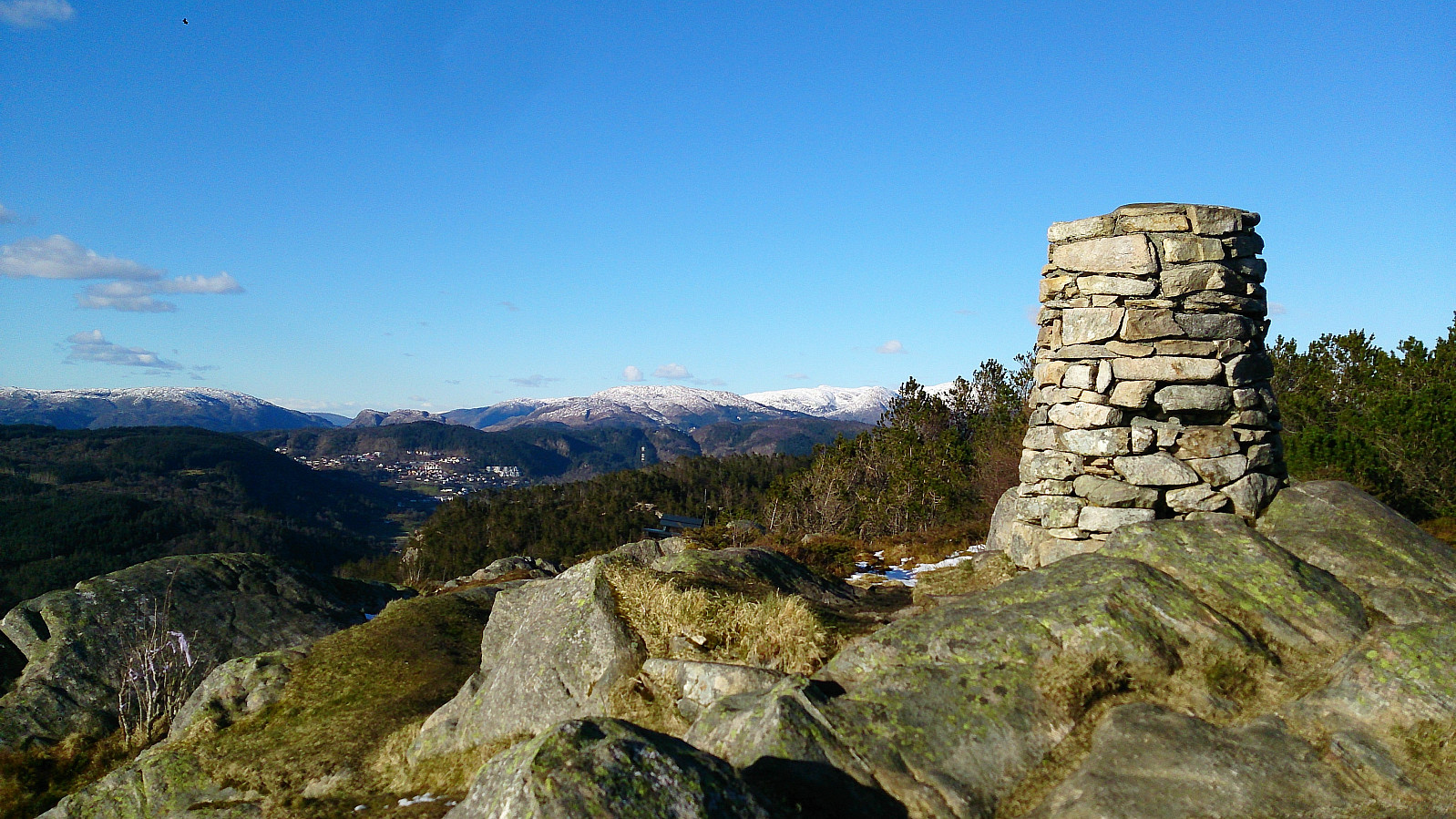 Started by taking the bus to the parking lot at Fanafjellet and walking in the southern direction along the gravel road. I quickly noticed that this was a mistake though, and that I rather should have taken the path right next to the buildings on my right. Instead of going back to the starting point (as there was a fence I thought I should not cross), I took a shortcut through the terrain to connect to the proper trail. I then follow this marked trail to Ramberget for some excellent views.
Next, I continued along the marked trail towards Lyseskarfjellet (called "Linken" on all the local signs and hiking maps). The trail was easy to follow, and included stairs to get to the summit at the end, but the trail itself was very muddy. Nice views here as well, but the summit is a bit ruined by what I assume is a >>>
Started by taking the bus to the parking lot at Fanafjellet and walking in the southern direction along the gravel road. I quickly noticed that this was a mistake though, and that I rather should have taken the path right next to the buildings on my right. Instead of going back to the starting point (as there was a fence I thought I should not cross), I took a shortcut through the terrain to connect to the proper trail. I then follow this marked trail to Ramberget for some excellent views.
Next, I continued along the marked trail towards Lyseskarfjellet (called "Linken" on all the local signs and hiking maps). The trail was easy to follow, and included stairs to get to the summit at the end, but the trail itself was very muddy. Nice views here as well, but the summit is a bit ruined by what I assume is a >>>
Brakstadfjellet, Tveitanipa, Røysetfjellet and Storfjellet
- Dato:
- 22.04.2017
- Turtype:
- Fjelltur
- Turlengde:
- 4:30t
- Distanse:
- 12,4km
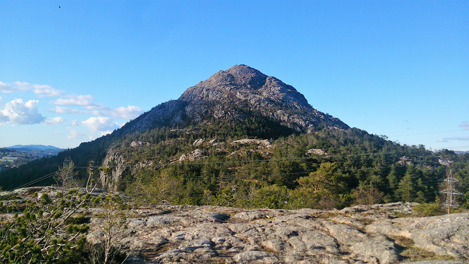
 Brakstadfjellet
Started by taking the bus (or rather buses, four in total) to Valde (called Vollo on the map) and from there followed a gravel road and later a very muddy trail to the summit of Brakstadfjellet . Excellent views from the summit in all directions! I walked around a bit to see if I could get an even better view to the northeast, but the terrain was not really made for this and in the end the views were not much improved anyway.
Tveitanipa
From Brakstadfjellet I doubled back almost to the gravel road and then continued in the northern direction for around 100 meters before taking a right turn to the east and followed the trail the next top of the day: Tveitanipa . Again the trail had its muddy sections, but overall a nice trail that was easy to follow. I quickly arrived at the summit and from there continued >>>
Brakstadfjellet
Started by taking the bus (or rather buses, four in total) to Valde (called Vollo on the map) and from there followed a gravel road and later a very muddy trail to the summit of Brakstadfjellet . Excellent views from the summit in all directions! I walked around a bit to see if I could get an even better view to the northeast, but the terrain was not really made for this and in the end the views were not much improved anyway.
Tveitanipa
From Brakstadfjellet I doubled back almost to the gravel road and then continued in the northern direction for around 100 meters before taking a right turn to the east and followed the trail the next top of the day: Tveitanipa . Again the trail had its muddy sections, but overall a nice trail that was easy to follow. I quickly arrived at the summit and from there continued >>>
Smådal to Kirkebirkeland
- Dato:
- 17.04.2017
- Turtype:
- Fjelltur
- Turlengde:
- 4:13t
- Distanse:
- 12,8km
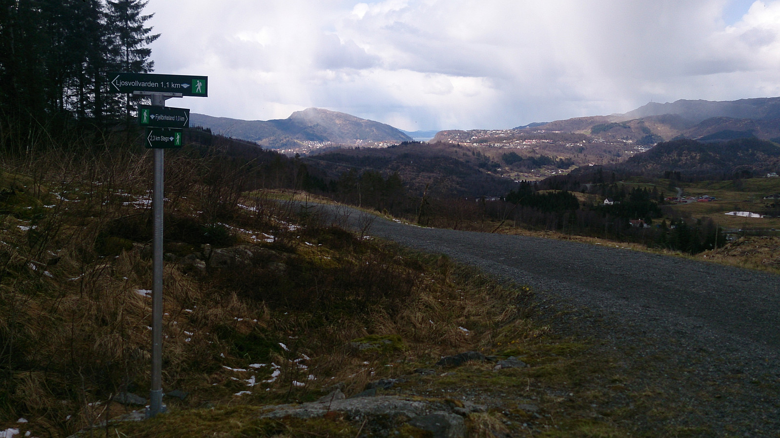 Last day of the 2017 Easter holidays and time for a new hike in the area around Kalandsvatnet. Started by taking the bus to Kaland skole and from there walking along E39 in the direction of Os. After walking for a couple of minutes and not finding the signs towards Orrtua and/or Vardafjellet , which I thought I'd seen when passing the area by car a couple of weeks earlier, I checked the GPS and discovered that I had already passed the planned start of the hike: Smådal. I therefore doubled back and quickly found the missed exit. There were no proper signs (at least none that I could see), but there was a map. One has to cross the road to see it though, so this could be clearer. But if keeping an eye on the GPS, the start of the trail should be easy to locate.
I then followed a well-marked trail (indicated with >>>
Last day of the 2017 Easter holidays and time for a new hike in the area around Kalandsvatnet. Started by taking the bus to Kaland skole and from there walking along E39 in the direction of Os. After walking for a couple of minutes and not finding the signs towards Orrtua and/or Vardafjellet , which I thought I'd seen when passing the area by car a couple of weeks earlier, I checked the GPS and discovered that I had already passed the planned start of the hike: Smådal. I therefore doubled back and quickly found the missed exit. There were no proper signs (at least none that I could see), but there was a map. One has to cross the road to see it though, so this could be clearer. But if keeping an eye on the GPS, the start of the trail should be easy to locate.
I then followed a well-marked trail (indicated with >>>
Reppanipa
- Dato:
- 15.04.2017
- Turtype:
- Fjellskitur
- Turlengde:
- 2:46t
- Distanse:
- 10,2km
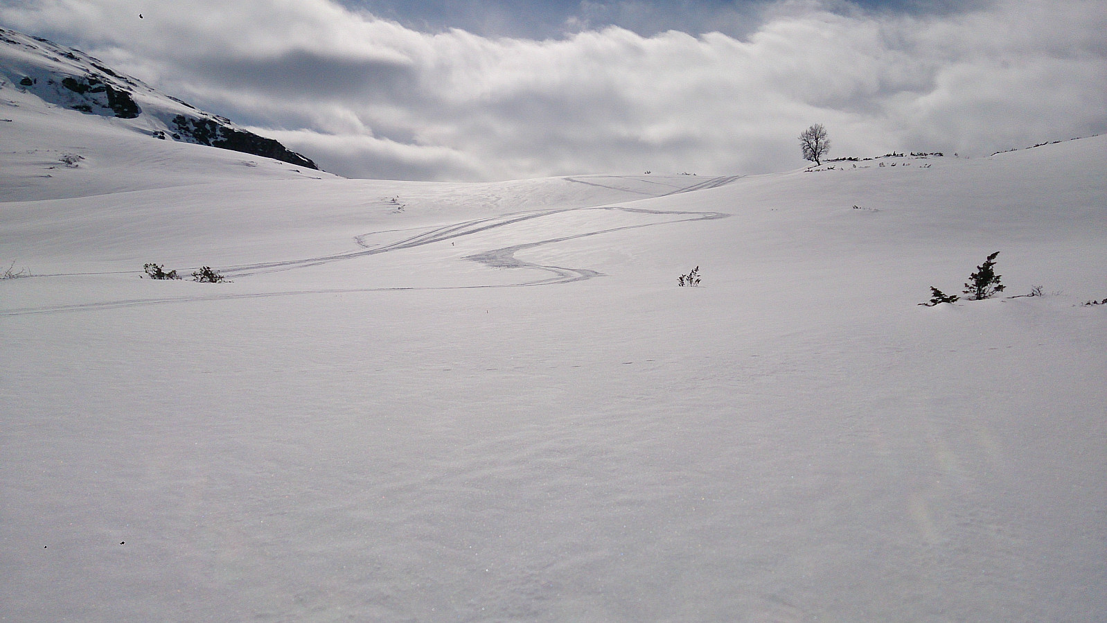 Started from the parking lot at Hodlekve and began by following the "lysløype" with some family members, before taking off on my own towards Kollsetestølen. I partly followed some old snow scooter tracks until reaching the cabins at the southern end of Reppanipa . From there I could not find any more tracks towards the summit, but it was fairly easy to find a safe route. After taking lots of pictures, as apparently the only visitor for some time, I followed pretty much the same route back to the parking lot under perfect skiing conditions!
Helleberget
- Dato:
- 14.04.2017
- Turtype:
- Fjellskitur
- Turlengde:
- 2:36t
- Distanse:
- 10,2km
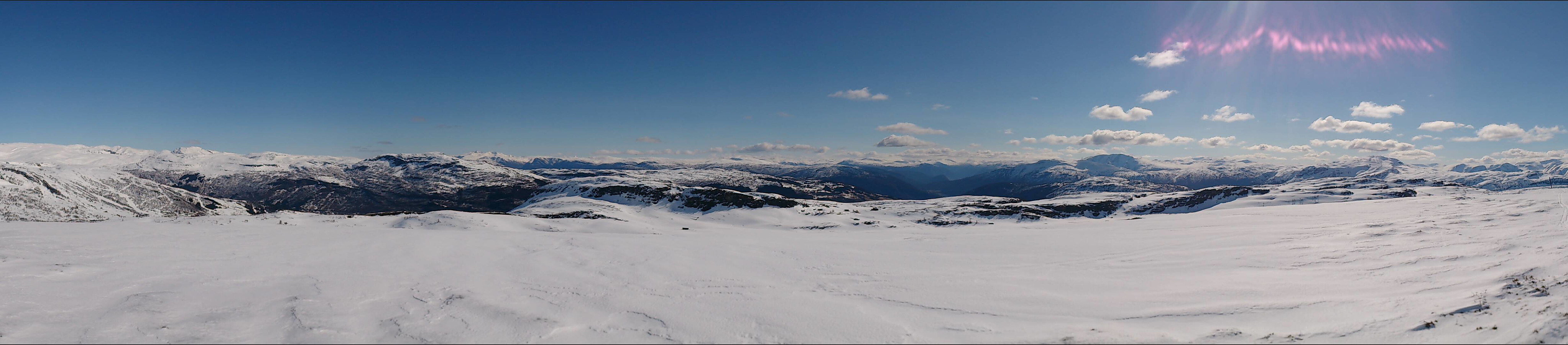 Started from the parking lot at Rindabotn and followed the marked trail towards Høgehaug, but before getting to Rysete we instead took the trail towards Fagreggi and ascended Helleberget from the south. Similar route back, but with a couple of shortcuts through the terrain.
Hiking alongside Barsnesfjorden
- Dato:
- 14.04.2017
- Turtype:
- Fottur
- Turlengde:
- 1:45t
- Distanse:
- 8,2km
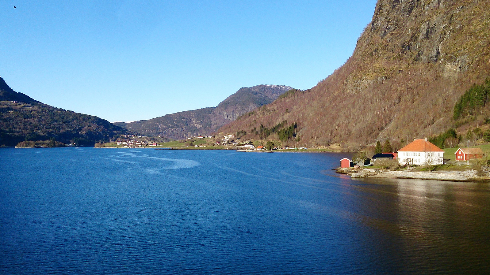 Started from the center of Sogndal and walked along the roads, and later gravel roads, to the end of Barsnesfjorden.
(Note that the road this hike follows towards the end is private, i.e. no cars allowed. There are however a couple of parking spaces down by the small wharf along Barsnesfjorden just before the road turns west and starts climbing slightly towards the crossroads at Barsnes.)
Started from the center of Sogndal and walked along the roads, and later gravel roads, to the end of Barsnesfjorden.
(Note that the road this hike follows towards the end is private, i.e. no cars allowed. There are however a couple of parking spaces down by the small wharf along Barsnesfjorden just before the road turns west and starts climbing slightly towards the crossroads at Barsnes.)
Romnaholten
- Dato:
- 13.04.2017
- Turtype:
- Fjelltur
- Turlengde:
- 3:17t
- Distanse:
- 9,2km
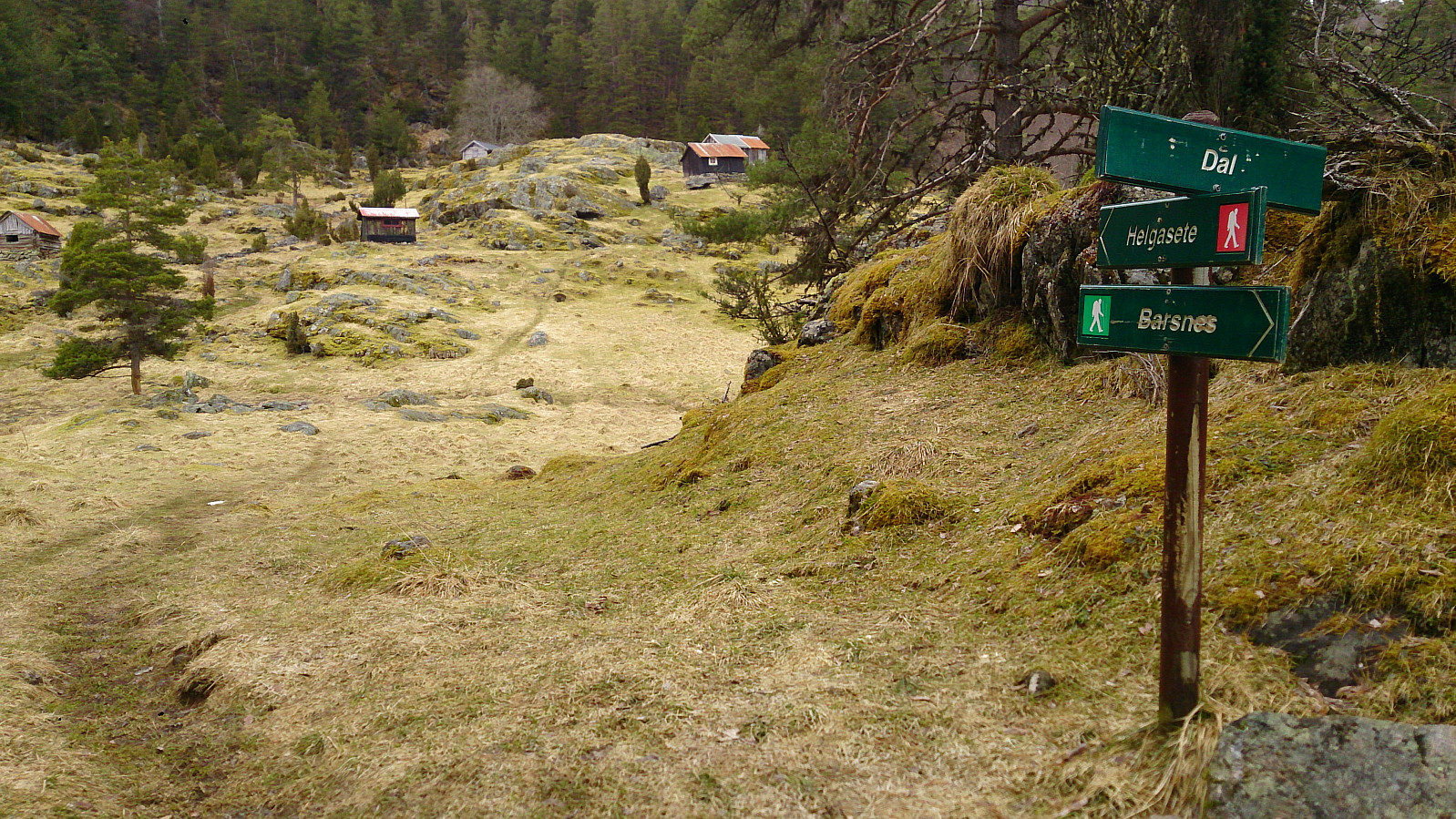 Started from Barsnes and walked along Barsnesfjorden until following the marked trail towards Helgasete . However, before reaching Dal we took a shortcut/more direct route to Dal. From Dal we partly followed a trail and partly found our own to reach the top of Romnaholten . Limited views from the summit, but there were several nice viewpoints just to the south of the summit. We more or less followed the same route for the descent, but this time following the main trail from Dal down to Barsnesfjorden.
(Note that the road to where the trail starts is private, i.e. no cars allowed. There are however a couple of parking spaces down by the small wharf along Barsnesfjorden just before the road turns west and starts climbing slightly towards the crossroads at Barsnes.)
Started from Barsnes and walked along Barsnesfjorden until following the marked trail towards Helgasete . However, before reaching Dal we took a shortcut/more direct route to Dal. From Dal we partly followed a trail and partly found our own to reach the top of Romnaholten . Limited views from the summit, but there were several nice viewpoints just to the south of the summit. We more or less followed the same route for the descent, but this time following the main trail from Dal down to Barsnesfjorden.
(Note that the road to where the trail starts is private, i.e. no cars allowed. There are however a couple of parking spaces down by the small wharf along Barsnesfjorden just before the road turns west and starts climbing slightly towards the crossroads at Barsnes.)
