Arkiv - dato
Arkiv - aktivitet
-
Annen tur (3)
- Kajakkpadling (3)
- Fottur (1898)
-
Kjøretur (9)
- Biltur (9)
-
Skitur (116)
- Fjellskitur (69)
- Langrennstur (47)
-
Sykkeltur (111)
- Blandet sykling (25)
- Gatesykling (86)
Lister jeg samler etter
-
Utvalgte topper og turmål i Bergen
(349/351)
 99%
99% -
Alle topper i Bergen
(393/400)
98%
-
Voss ≥ 100m pf.
(96/98)
97%
-
Opptur Hordaland
(144/159)
90%
-
Stasjoner på Bergensbanen
(33/40)
82%
-
Ulvik ≥ 100m pf.
(30/38)
78%
-
Hordaland ≥ 100m pf.
(624/863)
72%
-
Mjølfjell PF > 100m
(21/31)
67%
-
Jondal ≥ 100m pf.
(15/23)
65%
-
Dagsturhyttene i Vestland
(36/61)
59%
-
Sunnhordland PF >= 100m
(105/186)
56%
-
Hordaland: Hardanger PF>=100m
(196/359)
54%
-
DNT-hytter i Hordaland
(23/45)
51%
-
Kvinnherad ≥ 100m pf.
(40/79)
50%
-
Eidfjord ≥ 100m pf.
(13/42)
30%
-
Sogndal ≥ 100m pf.
(23/81)
28%
-
Gulen ≥ 100m pf.
(15/54)
27%
-
Vik i Sogn ≥ 100m pf.
(10/46)
21%
-
Sogn - Sør for Sognefjorden PF>=100m
(31/159)
19%
-
DNT-hytter i Sogn og Fjordane
(8/47)
17%

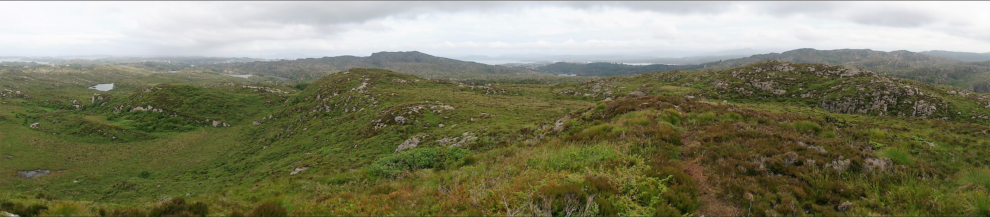
Hausdalen to Espeland via Søre Gullfjelltoppen
- Dato:
- 19.07.2017
- Turtype:
- Fjelltur
- Turlengde:
- 5:52t
- Distanse:
- 19,3km
 Locating the trailhead
Started by taking the bus to "Hausdalen snuplass" and continuing up the very nice gravel road through Brekkedalen, where I located a small cairn indicating the start of the unmarked trail towards Sydpolen and Søre Gullfjelltoppen .
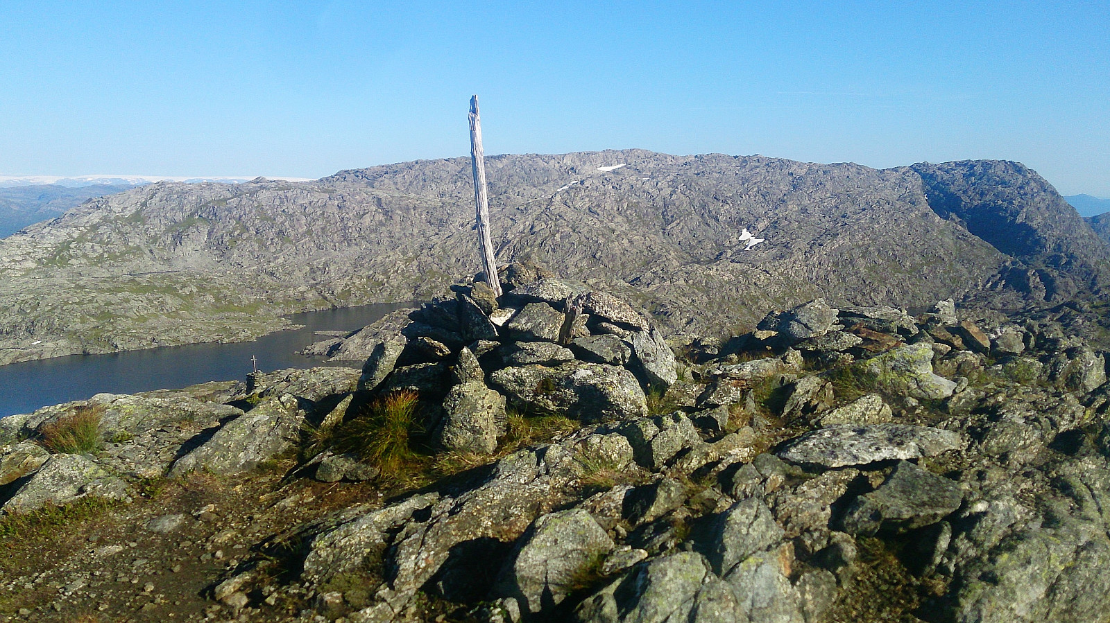
Sydpolen - 730 meter continuous ascent!
The trail was easy to follow as it winded its way up between the pine trees. It quickly turned quite steep though, and when the trail left the trees behind, the trail could get a bit weak at times, but it was relatively easy to relocate when lost. Note that the height difference from the trailhead to the cairn at the top, known as Sydpolen, is around 730 meters, with limited rest along the way with regards to the terrain. Sydpolen provided spectacular views in all direction. Definitely worth the long climb! Especially nice >>>
Locating the trailhead
Started by taking the bus to "Hausdalen snuplass" and continuing up the very nice gravel road through Brekkedalen, where I located a small cairn indicating the start of the unmarked trail towards Sydpolen and Søre Gullfjelltoppen .
Sydpolen - 730 meter continuous ascent!
The trail was easy to follow as it winded its way up between the pine trees. It quickly turned quite steep though, and when the trail left the trees behind, the trail could get a bit weak at times, but it was relatively easy to relocate when lost. Note that the height difference from the trailhead to the cairn at the top, known as Sydpolen, is around 730 meters, with limited rest along the way with regards to the terrain. Sydpolen provided spectacular views in all direction. Definitely worth the long climb! Especially nice >>>
Hjartåsfjellet (the extended version...)
- Dato:
- 15.07.2017
- Turtype:
- Fjelltur
- Turlengde:
- 3:42t
- Distanse:
- 15,8km
 The trail head
Started by taking the bus to Hjartås (bus stop "Frank Mohn Hjertås") and walking up to the car park on the east side of the factory building. The trail started at the northern end of the parking lot, with the first part being a gravel road. When the gravel road ended I located the start of the trail without much difficulty. The trail did include some wet areas, but various strategically placed wooden objects made sure that one could easily make progress without getting wet.
Ramusfjellet
I then followed the marked trail north until reaching an intersection at the western base of Ramusfjellet . Here I initially started right (east), but while there was a trail, I quickly figured out that it would not take me up to Ramusfjellet. I therefore turned back and tried left (west) instead, >>>
The trail head
Started by taking the bus to Hjartås (bus stop "Frank Mohn Hjertås") and walking up to the car park on the east side of the factory building. The trail started at the northern end of the parking lot, with the first part being a gravel road. When the gravel road ended I located the start of the trail without much difficulty. The trail did include some wet areas, but various strategically placed wooden objects made sure that one could easily make progress without getting wet.
Ramusfjellet
I then followed the marked trail north until reaching an intersection at the western base of Ramusfjellet . Here I initially started right (east), but while there was a trail, I quickly figured out that it would not take me up to Ramusfjellet. I therefore turned back and tried left (west) instead, >>>
Solbakkefjellet from Kalandseidet
- Dato:
- 14.07.2017
- Turtype:
- Fjelltur
- Turlengde:
- 4:18t
- Distanse:
- 12,8km
 The plan for the day was to take the bus to Hausdal and hike up to Søre Gullfjelltoppen , but it soon became clear that the corresponding bus from Kalandseidet was not showing up or had already left. As an alternative we decided on Solbakkefjellet . We followed one of the marked trails to the summit, and then doubled back to end up at Kaland for the bus back to the city center.
For a longer version of the same hike see Solbakkefjellet from Kalandseidet .
The plan for the day was to take the bus to Hausdal and hike up to Søre Gullfjelltoppen , but it soon became clear that the corresponding bus from Kalandseidet was not showing up or had already left. As an alternative we decided on Solbakkefjellet . We followed one of the marked trails to the summit, and then doubled back to end up at Kaland for the bus back to the city center.
For a longer version of the same hike see Solbakkefjellet from Kalandseidet .
Ørneberget
- Dato:
- 11.07.2017
- Turtype:
- Fjelltur
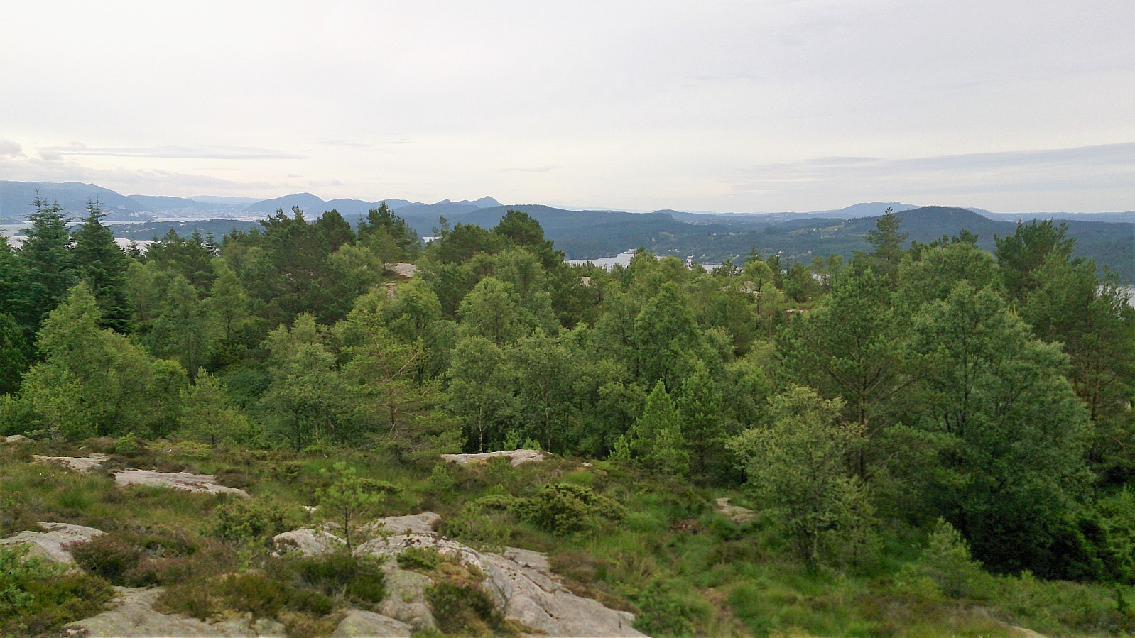
 Short evening hike across Øyjordsfjellet, aka Ørneberget. (Too short to bother with GPS tracking.)
Døsjeskiftet to Liaskjeret
- Dato:
- 08.07.2017
- Turtype:
- Fjelltur
- Turlengde:
- 4:46t
- Distanse:
- 15,2km
 Døsjeskiftet to Liatårnet
Started by taking the bus to Døsjeskiftet and following the paved road up towards Bildøyvatnet. From there I followed the standard trail south until reaching the road that goes up to Pyttane (with minor detours for quick visits to Skinntikavarden and Skitnafenet ), which I then followed to the top of Pyttane before continuing along the trail to Liatårnet . This is where the real hike started, as I was now finally heading into, for me, new territory.
Høgafjellet..?
From the top of Liatårnet I followed the trail south, but where the trail started to turn west I instead continued south towards Høgafjellet . To my surprise, I found a trail in this direction as well, which I decided to follow. However, the trail was passing west of Høgafjellet, i.e. not across the summit, but it was straightforward to ascend from the south.
Døsjeskiftet to Liatårnet
Started by taking the bus to Døsjeskiftet and following the paved road up towards Bildøyvatnet. From there I followed the standard trail south until reaching the road that goes up to Pyttane (with minor detours for quick visits to Skinntikavarden and Skitnafenet ), which I then followed to the top of Pyttane before continuing along the trail to Liatårnet . This is where the real hike started, as I was now finally heading into, for me, new territory.
Høgafjellet..?
From the top of Liatårnet I followed the trail south, but where the trail started to turn west I instead continued south towards Høgafjellet . To my surprise, I found a trail in this direction as well, which I decided to follow. However, the trail was passing west of Høgafjellet, i.e. not across the summit, but it was straightforward to ascend from the south.
Signalen and Gardafjellet
- Dato:
- 05.07.2017
- Turtype:
- Fjelltur
- Turlengde:
- 2:35t
- Distanse:
- 10,5km
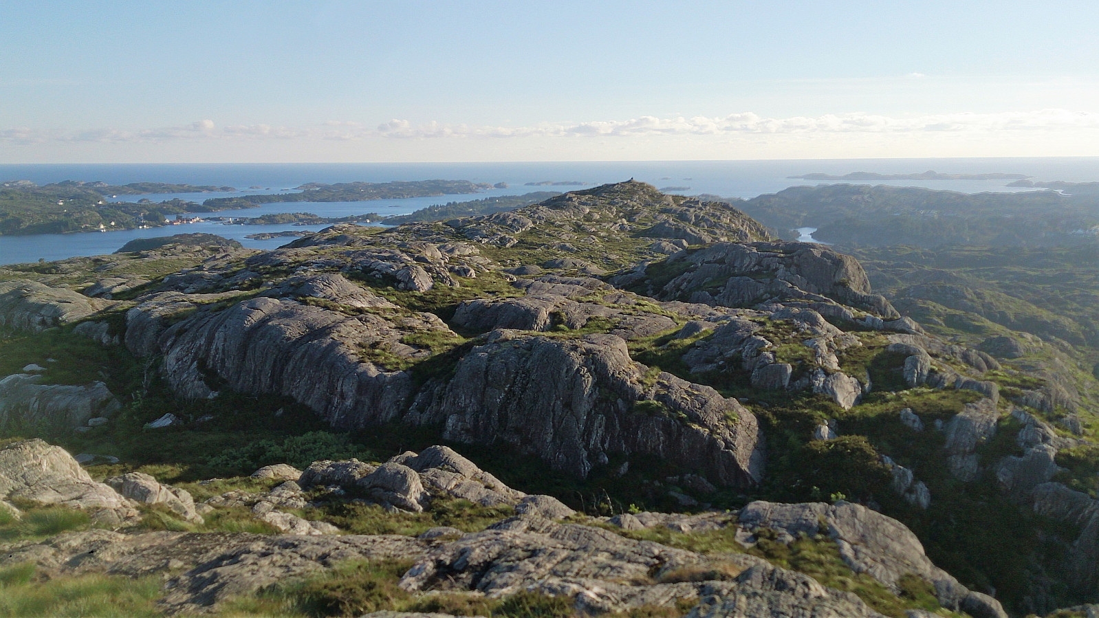 Signalen
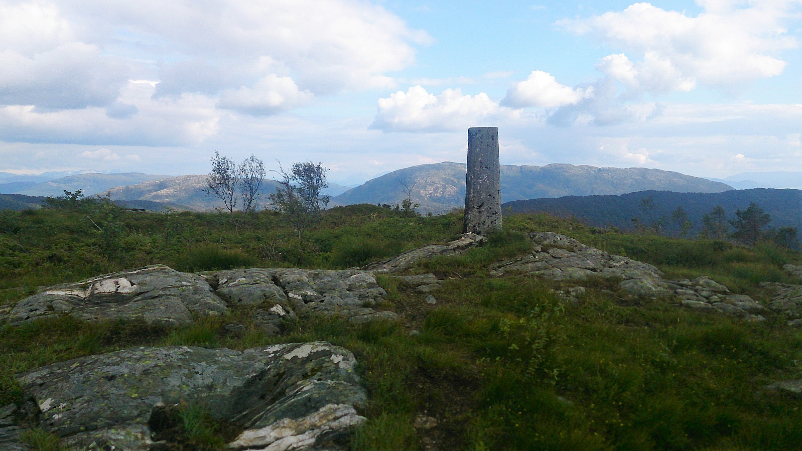
Started by taking the bus to Møvik (bus stop called Halsvarden) and walking up Signalvegen to Signalsvatnet, along a paved road and then a gravel road. Upon reaching the small lake, I continued on the west side of the lake, using the stairs at the end of the dam to start the ascent to the western summit at Signalen . There was a trail, but it was not always easy to follow, and sometimes there were also multiple trails in the same general direction. Reaching the cairn was still straightforward though, and the views were excellent, especially towards the west.
Next, I continued east, along slightly easier to follow trails, towards the highest point at Signalen , which also had its own cairn. Spectacular views in all directions here as well, especially in the very nice weather I was lucky enough to have on this particular visit. From the >>>
Signalen
Started by taking the bus to Møvik (bus stop called Halsvarden) and walking up Signalvegen to Signalsvatnet, along a paved road and then a gravel road. Upon reaching the small lake, I continued on the west side of the lake, using the stairs at the end of the dam to start the ascent to the western summit at Signalen . There was a trail, but it was not always easy to follow, and sometimes there were also multiple trails in the same general direction. Reaching the cairn was still straightforward though, and the views were excellent, especially towards the west.
Next, I continued east, along slightly easier to follow trails, towards the highest point at Signalen , which also had its own cairn. Spectacular views in all directions here as well, especially in the very nice weather I was lucky enough to have on this particular visit. From the >>>
Møsnuken and Tyssdalsfjellet
- Dato:
- 04.07.2017
- Turtype:
- Fjelltur
- Turlengde:
- 5:11t
- Distanse:
- 12,8km
 Started by taking the bus to Ulvenskiftet and walking up Tøsdalsvegen to Tyssdal for the real start of the hike. We then followed the marked trail northeast, first along a gravel road and later along a nice trail, until reaching the sign for "Møsnuken (bratt)", i.e. "Møsnuken (steep)", where the trail turned north. The indication on the sign was quite accurate, as we soon found ourselves climbing upwards among lots of large rocks. But while rather steep, making progress upwards was still not very difficult.
Upon reaching the end of the large rocks, the trail again turned northeast and flattened out, and we quickly arrived at the summit of Møsnuken for spectacular views in all directions! Quite windy at the summit, so we did not stay too long, and soon doubled back in the direction >>>
Started by taking the bus to Ulvenskiftet and walking up Tøsdalsvegen to Tyssdal for the real start of the hike. We then followed the marked trail northeast, first along a gravel road and later along a nice trail, until reaching the sign for "Møsnuken (bratt)", i.e. "Møsnuken (steep)", where the trail turned north. The indication on the sign was quite accurate, as we soon found ourselves climbing upwards among lots of large rocks. But while rather steep, making progress upwards was still not very difficult.
Upon reaching the end of the large rocks, the trail again turned northeast and flattened out, and we quickly arrived at the summit of Møsnuken for spectacular views in all directions! Quite windy at the summit, so we did not stay too long, and soon doubled back in the direction >>>
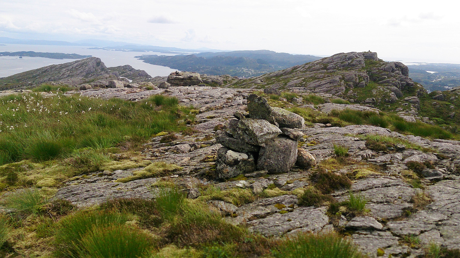
Ebbesvikfjellet from Straume terminal
- Dato:
- 02.07.2017
- Turtype:
- Fottur
- Turlengde:
- 1:16t
- Distanse:
- 6,1km
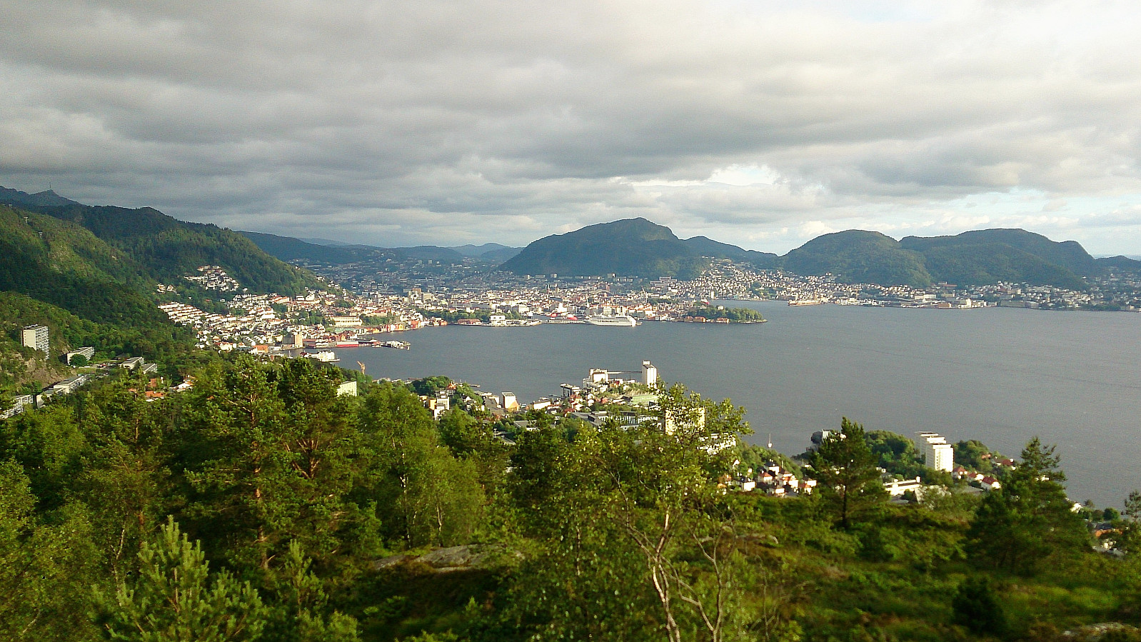
 Took the bus to Straume terminal and from there walked along the roads to Sotra Arena and Skogavatnet. Here I followed a nice gravel road south to Ebbesvikvatnet, before locating the trail towards Ebbesvikfjellet .
The start of the trail was indicated by a sign, but as the trail shortly crossed a new road being built, it required a bit of searching to figure out where the trail continued on the other side. But upon relocating the trail it could easily be followed south, although this trail did not seem to be very heavily used.
Even though the map did not indicate a trail towards the summit of Ebbesvikfjellet, the trail, as expected, could be followed all the way to the summit. If approaching from the north the trail towards the summit starts just before reaching the power line. The summit had much better views >>>
Took the bus to Straume terminal and from there walked along the roads to Sotra Arena and Skogavatnet. Here I followed a nice gravel road south to Ebbesvikvatnet, before locating the trail towards Ebbesvikfjellet .
The start of the trail was indicated by a sign, but as the trail shortly crossed a new road being built, it required a bit of searching to figure out where the trail continued on the other side. But upon relocating the trail it could easily be followed south, although this trail did not seem to be very heavily used.
Even though the map did not indicate a trail towards the summit of Ebbesvikfjellet, the trail, as expected, could be followed all the way to the summit. If approaching from the north the trail towards the summit starts just before reaching the power line. The summit had much better views >>>
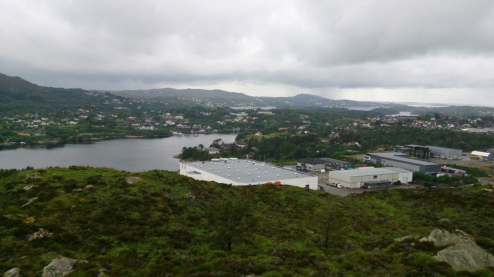
Spjeldsfjellet, Sauafjellet and Knappskogfjellet
- Dato:
- 01.07.2017
- Turtype:
- Fjelltur
- Turlengde:
- 3:19t
- Distanse:
- 10,4km
 Spjeldsfjellet
Started by taking the bus to Spjeldbrekko and locating the trail towards Spjeldsfjellet . The trailhead was not marked, but easy to find as it started directly from the sidewalk on the opposite side of the road from the bus stop. The trail itself was easy to follow and I quickly arrived at the summit for some nice views in all directions. Even though the weather conditions were not optimal in terms of visibility.
Sauafjellet
From Spjeldsfjellet, I continued south along the trail towards Fjæreide on the west side of Fjæreidpollen. This trail was also unmarked (with the exception of the N's indicating that the trail was part of Nordsjøløypa), but for the most part it was straightforward to follow and within not too long I arrived at Fjæreide.
I then continued along the road for about 200 meters, >>>
Spjeldsfjellet
Started by taking the bus to Spjeldbrekko and locating the trail towards Spjeldsfjellet . The trailhead was not marked, but easy to find as it started directly from the sidewalk on the opposite side of the road from the bus stop. The trail itself was easy to follow and I quickly arrived at the summit for some nice views in all directions. Even though the weather conditions were not optimal in terms of visibility.
Sauafjellet
From Spjeldsfjellet, I continued south along the trail towards Fjæreide on the west side of Fjæreidpollen. This trail was also unmarked (with the exception of the N's indicating that the trail was part of Nordsjøløypa), but for the most part it was straightforward to follow and within not too long I arrived at Fjæreide.
I then continued along the road for about 200 meters, >>>
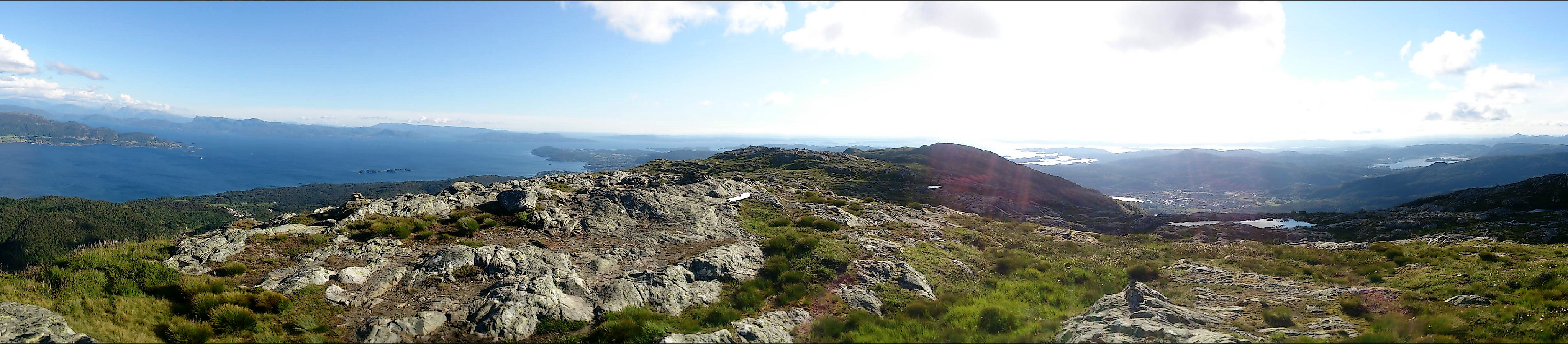
Roundtrip at Gullfjellet
- Dato:
- 28.06.2017
- Turtype:
- Fjelltur
- Turlengde:
- 7:22t
- Distanse:
- 18,1km
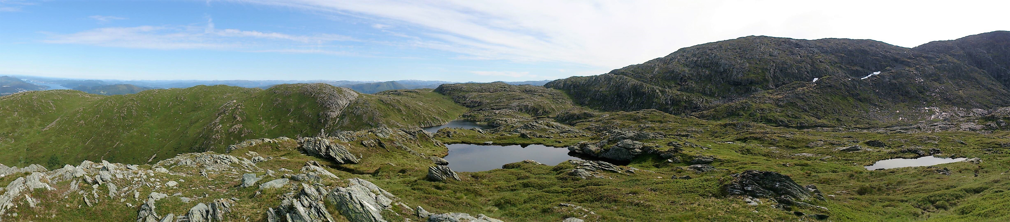 From Osavatnet to Tjørnane
Starting from the parking lot at Osavatnet we followed the trail along the west and later north side of Svartavatnet, then up Svartavasslia to Tjørndalen, before arriving at Tjørnane. The trail was unmarked, but very nice and easy to follow.
Litlagullfjellet
After arriving at Tjørnane, I made a quick detour to the summit of Litlagullfjellet . At first it seemed a bit difficult to ascend directly from the north. The trick was to utilize the stones sticking up out of the water on the Litlagullfjellet side of the lake (right next to where the stream from Tjørnane starts heading down to Tjørndalen). This takes you a couple of meters east, thus avoiding the steepest sections. The ascent was then much easier and only required some light climbing. The summit itself provided spectacular views in all directions >>>
From Osavatnet to Tjørnane
Starting from the parking lot at Osavatnet we followed the trail along the west and later north side of Svartavatnet, then up Svartavasslia to Tjørndalen, before arriving at Tjørnane. The trail was unmarked, but very nice and easy to follow.
Litlagullfjellet
After arriving at Tjørnane, I made a quick detour to the summit of Litlagullfjellet . At first it seemed a bit difficult to ascend directly from the north. The trick was to utilize the stones sticking up out of the water on the Litlagullfjellet side of the lake (right next to where the stream from Tjørnane starts heading down to Tjørndalen). This takes you a couple of meters east, thus avoiding the steepest sections. The ascent was then much easier and only required some light climbing. The summit itself provided spectacular views in all directions >>>
