Arkiv - dato
Arkiv - aktivitet
-
Annen tur (3)
- Kajakkpadling (3)
- Fottur (1870)
-
Kjøretur (9)
- Biltur (9)
-
Skitur (116)
- Fjellskitur (69)
- Langrennstur (47)
-
Sykkeltur (108)
- Blandet sykling (25)
- Gatesykling (83)
Lister jeg samler etter
-
Utvalgte topper og turmål i Bergen
(346/347)
 99%
99% -
Alle topper i Bergen
(391/398)
98%
-
Voss ≥ 100m pf.
(96/98)
97%
-
Opptur Hordaland
(144/159)
90%
-
Stasjoner på Bergensbanen
(31/40)
77%
-
Ulvik ≥ 100m pf.
(28/38)
73%
-
Hordaland ≥ 100m pf.
(622/863)
72%
-
Mjølfjell PF > 100m
(21/31)
67%
-
Jondal ≥ 100m pf.
(15/23)
65%
-
Dagsturhyttene i Vestland
(36/61)
59%
-
Sunnhordland PF >= 100m
(105/186)
56%
-
Hordaland: Hardanger PF>=100m
(194/359)
54%
-
DNT-hytter i Hordaland
(23/45)
51%
-
Kvinnherad ≥ 100m pf.
(40/79)
50%
-
Eidfjord ≥ 100m pf.
(13/42)
30%
-
Sogndal ≥ 100m pf.
(23/81)
28%
-
Gulen ≥ 100m pf.
(14/54)
25%
-
Vik i Sogn ≥ 100m pf.
(10/46)
21%
-
Sogn - Sør for Sognefjorden PF>=100m
(30/159)
18%
-
DNT-hytter i Sogn og Fjordane
(8/47)
17%

Ørneberget and Hellen festning
- Dato:
- 19.04.2022
- Turtype:
- Fjelltur
- Turlengde:
- 1:01t
- Distanse:
- 4,6km
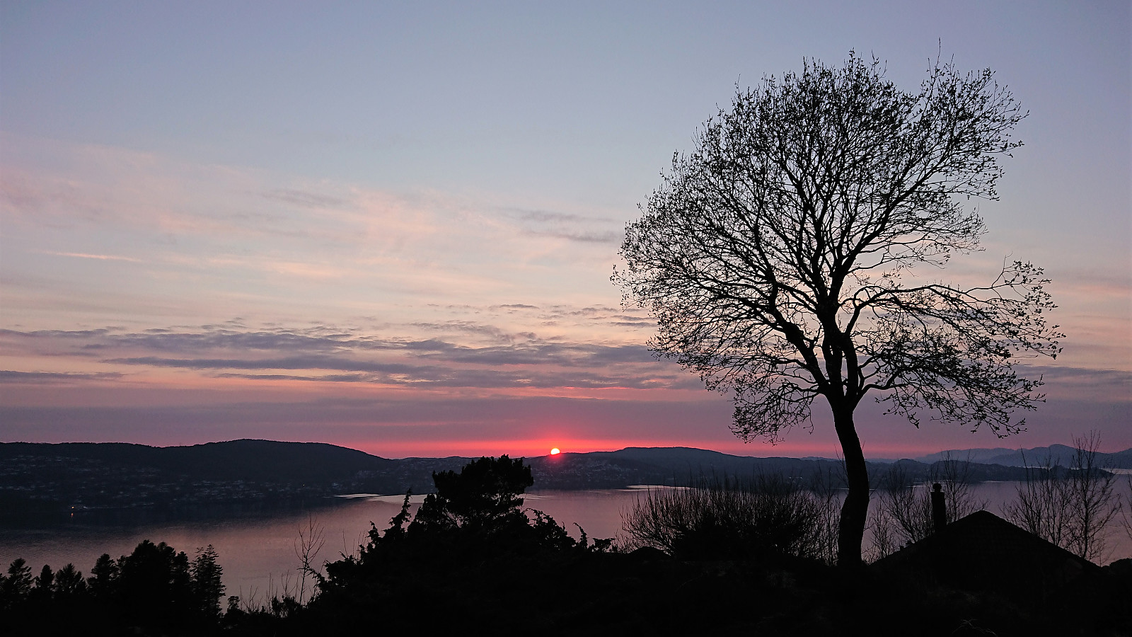 Short local evening hike to catch the sunset.
Cycling: Salhus Roundtrip
- Dato:
- 18.04.2022
- Turtype:
- Gatesykling
- Turlengde:
- 2:32t
- Distanse:
- 39,2km
 The first cycling trip of 2022! I did the usual trip around Salhus, only adding a minor detour to Storåkervika .
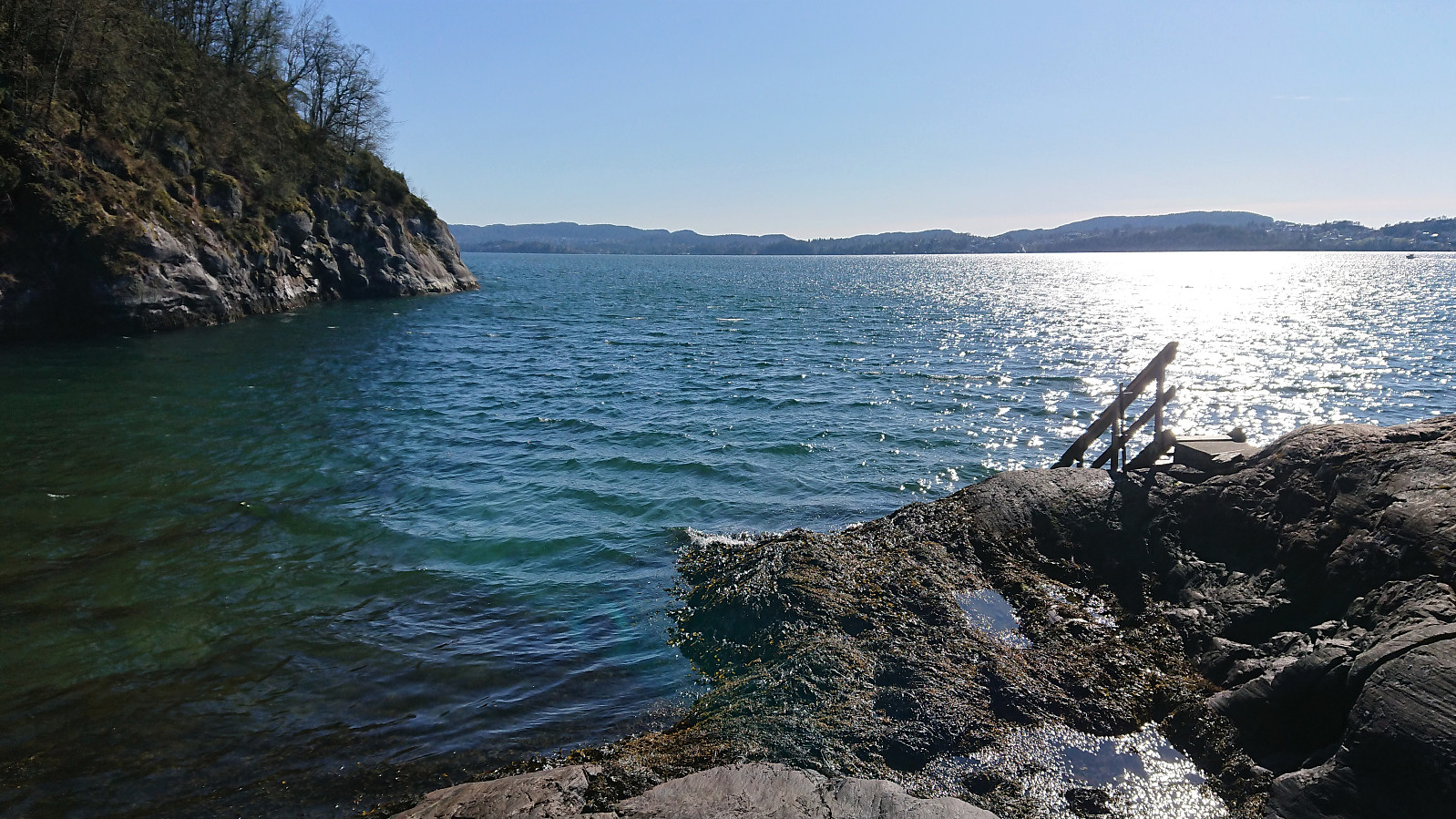
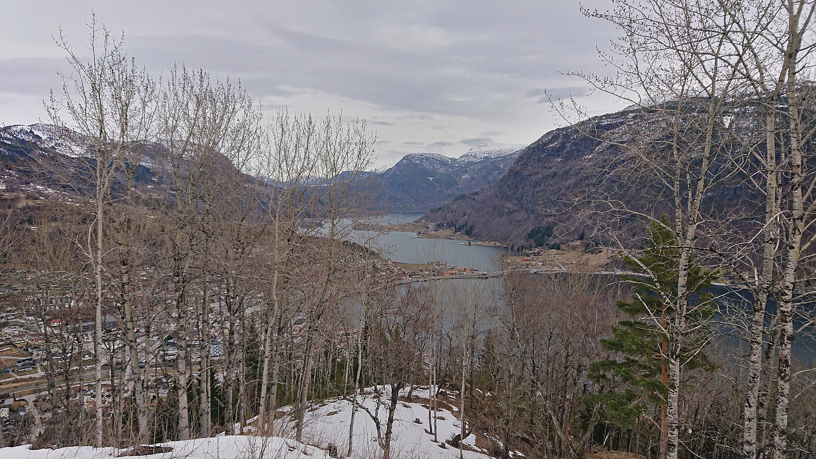
Hellen festning and Hellemyrstien
- Dato:
- 17.04.2022
- Turtype:
- Fottur
- Turlengde:
- 1:32t
- Distanse:
- 7,8km
 Local afternoon hike back in Bergen after spending Easter in Sogndal.
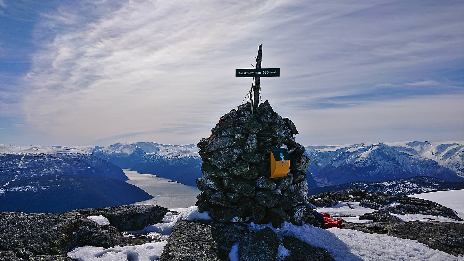
Dueskardhøgdi and Lingesetfjellet from Haukåsen
- Dato:
- 16.04.2022
- Turtype:
- Fjellskitur
- Turlengde:
- 3:53t
- Distanse:
- 15,7km
 The small free parking lot at the start of the ski trail was full. Hence we had to park at the larger parking lot next to the airport. (Note that if installing an app it is apparently possible to get a discount on the parking fee when going hiking or skiing. We however did not notice this until it was too late. See the small poster when entering the parking lot for more details.)
From the parking lot we walked the short distance to the trailhead where we put on the skis and followed the snow-covered gravel road up to Lingesete . The road continued beyond Lingesete, but as we passed south of Lingesetfjellet it started to feel a lot more like backcountry skiing. There should be a trail all the way to the summit in the summer time though. The summit provided spectacular panoramic views and, with next to no wind, a very >>>
The small free parking lot at the start of the ski trail was full. Hence we had to park at the larger parking lot next to the airport. (Note that if installing an app it is apparently possible to get a discount on the parking fee when going hiking or skiing. We however did not notice this until it was too late. See the small poster when entering the parking lot for more details.)
From the parking lot we walked the short distance to the trailhead where we put on the skis and followed the snow-covered gravel road up to Lingesete . The road continued beyond Lingesete, but as we passed south of Lingesetfjellet it started to feel a lot more like backcountry skiing. There should be a trail all the way to the summit in the summer time though. The summit provided spectacular panoramic views and, with next to no wind, a very >>>
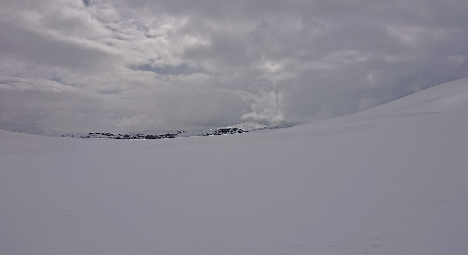
Skiing in Hodlekve
- Dato:
- 15.04.2022
- Turtype:
- Fjellskitur
- Turlengde:
- 2:38t
- Distanse:
- 7,3km
 Short skiing trip in Hodlekve. First with my young nephew in the area around the skiing trails, before some of us took a short off-trail ascent towards Faggreggi and later returning to Rindabotn.
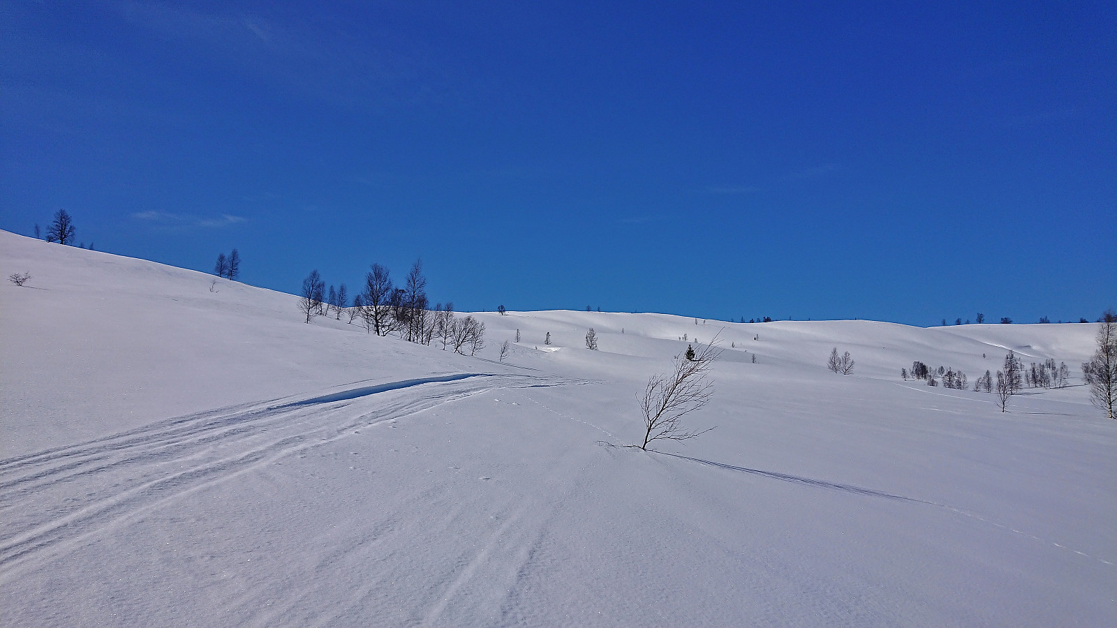
Britabu Easter Barbecue 2022 + Around Fjærlandssetvatnet
- Dato:
- 14.04.2022
- Turtype:
- Langrennstur
- Turlengde:
- 4:14t
- Distanse:
- 16,6km
 Followed the ski trail from Rindabotn via Høgehaug around Fjærlandssetvatnet with an off-trail shortcut for the descent. The trip also included a visit to the traditional Easter barbecue at the Red Cross cabin Britabu .
Stedjestova from Stedje kyrkje
- Dato:
- 13.04.2022
- Turtype:
- Fjelltur
- Turlengde:
- 1:37t
- Distanse:
- 3,3km
 Short but steep hike from Stedje kyrkje to Stedjestova which provided more limited views than expected due to lots of trees.
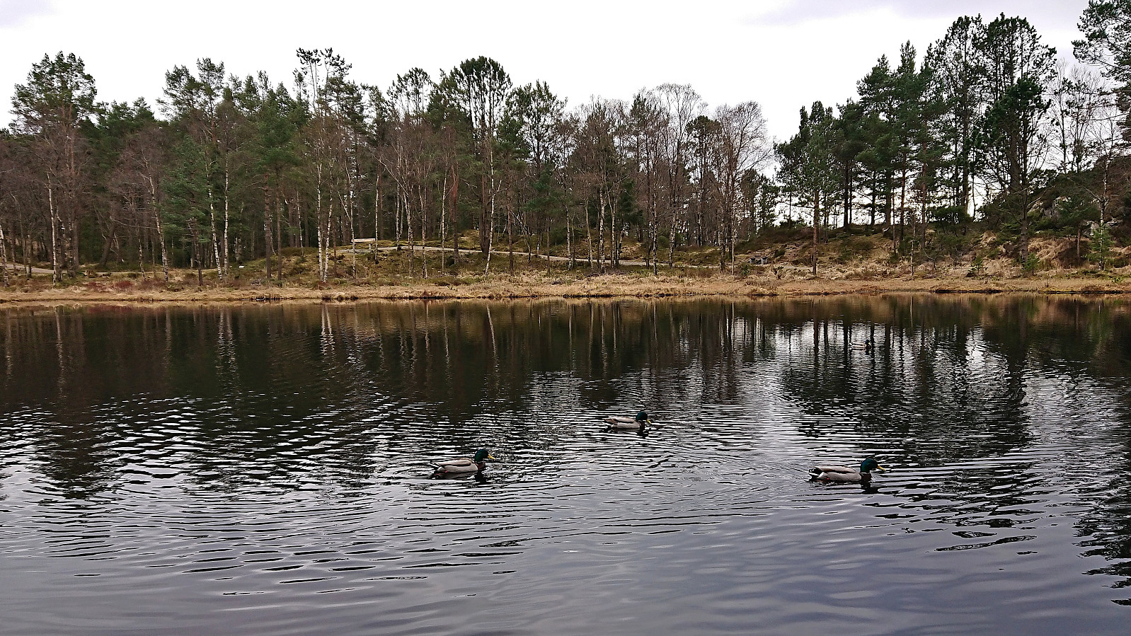
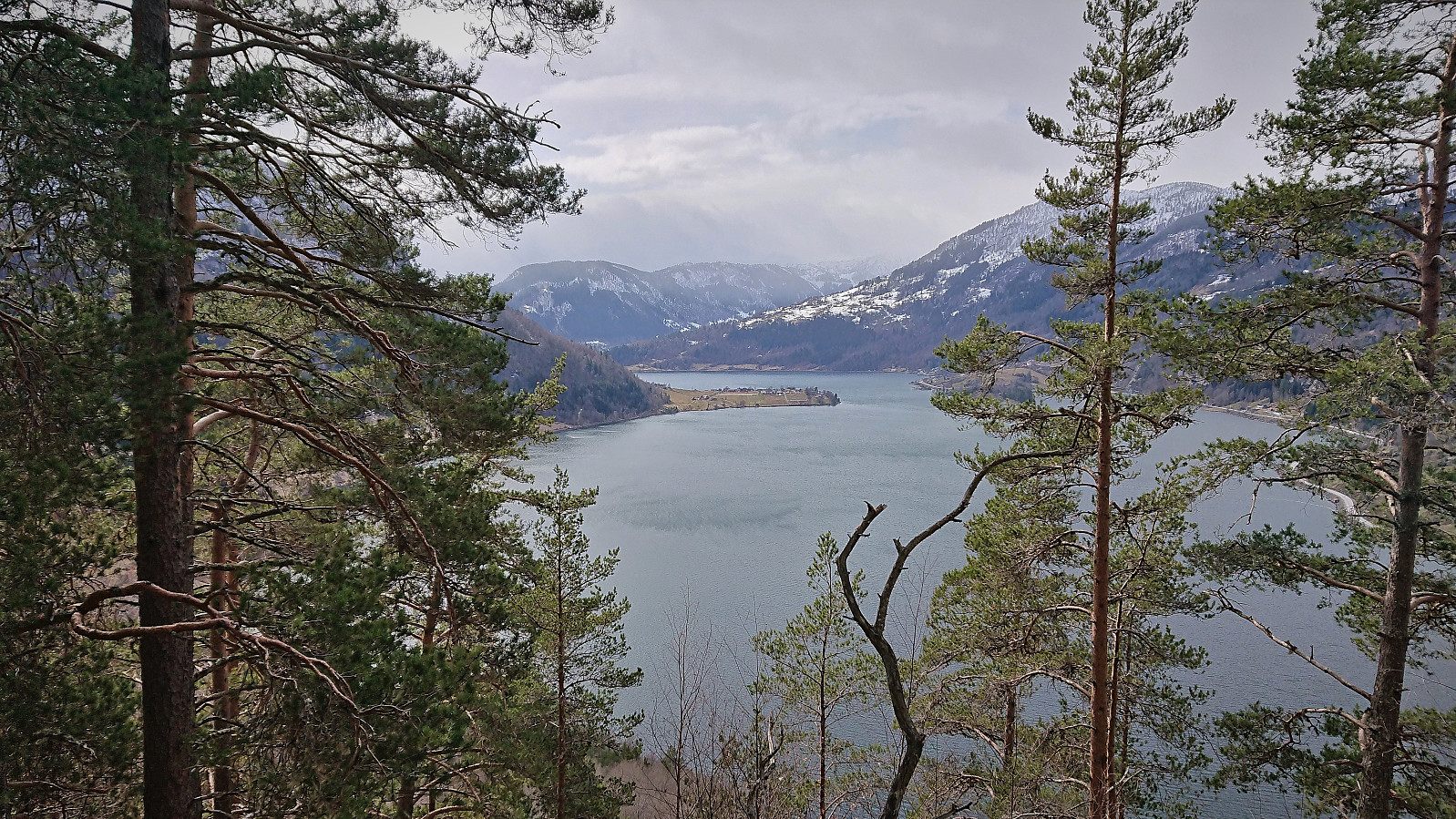
Barsnesfjorden
- Dato:
- 12.04.2022
- Turtype:
- Fottur
- Turlengde:
- 0:55t
- Distanse:
- 4,4km
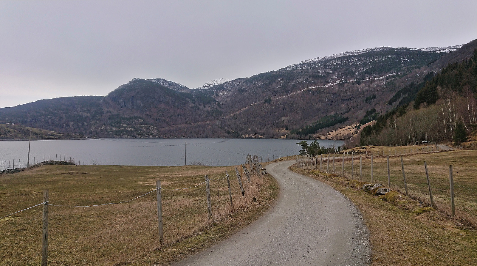 Short walk along Barsnesfjorden.
(Note that the road this hike follows is private, i.e. no cars allowed. There are however a couple of parking spaces down by the small wharf along Barsnesfjorden just before the road turns west and starts climbing slightly towards the crossroads at Barsnes.)
Short walk along Barsnesfjorden.
(Note that the road this hike follows is private, i.e. no cars allowed. There are however a couple of parking spaces down by the small wharf along Barsnesfjorden just before the road turns west and starts climbing slightly towards the crossroads at Barsnes.)
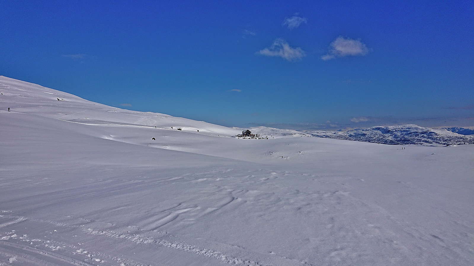
Skiing: Fagreggi
- Dato:
- 11.04.2022
- Turtype:
- Langrennstur
- Turlengde:
- 3:08t
- Distanse:
- 11,8km
 Short skiing trip to Fagreggi on a rather gray day where the sun did not show up until we had started our off-trail descent back to Rindabotn.
Helgasete from Barsnesfjorden
- Dato:
- 10.04.2022
- Turtype:
- Fjelltur
- Turlengde:
- 3:55t
- Distanse:
- 7,7km
 We started from the private parking lot at the end of the gravel road on the east side of Barsnesfjorden. From there we followed the trail via Dal to Helgasete . Snow covered the trail from just below Dal and there were light snow showers at Helgasete.
Note that the road to where the trail starts is private, i.e. no cars allowed. There are however a couple of parking spaces down by the small wharf along Barsnesfjorden just before the road turns west and starts climbing slightly towards the crossroads at Barsnes.
We started from the private parking lot at the end of the gravel road on the east side of Barsnesfjorden. From there we followed the trail via Dal to Helgasete . Snow covered the trail from just below Dal and there were light snow showers at Helgasete.
Note that the road to where the trail starts is private, i.e. no cars allowed. There are however a couple of parking spaces down by the small wharf along Barsnesfjorden just before the road turns west and starts climbing slightly towards the crossroads at Barsnes.
