Arkiv - dato
Arkiv - aktivitet
-
Annen tur (3)
- Kajakkpadling (3)
- Fottur (1844)
-
Kjøretur (9)
- Biltur (9)
-
Skitur (113)
- Fjellskitur (67)
- Langrennstur (46)
-
Sykkeltur (108)
- Blandet sykling (25)
- Gatesykling (83)
Lister jeg samler etter
-
Utvalgte topper og turmål i Bergen
(343/344)
 99%
99% -
Alle topper i Bergen
(390/397)
98%
-
Voss ≥ 100m pf.
(96/98)
97%
-
Opptur Hordaland
(144/159)
90%
-
Stasjoner på Bergensbanen
(31/40)
77%
-
Ulvik ≥ 100m pf.
(28/38)
73%
-
Hordaland ≥ 100m pf.
(617/863)
71%
-
Mjølfjell PF > 100m
(21/31)
67%
-
Jondal ≥ 100m pf.
(15/23)
65%
-
Sunnhordland PF >= 100m
(105/186)
56%
-
Dagsturhyttene i Vestland
(33/61)
54%
-
Hordaland: Hardanger PF>=100m
(189/359)
52%
-
DNT-hytter i Hordaland
(23/45)
51%
-
Kvinnherad ≥ 100m pf.
(40/79)
50%
-
Sogndal ≥ 100m pf.
(23/81)
28%
-
Eidfjord ≥ 100m pf.
(10/42)
23%
-
Vik i Sogn ≥ 100m pf.
(10/46)
21%
-
Gulen ≥ 100m pf.
(10/54)
18%
-
DNT-hytter i Sogn og Fjordane
(8/47)
17%
-
Sogn - Sør for Sognefjorden PF>=100m
(26/159)
16%

Cycling: Salhus Roundtrip
- Dato:
- 17.05.2019
- Turtype:
- Gatesykling
- Turlengde:
- 2:16t
- Distanse:
- 36,7km
 The usual bike trip around Salhus.
Marineholmen to Munkebotn
- Dato:
- 16.05.2019
- Turtype:
- Spasertur
- Turlengde:
- 1:09t
- Distanse:
- 5,8km
 Another short walk on the way home from work.
Cycling: Åsane Roundtrip
- Dato:
- 15.05.2019
- Turtype:
- Gatesykling
- Turlengde:
- 2:23t
- Distanse:
- 32,2km
 The first bike trip of 2019, including local explorations of Eidsvåg and Åsane.
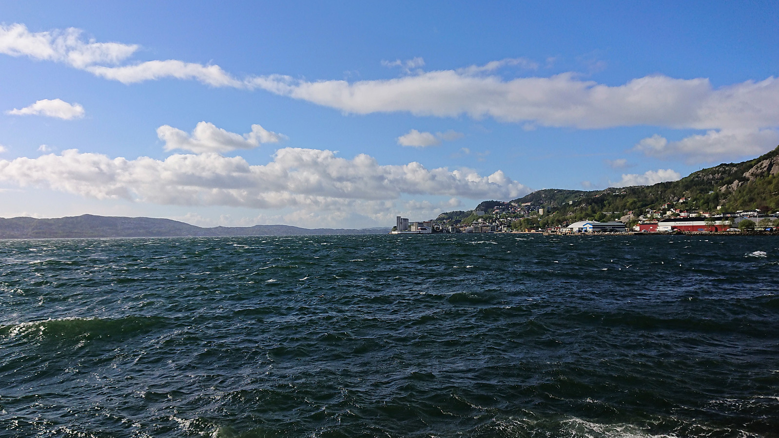
Kongsfjellet via boat from Bergen
- Dato:
- 12.05.2019
- Turtype:
- Fjelltur
- Turlengde:
- 2:28t
- Distanse:
- 6,3km
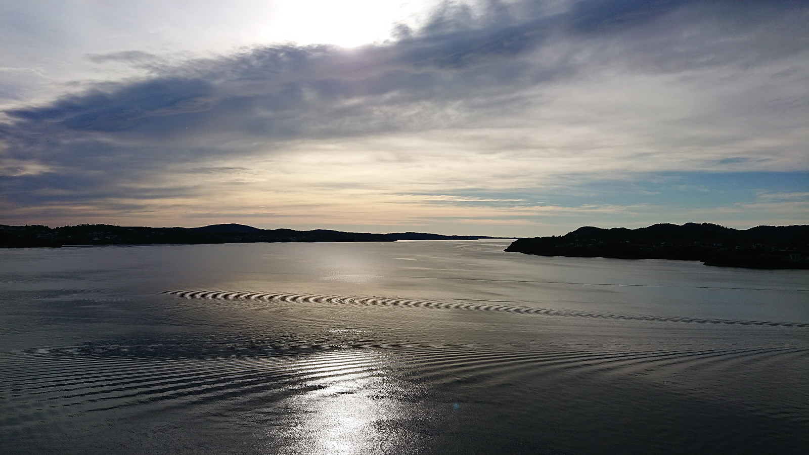
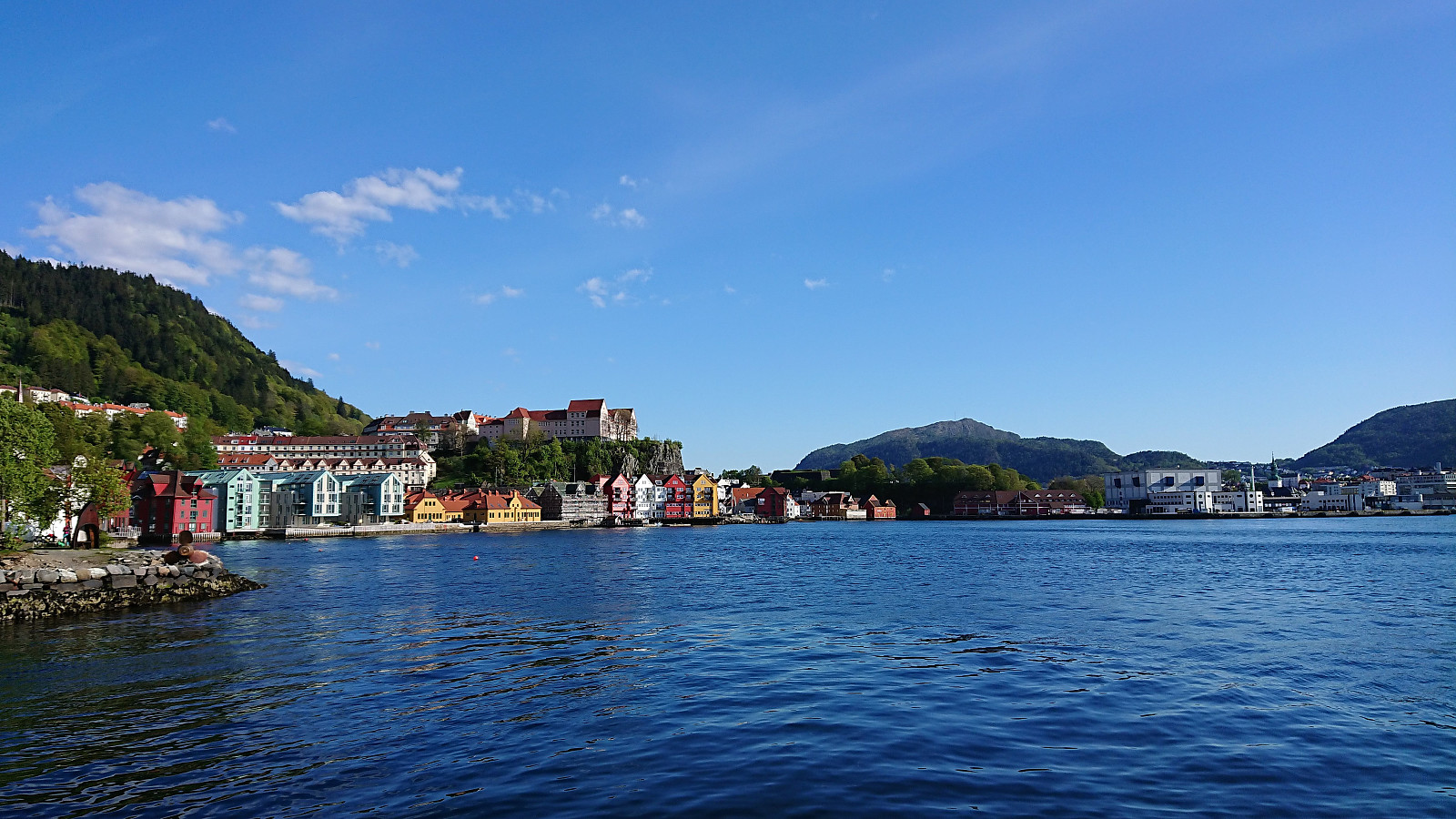
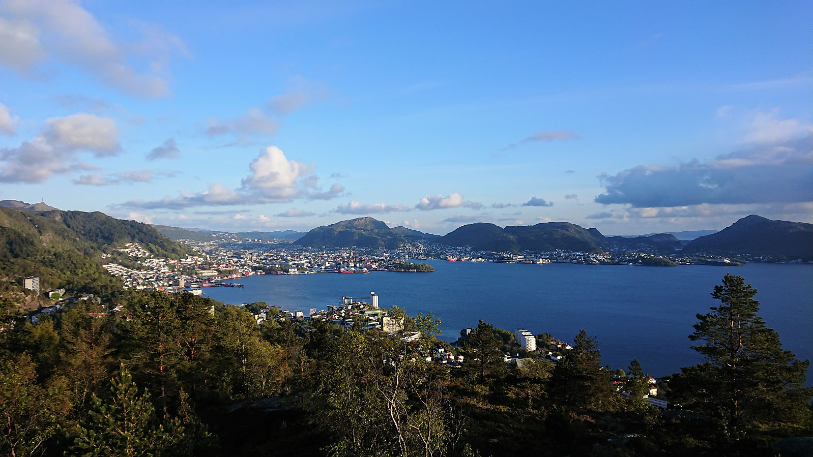
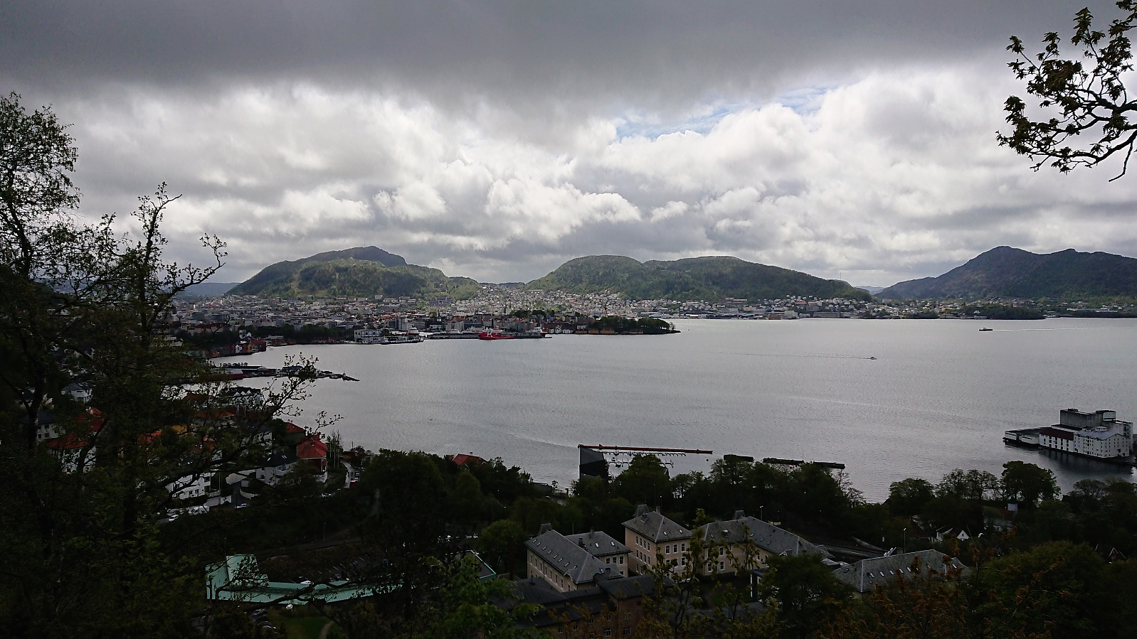
 The trip started by taking the boat from Strandkaiterminalen in Bergen to Bekkjarvik, which took around one hour and provided excellent views along the way. Shortly after disembarking, we came across a hiking sign for "Kongsen", which we assumed was short for Kongsfjellet . Did not see any additional signs though, except for a sign for Kongskleiva (which we did not follow, but which we will come back to later), but soon arrived at the football field north of Kongsfjellet where we easily located the trailhead, marked with the familiar blue "N" for "Nordsjøløypa".
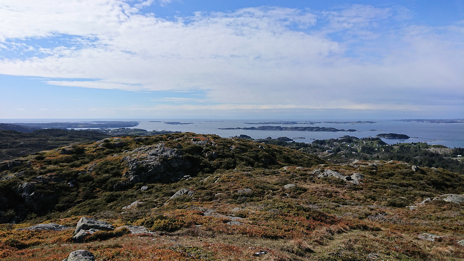
From there on it was straightforward to follow the trail all the way to Kongsfjellet, enjoying the rapidly improving views. The summit itself provided excellent views in all directions. We still had plenty of time >>>
The trip started by taking the boat from Strandkaiterminalen in Bergen to Bekkjarvik, which took around one hour and provided excellent views along the way. Shortly after disembarking, we came across a hiking sign for "Kongsen", which we assumed was short for Kongsfjellet . Did not see any additional signs though, except for a sign for Kongskleiva (which we did not follow, but which we will come back to later), but soon arrived at the football field north of Kongsfjellet where we easily located the trailhead, marked with the familiar blue "N" for "Nordsjøløypa".
From there on it was straightforward to follow the trail all the way to Kongsfjellet, enjoying the rapidly improving views. The summit itself provided excellent views in all directions. We still had plenty of time >>>
Dyrskarfjellet and Rundesteinen
- Dato:
- 11.05.2019
- Turtype:
- Fjelltur
- Turlengde:
- 3:12t
- Distanse:
- 9,8km
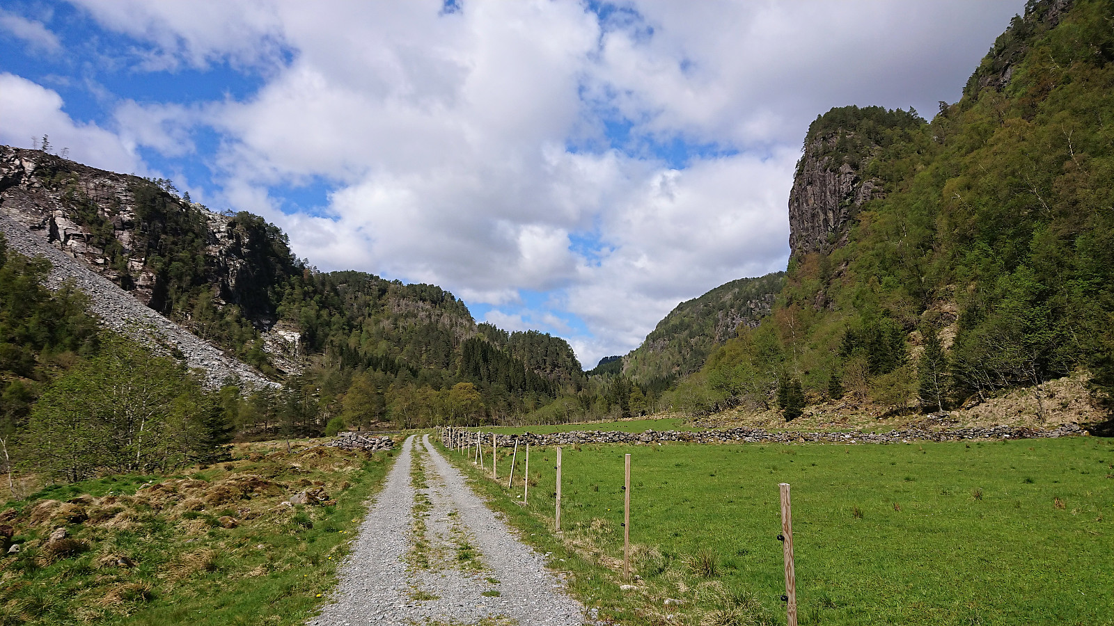 Started by taking the bus to Store-Aurdal (bus stop called "Urdal (Lindås)") and from there followed the gravel road north, making sure to avoid the demolition site of Husafjellet and instead continued on the forest road slightly further to the east. I soon left Husafjellet behind and started looking for the tractor road east of Dyrskarfjellet that should simplify my ascent. I was a bit too eager though, ending up leaving the road too early, but shortly connected with the actual tractor road.
The tractor road was easy to follow, but clearly not very heavily used, and at times looked more like a trail than a road. From where the road/trail finally came to an end, it was however pretty straightforward to proceed to the summit. Although there were a couple of steep sections that had to be avoided. The summit >>>
Started by taking the bus to Store-Aurdal (bus stop called "Urdal (Lindås)") and from there followed the gravel road north, making sure to avoid the demolition site of Husafjellet and instead continued on the forest road slightly further to the east. I soon left Husafjellet behind and started looking for the tractor road east of Dyrskarfjellet that should simplify my ascent. I was a bit too eager though, ending up leaving the road too early, but shortly connected with the actual tractor road.
The tractor road was easy to follow, but clearly not very heavily used, and at times looked more like a trail than a road. From where the road/trail finally came to an end, it was however pretty straightforward to proceed to the summit. Although there were a couple of steep sections that had to be avoided. The summit >>>
Ørneberget
- Dato:
- 07.05.2019
- Turtype:
- Fjelltur
- Turlengde:
- 1:09t
- Distanse:
- 5,5km
 Short local evening hike.
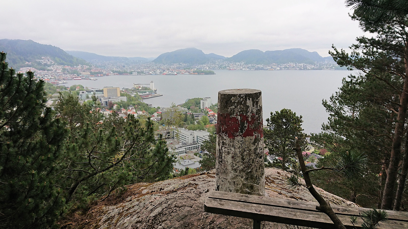
Lønborg - Strandkaien - Sandvikstorget
- Dato:
- 05.05.2019
- Turtype:
- Fottur
- Turlengde:
- 2:31t
- Distanse:
- 11,3km
 Local hike from Lønborg to Strandkaien and back to Sandvikstorget for the bus back home.
Hemningsfjellet from Eikefet
- Dato:
- 04.05.2019
- Turtype:
- Fjelltur
- Turlengde:
- 3:25t
- Distanse:
- 11,5km
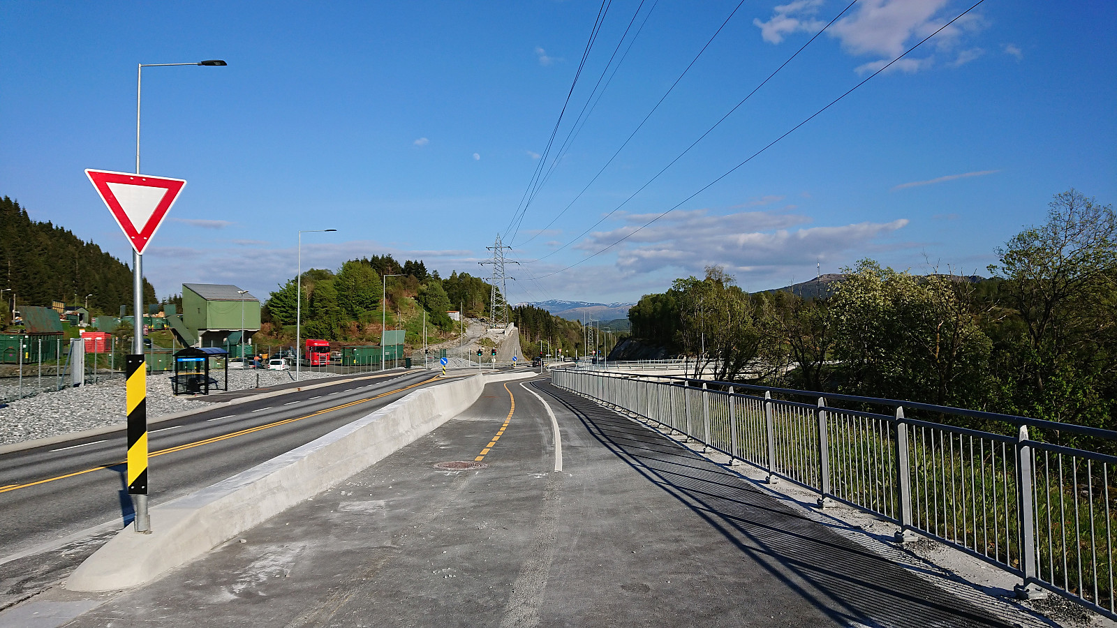
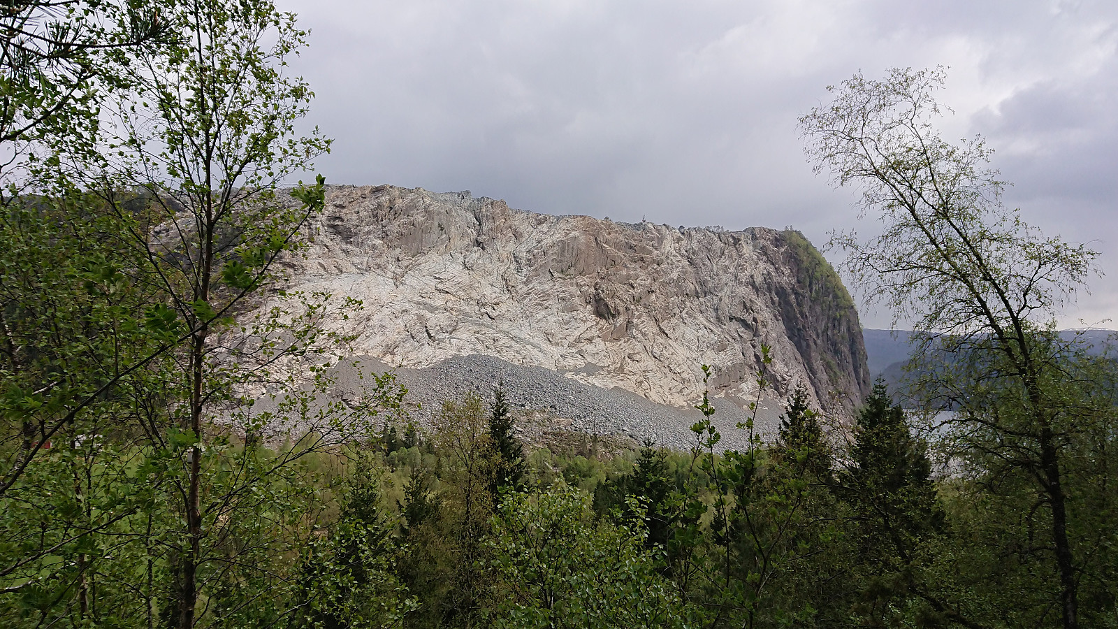 Took the bus to Eikefet and from there followed the road north to Eikemo, where the trailhead was easily located just before the road was about to cross Eikefetelva for a second time. The trail was unmarked but easy to follow and more or less followed the river all the way up to Eikemosætra via Sætre . The bridge used to cross the river, named Sæterbrua , was also of good quality.
Upon arriving at Eikemosætra, I decided to continue north to Båtevatnet, on the off chance that I'd come across an unknown trail to Hemningsfjellet . But even the trail to Båtevatnet soon turned very weak, and I could not see any trails going east. Heading straight for the summit from Båtevatnet without a trail was not really an option either, as the terrain seemed too steep. I therefore doubled back, getting almost to Eikemosætra, before starting my final >>>
Took the bus to Eikefet and from there followed the road north to Eikemo, where the trailhead was easily located just before the road was about to cross Eikefetelva for a second time. The trail was unmarked but easy to follow and more or less followed the river all the way up to Eikemosætra via Sætre . The bridge used to cross the river, named Sæterbrua , was also of good quality.
Upon arriving at Eikemosætra, I decided to continue north to Båtevatnet, on the off chance that I'd come across an unknown trail to Hemningsfjellet . But even the trail to Båtevatnet soon turned very weak, and I could not see any trails going east. Heading straight for the summit from Båtevatnet without a trail was not really an option either, as the terrain seemed too steep. I therefore doubled back, getting almost to Eikemosætra, before starting my final >>>
Marineholmen to Ludebryggen
- Dato:
- 02.05.2019
- Turtype:
- Spasertur
- Turlengde:
- 0:45t
- Distanse:
- 4,3km
 Another short walk on the way home from work.
Hellen festning and Furukammen
- Dato:
- 01.05.2019
- Turtype:
- Fottur
- Turlengde:
- 1:41t
- Distanse:
- 5,3km
 Short local hike across Hellen festning and Furukammen.
