Arkiv - dato
Arkiv - aktivitet
-
Annen tur (3)
- Kajakkpadling (3)
- Fottur (1893)
-
Kjøretur (9)
- Biltur (9)
-
Skitur (116)
- Fjellskitur (69)
- Langrennstur (47)
-
Sykkeltur (110)
- Blandet sykling (25)
- Gatesykling (85)
Lister jeg samler etter
-
Utvalgte topper og turmål i Bergen
(349/350)
 99%
99% -
Alle topper i Bergen
(393/398)
98%
-
Voss ≥ 100m pf.
(96/98)
97%
-
Opptur Hordaland
(144/159)
90%
-
Stasjoner på Bergensbanen
(33/40)
82%
-
Ulvik ≥ 100m pf.
(28/38)
73%
-
Hordaland ≥ 100m pf.
(622/863)
72%
-
Mjølfjell PF > 100m
(21/31)
67%
-
Jondal ≥ 100m pf.
(15/23)
65%
-
Dagsturhyttene i Vestland
(36/61)
59%
-
Sunnhordland PF >= 100m
(105/186)
56%
-
Hordaland: Hardanger PF>=100m
(194/359)
54%
-
DNT-hytter i Hordaland
(23/45)
51%
-
Kvinnherad ≥ 100m pf.
(40/79)
50%
-
Eidfjord ≥ 100m pf.
(13/42)
30%
-
Sogndal ≥ 100m pf.
(23/81)
28%
-
Gulen ≥ 100m pf.
(15/54)
27%
-
Vik i Sogn ≥ 100m pf.
(10/46)
21%
-
Sogn - Sør for Sognefjorden PF>=100m
(31/159)
19%
-
DNT-hytter i Sogn og Fjordane
(8/47)
17%

Across Hellen festning
- Dato:
- 20.08.2025
- Turtype:
- Fottur
- Turlengde:
- 0:36t
- Distanse:
- 3,2km
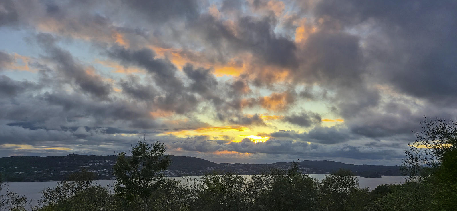 Short local evening hike around sunset.
Solsævatnet to Ljosandbotn via Skorafjellet and Mjølfjellet
- Dato:
- 17.08.2025
- Turtype:
- Fjelltur
- Turlengde:
- 8:00t
- Distanse:
- 20,4km
 On a Sunday in mid-August where the warm summer weather made a comeback, I hopped on a train Voss and from there continued by bus to Ulsberg, where I for the second time had to help the bus driver locate the bus stop (see my hike to Kjerringafjellet and Kvasshovden ). After getting off the bus, I first followed the gravel road to Solsævatnet and then continued on the unmarked trail via Rubbelii to Nedre Skor. This was overall straightforward with the main challenge being to spot the trail between the numerous tall ferns doing their best to hide it.
I think I made a wrong turn after crossing the stream west of Rubbelii though, descending to the lake instead of continuing upwards. I therefore shortly ended up on a much weaker trail before reconnecting with the main trail. (Note that there is also a trail going around the lake. So be sure >>>
On a Sunday in mid-August where the warm summer weather made a comeback, I hopped on a train Voss and from there continued by bus to Ulsberg, where I for the second time had to help the bus driver locate the bus stop (see my hike to Kjerringafjellet and Kvasshovden ). After getting off the bus, I first followed the gravel road to Solsævatnet and then continued on the unmarked trail via Rubbelii to Nedre Skor. This was overall straightforward with the main challenge being to spot the trail between the numerous tall ferns doing their best to hide it.
I think I made a wrong turn after crossing the stream west of Rubbelii though, descending to the lake instead of continuing upwards. I therefore shortly ended up on a much weaker trail before reconnecting with the main trail. (Note that there is also a trail going around the lake. So be sure >>>
Across Hellen festning
- Dato:
- 16.08.2025
- Turtype:
- Fottur
- Turlengde:
- 0:38t
- Distanse:
- 3,2km
 Short local Saturday hike.
Sandviksbatteriet and Sandviksfjellet from Haukeland sykehus
- Dato:
- 13.08.2025
- Turtype:
- Fjelltur
- Turlengde:
- 4:54t
- Distanse:
- 14,6km
 Hike after work with some of my colleagues.
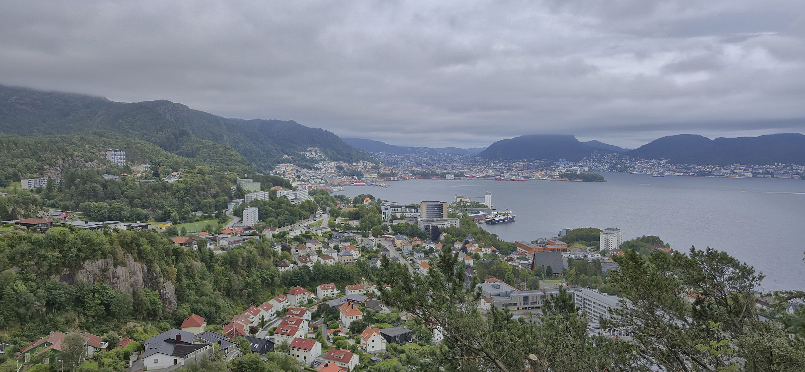
Fjellveien, Fløyen, Rundemanen and Kvitebjørnen
- Dato:
- 10.08.2025
- Turtype:
- Fjelltur
- Turlengde:
- 4:42t
- Distanse:
- 20,0km
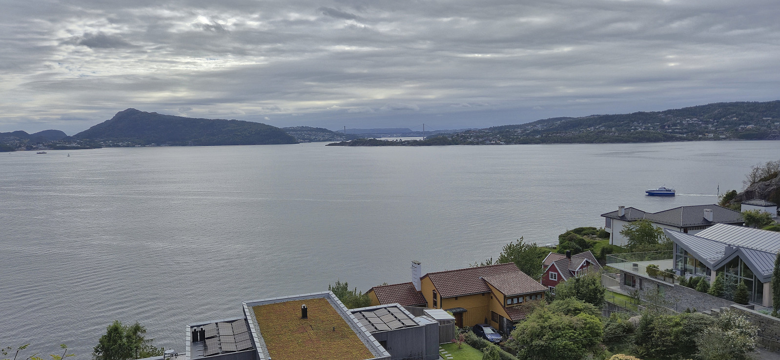
 Sunday hike in familiar terrain that I realized I had not visited in a long time. The weather ranged from warm sunshine to cold wind and rain. The latter probably explains why I only met one other hiker between Rundemanen Vest and Munkebotsvatnet. Lots of people up until that point though.
Romslo to Takvam
- Dato:
- 09.08.2025
- Turtype:
- Fottur
- Turlengde:
- 1:15t
- Distanse:
- 6,0km
 On an overall wet and windy Saturday I found a late afternoon longer opening between the rain showers and decided to make a visit of the old train station at Romslo. According to Wikipedia the station was in use until 1991 and had clearly seen better days.
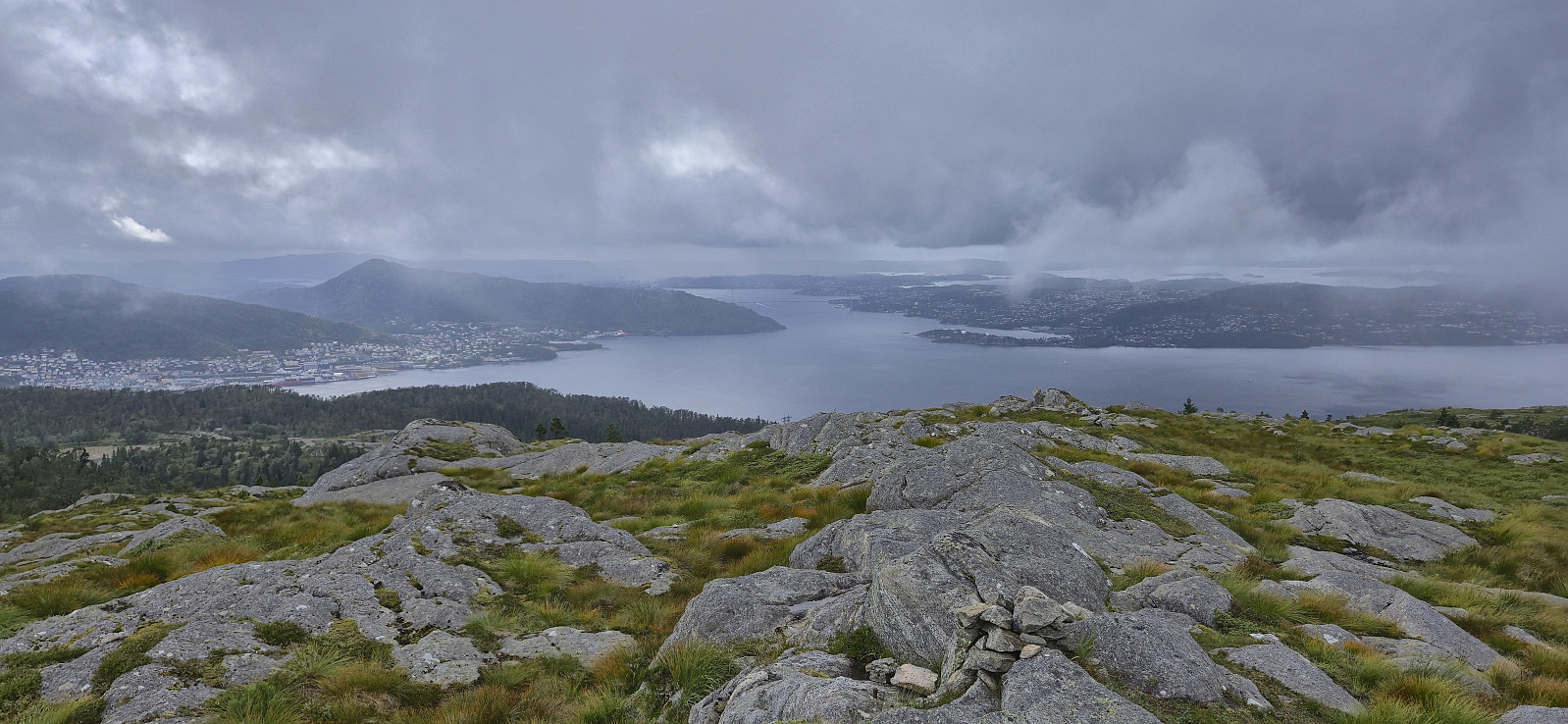
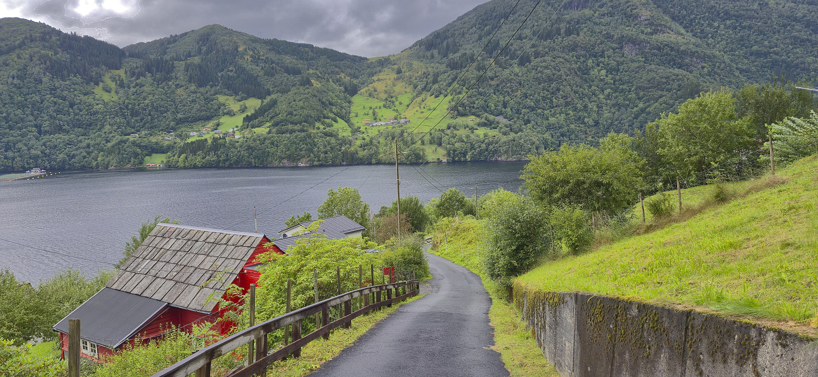
Folgefonna to Jondal via Storafjellet and Grytingsfjellet
- Dato:
- 02.08.2025
- Turtype:
- Fjelltur
- Turlengde:
- 6:58t
- Distanse:
- 23,8km
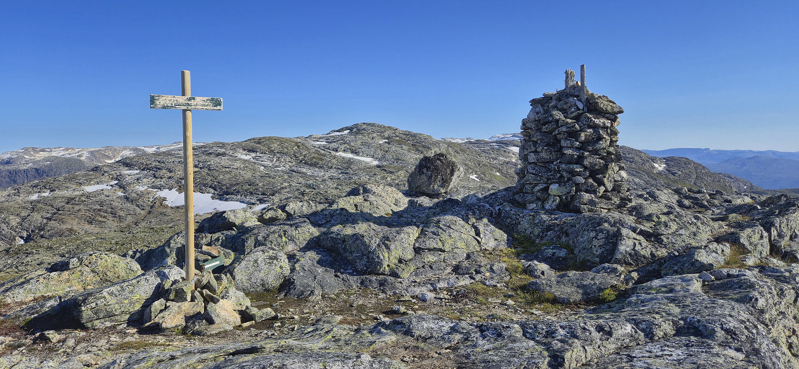
 I started my journey by taking the bus to Norheimsund, the passenger ferry to Herand and finally a second bus via Jondal up to Folgefonna Skisenter . From the parking lot at the ski center I returned along the paved road down to Hestadalen p-plass . Here I continued on a trail marked with red T's towards Breidsete before shortly starting my off-trail ascent to Storafjellet . Or so I thought. Very quickly I however came across another trail marked with small cairns that led me all the way to the summit, hence it ought to be possible to stay on a trail all the way from the paved road.
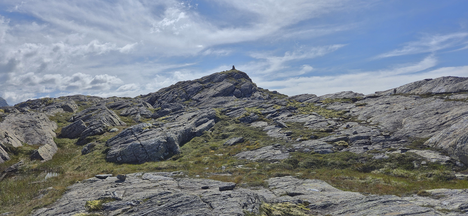
After a short break at the summit to take in the excellent views, I continued northwest to Grytingsfjellet . No trails or cairns marking the way here as far as I could tell. Lots of minor ups and downs and one or two steeper sections that had to be carefully navigated, but with one exception, >>>
I started my journey by taking the bus to Norheimsund, the passenger ferry to Herand and finally a second bus via Jondal up to Folgefonna Skisenter . From the parking lot at the ski center I returned along the paved road down to Hestadalen p-plass . Here I continued on a trail marked with red T's towards Breidsete before shortly starting my off-trail ascent to Storafjellet . Or so I thought. Very quickly I however came across another trail marked with small cairns that led me all the way to the summit, hence it ought to be possible to stay on a trail all the way from the paved road.
After a short break at the summit to take in the excellent views, I continued northwest to Grytingsfjellet . No trails or cairns marking the way here as far as I could tell. Lots of minor ups and downs and one or two steeper sections that had to be carefully navigated, but with one exception, >>>
Furukammen
- Dato:
- 01.08.2025
- Turtype:
- Fottur
- Turlengde:
- 3:22t
- Distanse:
- 3,7km
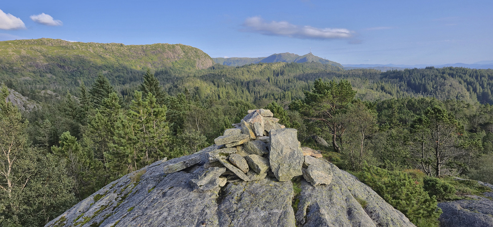
 Short local evening hike.
Cycling: Garnes
- Dato:
- 31.07.2025
- Turtype:
- Gatesykling
- Turlengde:
- 3:38t
- Distanse:
- 50,2km
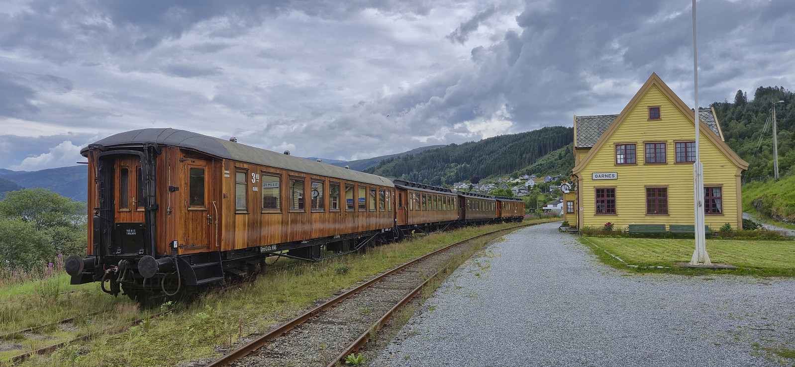 Cycling trip to Garnes where I had a look at the old train station .
Cycling: Eidsvåg
- Dato:
- 30.07.2025
- Turtype:
- Gatesykling
- Turlengde:
- 0:48t
- Distanse:
- 11,1km
 Short local cycling trip.
