Ruklehaugnuten and Solnuten (21.04.2024)

| Startsted | Grimevegen v/Grimestølen (435moh) |
|---|---|
| Sluttsted | Grimevegen v/Herandsvegen (259moh) |
| Turtype | Fjellskitur |
| Turlengde | 11t 54min |
| Distanse | 31,9km |
| Høydemeter | 1934m |
| GPS |
|
| Bestigninger | Ruklehaugnuten (1268moh) | 21.04.2024 |
|---|---|---|
| Solnuten (1551moh) | 21.04.2024 | |
| Vardanuten (1506moh) | 21.04.2024 | |
| Andre besøkte PBE'er | Grimevegen (vinterstengt!) (263moh) | 21.04.2024 |
Ruklehaugnuten and Solnuten
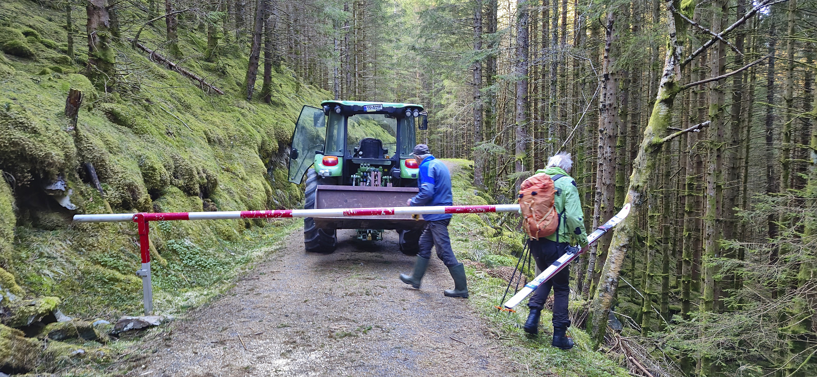

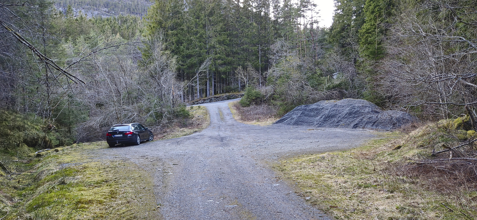
Petter picked me up at my place at 06:20 for our drive to Tørvikbygd and the first ferry to Jondal. After the short ferry crossing we continued northeast to Herand and Åsleitet where we planned to follow a gravel road up to the parking lot at Vårhaug. We had however not driven many meters on the Grimevegen toll road before we arrived at a locked gate where a local farmer in a tractor told us that the road was closed during the winter. We therefore had no choice but to return to the start of the gravel road and park there.
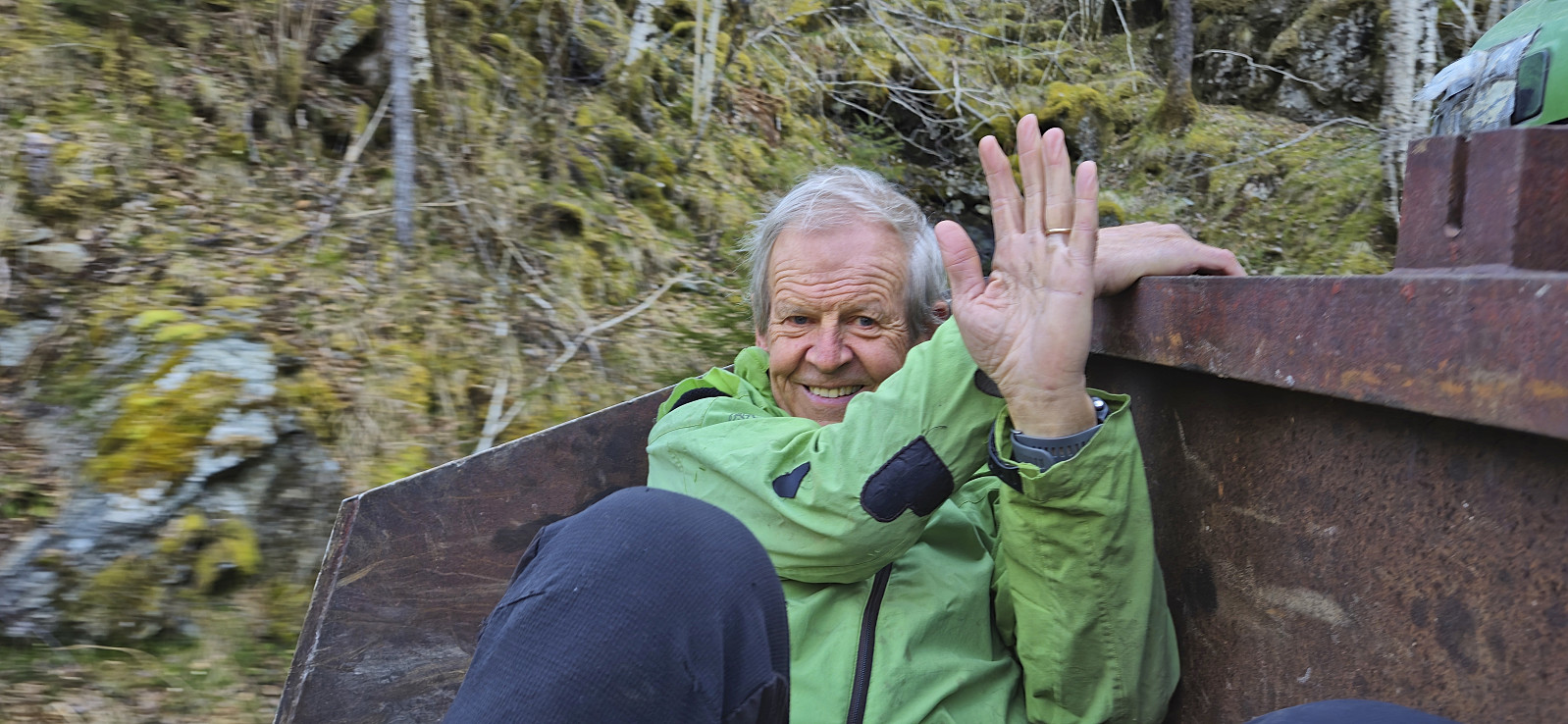
But just as we were beginning to dread having to carry the skis up the steep extra vertical meters, the farmer returned and asked if we wanted a lift! We of course quickly said yes and hurriedly got ready, placed our gear and ourselves at the back of the tractor and off we went, trying to hold on the best we could. Due to snow still covering the upper parts of the road, he could not drive us all the way to Vårhaug, but we got to just below Grimestølen and saved around 200 vertical meters.
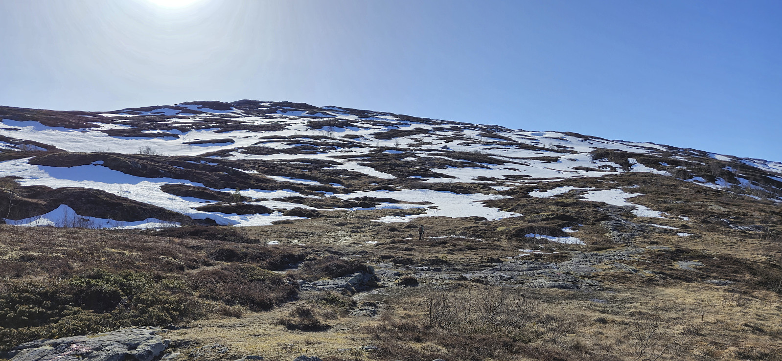
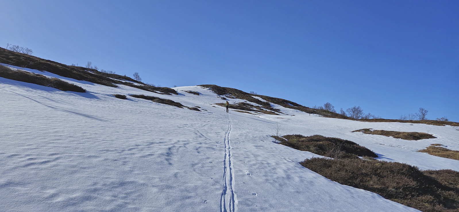
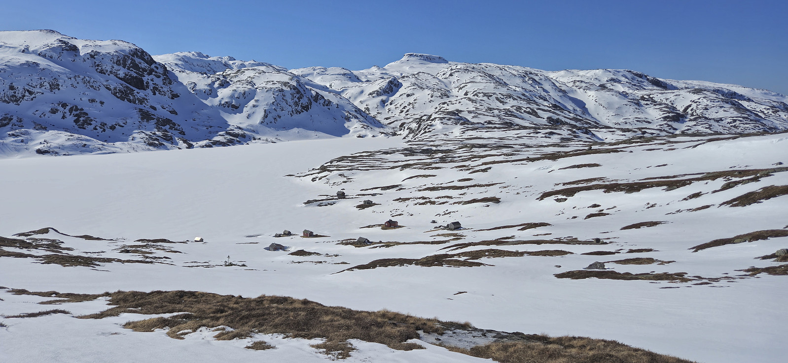
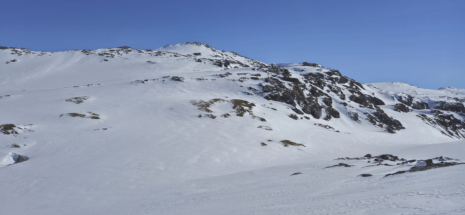
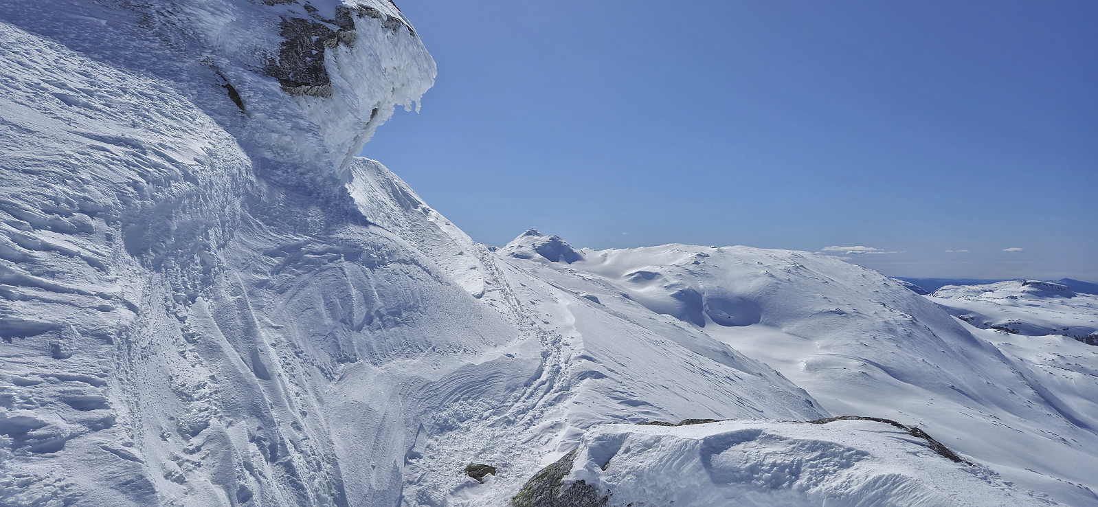
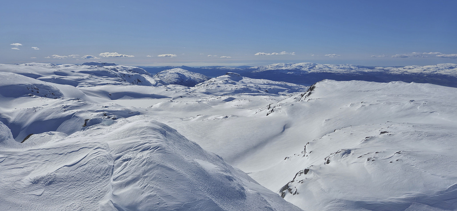
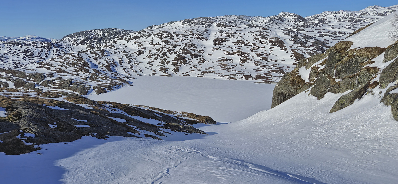
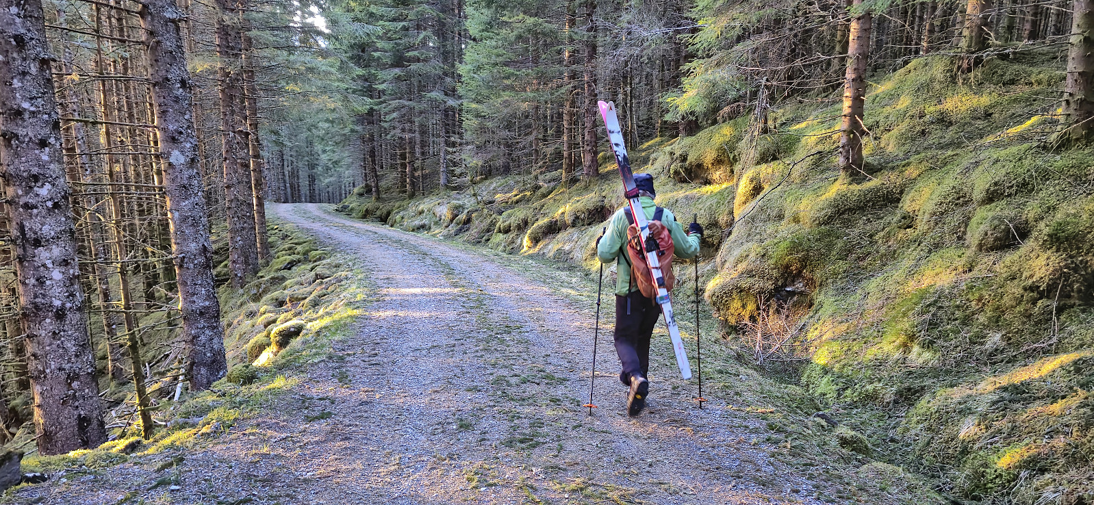
We carried the skis the rest of the way to Vårhaug and briefly continued along a trail before there was enough snow to put in the skis. At the start we had to move from snow patch to snow patch but it did not take long before the snow took over completely. Initially we had planned to ascend to Ruklehaugnuten via Vatnasetnuten but in the end we opted for a more direct route to Ruklehaugnuten. This did not present any real challenges, however the terrain was rather rugged with lots of small hills that had to be properly navigated.
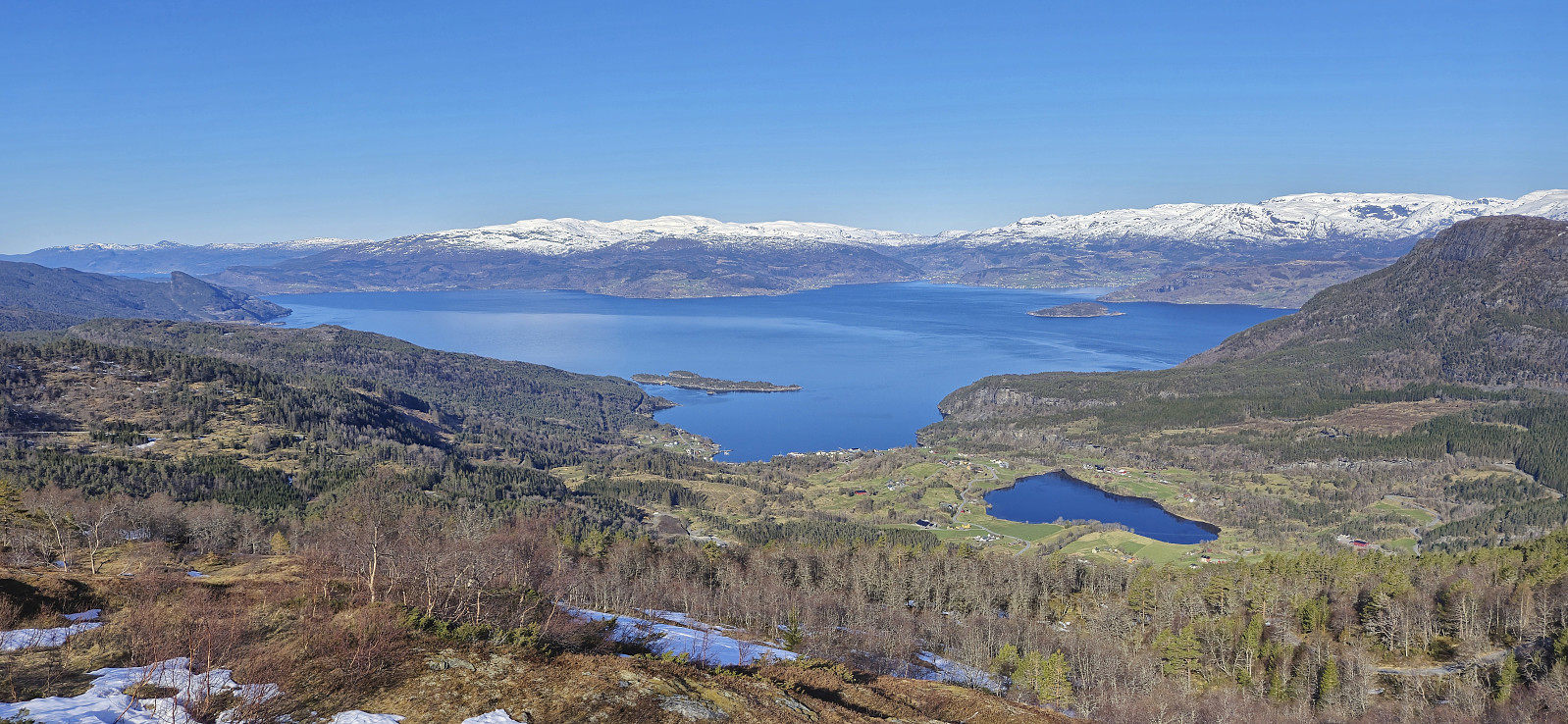
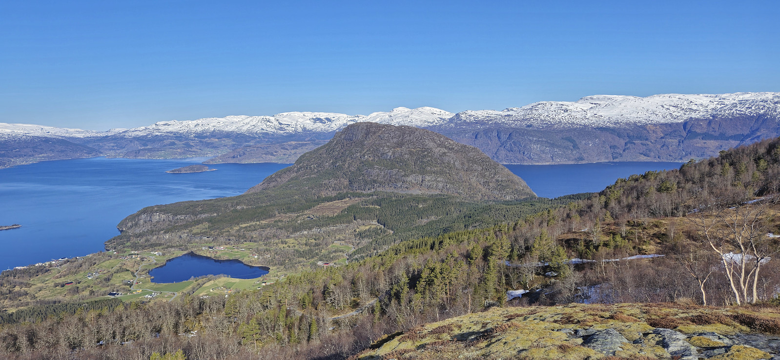
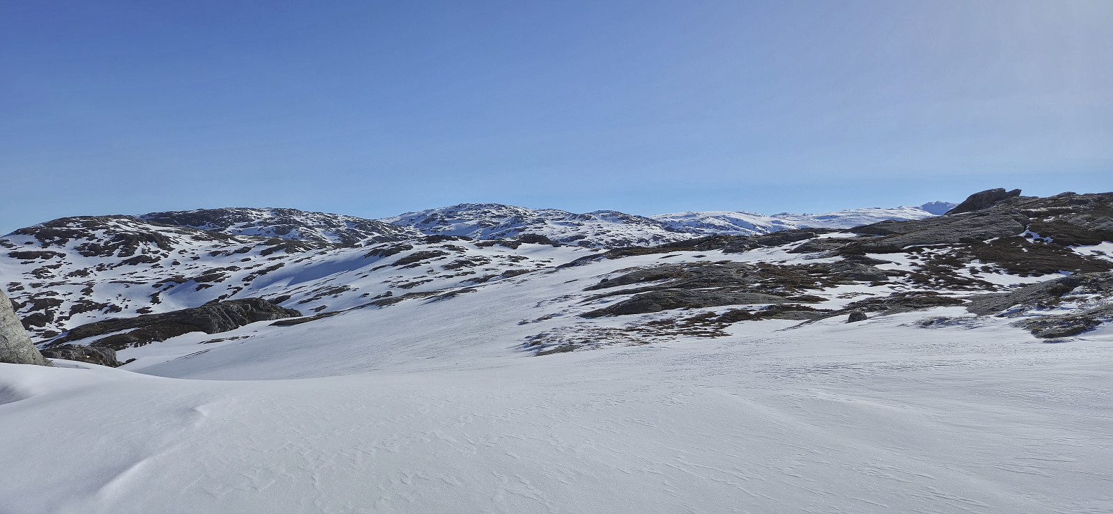
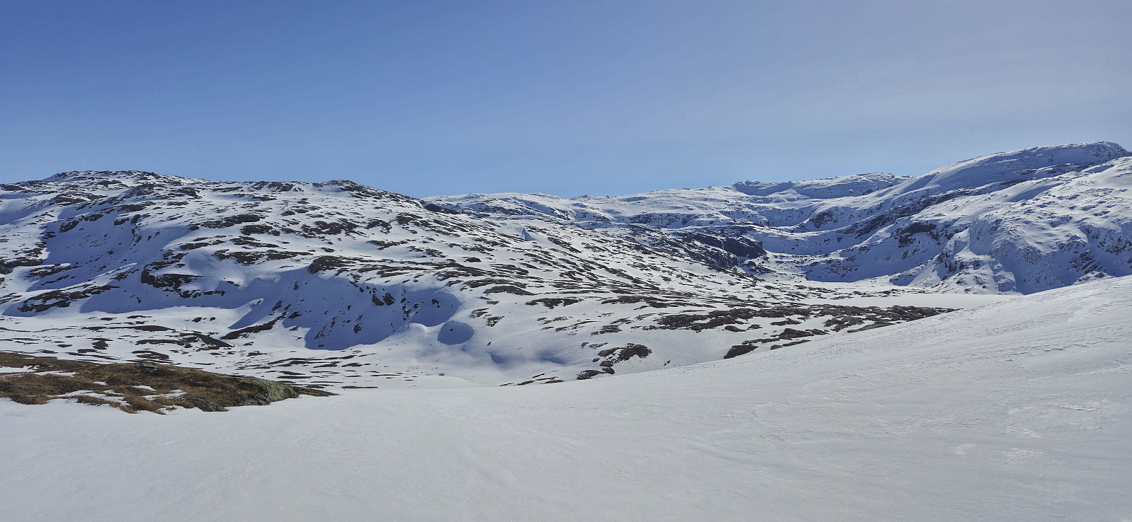
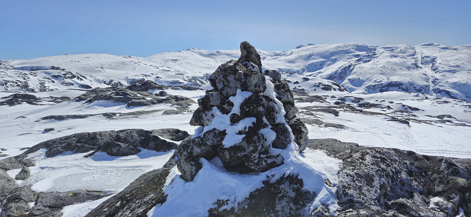
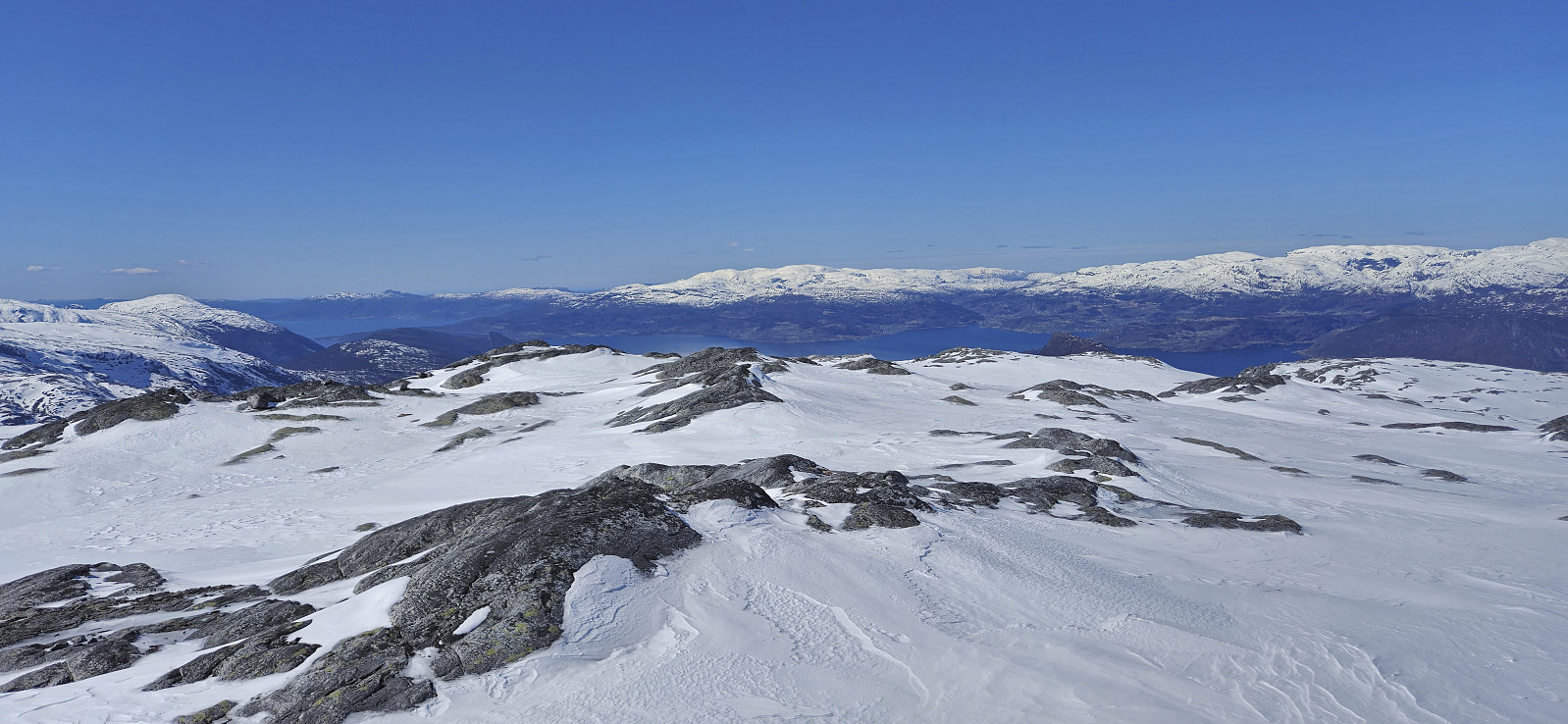
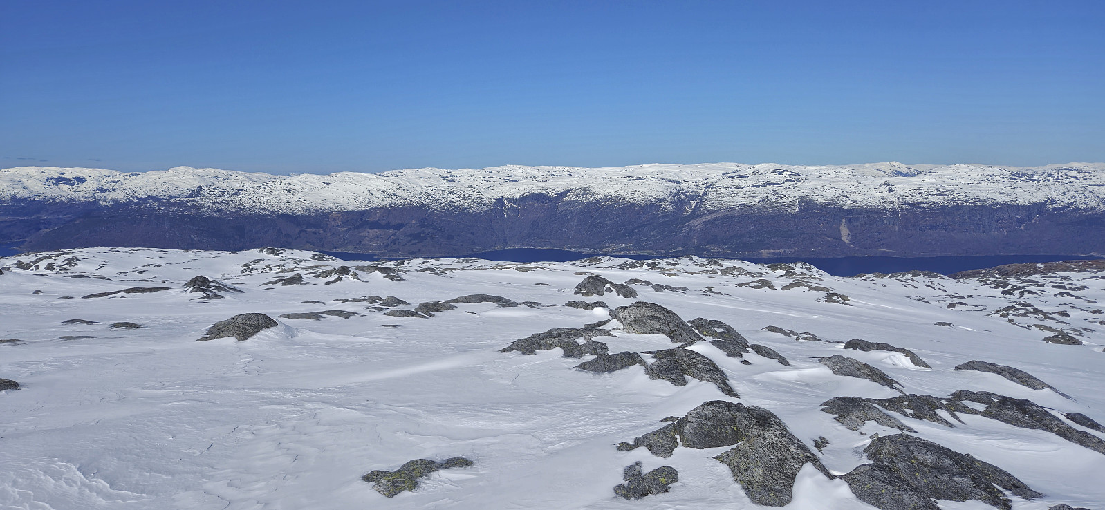
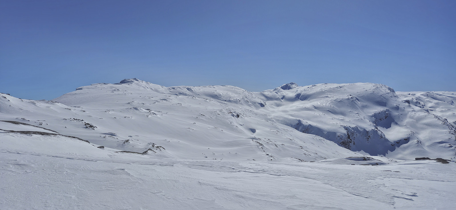
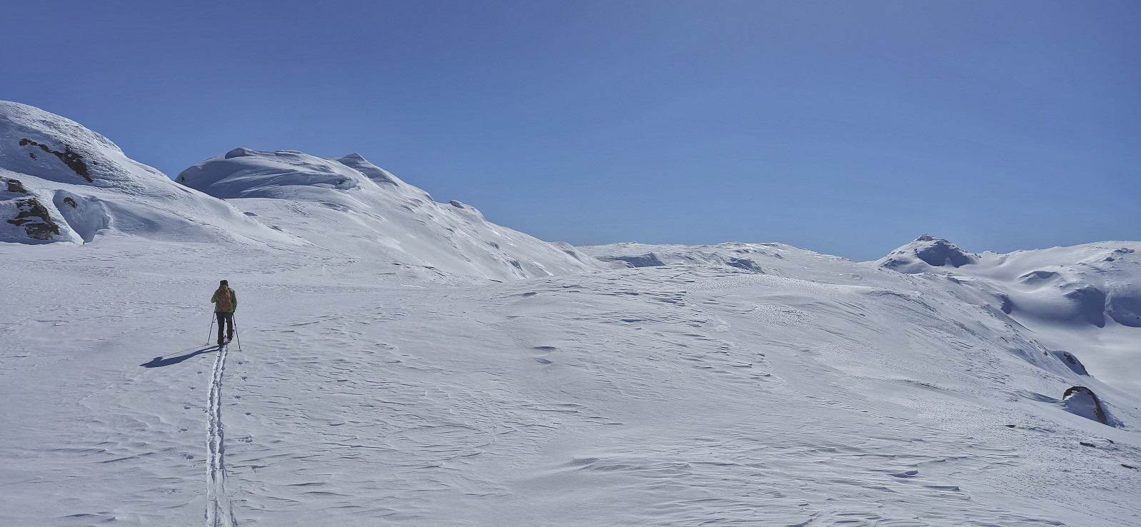
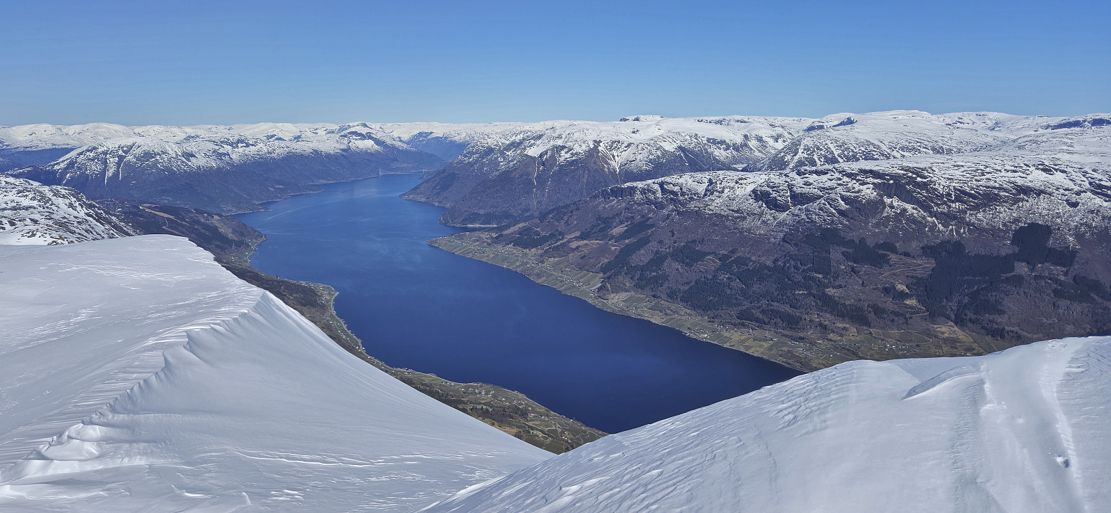
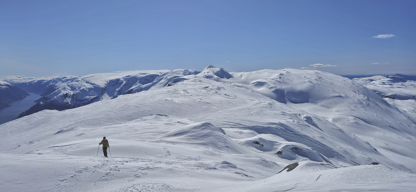
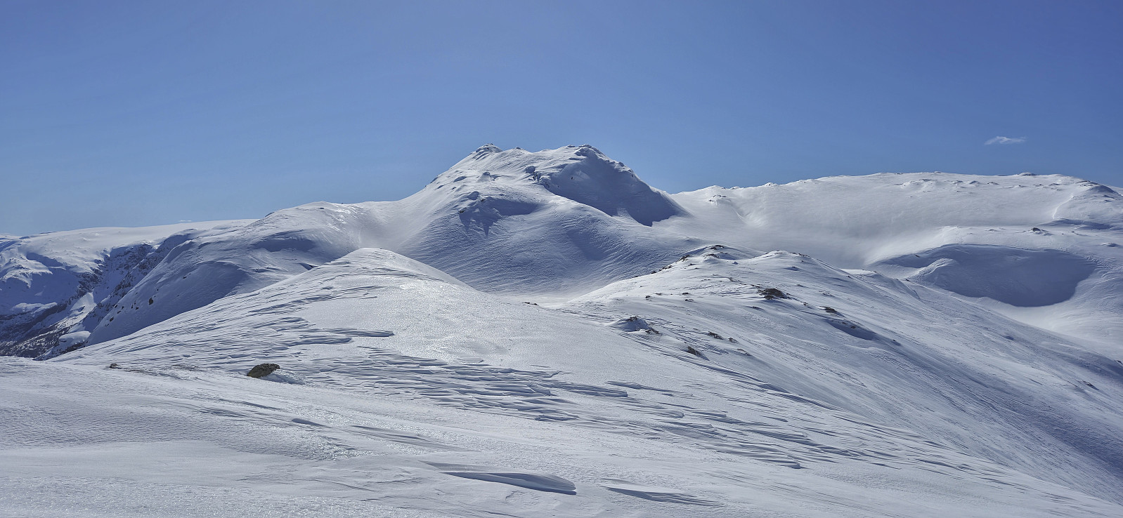
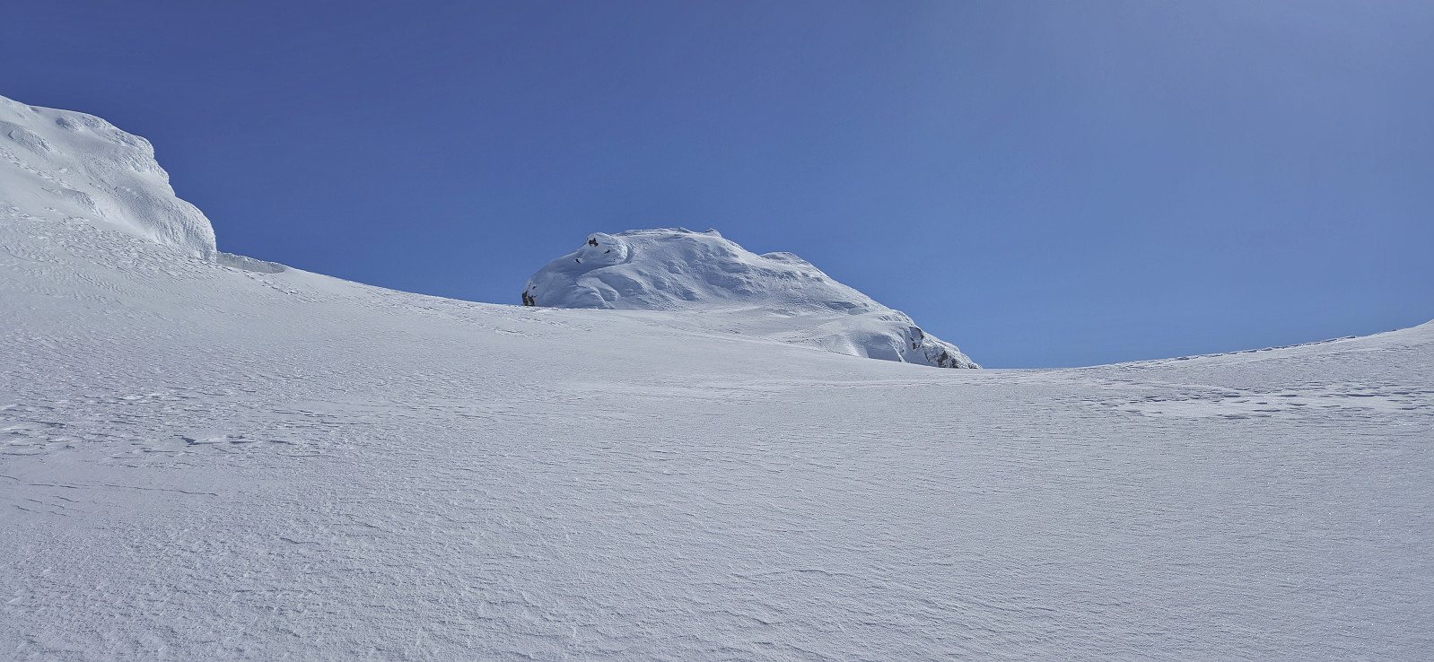
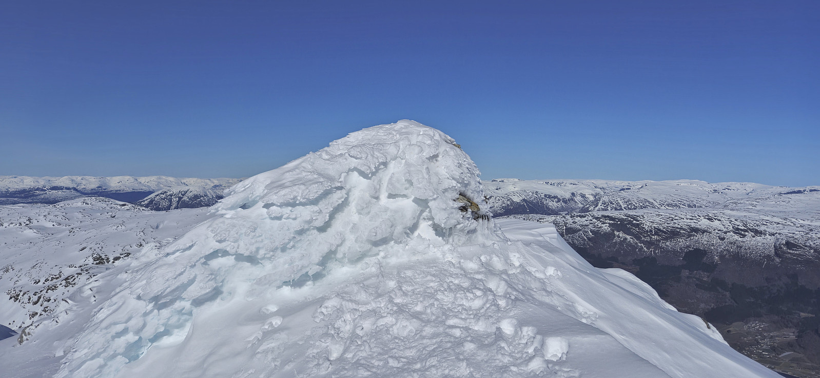
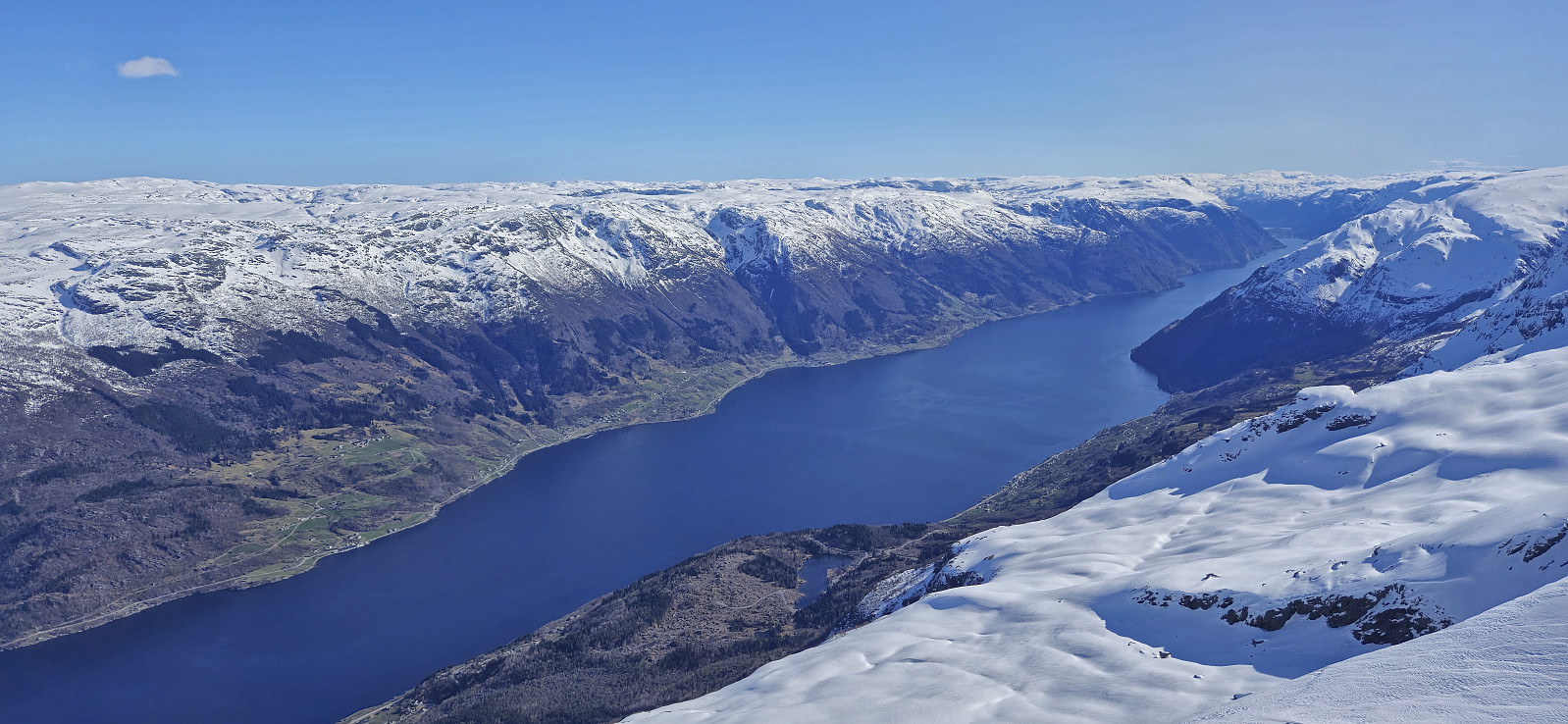
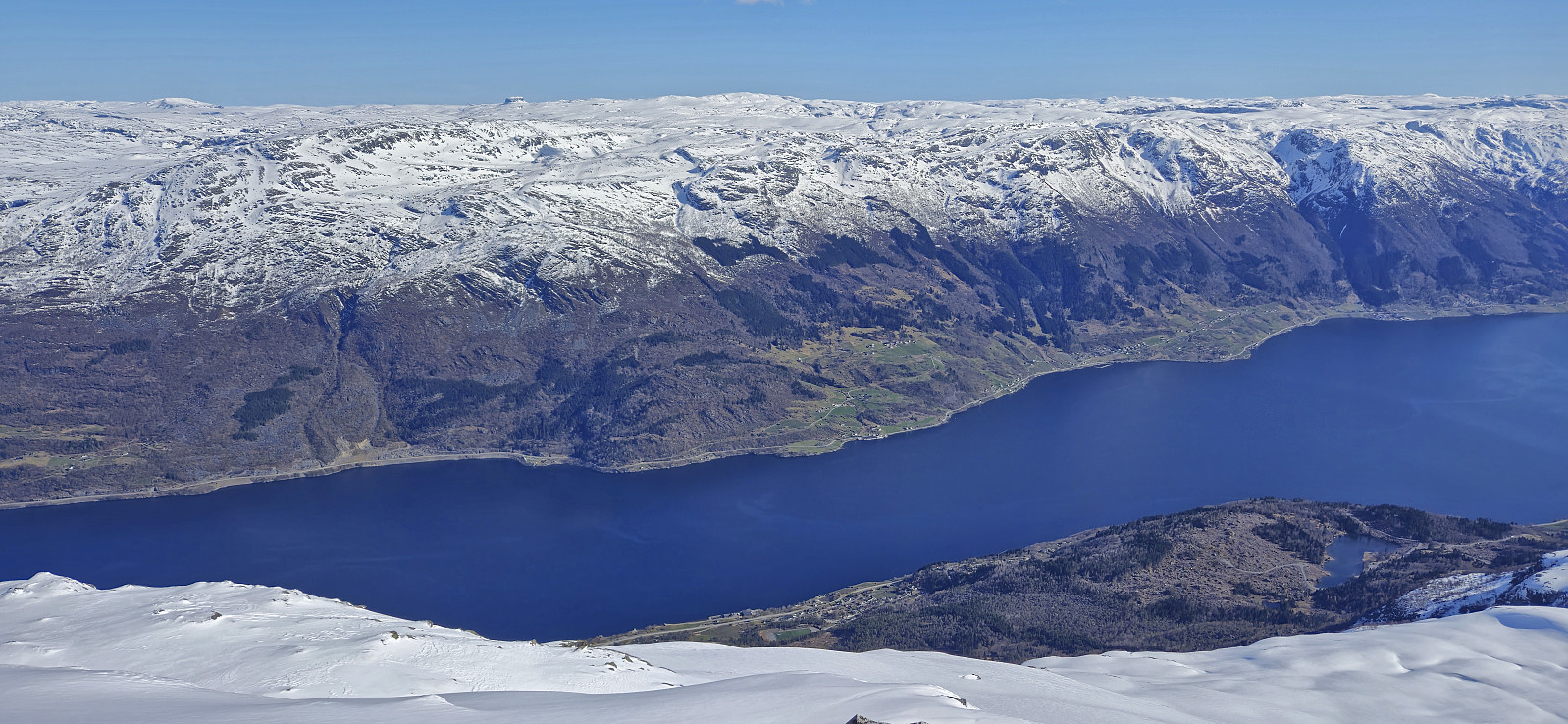
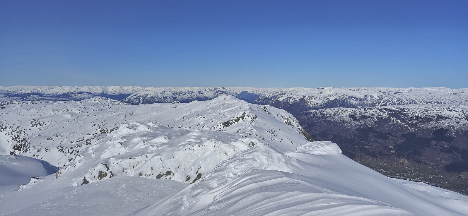
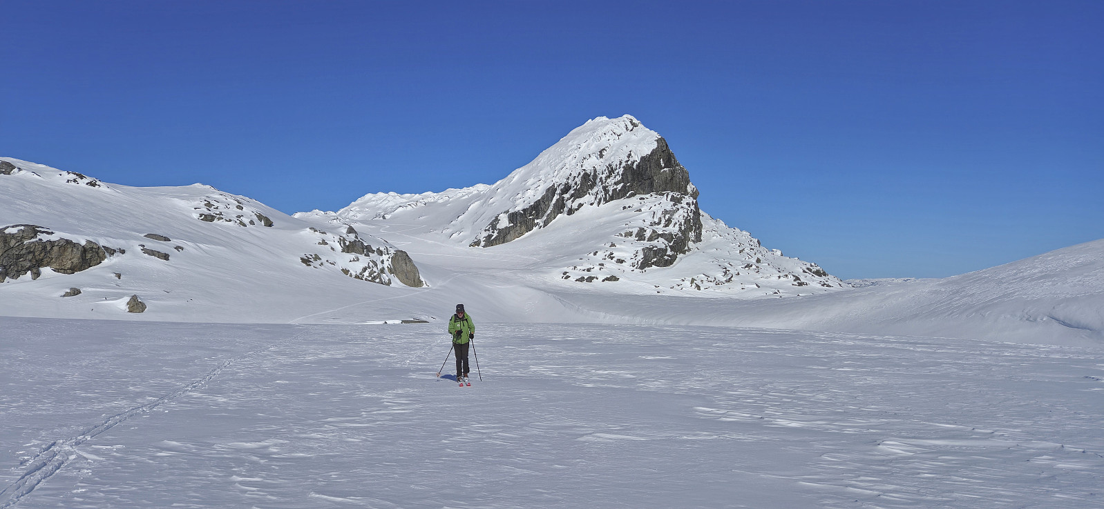
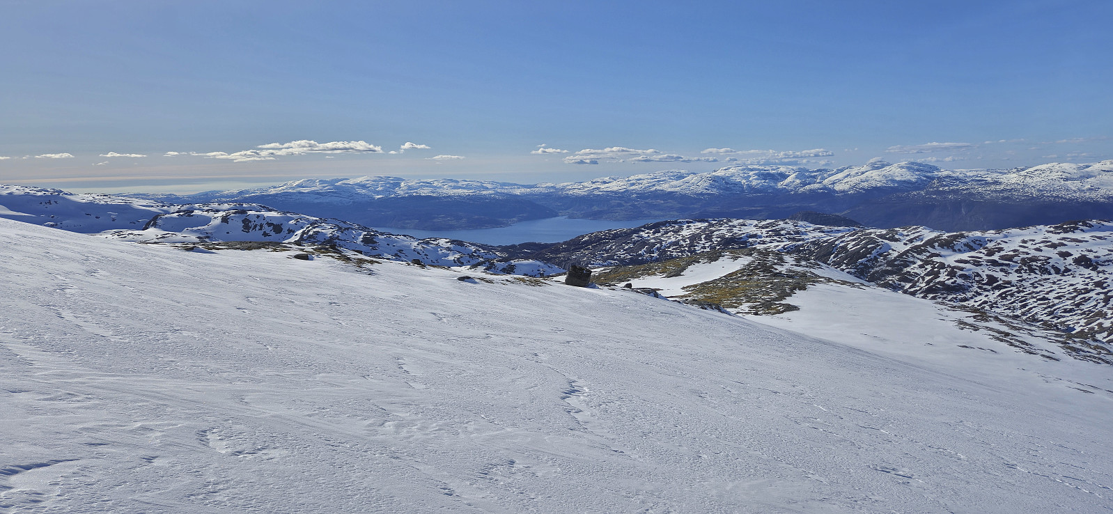
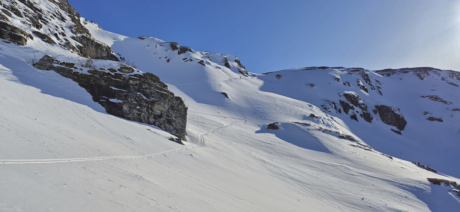
After a short break at Ruklehaugnuten we headed southeast and then south towards Solnuten. At first this was relatively easy but the terrain quickly got more complicated as we approached the ridge starting at Vardanuten. With steep drops on either side there was really only one route up and across the ridge. But except for a short section where we decided it was easier to take off the skis, we made it to the start of the final ascent of Solnuten without any issues. Here we once more took off the skis and completed the rest of the steep ascent to the cairn on foot. The summit of Solnuten, and indeed all of the ridge north of it, provided spectacular views along Sørfjorden, and the perfect weather conditions did not hurt either!
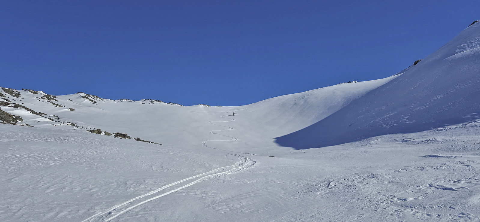
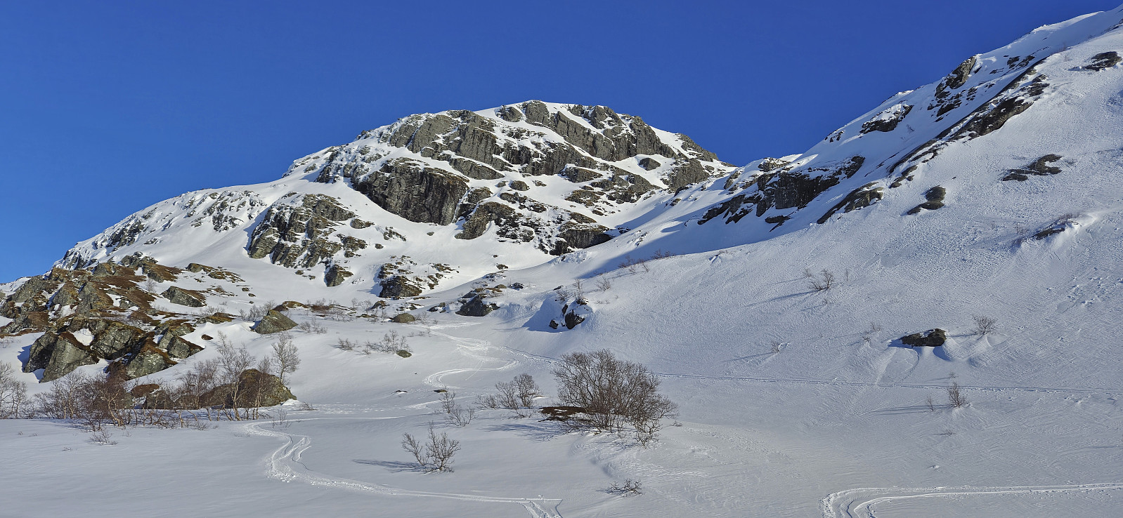
After lots of pictures we carefully returned to our skis and started on the rest of the descent, deciding to try a more direct route Tostølsvatnet. This started out brilliantly with lots of excellent downhill skiing but later on also included a short steep section where the skis again had to come off, however this may be possible to avoid by spending more time searching for alternative routes. Note that the final descent to Tostølsvatnet was also quite steep and should most likely be avoided if there is a risk of avalanches, even though this will probably require a longer detour.
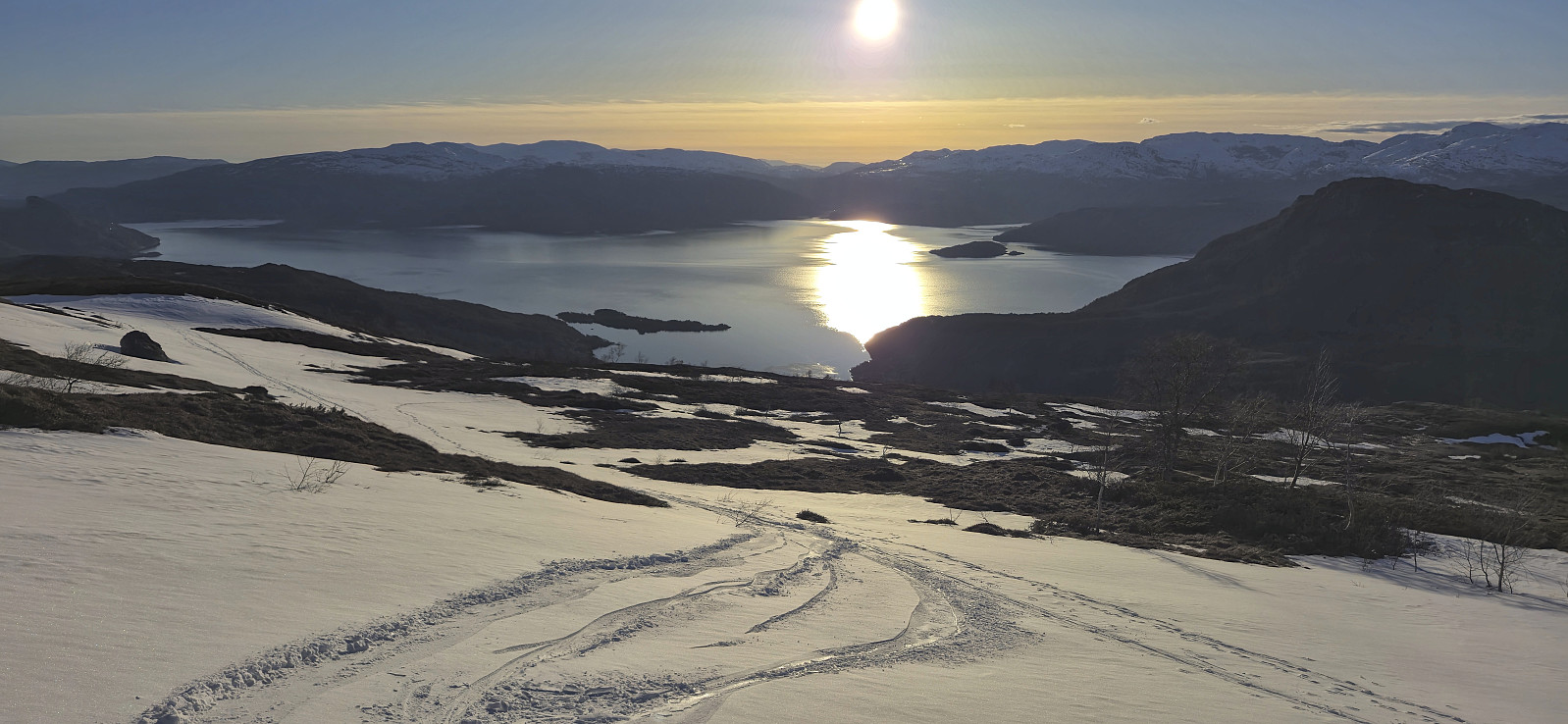
Next, we crossed the ice-covered Tostølsvatnet with the plan to go via Samdalstølen to reconnect with our ascent route. Here we however made the silly mistake of getting off the lake on the wrong side of the river from Tostølsvatnet to Viddalsvatnet, and given that there was no bridge, neither of wood nor snow, we ended up descending all the way to Viddalsvatnet before finally being able to start our final ascent. But after this final push it was just a matter of keeping the skis on as far as possible on our return to end the gravel road, which we then proceeded to follow, now carrying the skis, back to the car at the start of the gravel road. As it would happen we reached the car with just the right amount of time left to catch the next ferry at Jondal on our way back to Bergen.
In summary, an excellent trip with spectacular views! Note however that, due to the rugged and sometimes steep terrain, this trip is not for beginners. Takk for turen, Petter!

| Starttidspunkt | 21.04.2024 08:54 (UTC+01:00 ST) |
| Sluttidspunkt | 21.04.2024 20:48 (UTC+01:00 ST) |
| Totaltid | 11t 54min |
| Bevegelsestid | 8t 50min |
| Pausetid | 3t 03min |
| Snittfart totalt | 2,7km/t |
| Snittfart bevegelsestid | 3,6km/t |
| Distanse | 31,9km |
| Høydemeter | 1933m |

Kommentarer