Arkiv - dato
Arkiv - aktivitet
-
Annen tur (1)
- Ekspedisjon (1)
-
Annen vintertur (10)
- Trugetur (10)
- Fottur (228)
-
Klatring (8)
- Alpin klatring (7)
- Miksklatring (1)
-
Skitur (49)
- Randonnée/Telemark (49)
-
Sykkeltur (2)
- Terrengsykling (1)


Lister jeg samler etter
-
Romsdal ≥ 100m pf.
(134/301)
 44%
44% -
Sunnmøre ≥ 100m pf.
(78/531)
14%
-
Norges 1000 største fjell målt i primærfaktor
(52/1000)
5%

Til Grønfonnfjellet og Brekkehornet
- Dato:
- 12.07.2025
- Turtype:
- Alpintur
- Turlengde:
- 9:33t
- Distanse:
- 14,9km
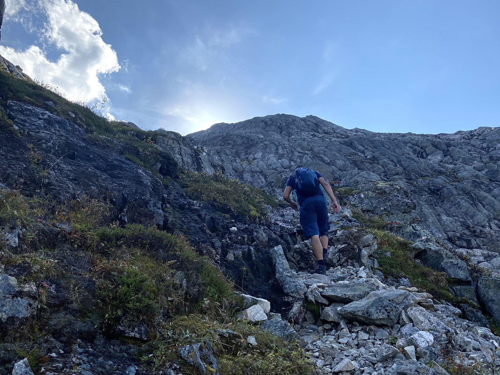
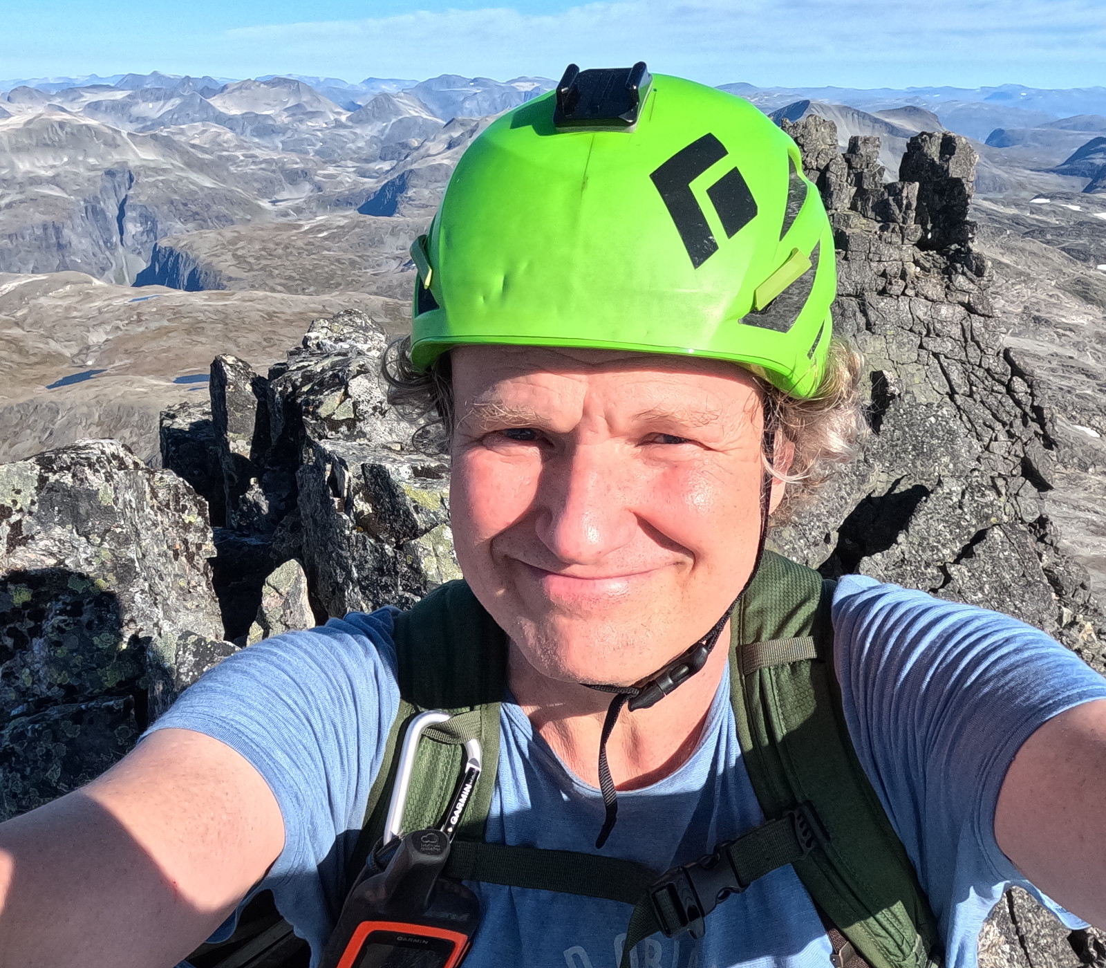
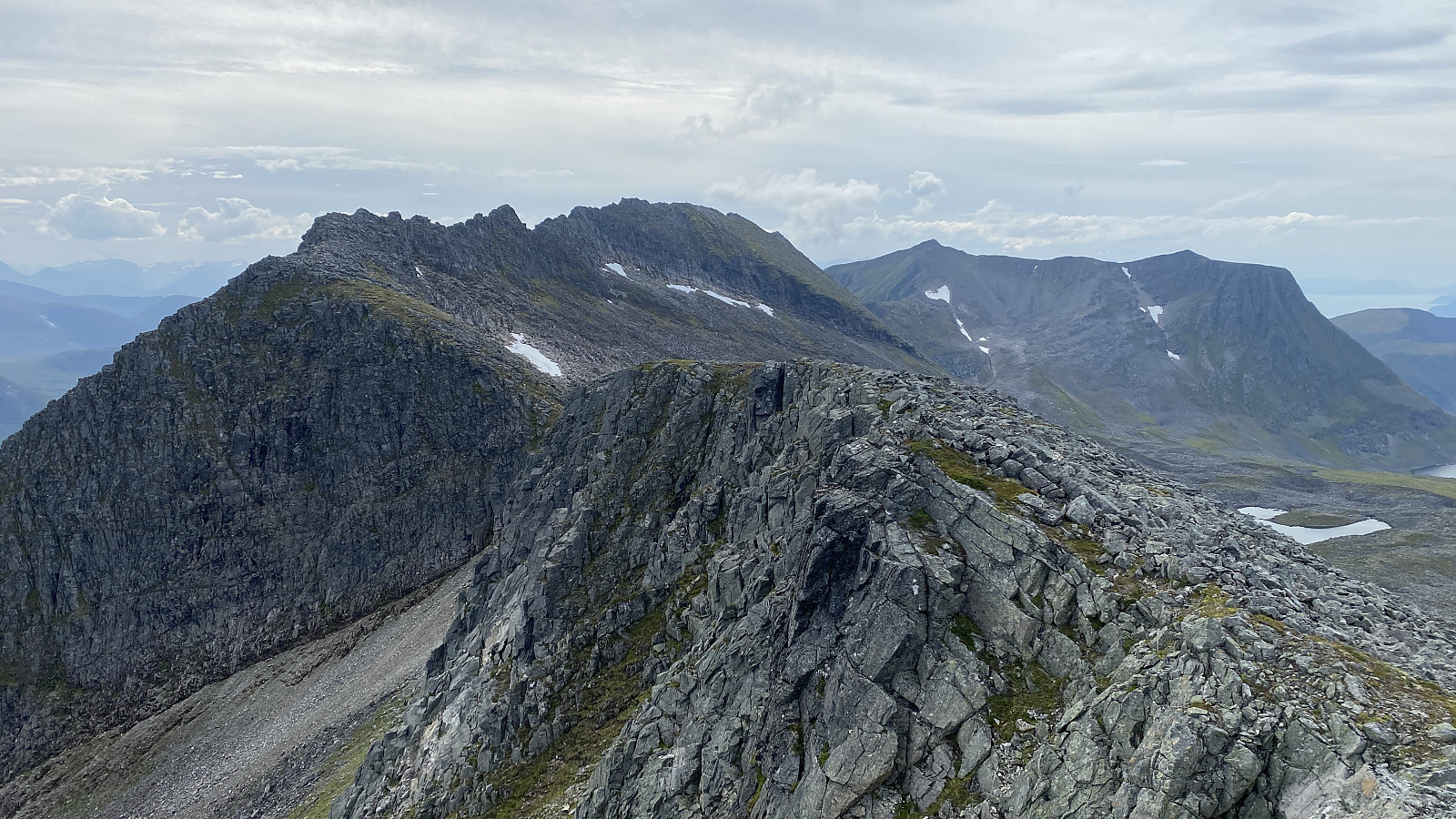
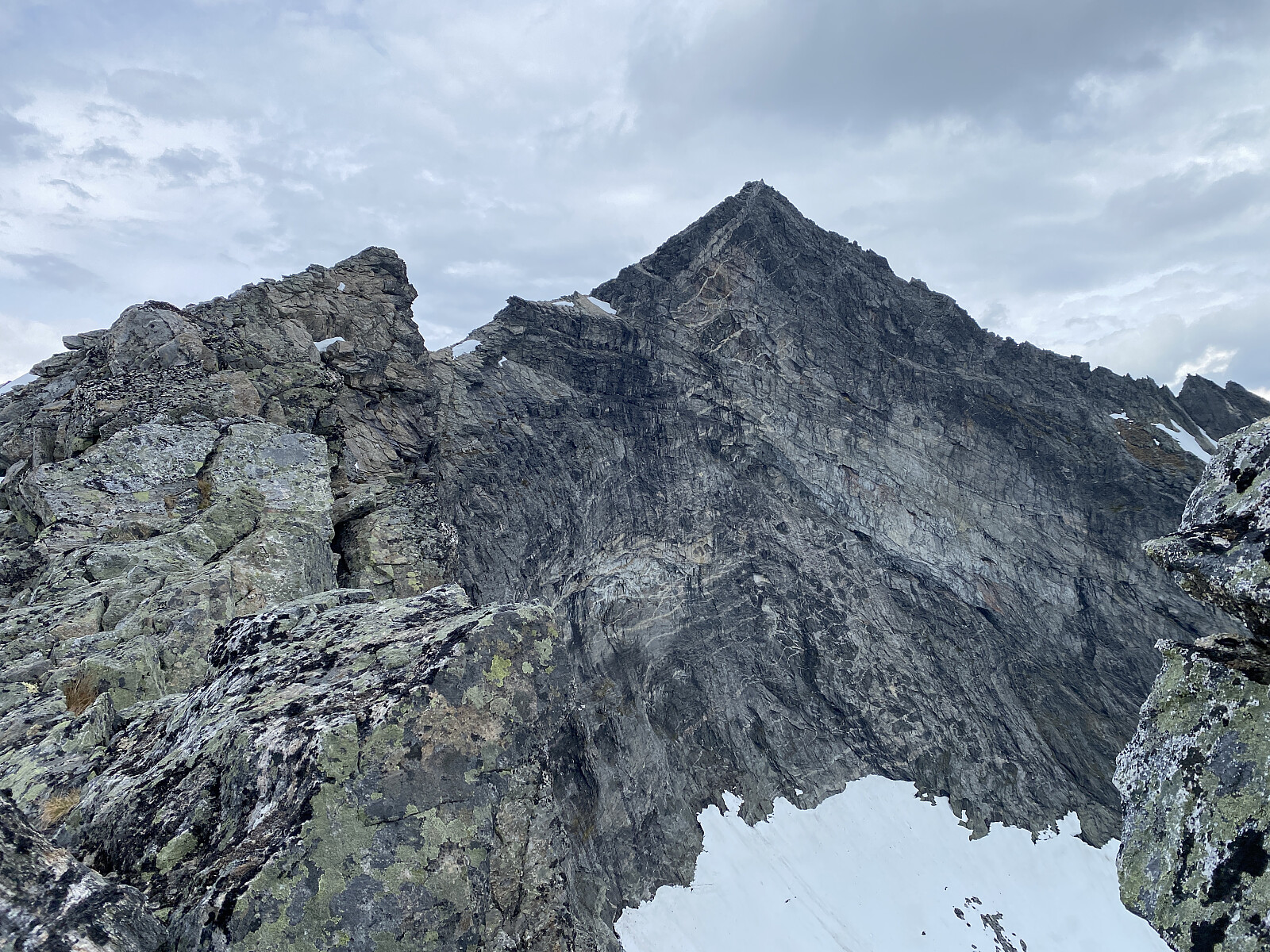
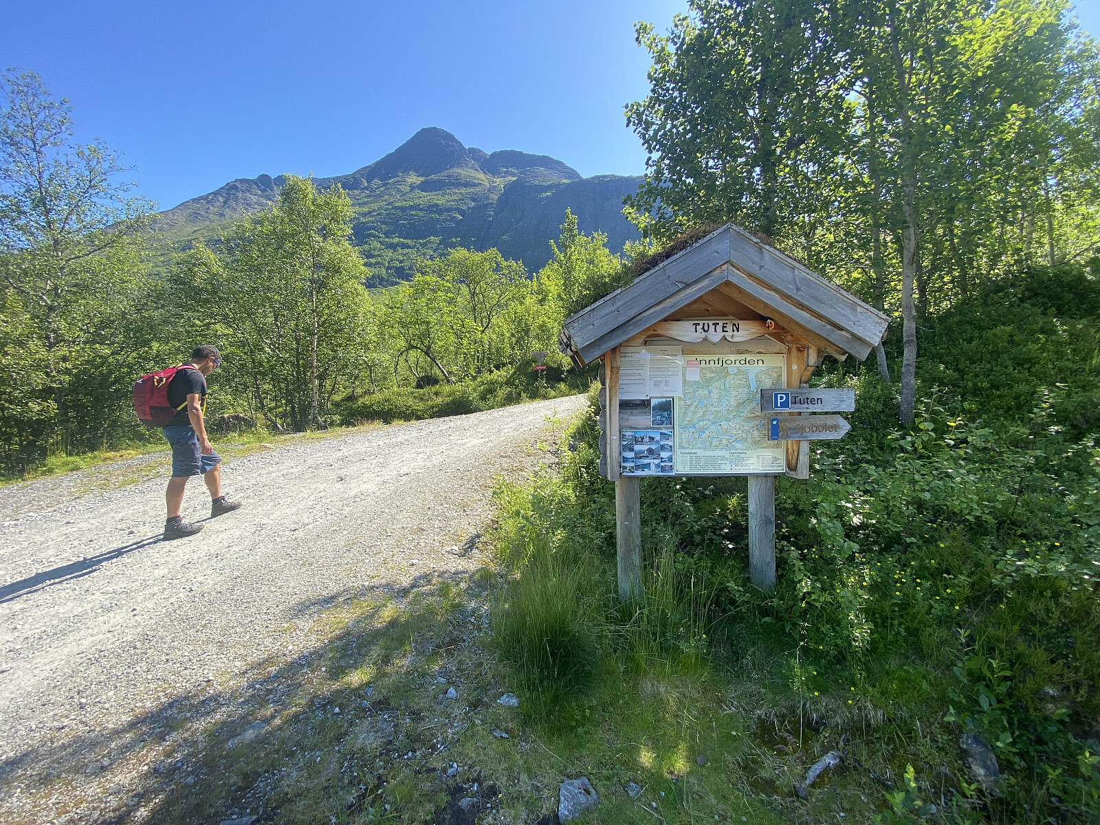 Jeg har i den senere tid tatt turen opp på en del av fjella i Innfjordsområdet, og hadde dagene i forkant av denne dagen planlagt en tur opp på Grønfonnfjellet [1509 m.o.h.] og Brekkehornet [1525 m.o.h.]. Egentlig hadde jeg tenkt å fortsette fra Brekkehornet videre opp på Taskedalstinden [1609 m.o.h.], men det ble det til at vi droppet. Vår eldste sønn, Dag, hadde vært på Grønfonnfjellet før, men ikke på de to andre, så han bestemte seg for å hive seg med på turen.
Vi kjørte inn til Innfjorden, tok veien oppover mot Bøstølen [420-480 m.o.h.], og parkerte oppe på Tuten parkeringsplass [480 m.o.h.]. Herfra gav vi oss i vei videre oppover grusveien som går oppover langs Grønfonnelva i retning Strupen [600 m.o.h.]. Etter omkring 800 meters gange, tok vi av på en sti som går >>>
Jeg har i den senere tid tatt turen opp på en del av fjella i Innfjordsområdet, og hadde dagene i forkant av denne dagen planlagt en tur opp på Grønfonnfjellet [1509 m.o.h.] og Brekkehornet [1525 m.o.h.]. Egentlig hadde jeg tenkt å fortsette fra Brekkehornet videre opp på Taskedalstinden [1609 m.o.h.], men det ble det til at vi droppet. Vår eldste sønn, Dag, hadde vært på Grønfonnfjellet før, men ikke på de to andre, så han bestemte seg for å hive seg med på turen.
Vi kjørte inn til Innfjorden, tok veien oppover mot Bøstølen [420-480 m.o.h.], og parkerte oppe på Tuten parkeringsplass [480 m.o.h.]. Herfra gav vi oss i vei videre oppover grusveien som går oppover langs Grønfonnelva i retning Strupen [600 m.o.h.]. Etter omkring 800 meters gange, tok vi av på en sti som går >>>
Til Skarfjellet og Kulehøgda med Dag
- Dato:
- 07.09.2024
- Turtype:
- Alpintur
- Turlengde:
- 10:34t
- Distanse:
- 20,7km
 Det var min eldste sønn, Dag, som kvelden i forveien spurte om ikke jeg ville være med ham på Skarfjellet [1723 m.o.h.] oppe ved Trollstigplatået og Alnesdalen. Han hadde vært på Skarfjellet Nord helga i forveien, og kjente derfor godt stien som går opp mellom Skarfjellenden og Skarfjellenden Sør ; og siden det var meldt godvær denne dagen, hadde han lyst til å forsøke seg på selve hovedtoppen denne dagen. Trollstigen er for tiden stengt, så vi kjørte opp via Valldalen, parkerte oppe på Alnesreset, og gav oss i vei derfra.
Vi fulgte den nevnte stien opp til det nevnte skaret. Det er temmelig bratt oppover mot dette skaret, men både stien og merkingen er god, så det at traséen er bratt byr ikke på noen problemer, så lenge man er nogenlunde fjellvant. Rett før vi var oppe i skaret, tok vi til høyre opp mot toppen av Skarfjellenden >>>
Det var min eldste sønn, Dag, som kvelden i forveien spurte om ikke jeg ville være med ham på Skarfjellet [1723 m.o.h.] oppe ved Trollstigplatået og Alnesdalen. Han hadde vært på Skarfjellet Nord helga i forveien, og kjente derfor godt stien som går opp mellom Skarfjellenden og Skarfjellenden Sør ; og siden det var meldt godvær denne dagen, hadde han lyst til å forsøke seg på selve hovedtoppen denne dagen. Trollstigen er for tiden stengt, så vi kjørte opp via Valldalen, parkerte oppe på Alnesreset, og gav oss i vei derfra.
Vi fulgte den nevnte stien opp til det nevnte skaret. Det er temmelig bratt oppover mot dette skaret, men både stien og merkingen er god, så det at traséen er bratt byr ikke på noen problemer, så lenge man er nogenlunde fjellvant. Rett før vi var oppe i skaret, tok vi til høyre opp mot toppen av Skarfjellenden >>>
Til Kvanndalstinden med Lisa og Stian
- Dato:
- 01.09.2024
- Turtype:
- Alpintur
- Turlengde:
- 10:59t
- Distanse:
- 14,4km
 Det var meldt fint vær denne søndagen, og Lisa hadde i forkant sendt meg en melding der hun lurte på om jeg kunne tenke meg å være med henne og Stian opp på Kvanndalstinden. Jeg har vært på Kvanndalstinden bare én gang tidligere, da jeg og eldste sønn klatret opp nordryggen, dvs. samme rute som sir William C. Slingsby benyttet i 1885. Vi ble dermed enige om å ta denne ruta også denne dagen, for det ville jo ikke være noe poeng i å ha meg med som kjentmann om vi skulle benytte en rute jeg ikke har gått før. Vi møttes på parkeringsplassen ved matbutikken i Isfjorden, hvor jeg satte igjen min bil, og så kjørte vi sammen inn til Dalsbygda; hvor vi parkerte på parkeringsplassen akkurat der Erstaddalen møter Kvanndalen, og startet turen derfra.
Første del av turen kan sees på >>>
Det var meldt fint vær denne søndagen, og Lisa hadde i forkant sendt meg en melding der hun lurte på om jeg kunne tenke meg å være med henne og Stian opp på Kvanndalstinden. Jeg har vært på Kvanndalstinden bare én gang tidligere, da jeg og eldste sønn klatret opp nordryggen, dvs. samme rute som sir William C. Slingsby benyttet i 1885. Vi ble dermed enige om å ta denne ruta også denne dagen, for det ville jo ikke være noe poeng i å ha meg med som kjentmann om vi skulle benytte en rute jeg ikke har gått før. Vi møttes på parkeringsplassen ved matbutikken i Isfjorden, hvor jeg satte igjen min bil, og så kjørte vi sammen inn til Dalsbygda; hvor vi parkerte på parkeringsplassen akkurat der Erstaddalen møter Kvanndalen, og startet turen derfra.
Første del av turen kan sees på >>>
Tur over Neremstindane
- Dato:
- 03.08.2024
- Turtype:
- Alpintur
- Turlengde:
- 5:15t
- Distanse:
- 11,7km
 Jeg hadde i forkant av denne turen nøye studert både kart over Neremstindane, og turbeskrivelser fra flere som hadde tatt turen langsetter denne fjellkjeden. Ut fra det jeg kunne lese og studere meg til, skulle turen stort sett være overkommelig, men det skulle være et crux ca. 300 meter øst for hovedtoppen (Neremstindan Øst), hvor det kunne være litt tricky å passere. Jeg hadde allerede sett for meg at jeg ville gå fjellkjeden fra ene enden til den andre, og dermed få med meg samtlige topper bortetter denne ryggen; selv om det naturligvis hadde vært lettere å bare gå fra Sollisætra via Høgsvora opp til hovedtoppen, og deretter ned igjen samme veien. Jeg kom til at det lureste var å starte nede i Tresfjorden, for så å ende opp på Sollisætra; ettersom jeg da slapp å klatre >>>
Min åttende bestigning av Romsdalshornet
- Dato:
- 29.07.2024
- Turtype:
- Alpintur
- Turlengde:
- 3:07t
- Distanse:
- 3,5km
 Romsdalshornet er et av de mest spennende fjellene vi har i vårt nærområde. Jeg har klatret opp til topps på dette fjellet syv ganger før, men jeg har klødd i fingrene etter å få meg en klatretur opp der i år også; og denne mandagen var værmeldingen på min side, så da tok jeg turen. Jeg parkerte på siste parkeringsplassen oppe i Vengedalen, og la avsted derfra. Jeg fulgte stien opp forbi Hornvatnet [760 m.o.h.], og derfra videre opp på fjellryggen mellom Litlefjellet og Romsdalshornet. Litt før jeg var helt oppe på ryggen, skrået jeg sørvestover i retning innsteget til klatrepartiet på nordveggen av Romsdalshornet. I det jeg kom opp på den lille knausen [1283 m.o.h.] rett før det skaret som kalles gapet, støtte jeg på flere andre klatrere; de fleste av dem på vei ned >>>
Til Middagstinden via Gullkoppen
- Dato:
- 18.05.2024
- Turtype:
- Alpintur
- Turlengde:
- 6:28t
- Distanse:
- 7,8km
 Middagstinden [1568 m.o.h.] er et fjell jeg en tid har hatt tanker om å bestige. Jeg hadde egentlig tenkt å gjøre det som en kombinert fot- og skitur, men da jeg i slutten av april måned i år skulle prøve meg på dette, startet jeg turen med å glemme randostøvlene igjen hjemme; og da jeg i stedet forsøkte å gjøre turen som en kombinert fot- og trugetur, gikk det i vasken fordi trugene viste seg å ikke fungere som de skulle. Dermed ble det til at jeg snudde på Lille Middagstinden [943 m.o.h.], og gikk ned igjen [for turbeskrivelse klikk her: Med Snowline-brodder i dyp snø til Lille Middagstinden ]. Traséen opp fra Bøstølveien til Lille Middagstinden er nemlig såpass bratt, at det er uhensiktsmessig å gå på ski opp her, og planen for en vinter- eller vårbestigning har derfor vært å gå til fots (eventuelt med Snowline-brodder) >>>
Med Snowline-brodder i dyp snø til Lille Middagstinden
- Dato:
- 20.04.2024
- Turtype:
- Alpintur
- Turlengde:
- 5:02t
- Distanse:
- 9,6km
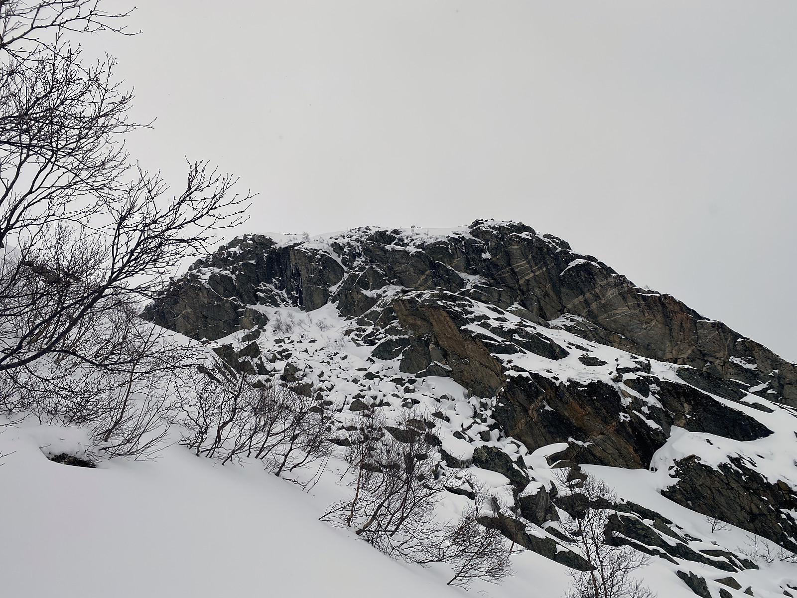 Denne dagen hadde jeg egentlig tenkt å forsøke meg på en kombinert fot- og randoneetur til Middagstinden [1568 m.o.h.]. Når jeg nærmet meg Innfjorden, kom jeg imidlertid på at jeg hadde glemt randostøvlene igjen hjemme, og da hjelper det lite at jeg hadde husket på å ta med meg alt mulig annet. Planen var å gå med Snowline-brodder på beina, og ski og støvler på sekk, opp til Lille Middagstinden [943 m.o.h.]; for så å bytte til rando-utstyr der oppe, og gå de siste 600 høydemetrene på ski. Langs denne traséen er turen opp til Lille Middagstinden såpass bratt, og vegetasjonen såpass tett, at det uansett er nokså uegnet for å gå på ski, det være seg rando- eller fjellski.
Da jeg kom til Innfjorden, tok jeg av fra riksveien, og fulgte Berillvegen [Fylkesvei 5990] inn til >>>
Denne dagen hadde jeg egentlig tenkt å forsøke meg på en kombinert fot- og randoneetur til Middagstinden [1568 m.o.h.]. Når jeg nærmet meg Innfjorden, kom jeg imidlertid på at jeg hadde glemt randostøvlene igjen hjemme, og da hjelper det lite at jeg hadde husket på å ta med meg alt mulig annet. Planen var å gå med Snowline-brodder på beina, og ski og støvler på sekk, opp til Lille Middagstinden [943 m.o.h.]; for så å bytte til rando-utstyr der oppe, og gå de siste 600 høydemetrene på ski. Langs denne traséen er turen opp til Lille Middagstinden såpass bratt, og vegetasjonen såpass tett, at det uansett er nokså uegnet for å gå på ski, det være seg rando- eller fjellski.
Da jeg kom til Innfjorden, tok jeg av fra riksveien, og fulgte Berillvegen [Fylkesvei 5990] inn til >>>
Til Gjuratinden med Lisa, Stian og Dag
- Dato:
- 26.08.2023
- Turtype:
- Alpintur
- Turlengde:
- 5:58t
- Distanse:
- 12,0km
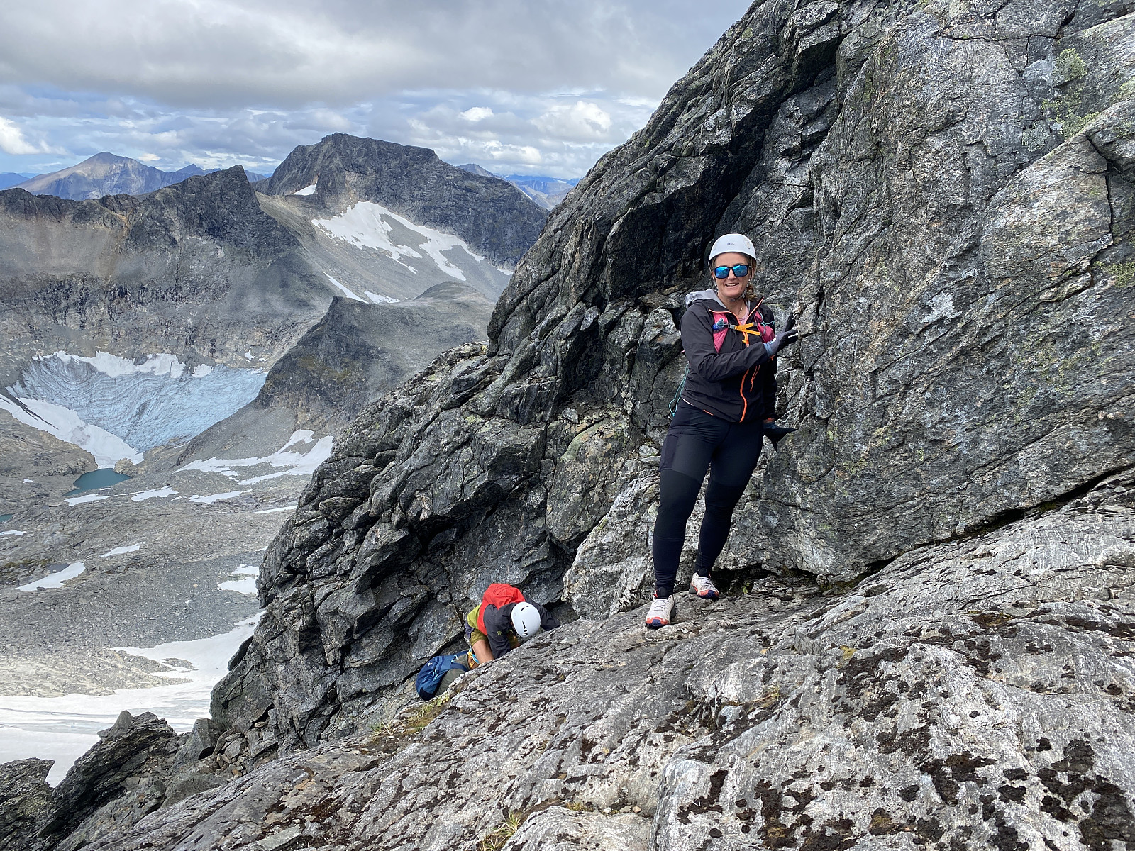 Det hadde vært mye dårlig vær de siste ukene, men denne dagen var det meldt opplett, og dermed hadde Lisa tatt kontakt, og spurt om jeg og Dag ville være med henne og Stian opp på Gjuratinden. Jeg synes alltid det er gøy å være kjentmann på slike fjellturer, så jeg lot meg ikke be to ganger. Vi parkerte på parkeringsplassen like før Rabben hyttefelt. Turen opp på Gjuratinden har en nokså bratt stigning hele veien, men det er først oppe på nordryggen av fjellet, at man kommer til noen partier med krevende klyving. Stien vi fulgte gikk oppover dalføret Nyheia, og vi fulgte stien helt opp til Nyheivatnet [1097 m.o.h.]. Stien og dalføret flater litt ut mellom ca. 700 og 800 høydemeter, men ellers bærer det nokså bratt oppover, så det er en relativt krevende tur, dersom man >>>
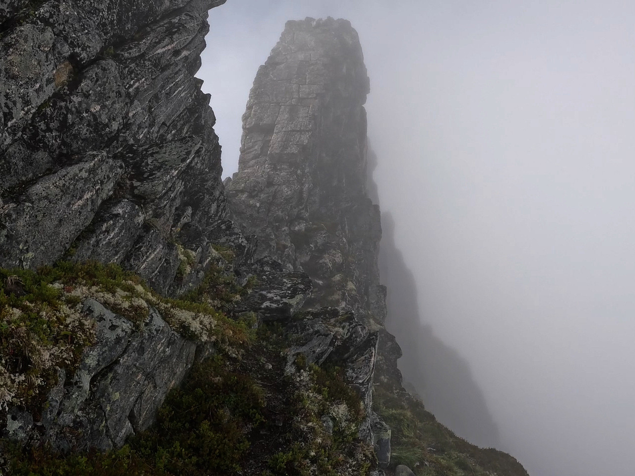
Venjetindtraversen med Dag, Lisa og Stian
- Dato:
- 19.08.2023
- Turtype:
- Alpintur
- Turlengde:
- 7:45t
- Distanse:
- 9,1km
 Jeg har tidligere gått Venjetindtraversen alene én gang, og deler av den et par ganger utenom; én gang gikk jeg til Store og Lille Venjetind fra Naustvika, og én gang gikk jeg fra parkeringsplassen øverst i Venjedalen til Søre Venjetind Nord, før jeg snudde og gikk tilbake, for å være sikker på å komme meg ned igjen før det ble mørkt (hadde den gangen glemt å ta med hodelhykt). Forut for den turen som nå skal beskrives hadde jeg med andre ord gått det meste av Venjetindtraversen tre ganger, men altså med unntak av partiet mellom Søre Venjetind Nord og Lille Venjetind, som jeg kun hadde gått én gang. Jeg var med andre ord for "kjentmann" å regne, og dermed ble det til at mine turvenner Lisa og Stian spurte om jeg kunne ta dem med på turen over traversen. Jeg hadde >>>
Rundtur rundt Svartevatnet
- Dato:
- 11.08.2023
- Turtype:
- Alpintur
- Turlengde:
- 11:24t
- Distanse:
- 20,4km
 Det hadde vært mye dårlig vær i dagene forut for denne turen, så når det på værmeldingene så ut til å skulle bli brukbart vær denne ene dagen, var jeg snar om å hive meg rundt og ta turen, for dette var en tur jeg hadde drømt om å gå, helt siden jeg leste om et par damer som gikk den for noen år siden. Nå ble været likevel ikke helt slik de hadde meldt, i hvert fall ikke før helt utpå kvelden, men om det var værmeldingen som bommet, eller om det var jeg som hadde fått opp feil Svartevasstind på yr.no, det har jeg ikke helt funnet ut av (det er i hvert fall to av dem i Møre og Romsdal).
Jeg tok bilen inn til Måndalen, og kjørte inn til gardsbruket Moen, hvor jeg parkerte oppe ved grinda mellom innmark og utmark. Her er det tilrettelagt for at turgåere kan parkere, og >>>
Det hadde vært mye dårlig vær i dagene forut for denne turen, så når det på værmeldingene så ut til å skulle bli brukbart vær denne ene dagen, var jeg snar om å hive meg rundt og ta turen, for dette var en tur jeg hadde drømt om å gå, helt siden jeg leste om et par damer som gikk den for noen år siden. Nå ble været likevel ikke helt slik de hadde meldt, i hvert fall ikke før helt utpå kvelden, men om det var værmeldingen som bommet, eller om det var jeg som hadde fått opp feil Svartevasstind på yr.no, det har jeg ikke helt funnet ut av (det er i hvert fall to av dem i Møre og Romsdal).
Jeg tok bilen inn til Måndalen, og kjørte inn til gardsbruket Moen, hvor jeg parkerte oppe ved grinda mellom innmark og utmark. Her er det tilrettelagt for at turgåere kan parkere, og >>>
