Arkiv - dato
Arkiv - aktivitet
-
Annen tur (1)
- Ekspedisjon (1)
-
Annen vintertur (10)
- Trugetur (10)
- Fottur (228)
-
Klatring (8)
- Alpin klatring (7)
- Miksklatring (1)
-
Skitur (49)
- Randonnée/Telemark (49)
-
Sykkeltur (2)
- Terrengsykling (1)


Lister jeg samler etter
-
Romsdal ≥ 100m pf.
(134/301)
 44%
44% -
Sunnmøre ≥ 100m pf.
(78/531)
14%
-
Norges 1000 største fjell målt i primærfaktor
(52/1000)
5%

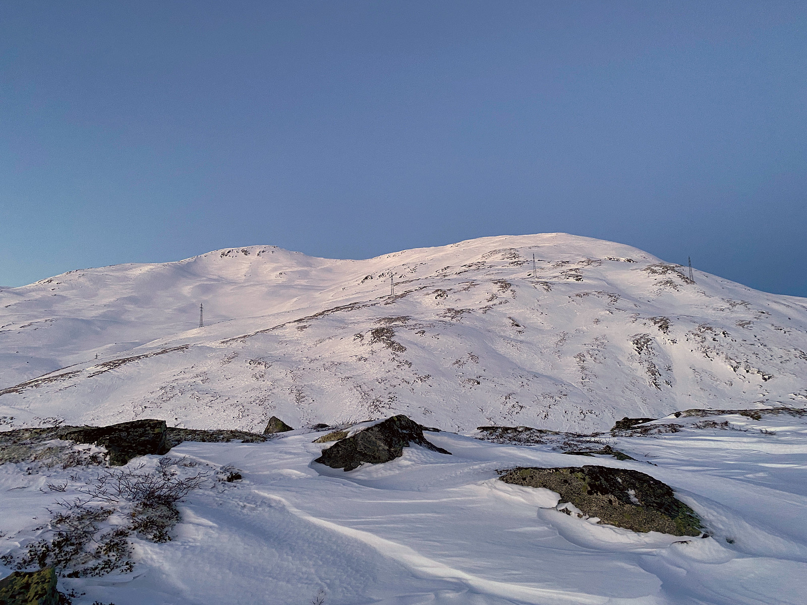
Til Berdalsnibba
- Dato:
- 23.04.2022
- Turtype:
- Randonnée/Telemark
- Turlengde:
- 4:47t
- Distanse:
- 12,5km
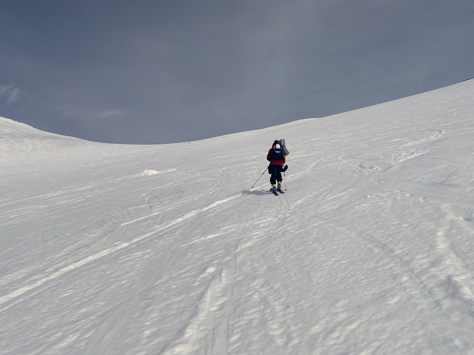
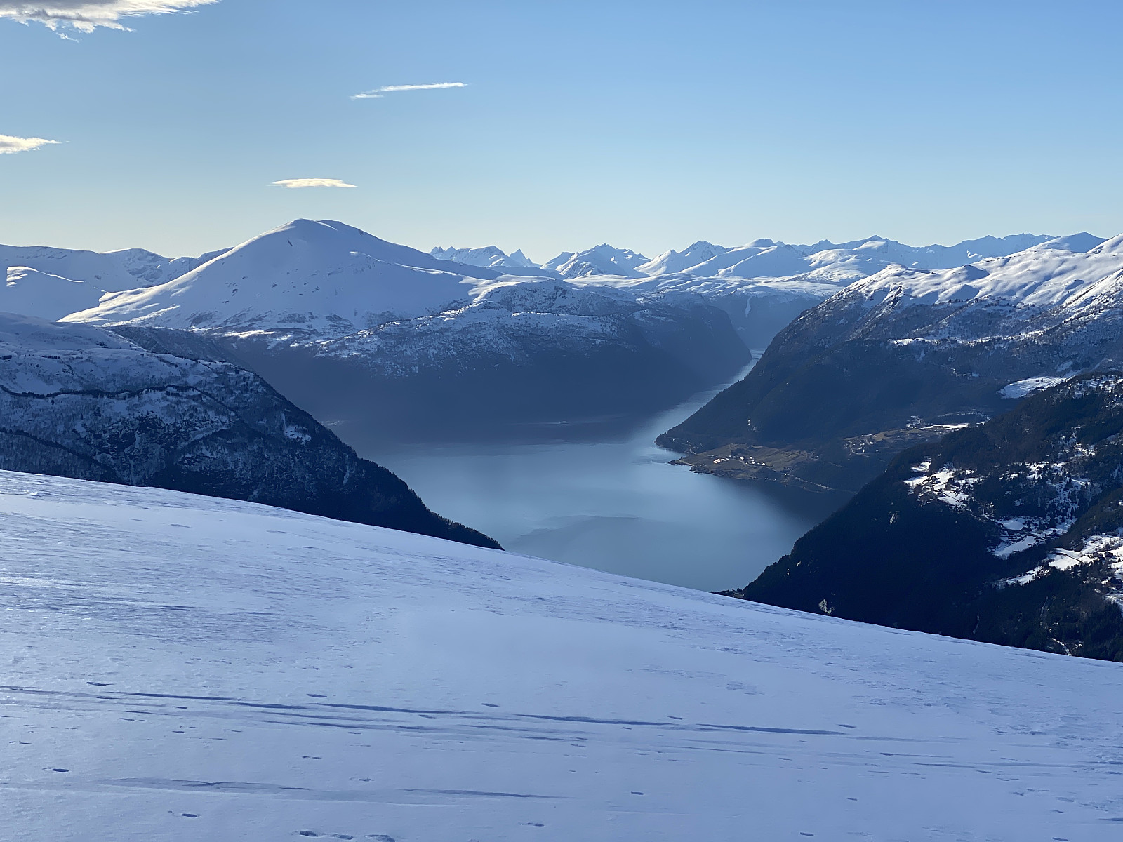
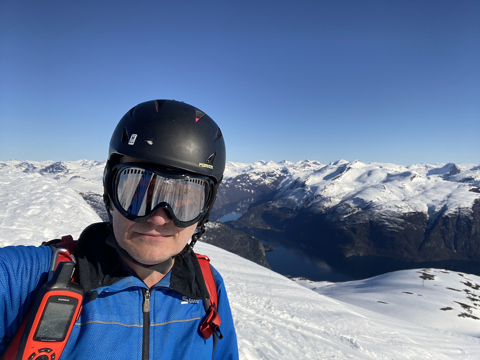 Jeg prøvde meg på Berdalsnibba sammen med Dag, min eldste sønn tidligere i vinter [ Randonee-tur til Hunden ved Lingåsen ], men da var dagene kortere, i tillegg til at vi startet litt seint, så da ble det til at vi nøyde oss med å gå til Hunden [943 m.o.h.] i stedet. Etter den tid har imidlertid Dag gjennomført turen (i tillegg til at han tidligere også har gjort turen til fots), så denne dagen satte jeg meg fore at jeg skulle nå klare å komme meg opp på Berdalsnibba jeg også...
Jeg kjørte inn til Valldalen, og tråklet meg så oppover hårnålssvingene opp til Lingåsen, hvor jeg parkerte på en liten parkeringsplass akkurat der bomveien starter. Om sommeren kan man betale noen kroner for å kjøre veien omtrent helt opp til Klovsætra, men veien brøytes ikke om vinteren, så da må man parkere her nede. Jeg stoppet >>>
Jeg prøvde meg på Berdalsnibba sammen med Dag, min eldste sønn tidligere i vinter [ Randonee-tur til Hunden ved Lingåsen ], men da var dagene kortere, i tillegg til at vi startet litt seint, så da ble det til at vi nøyde oss med å gå til Hunden [943 m.o.h.] i stedet. Etter den tid har imidlertid Dag gjennomført turen (i tillegg til at han tidligere også har gjort turen til fots), så denne dagen satte jeg meg fore at jeg skulle nå klare å komme meg opp på Berdalsnibba jeg også...
Jeg kjørte inn til Valldalen, og tråklet meg så oppover hårnålssvingene opp til Lingåsen, hvor jeg parkerte på en liten parkeringsplass akkurat der bomveien starter. Om sommeren kan man betale noen kroner for å kjøre veien omtrent helt opp til Klovsætra, men veien brøytes ikke om vinteren, så da må man parkere her nede. Jeg stoppet >>>
Til Smørbottinden med Vår
- Dato:
- 17.04.2022
- Turtype:
- Randonnée/Telemark
- Turlengde:
- 2:58t
- Distanse:
- 8,6km
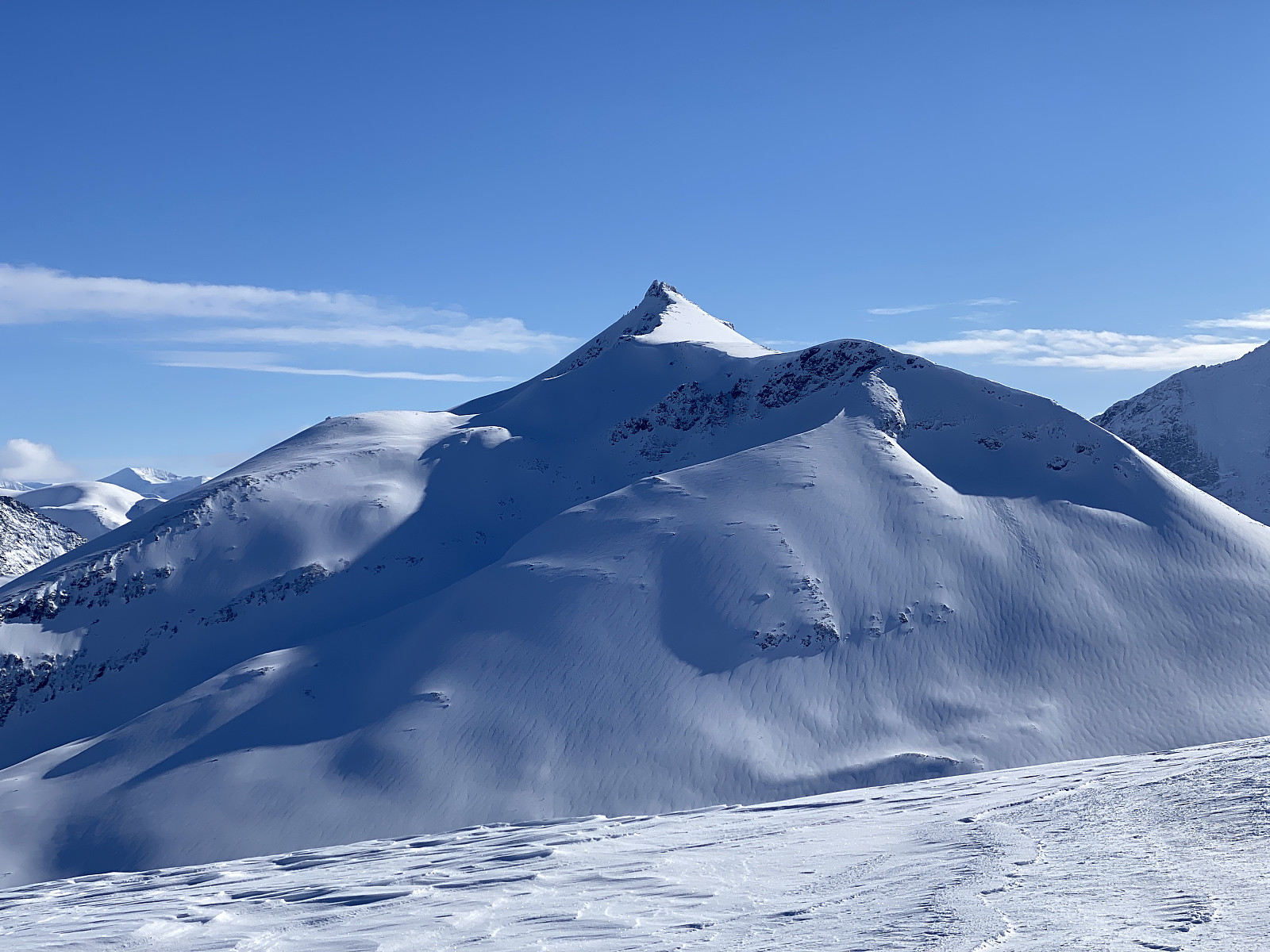
 Jeg har tidligere vært tilsammen tre ganger på Smørbottinden; først én gang alene på Telemarkski [ Telemark Skiing to Mount Smørbottinden in Rauma Municipality ], så én gang alene på Randonee-ski [ Alpine Ski Touring to Mount Smørbottind and Mount Kvasstind ], og så én gang på Randonee-ski sammen med min eldste sønn [ Ski Touring to Mount Smørbotstinden with my son ]. Min yngste datter, som jeg også ofte går skiturer sammen med, hadde imidlertid ikke vært der enda, og dermed ble vi enige om å ta denne turen sammen denne dagen. Vi kjørte inn til Rauma, forbi Åndalsnes og Isfjorden, og tok så av fra hovedveien, og fulgte den smale bomveien opp til skisenteret i Skorgedalen. Det er vanligvis godt om plass på parkeringsplassen ved skisenteret, og parkeringen er inkludert i bompengene man betaler for å bruke veien opp dit. Parkeringsplassen benyttes imidlertid også av alle de som har hytte i området; og i og med at det nå var påskeferie, >>>
Til Auskjeret i Sykkylven
- Dato:
- 16.04.2022
- Turtype:
- Randonnée/Telemark
- Turlengde:
- 4:19t
- Distanse:
- 8,5km
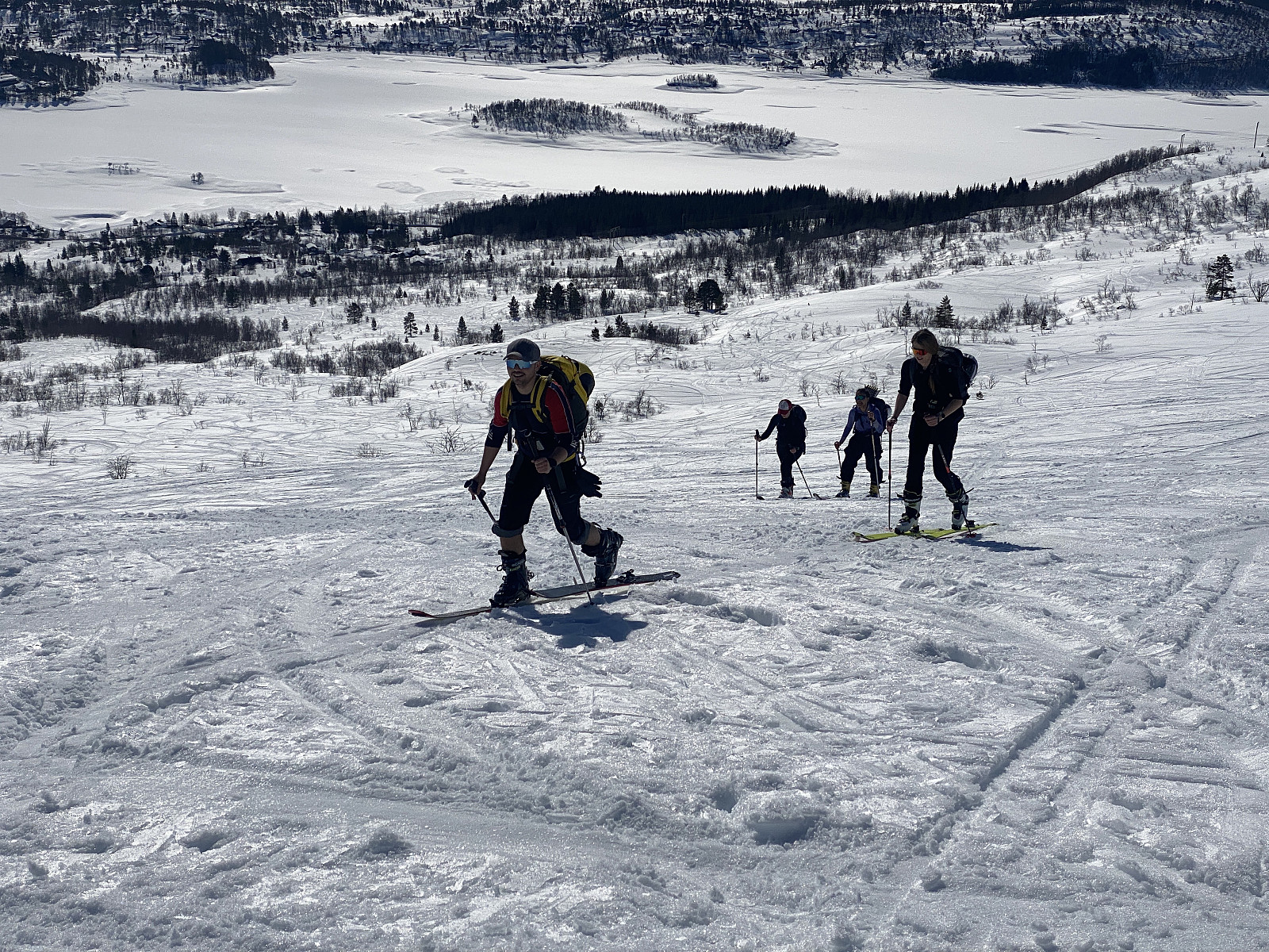 Det var min datter og noen venner av henne som hadde tenkt seg på topptur denne dagen, og så var jeg heldig å få være med. Valget falt på Auskjeret i Sykkylvsfjella fordi det var meldt stor skredfare, og "normalruta" opp på Auskjeret har såpass slakk stigning at det likevel skulle være nokså trygt. Min datters venner var først noe skeptiske til å ha meg med, men hun beroliget dem med at jeg bare var en gammel mann med tunge ski, og da fikk jeg være med. Vi kjørte gjennom Sykkylven og Straumgjerdet, tok veien mot Fjellsetra, og kjørte helt inn til nordøstre ende av Nysetervatnet, og parkerte på en svær parkeringsplass som er opparbeidet akkurat der det tar av en vei mot Orreneset og Fausa.
Vi spendte på oss skia, og begynte å gå. Traséen er ganske slak i starten >>>
Det var min datter og noen venner av henne som hadde tenkt seg på topptur denne dagen, og så var jeg heldig å få være med. Valget falt på Auskjeret i Sykkylvsfjella fordi det var meldt stor skredfare, og "normalruta" opp på Auskjeret har såpass slakk stigning at det likevel skulle være nokså trygt. Min datters venner var først noe skeptiske til å ha meg med, men hun beroliget dem med at jeg bare var en gammel mann med tunge ski, og da fikk jeg være med. Vi kjørte gjennom Sykkylven og Straumgjerdet, tok veien mot Fjellsetra, og kjørte helt inn til nordøstre ende av Nysetervatnet, og parkerte på en svær parkeringsplass som er opparbeidet akkurat der det tar av en vei mot Orreneset og Fausa.
Vi spendte på oss skia, og begynte å gå. Traséen er ganske slak i starten >>>
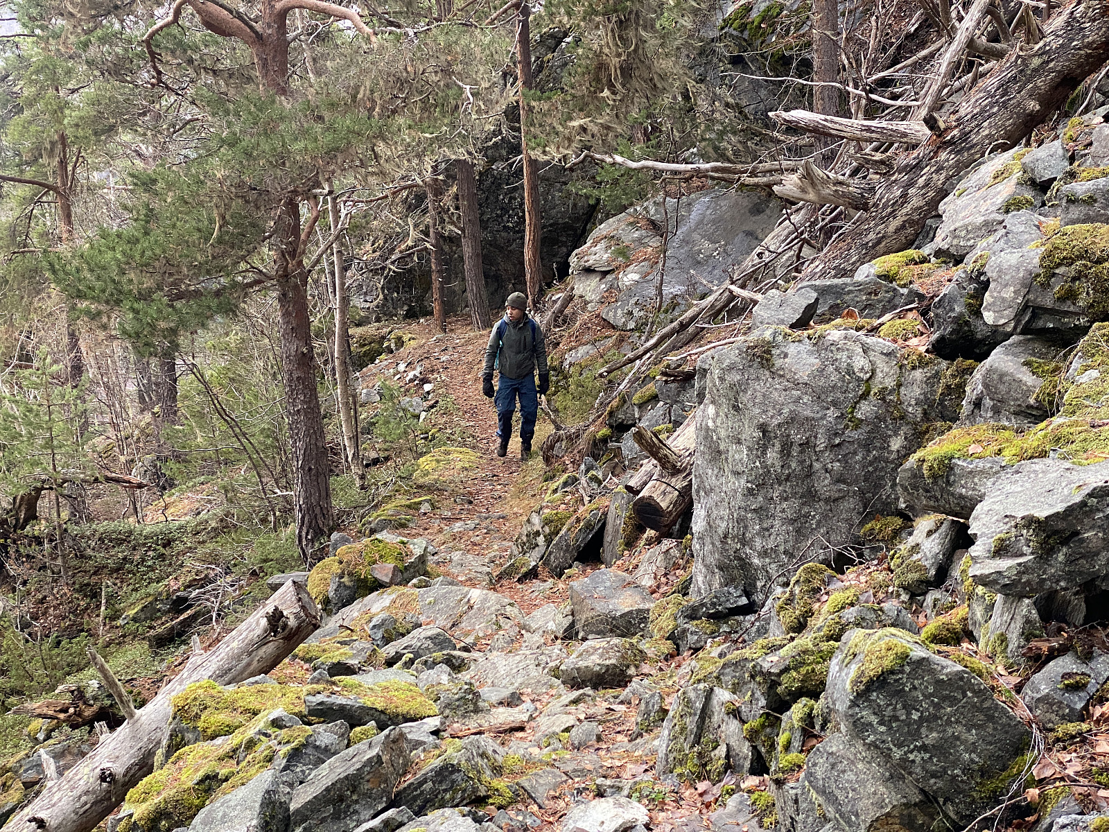
Til Skarven i Innfjorden ("Høgsteskarven")
- Dato:
- 06.04.2022
- Turtype:
- Randonnée/Telemark
- Turlengde:
- 4:41t
- Distanse:
- 9,6km
 Det var meldt skredfare grad 3 denne dagen, så vi valgte å legge dagens randonee-tur til Skarven i Isfjorden, også kalt Høgsteskarven, da dette er et fjell hvor man relativt greit kan unngå bratte partier, og dermed også å utsette seg selv for skredfare. Vi kjørte til Innfjorden, og parkerte helt nede ved europaveien, hvor det er anlagt en parkeringsplass der man kan betale for å parkere ved å Vipps'e over et mindre beløp.
Fra parkeringsplassen går det en grusvei opp til en gårdsbruket Lia, beliggende ca. 50 m.o.h. Veien opp til dette bruket var brøytet, og derfor nesten helt bar; så vi måtte bære skiene til vi var kommet et lite stykke ovenfor bruket, før vi kunne spenne dem på. På ca. 80 høydemeter kunne vi så ta på oss skiene, for herfra gikk det en setervei, som vi >>>
Det var meldt skredfare grad 3 denne dagen, så vi valgte å legge dagens randonee-tur til Skarven i Isfjorden, også kalt Høgsteskarven, da dette er et fjell hvor man relativt greit kan unngå bratte partier, og dermed også å utsette seg selv for skredfare. Vi kjørte til Innfjorden, og parkerte helt nede ved europaveien, hvor det er anlagt en parkeringsplass der man kan betale for å parkere ved å Vipps'e over et mindre beløp.
Fra parkeringsplassen går det en grusvei opp til en gårdsbruket Lia, beliggende ca. 50 m.o.h. Veien opp til dette bruket var brøytet, og derfor nesten helt bar; så vi måtte bære skiene til vi var kommet et lite stykke ovenfor bruket, før vi kunne spenne dem på. På ca. 80 høydemeter kunne vi så ta på oss skiene, for herfra gikk det en setervei, som vi >>>
Topptur til Hegguraksla med Dag
- Dato:
- 20.03.2022
- Turtype:
- Randonnée/Telemark
- Turlengde:
- 4:07t
- Distanse:
- 11,6km
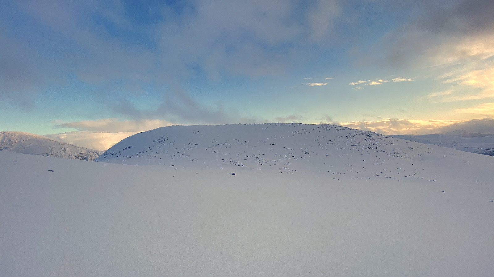
 Vi kjørte denne dagen inn til bygda Fjøra i Fjord Kommune, og tok der av fra Tafjordvegen, og tok Bygdevegen opp til Hauge [390 m.o.h.], hvor det er tilrettelagt en flott parkeringsplass. Vi kunne spenne på oss skiene allerede ved parkeringsplassen, enskjønt de måtte av igjen når vi skulle krysse veien like ovenfor parkeringsplassen. Vi krysset over et bratt jorde, og kom opp på veien igjen litt høyere oppe, hvor den ikke var brøytet, og kunne så følge denne videre oppover mot Nysætra. Vegen opp dit er en slags hårnålsvei, men det er i grunnen like greit, så blir det ikke for bratt. Andre hadde gått samme vegen både denne dagen og tidligere, så vi hadde fine spor å følge opp til sætrene.
Vi hadde ikke på forhånd helt bestemt oss for om vi skulle ta turen opp på Mefjellet >>>
Vi kjørte denne dagen inn til bygda Fjøra i Fjord Kommune, og tok der av fra Tafjordvegen, og tok Bygdevegen opp til Hauge [390 m.o.h.], hvor det er tilrettelagt en flott parkeringsplass. Vi kunne spenne på oss skiene allerede ved parkeringsplassen, enskjønt de måtte av igjen når vi skulle krysse veien like ovenfor parkeringsplassen. Vi krysset over et bratt jorde, og kom opp på veien igjen litt høyere oppe, hvor den ikke var brøytet, og kunne så følge denne videre oppover mot Nysætra. Vegen opp dit er en slags hårnålsvei, men det er i grunnen like greit, så blir det ikke for bratt. Andre hadde gått samme vegen både denne dagen og tidligere, så vi hadde fine spor å følge opp til sætrene.
Vi hadde ikke på forhånd helt bestemt oss for om vi skulle ta turen opp på Mefjellet >>>
Til Skjerdingen på truger
- Dato:
- 19.02.2022
- Turtype:
- Trugetur
- Turlengde:
- 4:21t
- Distanse:
- 10,2km
 Jeg har tidligere besøkt Skjerdingen to ganger på ski, og tre ganger til fots; og i tillegg har jeg fire ganger vært på vei opp dit på ski, men snudd underveis, enten på grunn av dårlig vær, på grunn av feil på utstyret, eller fordi føret var så isete at det var håpløst å ta seg opp det siste bratte partiet uten stegjern. Jeg hadde imidlertid aldri tatt turen på truger før nå, men en gang jeg og yngste datter forsøkte oss på turen opp dit på ski, fulgte vi mer eller mindre sporene til to damer som hadde tatt turen på truger; og de brukte ikke veldig lang tid på turen, så jeg visste at en slik tur var fullt gjennomførbar, og siden jeg denne dagen var litt usikker på føreforholdene, bestemte jeg meg for å forsøke meg på en trugetur. Jeg kjørte helt opp til vannskillet >>>
Over Skulen og fjørelangs tilbake til Flem
- Dato:
- 29.01.2022
- Turtype:
- Fjelltur
- Turlengde:
- 4:12t
- Distanse:
- 15,4km
 Jeg hadde vært på Skulen [492 m.o.h.] to ganger før, og jeg tror Dag hadde vært der tre ganger før, men ingen av oss hadde tidligere gått stien som går fjørelangs på nordsida av Flemsøya, der det ikke er noen vei; og det hadde vi lyst til å gjøre denne dagen. Vi kjørte ut til Flemsøya via Lepsøybrua og Haramsøytunnelen, parkerte rett ved informasjonsskiltet ved Skolvågen (se kart), og gikk derfra. Fra Flem fulgte vi Longvafjordvegen bare ca. 150 meter, til vi kom til en gard som kalles Knuttunet . Her tok vi til venstre, og fulgte en gårdsvei som krysset tunet, og deretter fortsatte oppover mot fjellsida ovenfor. Herfra går det så en skogsvei, som vi fulgte oppover langs sørsida av fjellryggen mellom Sakshamaren [162 m.o.h.] og Århammaren [152 m.o.h.]; til vi kom til Flemshalsen >>>
På Goaldet og Lepsøya
- Dato:
- 15.01.2022
- Turtype:
- Fjelltur
- Turlengde:
- 4:32t
- Distanse:
- 14,3km
 For bare en knapp måned siden, åpna bruene mellom Skjelten og Lepsøya (bilde #2), slik at man nå kan kjøre fergefritt over til Lepsøya, og min eldste sønn foreslo derfor at vi i løpet av vinteren kunne benytte anledningen til å gå noen fjellturer på Nordøyane . Vi hadde begge vært på Lepsøyfjellet, eller Goaldet [490 m.o.h.] tidligere, men nå hadde han lyst til å gå stien som går fjørelangs rundt på utsida av Lepsøya, dvs. hele veien rundt fra Hellevika til Rønstad. [For tidligere tur, hvor jeg sammen med min kone og vår eldste datter gikk opp fra Hellevika opp på Goaldet, se her: Til Goaldet på Lepsøya med kone og datter ]
Vi parkerte ved Sanitetshuset (Lyngstadveien 38). For å komme dit, kjører man Lepsøyveien opp til Joker-butikken, hvor man tar av og følger Lyngstadveien mot foten av fjellet, og der ligger >>>
For bare en knapp måned siden, åpna bruene mellom Skjelten og Lepsøya (bilde #2), slik at man nå kan kjøre fergefritt over til Lepsøya, og min eldste sønn foreslo derfor at vi i løpet av vinteren kunne benytte anledningen til å gå noen fjellturer på Nordøyane . Vi hadde begge vært på Lepsøyfjellet, eller Goaldet [490 m.o.h.] tidligere, men nå hadde han lyst til å gå stien som går fjørelangs rundt på utsida av Lepsøya, dvs. hele veien rundt fra Hellevika til Rønstad. [For tidligere tur, hvor jeg sammen med min kone og vår eldste datter gikk opp fra Hellevika opp på Goaldet, se her: Til Goaldet på Lepsøya med kone og datter ]
Vi parkerte ved Sanitetshuset (Lyngstadveien 38). For å komme dit, kjører man Lepsøyveien opp til Joker-butikken, hvor man tar av og følger Lyngstadveien mot foten av fjellet, og der ligger >>>
Til Syltefjellet i Valldalen
- Dato:
- 18.12.2021
- Turtype:
- Fjelltur
- Turlengde:
- 5:06t
- Distanse:
- 16,0km
 Denne turen var, i likhet med så mange andre, en tur min sønn foreslo at vi kunne ta. Han hadde gått deler av den tidligere en gang, og så hadde han tenkt ut at vi i tillegg til å gå over fjellet fra Sylte til Ytterlia, også kunne legge turen oppom toppen på Syltefjellet, også kalt Ytterlinakken. Vi kjørte inn til Valldalen, og parkerte nede ved småbåthavna, og begynte å gå derfra.
Første del av turen var langs den såkalte Olavsvegen (bilde #1). Fra Sylte, dvs. fra "Valldalen sentrum", er fjellsida såpass bratt, at det ikke går noen sti rett opp der. For å komme opp på utsiktspunktet Kamben [325 m.o.h.], eller opp på den knausen av Syltefjellet som kalles Klosterfjellet [382 m.o.h.]; går man derfor først ca. 1 km nordover langsetter Olavsvegen, før man tar av >>>
Denne turen var, i likhet med så mange andre, en tur min sønn foreslo at vi kunne ta. Han hadde gått deler av den tidligere en gang, og så hadde han tenkt ut at vi i tillegg til å gå over fjellet fra Sylte til Ytterlia, også kunne legge turen oppom toppen på Syltefjellet, også kalt Ytterlinakken. Vi kjørte inn til Valldalen, og parkerte nede ved småbåthavna, og begynte å gå derfra.
Første del av turen var langs den såkalte Olavsvegen (bilde #1). Fra Sylte, dvs. fra "Valldalen sentrum", er fjellsida såpass bratt, at det ikke går noen sti rett opp der. For å komme opp på utsiktspunktet Kamben [325 m.o.h.], eller opp på den knausen av Syltefjellet som kalles Klosterfjellet [382 m.o.h.]; går man derfor først ca. 1 km nordover langsetter Olavsvegen, før man tar av >>>
Randonee-tur til Hunden ved Lingåsen
- Dato:
- 11.12.2021
- Turtype:
- Randonnée/Telemark
- Turlengde:
- 4:24t
- Distanse:
- 10,9km
 Vi hadde lurt litt på å ta skituren opp på Berdalsnibba [1344 m.o.h.] denne dagen, men forstod egentlig allerede på vei innover mot Valldalen at vi antagelig var litt seint ute med tanke på en såpass lang tur, så vi hadde litt i tankene at vi kanskje skulle ta sikte på Hunden [943 m.o.h.] i stedet. Vi parkerte der bomvegen begynner oppe på Lingåsen, og spente på oss skiene, og så fulgte vi veien oppover mot Klovset. Det var uansett alt for mye snø til at vi kunne fortsatt med bil oppover, men det gikk helt greit å gå på ski opp disse bakkene; med unntak av et par plasser hvor det var såpass avblåst at man kunne risikere å ripe opp skia på grusen, med mindre man passet på å passere disse stedene ved å gå ute i grøfta.
Vi passerte Klovsetsetra på baksida, i skogen litt >>>
Vi hadde lurt litt på å ta skituren opp på Berdalsnibba [1344 m.o.h.] denne dagen, men forstod egentlig allerede på vei innover mot Valldalen at vi antagelig var litt seint ute med tanke på en såpass lang tur, så vi hadde litt i tankene at vi kanskje skulle ta sikte på Hunden [943 m.o.h.] i stedet. Vi parkerte der bomvegen begynner oppe på Lingåsen, og spente på oss skiene, og så fulgte vi veien oppover mot Klovset. Det var uansett alt for mye snø til at vi kunne fortsatt med bil oppover, men det gikk helt greit å gå på ski opp disse bakkene; med unntak av et par plasser hvor det var såpass avblåst at man kunne risikere å ripe opp skia på grusen, med mindre man passet på å passere disse stedene ved å gå ute i grøfta.
Vi passerte Klovsetsetra på baksida, i skogen litt >>>
