Arkiv - dato
Arkiv - aktivitet
-
Annen tur (1)
- Kajakkpadling (1)
-
Annen vintertur (4)
- Trugetur (4)
- Fottur (740)
-
Skitur (4)
- Fjellskitur (4)
-
Sykkeltur (137)
- Blandet sykling (51)
- Gatesykling (9)
Arkiv - Etter geografi
"Peakbookvenner"


Lister jeg samler etter
-
Bergen ≥ 50m pf. og ≥ 100 m.o.h.
(87/89)
 97%
97% -
Most dominating tops of the Bergen peninsula
(68/75)
90%
-
Utvalgte topper og turmål i Bergen
(316/350)
90%
-
Alle topper i Bergen
(357/398)
89%
-
Opptur Bergen
(100/113)
88%
-
De syv fjell rundt Bergen
(6/7)
85%
-
Sund ≥ 50m pf.
(14/18)
77%
-
Os ≥ 50m pf.
(25/34)
73%
-
Søyler (fastmerker) i Bergen
(68/100)
68%
-
Fjell ≥ 50m pf.
(21/32)
65%

Olsnesnipa
- Dato:
- 16.01.2016
- Turtype:
- Fjellskitur
- Turlengde:
- 4:00t
- Distanse:
- 5,8km
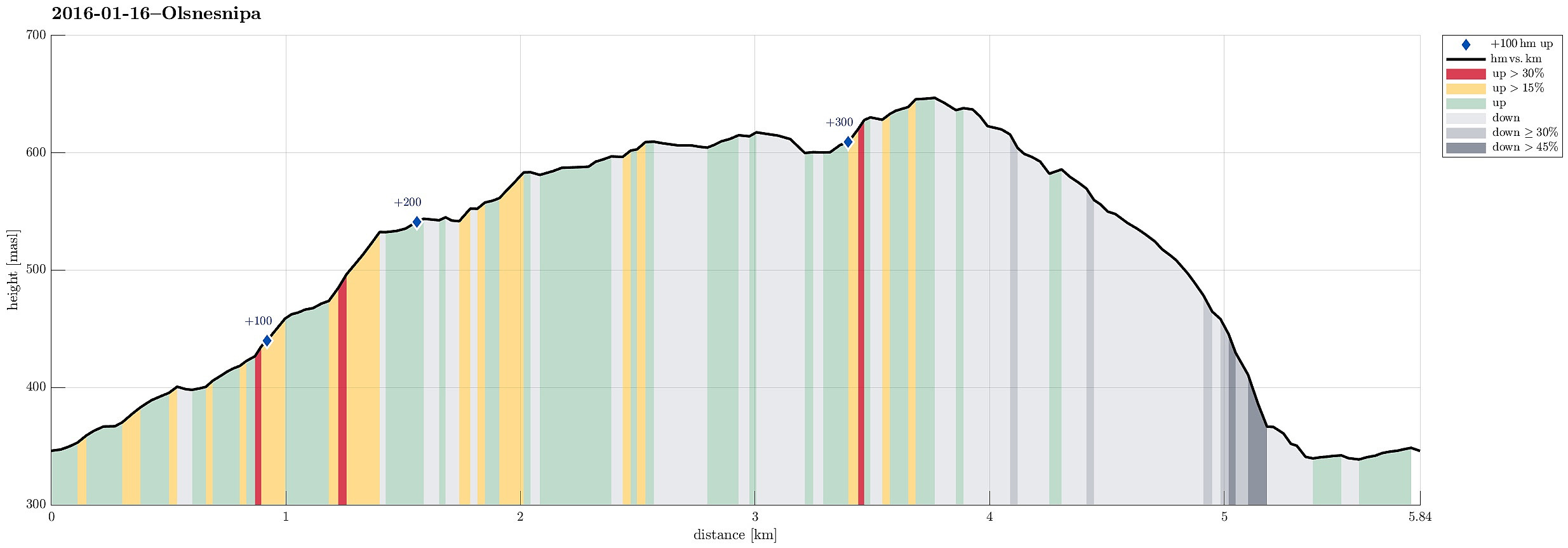 We parked at the parking on saddle Trollskaret, right about Bruvik on the southeastern "corner" of Osterøy (after crossing the bridge, you turn right right away to get to Bruvik). From the parking place, we stepped into the terrain at once, skiing into an Eastern direction, first. We ascended to Sethaugen and then continued along a gentle ridge towards Olsnesnipa. It's interesting that this is "only the other Olsnesnipa" up there, with the more prominent one being close, at "the Southern end" of the mountain range, which is most prominently marked by Rispingen in the north. This other, more prominent Olsnesnipa is also called Olsnessåta. From the one Olsnesnipa that we had come by, we continued towards Skarvenipa, first, before then turning right (bascially >>>
Kossdalen
- Dato:
- 02.01.2016
- Turtype:
- Spasertur
- Turlengde:
- 2:30t
- Distanse:
- 7,7km
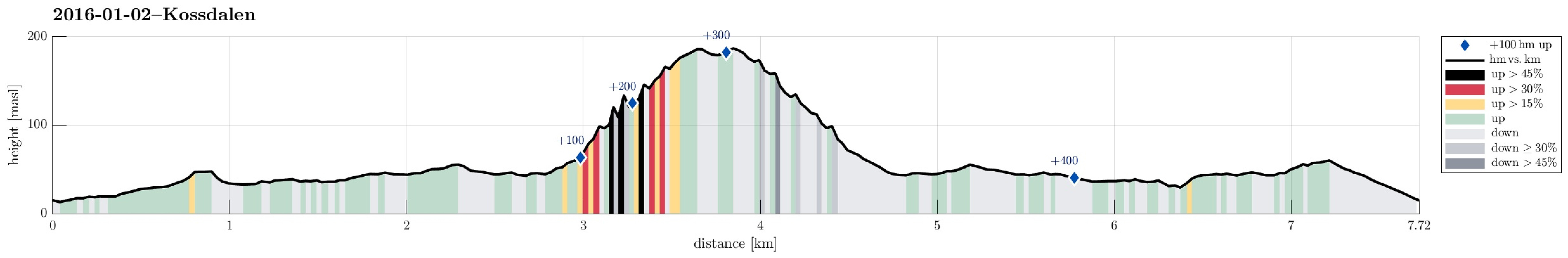 We drove to Osterøy and then on Osterøy first to Lonevåg. From there, we continued to Hosanger at Osterfjorden, on the northwestern side of Osterøy. In Hosanger, we took a sharp turn to the right, where a sign leads to the Waldorf school in Holanger. Before getting to the school, we parked right next to the graveyard. From there we walked along a simple road, first on the western side of the little stream that comes down from Holevatnet, that leads directly into Kossdalen. In Kossdalen, the path switches sides and continues further in on the eastern side of the valley, passing by Kossdalsvatnet. At the very end of Kossdalen, one finds a place called Gråura, where certainly some have enjoyed camping already---it's just a very nice place! :-) Behind Gråura, Kossdalssvingane start---an >>>
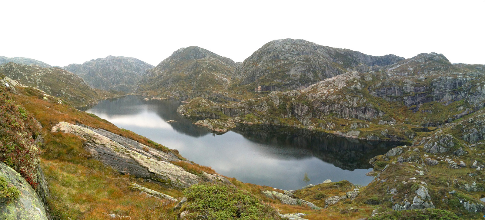
Kvigedalsegga
- Dato:
- 23.08.2015
- Turtype:
- Fjelltur
- Turlengde:
- 4:30t
- Distanse:
- 8,3km
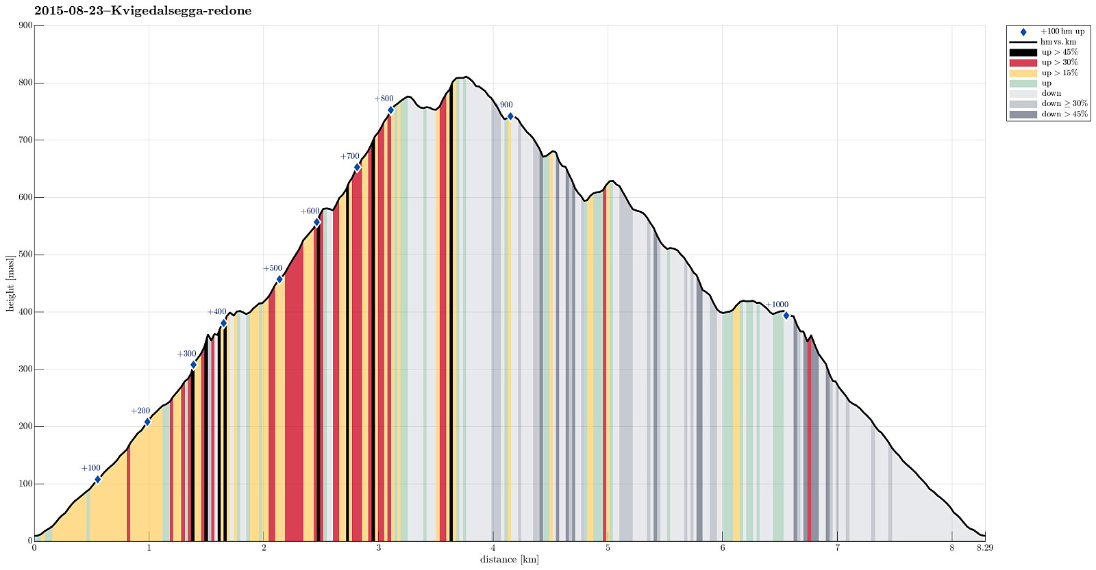 Taking E16 from Bergen into the direction of Voss, we passed by Dale and turned left in Dalseid, shortly after. We then came through five very short tunnels along the fjord, before parking next to the road, right before Tretteneset. From there, we first walked up a forest road, which quickly ascends through Dalseidmarkåna. At about 260 masl, the forest road turns left and connects to Sæterdalen, while we continued in Dalseidmarkåna, right underneath the steep and high northern cliffs of Stølsberget (while it is easy to see, where to leave the forest road, it isn't 100% easy to then find the path further upwards -- keeping as close to the cliffs and as high above the stream as possible, on the southern side of it, seems to be a good rule to find the simple path, though). At about 400 >>>
Såtefjellet
- Dato:
- 23.05.2015
- Turtype:
- Fjelltur
- Turlengde:
- 4:30t
- Distanse:
- 12,3km
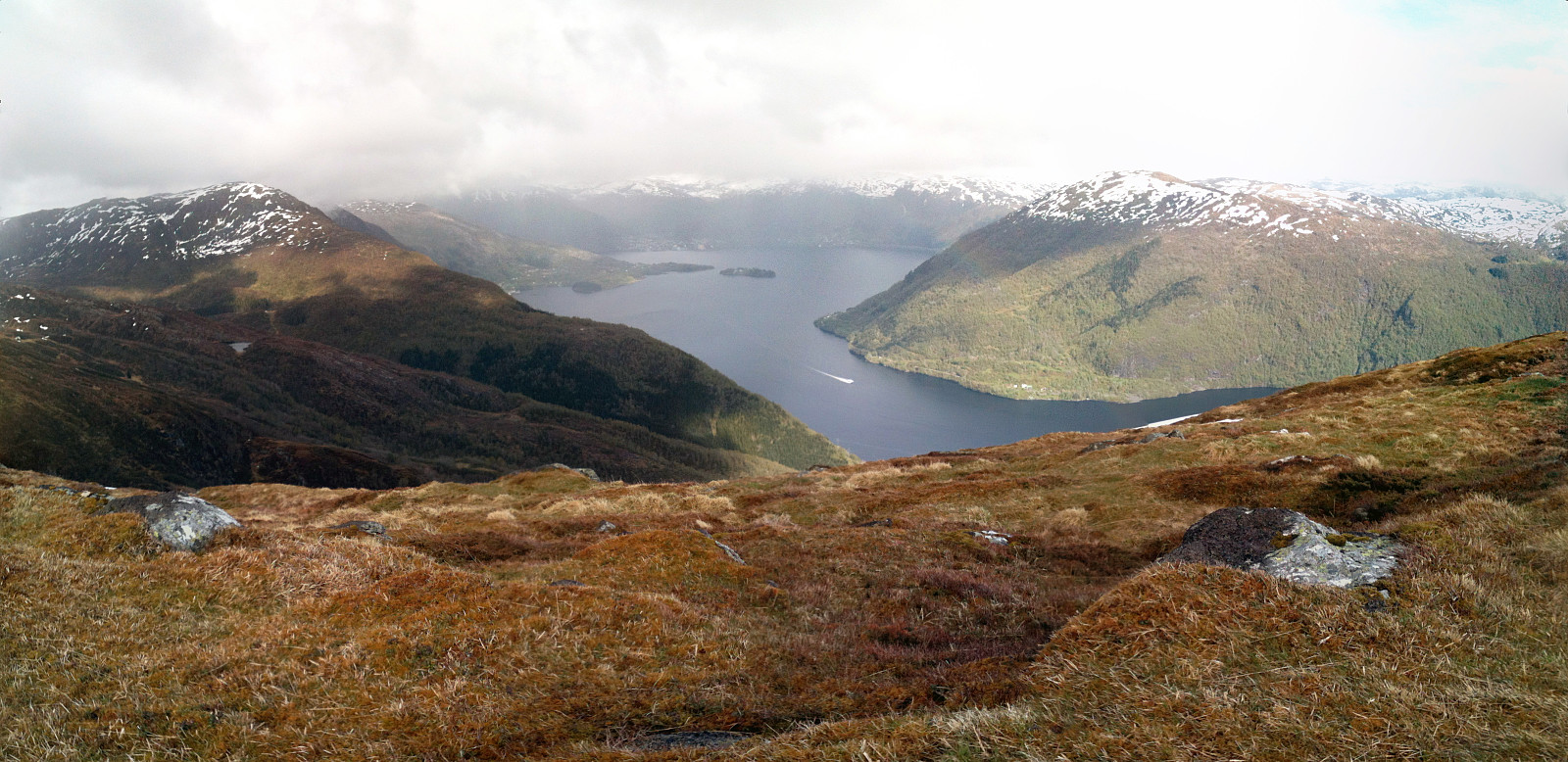 Driving to Osterøy via the impressive toll bridge was easy and quick from Bergen. Our plan was to start near Stokko and to ascend first to a forest road that goes along the fjord at some 100 meters above sea-level and which we had seen on the map in advance. Instead, we parked -- accidentally -- where the road crosses Kjindalen and ascended from there. It seemed to us that others have done that before -- at least it looked like steps in the steep terrain. The valley we ascended through is very steep and it was quite slippery due to the recent rain. When it started to open up a little (Erdalen?) and when we also had the impression that we should have reached the height of the forest road, we continued to the northeast, parallel to the fjord, to find the forest road. It turned out that >>>
Fedje
- Dato:
- 12.07.2014
- Turtype:
- Fottur
- Turlengde:
- 4:00t
- Distanse:
- 12,7km
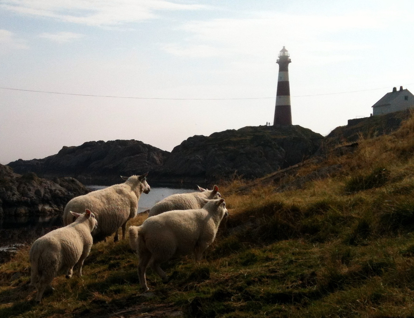 Nice summer hike around Fedje. The historic site (in the northwest of Fedje) is also quite interesting -- telling from hard times, not too long ago...
Selected photos are available as Google photo album .
Nice summer hike around Fedje. The historic site (in the northwest of Fedje) is also quite interesting -- telling from hard times, not too long ago...
Selected photos are available as Google photo album .
Hananipa
- Dato:
- 18.05.2014
- Turtype:
- Fjelltur
- Turlengde:
- 4:00t
- Distanse:
- 11,2km
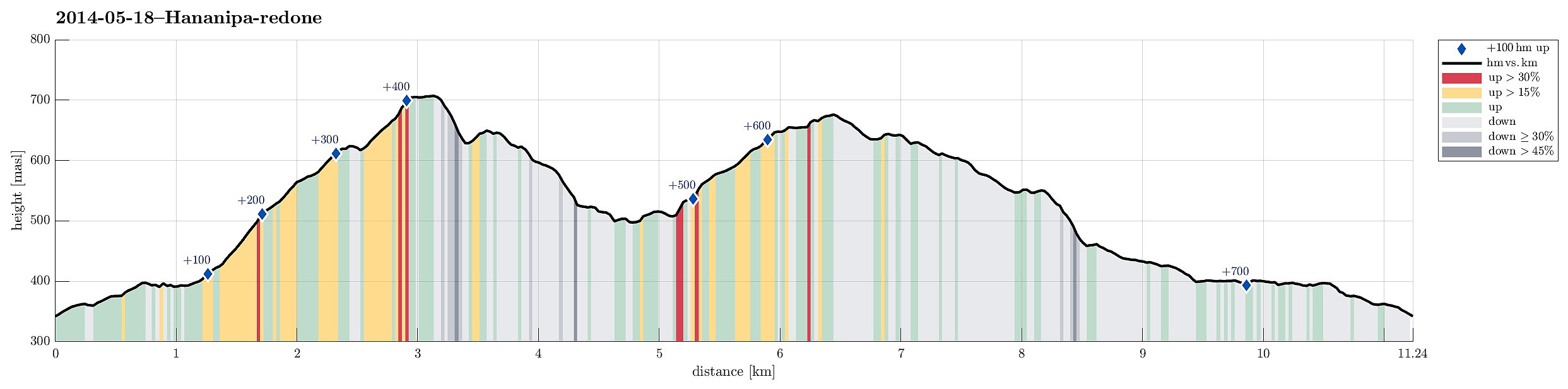 Hananipa from Skulestad (and back via Trollabotshaugen) was a nice round tour in beautiful landscape and with fantastic views over the fjord!
Web page WestCoastPeaks.com provides useful information about Hananipa, Raudnipa, Krånipa, and Raudfjell
and also Petter Bjørstad has a useful page about Hananipa .
Web page UT.no from the Norwegian Trekking Association recommends this hike up and down Hananipa (only part of our hike, though).
Hananipa from Skulestad (and back via Trollabotshaugen) was a nice round tour in beautiful landscape and with fantastic views over the fjord!
Web page WestCoastPeaks.com provides useful information about Hananipa, Raudnipa, Krånipa, and Raudfjell
and also Petter Bjørstad has a useful page about Hananipa .
Web page UT.no from the Norwegian Trekking Association recommends this hike up and down Hananipa (only part of our hike, though).
Hestafjellet
- Dato:
- 07.09.2013
- Turtype:
- Fjelltur
- Turlengde:
- 4:00t
- Distanse:
- 9,0km
 Quite a rough tour from Dalegarden (up along Brattreimelva and down to Helletræer) -- more demanding than expected, mostly because there wasn't any path when crossing the mountain.
Selected photos are available as Google photo album .
Web page WestCoastPeaks.com provides useful information about Høgenipa, Knutstignovi, Hestafjellet, Kvigedalseggi, Slåttenovi, Harafjellet, and Nipa .
Quite a rough tour from Dalegarden (up along Brattreimelva and down to Helletræer) -- more demanding than expected, mostly because there wasn't any path when crossing the mountain.
Selected photos are available as Google photo album .
Web page WestCoastPeaks.com provides useful information about Høgenipa, Knutstignovi, Hestafjellet, Kvigedalseggi, Slåttenovi, Harafjellet, and Nipa .
Bruviknipa
- Dato:
- 21.05.2009
- Turtype:
- Fjelltur
- Turlengde:
- 4:00t
- Distanse:
- 8,5km
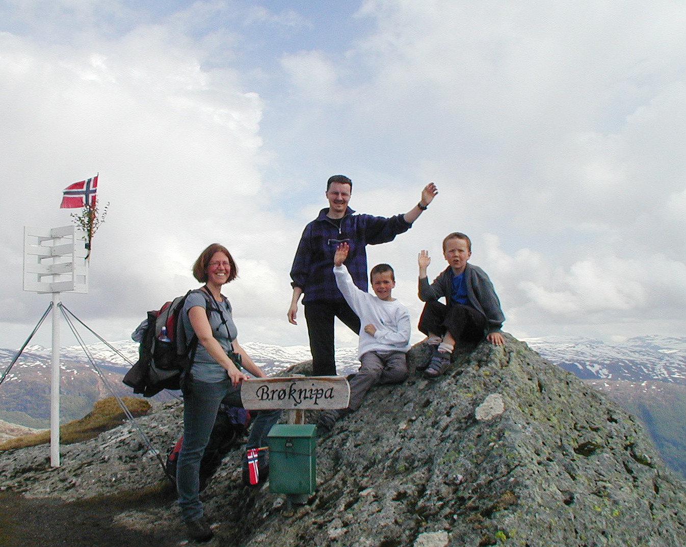 Very nice hike up and down Brøknipa.
Eldsfjellet
- Dato:
- 19.01.2008
- Turtype:
- Fjelltur
- Turlengde:
- 2:00t
- Distanse:
- 3,2km
 Impressive hike (with an intense hail storm!) up and down Eldsfjellet
