Arkiv - dato
Arkiv - aktivitet
-
Annen tur (1)
- Kajakkpadling (1)
-
Annen vintertur (4)
- Trugetur (4)
- Fottur (740)
-
Skitur (4)
- Fjellskitur (4)
-
Sykkeltur (137)
- Blandet sykling (51)
- Gatesykling (9)
Arkiv - Etter geografi
"Peakbookvenner"


Lister jeg samler etter
-
Bergen ≥ 50m pf. og ≥ 100 m.o.h.
(87/89)
 97%
97% -
Most dominating tops of the Bergen peninsula
(68/75)
90%
-
Utvalgte topper og turmål i Bergen
(316/350)
90%
-
Alle topper i Bergen
(357/398)
89%
-
Opptur Bergen
(100/113)
88%
-
De syv fjell rundt Bergen
(6/7)
85%
-
Sund ≥ 50m pf.
(14/18)
77%
-
Os ≥ 50m pf.
(25/34)
73%
-
Søyler (fastmerker) i Bergen
(68/100)
68%
-
Fjell ≥ 50m pf.
(21/32)
65%

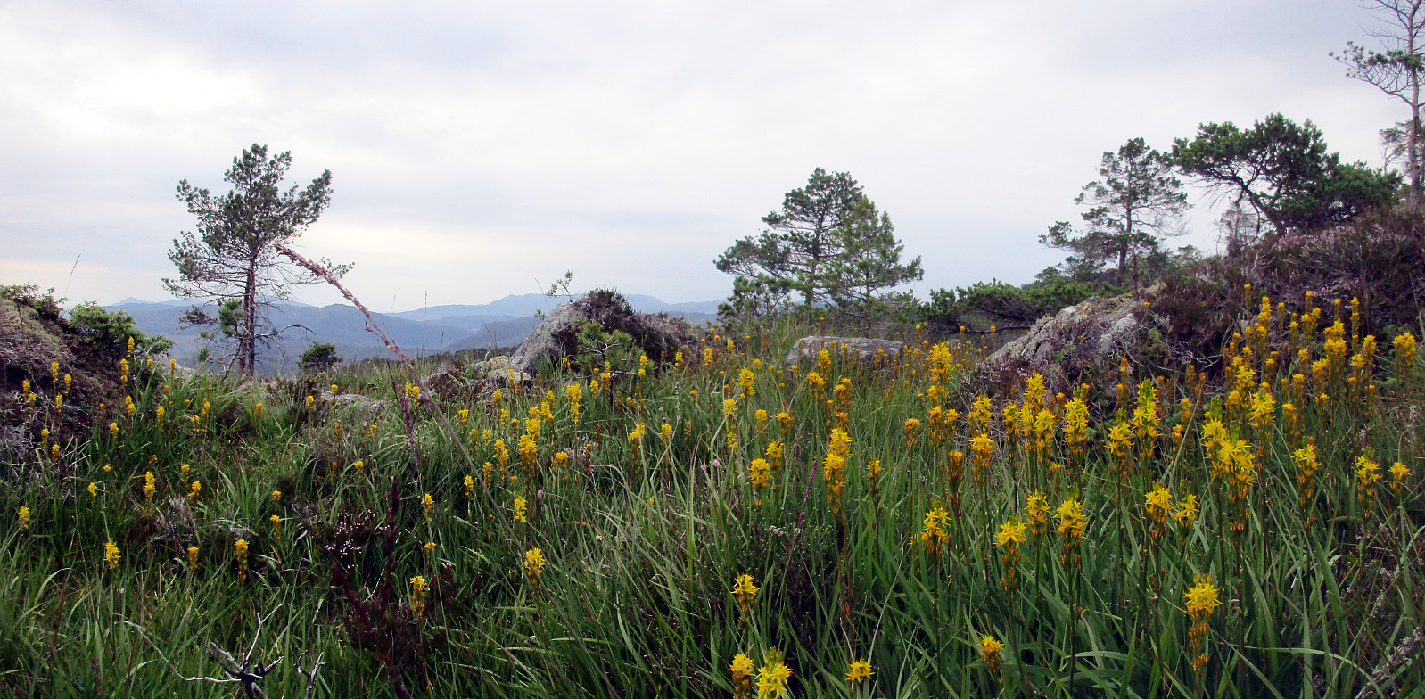
Skogafjellet
- Dato:
- 04.12.2016
- Turtype:
- Fjelltur
- Turlengde:
- 1:30t
- Distanse:
- 3,4km
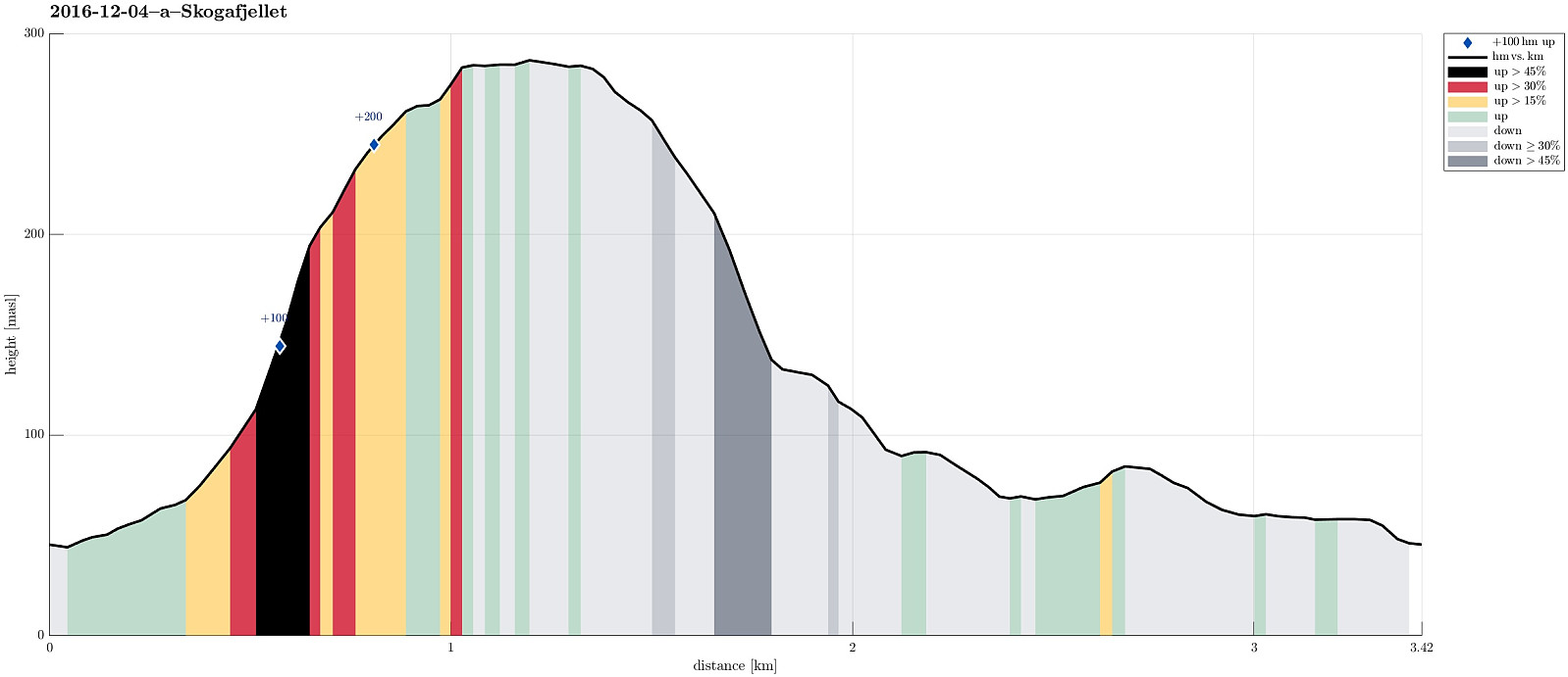 I took E39 southwards from Bergen, driving towards Os. Before coming to Ulven, near Os, I passed by Skogavika (a part of Hetleflotvatnet), lying right next to the road on the eastside. At about N60.2144, E5.4432, I left E39, turning to the right (westwards). Only few meters up this small road, I parked and started walking. I first followed a small, paved road in southern direction (in parallel to E39), which soon turned upwards and westwards (away from E39). Turning left, again, I ended up on a simple gravel road that didn't really seem to lead very far. Instead, I left this road, crossed a few meters of grass and some water, finding an old and overgrown forrest road, leading upwards (steeply) and, first, in southwestern direction (towards Skogafjellet), before soon chaning into a southern >>>
Tveitakvitingen from Tveita
- Dato:
- 09.10.2016
- Turtype:
- Fjelltur
- Turlengde:
- 7:00t
- Distanse:
- 16,4km
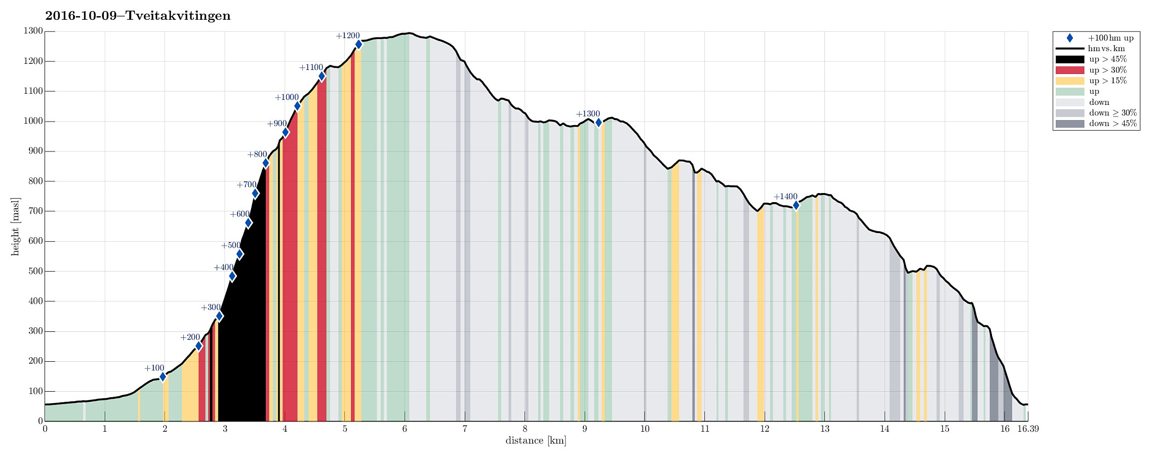 We took E16 from Bergen to Trengereid, then following road number 7 to Samnanger, before changing over to road number 48 right after Hagaåstunnelen. We passed through Eikelandsosen and continued to Holdhus, where we changed to a small road, which would lead us into the Tveita valley. Once there, we continued almost all the way in and parked near Bratthus, close to Indre Tveita. From there, we walked the rest of the road into the end of this nice valley, passing the last farm at Brekka soon after. The way continues into Tveitaskaret, where it becomes steep very soon (but easy to hike---mostly, because a gravel road has been constructed---probably to help maintaining a small power station that was opened in Tveitaskaret in 2009). At the end of the gravel road, one can further ascend through >>>
Gåssand
- Dato:
- 27.08.2016
- Turtype:
- Fjelltur
- Turlengde:
- 1:30t
- Distanse:
- 3,7km
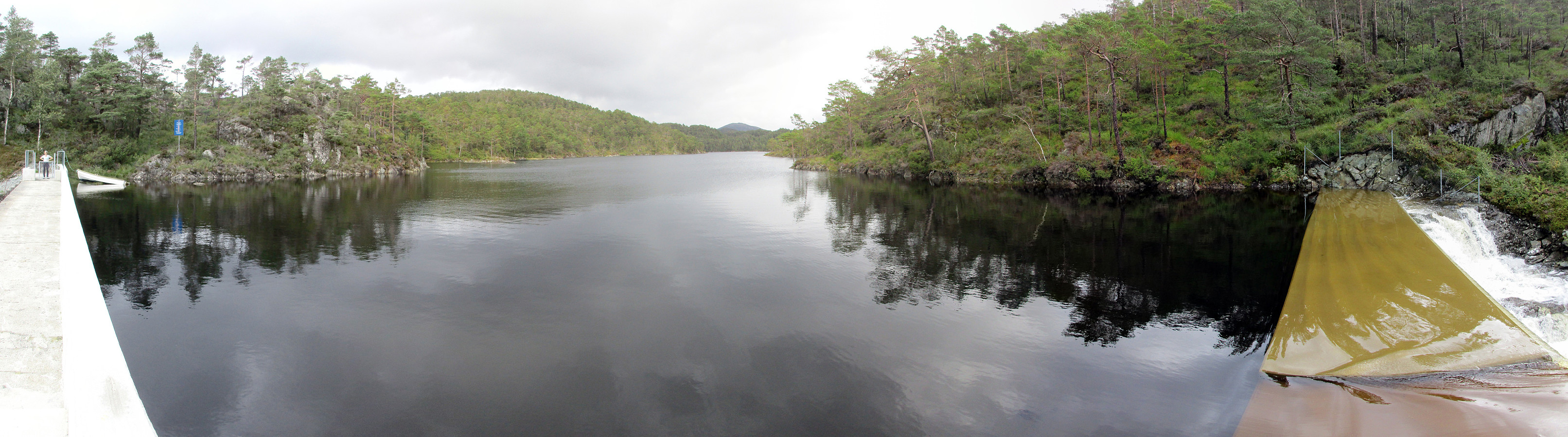 We used E39 towards Os from Bergen, taking a small road, Gåssandvegen, to the left, right before Søfteland. We then followed this narrow road to Hatlelia, where the road is taking a sharp turn to the right, crossing Nordelva there and then leading back to a farm that lies near Gåssandvatnet (where Sagelva comes down). We parked near to the lake and started to hike from there, following a forrest road that parallels Sagelva. After only a few steps, this forrest road passes Os El-verk, before it becomes a litte more steep. Eventually, we came over a small saddle with Krokvatnet right beneath us. We followed the pretty new road down to the dam, which holds back Krokvatnet, just to learn that there was no way to cross over the dam as we had planned. The southeastern side of this dam is >>>
Liafjellet from Moberg
- Dato:
- 14.08.2016
- Turtype:
- Fjelltur
- Turlengde:
- 2:00t
- Distanse:
- 4,9km
 South of Bergen, we crossed Ulvenvatnet near Os on the E39 and drove off it near Os Brannstasjonen in Moberg, right after coming through Liafjellstunnelen. We parked right next to the firestation and started to walk from there. Due to some construction work there, we could not use Halhjemsvegen, where it meets Mobergsbakken. Following a substitution path (leaving Mobergsbakken between Halhjemsvegen and Olavegen), we surrounded the construction site and connected to Liafjellstunnelen. When coming there, right in the beginning of this hike, we did not understand that crossing the E39 first on the lower gravel road (and turning left doing so) leads one to another forrest road that brings one back to the top of Liafjellstunnelen. We therefore ascended Liafjellstunnelen directly, connecting >>>
Sveningen from Hausdalen
- Dato:
- 12.06.2016
- Turtype:
- Fjelltur
- Turlengde:
- 6:30t
- Distanse:
- 13,5km
 This time, we had two cars, so we parked one at the very end of Hausdalen (where Brekkedalen starts). We then took the other car to get to our starting point, a little further out Hausdalen (near Samdalsvatnet, Tømmervika, Straumsrinden, Hausdalsvegen 425---about 3.4 km away from the parking at the very end of Hausdalen). This start point for the hike is not 100% obvious and one needs to know, where to leave the street in Hausdalen. One then drives just a few meters up a gravel road, before there is space for two or three cars on the left side. From there, we followed the forrest road, first over Straumsrinden (passing by Samdalsvatnet). On its southern / southwestern end, one uses two bridges to get over the stream that continues further out Hausdalen. Only shortly after, one crosses >>>
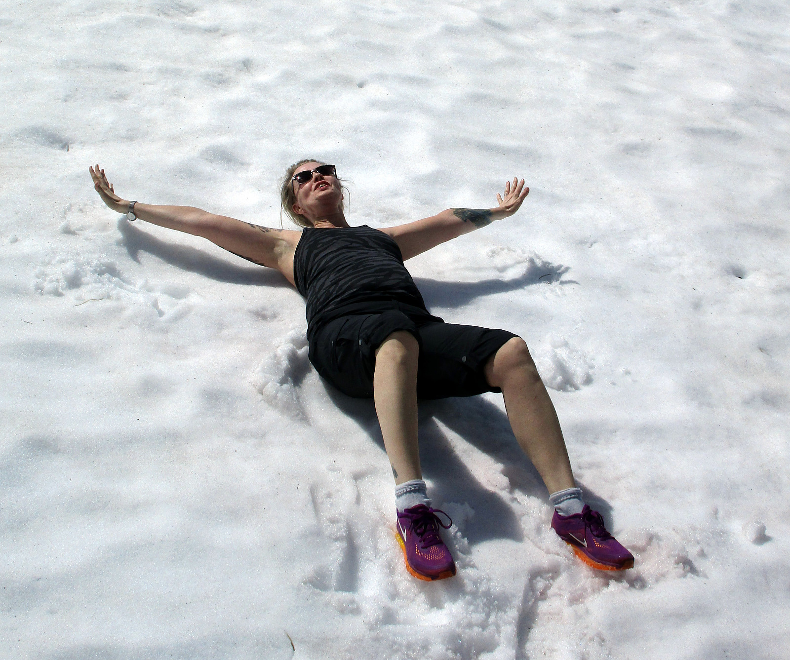
Møsnuken
- Dato:
- 17.04.2016
- Turtype:
- Fjelltur
- Turlengde:
- 5:00t
- Distanse:
- 11,8km
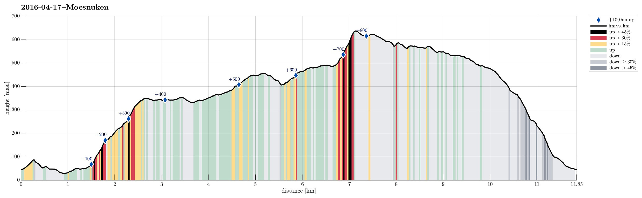 We took road E39 southwards from Bergen, passing by Kalandsvatnet and driving all the way to Ulven (near Os), where we turned left (right next to a gas station), finding the small road connecting to Tyssdal. On the other side of Oselva, near the point, where Tyssdalselva is coming down from Møsnuken, we found a parking place and started to hike from there. Since we wished to start with Borgafjellet, this time, we first tried to connect to the gravel road that connects Tyssdal with Os (right next to Oselva, on its eastern side). We could have done this "the easy way" :-) -- instead, we walked up to the houses on the hillside south of Tyssdal. Up there, we understood that we were too high and descended the few meters down to the gravel road through the forest. Following the gravel >>>
Lyshornet
- Dato:
- 26.09.2015
- Turtype:
- Fjelltur
- Turlengde:
- 2:00t
- Distanse:
- 8,9km
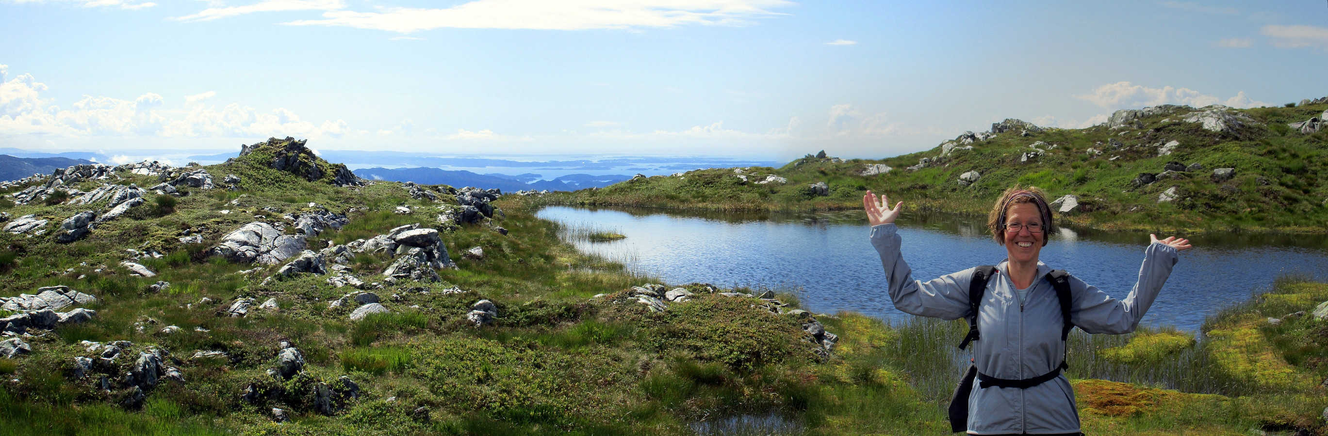
 We parked right next to Pøyla/Kalvatræ and followed the gravel road that leads up to Svartavatnet/Ulvvatnet, first. That's an easy walk and one passes a point, maybe 200m before getting to the dam, where one can enjoy a really nice view over Lysefjorden! Once at the dam, one could continue on a smaller path (on the western side of Svartavatnet/Ulvvatnet), but we turned around and followed the gravel road that we had walked up, first. About half way back, right underneath Geithaugen in the west, and at about 145mosl, a nice path towards Lysehornet leaves (to the east). We followed this path (via Grønhovda) to Lysehornet and enjoyed the great views that one has from there. From Lysehornet, we descended via the other path, which leads (via Lyshornskaret) to the ruins of Lyseklosteret. >>>
Fusafjellet
- Dato:
- 30.08.2015
- Turtype:
- Fjelltur
- Turlengde:
- 6:30t
- Distanse:
- 17,4km
 We took the ferry from Hattvik to Venjaneset and continued -- only a little less than 3km -- to Fusa. We parked the car right next to the street, where it crosses Sagelva and where a sign points towards the old postal path (gamle postveien) -- not at the least as also recommended by the page about Storehorga and Langenuen on WestCoastPeaks.com . We first went up a simple street called Øpstad (on the eastern side of Sagelva), which connects directly to a useful forest road, leading up the valley. At about 125mosl, we came to a road fork, continuing on the left, further up. At about 300mosl, another trail fork opens up for different alternatives -- we turned left, again, following the most direct route up to Fusafjellet (from there). Ascending a little further from there, we left the tree line below us and started to enjoy the many nice views that >>>
Raudlifjellet
- Dato:
- 22.08.2015
- Turtype:
- Fjelltur
- Turlengde:
- 1:30t
- Distanse:
- 4,6km
 A few hundred meters south of the gas station in Søfteland (along the E39), a narrow bridge leads over to Tømmernes. Behind there, right before crossing the little stream, which comes down there to enter Røkenesvatnet, we parked the car and walked into Botnabekken. We first tried to find a forest road on the northern side of the stream, but this was mostly forest terrain -- very wet, actually! About 100 height meters up in Tømmernesdalen, we crossed the stream, again, and continued -- steeply! -- towards the east (and up Raudlifjellet). This ascent was mostly without any path (at least not any visible path) -- still, this worked pretty nicely and we quickly arrived on a nice long ridge that would bring us to the top. Up on Raudlifjellet, we connected to the path that we had walked before (in 2014) and returned on it back to >>>
Sveningen from Midseterfjellet
- Dato:
- 02.08.2015
- Turtype:
- Fjelltur
- Turlengde:
- 6:15t
- Distanse:
- 20,1km
 We parked our car at the end of Øvredalsvatnet (in Øvredalen) and walked back (southwards) along the lake to get to our starting point for the hike over the ridge (in Løyningdalen, right south of where Øvredalesvatnet "ends"). We then walked up the narrow road, which leads up to Midsætret, where a small number of houses assemble. From there, we first followed (for a short stretch, only) a forrest road, which leads mostly westwards, before then taking the hiking path that leads up to Midseterfjellet. First, we hiked in the forrest, but as soon as we left the trees behind, nice views opened, first mostly in western direction. The approximately 15 degrees Celsius were comfortable hiking weather -- in the beginning, however, it rained freshly melted snow, which brought the thought >>>
