Arkiv - dato
Arkiv - aktivitet
-
Annen tur (1)
- Kajakkpadling (1)
-
Annen vintertur (4)
- Trugetur (4)
- Fottur (732)
-
Skitur (4)
- Fjellskitur (4)
-
Sykkeltur (120)
- Blandet sykling (38)
- Gatesykling (5)
Arkiv - Etter geografi
"Peakbookvenner"
Lister jeg samler etter
Jordalsnuten from Jordalen
- Dato:
- 25.08.2018
- Turtype:
- Fjelltur
- Turlengde:
- 3:30t
- Distanse:
- 5,8km
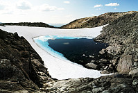
 We took road E16 into direction of Gudvangen first and turned to the left (towards Jordalen) after descending into Nærøydalen below Stalheim. We then drove through the new tunnel (now on the eastern side of the valley) up to Jordalen. After leaving the tunnel, we crossed one bridge immediately, before parking the car just ahead of the next bridge. From there we hiked, first over the bridge to the other side of Jordalselvi (to its eastern side), then southwards along the steep eastern side of the valley (into the direction of Jordalsnuten), following a proper path (note that the trail head is not really easy to see; we needed a bit of searching until we found it). It's interesting, also, that the path leads first (more or less) horizontally (with quite a bit of up and down, though) out >>>
Grindaflethytta
- Dato:
- 23.07.2014
- Turtype:
- Fottur
- Turlengde:
- 15:00t
- Distanse:
- 43,7km
 Two days tour from Ljosanbotn (arrival with the train from Bergen) -- first day to Grindflethytta (via a really well marked trail, including three summer bridges); then, next day, first along the marked trail towards Fyre (up to the pass near Stangahøgdi, where the trail starts to descend into Øvsthusdalen), before then following the ridge up to Kaldanuten (no trail along this part) and then down (via Bjørndalsvatnet) into Bjørndalen and out to Brandset. An intense hike, alltogether: about 42km and about 15h out in the beautiful nature.
Selected photos are available as Google photo album .
Vidasethovden
- Dato:
- 14.07.2012
- Turtype:
- Fjelltur
- Turlengde:
- 4:00t
- Distanse:
- 9,3km
 Very nice hike up and down Vidasethovden.
Selected photos are available as G+ photo album .
Rimstigen
- Dato:
- 12.07.2012
- Turtype:
- Fjelltur
- Turlengde:
- 3:00t
- Distanse:
- 9,2km
 Wonderful hike up and down Rimstigen!
Selected photos are available as G+ photo album .


