Arkiv - dato
Arkiv - aktivitet
-
Annen tur (1)
- Kajakkpadling (1)
-
Annen vintertur (4)
- Trugetur (4)
- Fottur (718)
-
Skitur (3)
- Fjellskitur (3)
-
Sykkeltur (120)
- Blandet sykling (38)
- Gatesykling (5)
Arkiv - Etter geografi
"Peakbookvenner"
Lister jeg samler etter
Rotterdam cycling round
- Dato:
- 21.04.2018
- Turtype:
- Sykkeltur
- Turlengde:
- 1:30t
- Distanse:
- 25,7km
 We started to cycle from the Cool district in Rotterdam, going north and northeast first. Coming through lakes Bergse Achterplas and Bergse Voorplas, we turned right and continued towards the river Rotte. After first following the river for a short distance (in northeastern direction), we crossed over and continued towards the northeastern end of Kralingse Plas. When "touching" the Kralingse Bos, the park around Kralingse Plas, we turned left (into eastern direction) and headed for the Alexander part of Rotterdam. After passing through Prinsenpark, we continued in southeastern direction towards the river Hollandsche IJssel. Instead of crossing over the large Algerabrug, we started our return-trip to the center of Rotterdam (mostly in western direction), following the IJssel river >>>
Cycle round from Rotterdam, including park Bergse Bos
- Dato:
- 14.04.2018
- Turtype:
- Sykkeltur
- Turlengde:
- 2:00t
- Distanse:
- 29,1km
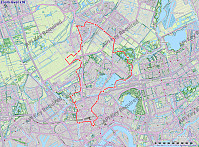 We started to cycle from the Cool district in Rotterdam, heading for the nice biking paths along the Rotte river (i.e., towards the northeast). After passing by the lake Bergse Voorplas and Prinsenmolen, we continued on the northwestern side of river Rotte (in northeastern direction) in order to get to the park Bergse Bos. Cycling through the park, we got to know it a little. We then continued to Bergschenhoek first (in northern direction), before crossing over (then in northwestern direction) to Berkel en Rodenrijs. Crossing through the settlement, we met the train line at station Berkel-Westpolder. From there, we turned back, i.e., continued in southern direction, towards Rotterdam. Close to the airport of Rotterdam, however, we included a small detour across the fields north of the >>>
Cycling to, in, and from De Biesbosch
- Dato:
- 07.04.2018
- Turtype:
- Sykkeltur
- Turlengde:
- 4:00t
- Distanse:
- 45,0km
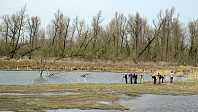 After taking the river boat (Waterbus) from Rotterdam to Dordrecht, we cycled (more or less) directly to Kop van Het Land, where we (after a short break) took the ferry over the river Nieuwe Merwede to the national park Biesbosch (the Brabant part of it). Once on the other side, we first took a turn to the left (north) in order to do a clockwise entry arch into the heart of the national park. Our plan was then to cycle longer through the national park and then take another ferry (over the river Amer) to Lage Zwaluwe. When arriving at the very southwestern end of the national park, however, we had to learn that the ferry was not yet put in service for this summer and we had to change our plans. We thus cycled back along the river Nieuwe Merwede and took the ferry to Kop van Het Land, from >>>
From Rotterdam to Kinderdijk, and back
- Dato:
- 06.04.2018
- Turtype:
- Sykkeltur
- Turlengde:
- 3:00t
- Distanse:
- 41,8km
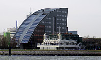 We took the bikes from Rotterdam downtown and headed first east, then southeast, to get to Kinderdijk, a cultural heritage site (with quite a few traditional windmills). To get back, we changed to the other side of the Noord (and with that to the southern side of the Nieuwe Maas), where we then headed back to Rotterdam. All in all, a very enjoyable bike trip!
Selected photos are available as Google photo album .
See also the related FB-page Hiking around Bergen, Norway .
The World Heritage Site Kinderdijk has, of course, it's own home page .
Exploring the dunes north of Den Haag
- Dato:
- 01.04.2018
- Turtype:
- Sykkeltur
- Turlengde:
- 4:00t
- Distanse:
- 38,5km
 We rented bikes from the train station Den Haag HS and biked first through the nice park Haagsche Bosch. We then cycled around the large park of Clingendael, before we entered the dunes in the north of Den Haad near the International Courthouse. We then enjoyed biking northwards (and "around"), getting to the very nice museum Voorlinden. After visiting the museum, we decided to have more of the dunes, before returning our bikes and taking the train home. Really a nice day!
Selected photos are available as Google photo album .
See also the related FB-page Hiking around Bergen, Norway .
Museum Voorlinden has, of course, it's own home page .
Short excursion into Kanadaskogen (from Fyllingsdalen)
- Dato:
- 28.02.2018
- Turtype:
- Fjelltur
- Turlengde:
- 1:00t
- Distanse:
- 2,2km
 Quick winter excursion into Kanadaskogen from Fyllingsdalen. Since the weather was beautiful and the snow invited for an excursion (and there was a bit of time), I used the opportunity to do a quick excursion into the vicinity of Nipetjørna. Up and down in short time, but greatly enjoyed! :-)
Selected photos are available as Google photo album .
See also the related FB-page Hiking around Bergen, Norway .
Snow-covered Liatårnet (via an unusual route)
- Dato:
- 25.02.2018
- Turtype:
- Fjelltur
- Turlengde:
- 2:00t
- Distanse:
- 9,2km
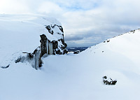 Very nice hike over snow-covered Liatårnet! We started from the west, followed the road (towards the shooting range), before we then entered one of the main hiking paths to Liatårnet (the main route up from the west). But instead of following this path all the way up, we took a turn to the right (southeast) shortly before reaching the main west-face of Liatårnet (at about 200mosl) and connected to another, not so major path, which leads up to Liatårnet from the south. We then connected to Pyttane, walking through a lovely winter landscape, passing by Tårnavatnet. Instead of then following the main road up/down Pyttane, we continued "along the ridge towards the north" (without a path). One has to look a little, where to go, but it's quite possible (especially with enough >>>
Middendelfland
- Dato:
- 12.02.2018
- Turtype:
- Gatesykling
- Turlengde:
- 4:00t
- Distanse:
- 43,4km
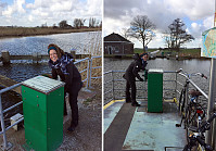 We started from nearby the main train station in Rotterdam, where we rented a bike. We then headed into northwestern direction in order to get outside of the city. We passed by Vroesenpark and continued further towards the airport of Rotterdam. We crossed through the Park de Buitenplaats and passed by the airport on its southwestern side. Once we arrived at Doenkade, we used the bridge to get over both the highway A13 and the canal Delftsche Schie. On the other (western) side, we got down from the bridge, then following the canal Delftsche Schie northwards in its western side. Near Kandelaar we turned towards the west, heading into Middendelfland. We then surrounded the more urban area in its north, following some very nice little roads through a nice rural area. Shortly, after crossing >>>
Eikelifjellet
- Dato:
- 05.01.2018
- Turtype:
- Fjelltur
- Turlengde:
- 2:00t
- Distanse:
- 2,5km
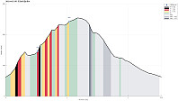 We started from the parking place at the end of Spelhaugen (near the Kindergarden) and took the clearly less used path into northern direction (a bit to the right from the main track up to Tennebekktjørna, also called Mørkebotn). After a short while, the hiking path then leaves the valley towards the right and (steeply) upwards. Before getting to the wet flat spot there, we first explored a little top south of it (mostly to check out the view over Spelhaugen). We then turned around, again into northern direction, got down to the wet flat, crossed it, and started our ascent to Eikelifjellet (this all isn't much of a hike, but it's very nice to go there, not at the least because Eikelifellet really is very steep at this side and one follows a little path up right next to impressive cliff >>>
Løvstakken from Fjøsanger
- Dato:
- 26.12.2017
- Turtype:
- Fjelltur
- Turlengde:
- 2:30t
- Distanse:
- 5,9km
 We parked near the supermarket at Fjøsanger and walked first a bit up towards the farm Fjøsanger. Before getting there, we connected to a gravel path that runs mostly parallel to the mountain and walked along this one until the forest starts to open up on the left side. At the very edge of the forest, another path then continues steeply upwards and we used this to get "to the next level" (the still relatively new path which maybe later will be connected with the new Løvstien all around Løvstakken's eastern side). We then walked this path to its current end (there is a little hut for having a break). From there, we then continued through the forest, again, getting up to Mindebakken (a little hill, northeast of Gullsteinen). Since Mindebakken is comparably steep on its western >>>


