Arkiv - dato
Arkiv - aktivitet
-
Annen tur (1)
- Kajakkpadling (1)
-
Annen vintertur (4)
- Trugetur (4)
- Fottur (740)
-
Skitur (4)
- Fjellskitur (4)
-
Sykkeltur (137)
- Blandet sykling (51)
- Gatesykling (9)
Arkiv - Etter geografi
"Peakbookvenner"


Lister jeg samler etter
-
Bergen ≥ 50m pf. og ≥ 100 m.o.h.
(87/89)
 97%
97% -
Most dominating tops of the Bergen peninsula
(68/75)
90%
-
Utvalgte topper og turmål i Bergen
(316/350)
90%
-
Alle topper i Bergen
(357/398)
89%
-
Opptur Bergen
(100/113)
88%
-
De syv fjell rundt Bergen
(6/7)
85%
-
Sund ≥ 50m pf.
(14/18)
77%
-
Os ≥ 50m pf.
(25/34)
73%
-
Søyler (fastmerker) i Bergen
(68/100)
68%
-
Fjell ≥ 50m pf.
(21/32)
65%

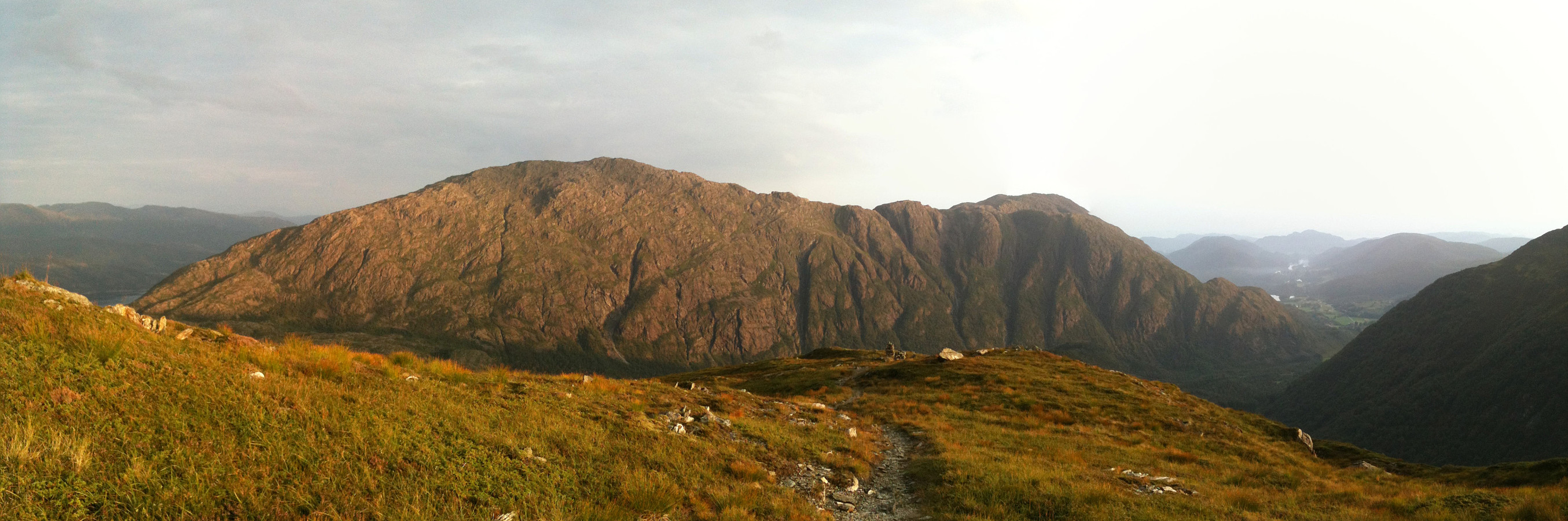
Lyderhorn
- Dato:
- 16.04.2014
- Turtype:
- Fjelltur
- Turlengde:
- 3:00t
- Distanse:
- 5,2km
 One of the many trip to Lyderhorn -- this time starting from Kjøkkelvik school, up a steep path to Lyderhorn, and then down to Kjøkkelvik -- very nice! :-)
Web page WestCoastPeaks.com provides useful information about Lyderhorn and Ørnafjellet
and also Petter Bjørstad has a page about Lyderhorn .
One of the many trip to Lyderhorn -- this time starting from Kjøkkelvik school, up a steep path to Lyderhorn, and then down to Kjøkkelvik -- very nice! :-)
Web page WestCoastPeaks.com provides useful information about Lyderhorn and Ørnafjellet
and also Petter Bjørstad has a page about Lyderhorn .
Gullsteinen
- Dato:
- 09.02.2014
- Turtype:
- Fjelltur
- Turlengde:
- 3:00t
- Distanse:
- 12,1km
 Gullsteinen is actually a nice alternative (or addition) to Løvstakken! :-)
Blåmanen
- Dato:
- 08.02.2014
- Turtype:
- Fjelltur
- Turlengde:
- 3:00t
- Distanse:
- 11,5km
 Blåmannen from the back side (first along Svartediket, then Tarlebøveien up until the path leaves to the left and up towards Blåmannen) -- a nice hike! :-)
Selected photos are available as Google photo album .
Blåmannen from the back side (first along Svartediket, then Tarlebøveien up until the path leaves to the left and up towards Blåmannen) -- a nice hike! :-)
Selected photos are available as Google photo album .
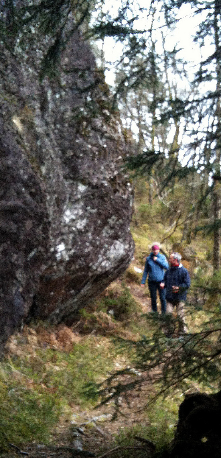
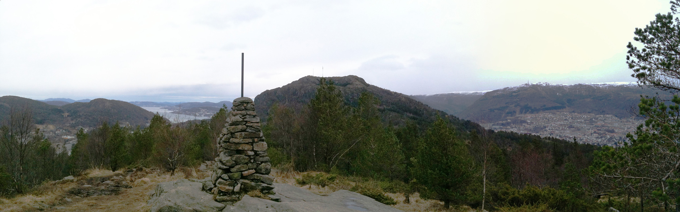
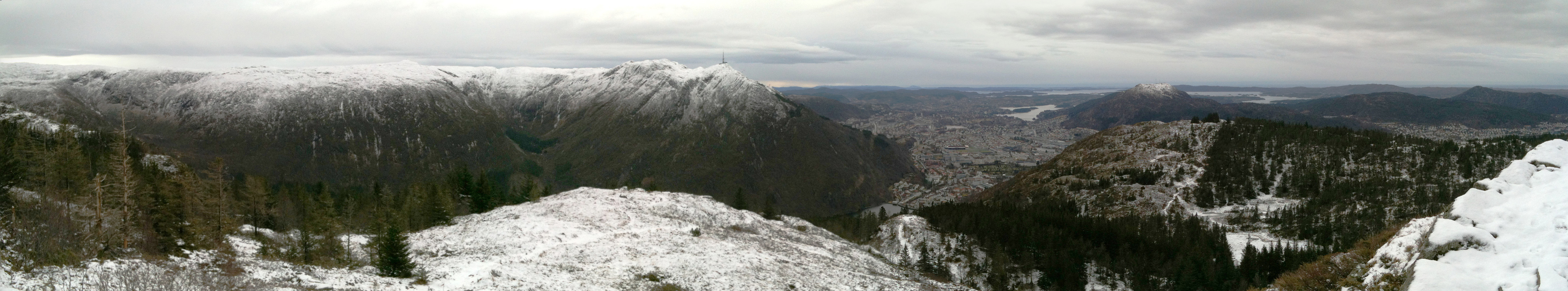
Hamrefjellet
- Dato:
- 01.01.2014
- Turtype:
- Fjelltur
- Turlengde:
- 2:00t
- Distanse:
- 8,2km
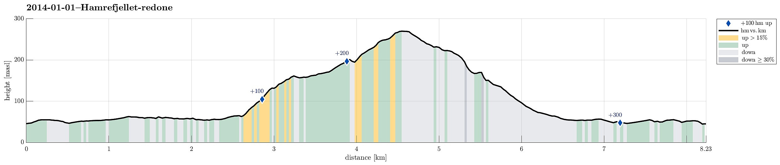 From Fana up to Hamrefjellet and back via Titlestad.
Web page WestCoastPeaks.com provides useful information about Hamrefjellet
and also Petter Bjørstad has a useful page about Hamrefjellet .
From Fana up to Hamrefjellet and back via Titlestad.
Web page WestCoastPeaks.com provides useful information about Hamrefjellet
and also Petter Bjørstad has a useful page about Hamrefjellet .
Løvstakken
- Dato:
- 07.12.2013
- Turtype:
- Fjelltur
 Løvstakken in winter (from parking place above Litlavatnet) is also very nice! :-)
Web page WestCoastPeaks.com provides useful information about Løvstakken .
Løvstakken in winter (from parking place above Litlavatnet) is also very nice! :-)
Web page WestCoastPeaks.com provides useful information about Løvstakken .
Ulriken
- Dato:
- 24.11.2013
- Turtype:
- Fjelltur
 Ulriken -- also nice in winter! :-)
Web page WestCoastPeaks.com provides useful information about Haugavarden, Ulriken, Storfjellet, and Landåsfjellet
and also Petter Bjørstad has a useful page about Ulriken .
Ulriken -- also nice in winter! :-)
Web page WestCoastPeaks.com provides useful information about Haugavarden, Ulriken, Storfjellet, and Landåsfjellet
and also Petter Bjørstad has a useful page about Ulriken .
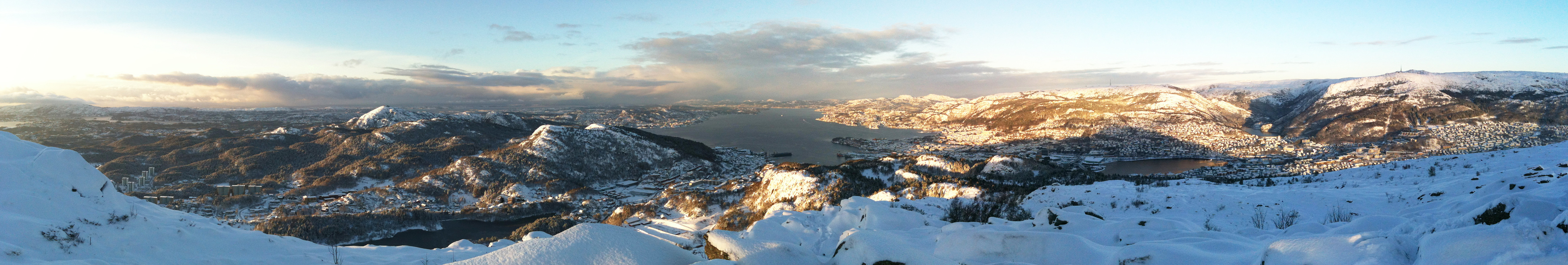
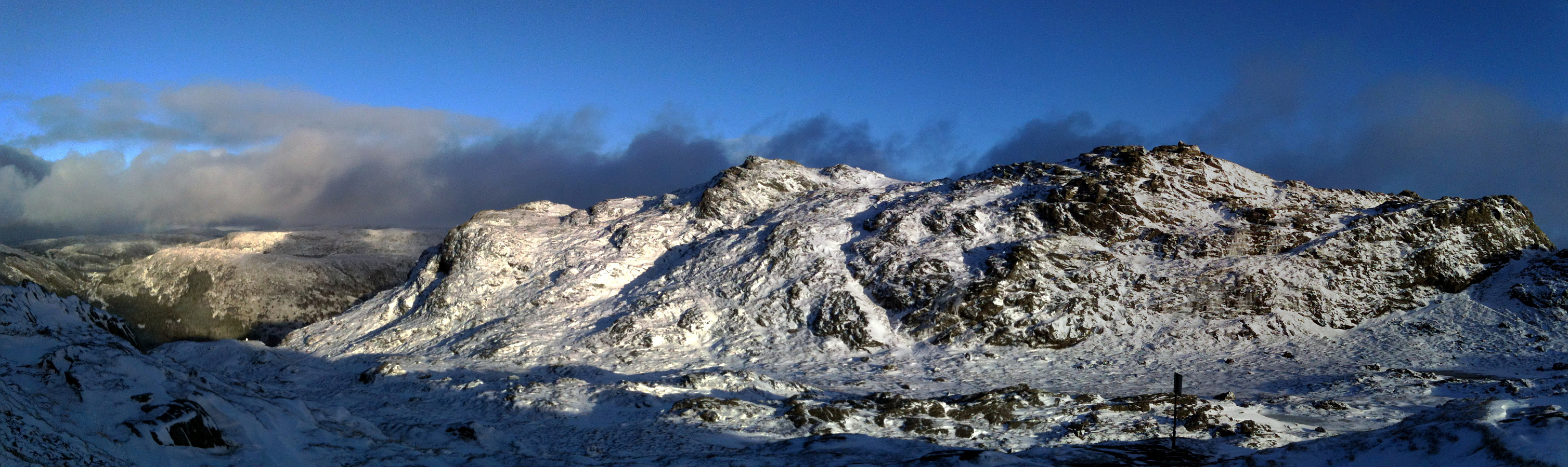
Hestafjellet
- Dato:
- 07.09.2013
- Turtype:
- Fjelltur
- Turlengde:
- 4:00t
- Distanse:
- 9,0km
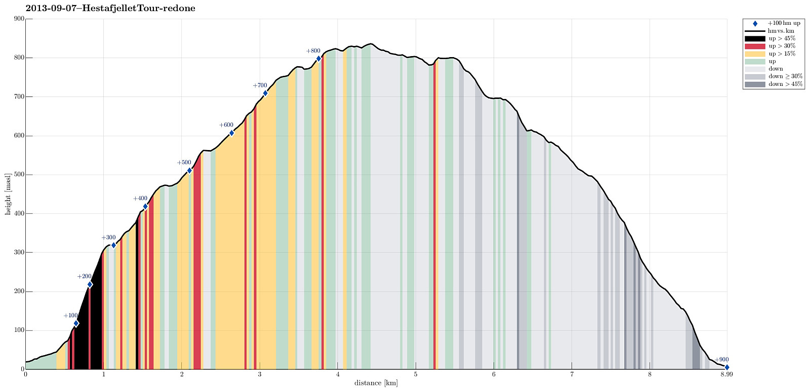 Quite a rough tour from Dalegarden (up along Brattreimelva and down to Helletræer) -- more demanding than expected, mostly because there wasn't any path when crossing the mountain.
Selected photos are available as Google photo album .
Web page WestCoastPeaks.com provides useful information about Høgenipa, Knutstignovi, Hestafjellet, Kvigedalseggi, Slåttenovi, Harafjellet, and Nipa .
Quite a rough tour from Dalegarden (up along Brattreimelva and down to Helletræer) -- more demanding than expected, mostly because there wasn't any path when crossing the mountain.
Selected photos are available as Google photo album .
Web page WestCoastPeaks.com provides useful information about Høgenipa, Knutstignovi, Hestafjellet, Kvigedalseggi, Slåttenovi, Harafjellet, and Nipa .
Ulriken
- Dato:
- 31.08.2013
- Turtype:
- Fjelltur
- Turlengde:
- 2:00t
- Distanse:
- 7,5km
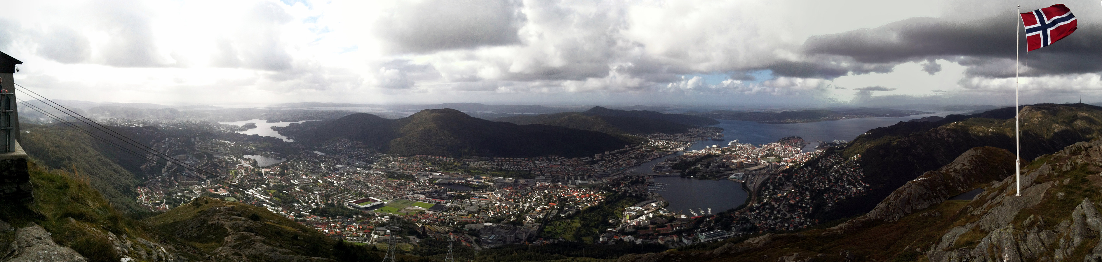 Great ascent to Ulriken via Ulrikseggen!
Selected photos are available as Google+ photo album .
Web page WestCoastPeaks.com provides useful information about Haugavarden, Ulriken, Storfjellet, and Landåsfjellet
and also Petter Bjørstad has a useful page about Ulriken .
Great ascent to Ulriken via Ulrikseggen!
Selected photos are available as Google+ photo album .
Web page WestCoastPeaks.com provides useful information about Haugavarden, Ulriken, Storfjellet, and Landåsfjellet
and also Petter Bjørstad has a useful page about Ulriken .
Sydpolen
- Dato:
- 23.08.2013
- Turtype:
- Fjelltur
- Turlengde:
- 3:00t
- Distanse:
- 13,3km
 Great quick evening walk from Brekkjedalen, up Sydpolen and then down again (via Toro) -- great walk-out in fantastic nature! :-)
Selected photos are available as Google photo album .
Web page WestCoastPeaks.com provides useful information about S. Gullfjellstoppen (Sydpolen)
and also Petter Bjørstad has a useful page about Sydpolen .
Great quick evening walk from Brekkjedalen, up Sydpolen and then down again (via Toro) -- great walk-out in fantastic nature! :-)
Selected photos are available as Google photo album .
Web page WestCoastPeaks.com provides useful information about S. Gullfjellstoppen (Sydpolen)
and also Petter Bjørstad has a useful page about Sydpolen .
Olsokfjellet
- Dato:
- 17.08.2013
- Turtype:
- Fjelltur
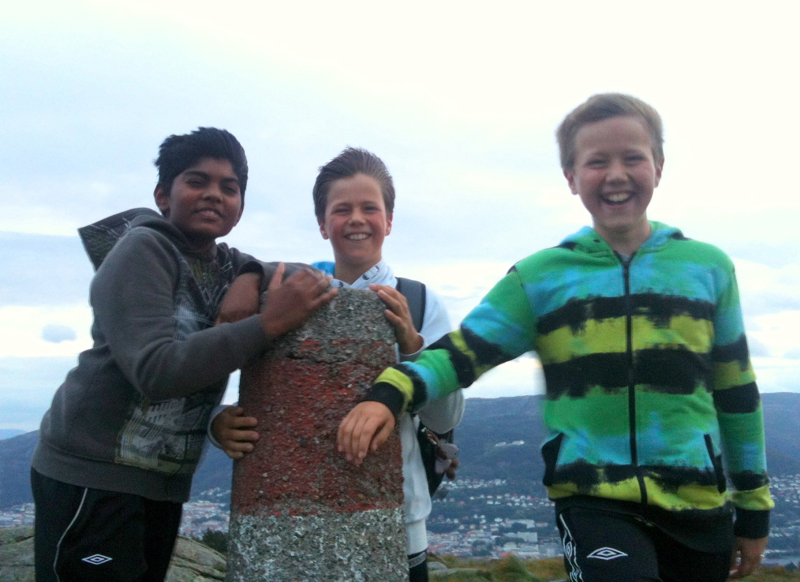 Quick hike with three boys in rough weather -- was that even at a storm's strength on the top? :-)
