Arkiv - dato
Arkiv - aktivitet
-
Annen tur (1)
- Kajakkpadling (1)
-
Annen vintertur (4)
- Trugetur (4)
- Fottur (740)
-
Skitur (4)
- Fjellskitur (4)
-
Sykkeltur (137)
- Blandet sykling (51)
- Gatesykling (9)
Arkiv - Etter geografi
"Peakbookvenner"


Lister jeg samler etter
-
Bergen ≥ 50m pf. og ≥ 100 m.o.h.
(87/89)
 97%
97% -
Most dominating tops of the Bergen peninsula
(68/75)
90%
-
Utvalgte topper og turmål i Bergen
(316/350)
90%
-
Alle topper i Bergen
(357/398)
89%
-
Opptur Bergen
(100/113)
88%
-
De syv fjell rundt Bergen
(6/7)
85%
-
Sund ≥ 50m pf.
(14/18)
77%
-
Os ≥ 50m pf.
(25/34)
73%
-
Søyler (fastmerker) i Bergen
(68/100)
68%
-
Fjell ≥ 50m pf.
(21/32)
65%

Vestkapp on Stadlandet
- Dato:
- 10.07.2023
- Turtype:
- Spasertur
- Turlengde:
- 0:30t
- Distanse:
- 0,6km
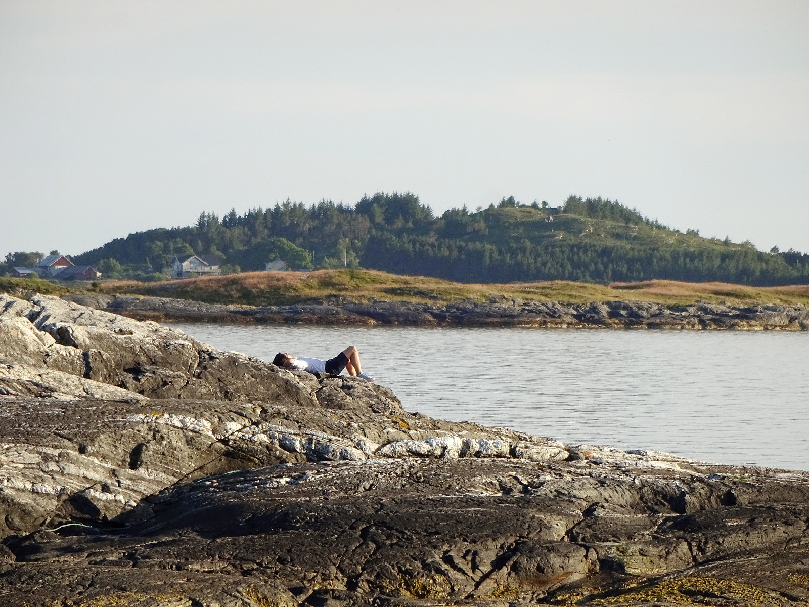
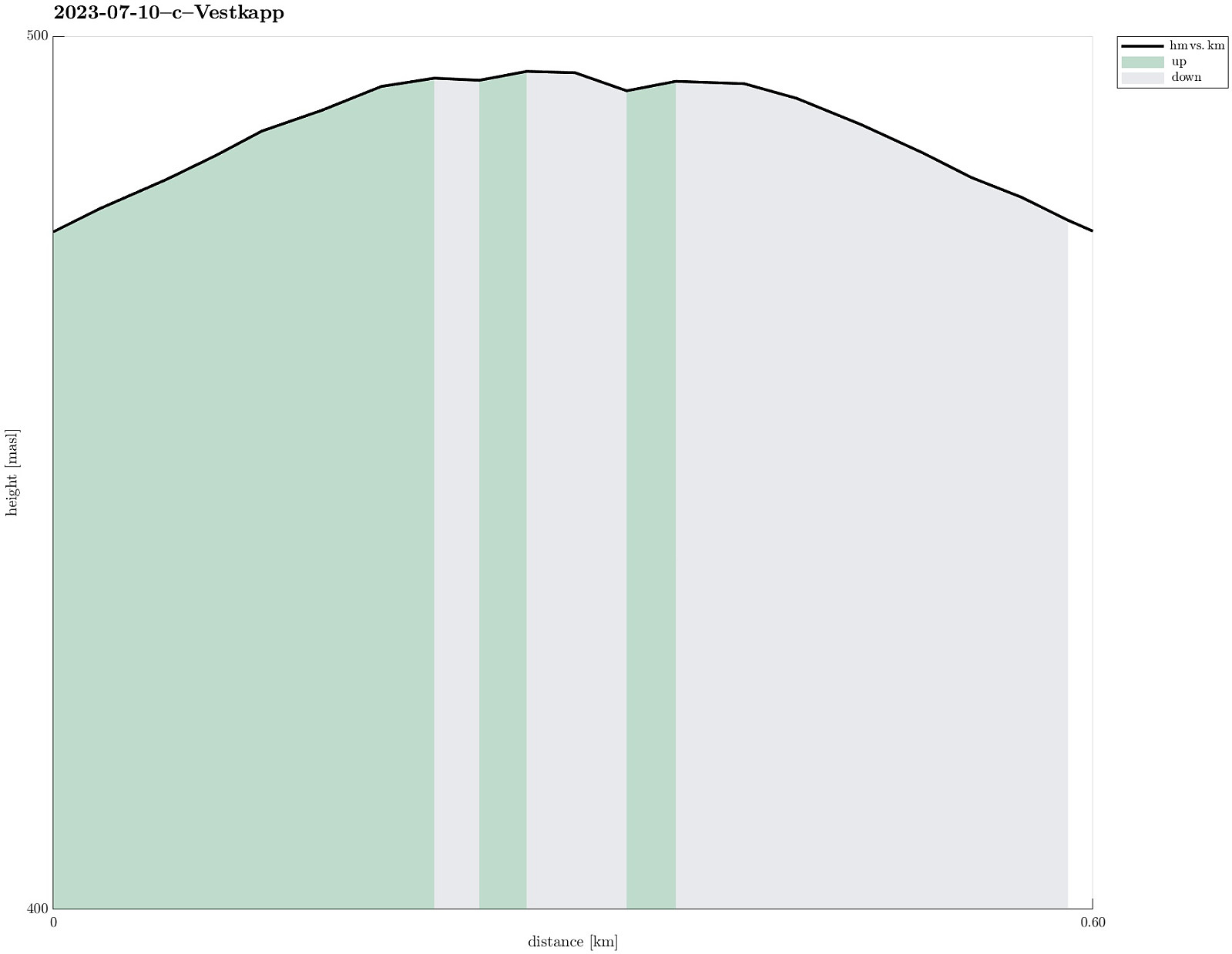 After first paying Vågsøy and Måløy a short visit, we continued to Stadlandet. Our first stop was Vestkapp on Kjerringa in the northwest of Stadlandet. Taking the road up to a parking spot quite close to the actual top, we eventually entered some very thick (and wet) clouds that enshrouded all of the top. Even just a few meters from the massive meteorological radar station on top of Kjerringa we had some difficulties to actually find and see it! :-) Since our views were extremely limited anyway (and it was quite a bit wet, also!), we decided to not stay there for any significant time, but return to our car soon, instead, with our next goal, Stålet , in front of us! :-)
Selected photos are available as Google photo album .
See also the related FB-page Hiking around Bergen, Norway .
After first paying Vågsøy and Måløy a short visit, we continued to Stadlandet. Our first stop was Vestkapp on Kjerringa in the northwest of Stadlandet. Taking the road up to a parking spot quite close to the actual top, we eventually entered some very thick (and wet) clouds that enshrouded all of the top. Even just a few meters from the massive meteorological radar station on top of Kjerringa we had some difficulties to actually find and see it! :-) Since our views were extremely limited anyway (and it was quite a bit wet, also!), we decided to not stay there for any significant time, but return to our car soon, instead, with our next goal, Stålet , in front of us! :-)
Selected photos are available as Google photo album .
See also the related FB-page Hiking around Bergen, Norway .
Short visit to Hendanes Fyret
- Dato:
- 10.07.2023
- Turtype:
- Spasertur
- Turlengde:
- 1:00t
- Distanse:
- 1,4km
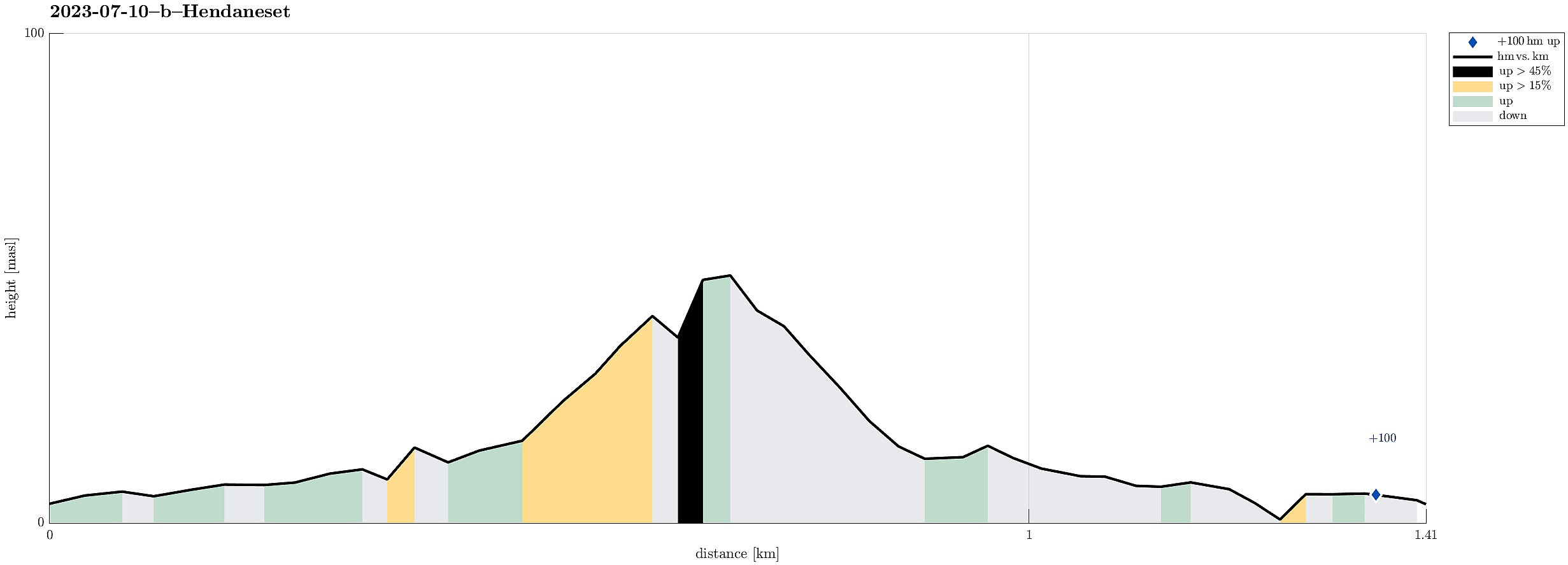 After visiting Kannesteinen , we also wished to see the other side of Torskangerpollen and walking out to the small light house at Hendanes seemed to be a good idea. :-) The path out there is in fact nicely prepared so that this very much is an easy and full uncomplicated walk. Once out at Hendaneset, we enjoyed some great views, not only across Torskangerpollen, but also across Kvalheimsvika to Ytre Kvalheim as well as into the opposite direction (towards Klovningen). Nice walk! :-)
Selected photos are available as Google photo album .
See also the related FB-page Hiking around Bergen, Norway .
After visiting Kannesteinen , we also wished to see the other side of Torskangerpollen and walking out to the small light house at Hendanes seemed to be a good idea. :-) The path out there is in fact nicely prepared so that this very much is an easy and full uncomplicated walk. Once out at Hendaneset, we enjoyed some great views, not only across Torskangerpollen, but also across Kvalheimsvika to Ytre Kvalheim as well as into the opposite direction (towards Klovningen). Nice walk! :-)
Selected photos are available as Google photo album .
See also the related FB-page Hiking around Bergen, Norway .
Kannesteinen on Vågsøy
- Dato:
- 10.07.2023
- Turtype:
- Spasertur
- Turlengde:
- 0:30t
- Distanse:
- 0,2km
 On our way to Stadlandet, we also paid Vågsøy and Måløy a visit. On Vågsøy, we then also drove out to Kannesteinen near Nordoppedalen. Not only is this stone impressive with its particular shape, but also the whole scenery around Torskangerpollen is worth seeing! :-)
Selected photos are available as Google photo album .
See also the related FB-page Hiking around Bergen, Norway .
See the Norwegian Wikipedia for a page about Kannesteinen .
On our way to Stadlandet, we also paid Vågsøy and Måløy a visit. On Vågsøy, we then also drove out to Kannesteinen near Nordoppedalen. Not only is this stone impressive with its particular shape, but also the whole scenery around Torskangerpollen is worth seeing! :-)
Selected photos are available as Google photo album .
See also the related FB-page Hiking around Bergen, Norway .
See the Norwegian Wikipedia for a page about Kannesteinen .
Havreneset and Nordnes in Florø
- Dato:
- 09.07.2023
- Turtype:
- Spasertur
- Turlengde:
- 1:30t
- Distanse:
- 3,8km
 After arriving relatively late in Florø, we still wished to get a bit of fresh air. We also liked the idea to visit Nordnes in the northwest of Florø and so we just went onto a short but nice stroll. First, we visited Havreneset, where quite a bit of installation of an (old) radio station (Florø Radio, discontinued after 2018) is still to be seen. We then stepped along the coast to Nordnes and the marina in Håvågen there. Always nice to smell a bit of ocean air; especially after a long drive! :-)
See also the related FB-page Hiking around Bergen, Norway .
After arriving relatively late in Florø, we still wished to get a bit of fresh air. We also liked the idea to visit Nordnes in the northwest of Florø and so we just went onto a short but nice stroll. First, we visited Havreneset, where quite a bit of installation of an (old) radio station (Florø Radio, discontinued after 2018) is still to be seen. We then stepped along the coast to Nordnes and the marina in Håvågen there. Always nice to smell a bit of ocean air; especially after a long drive! :-)
See also the related FB-page Hiking around Bergen, Norway .
Two old stone crosses in Eivindvik
- Dato:
- 09.07.2023
- Turtype:
- Spasertur
- Turlengde:
- 0:30t
- Distanse:
- 0,7km
 After visiting Gulatinget east of Eivindvik, we continued to Eivindvik to see the two old stone crosses there, also. We parked near the harbor and first walked up to Gulen church (east of the harbor) to see the first cross (Olavskorset). It's standing there with some help now after it broke into two when a nearby tree was cut down in 2012. From there, one can already see the other cross (Korset i Krossteigen), standing a bit up in Krossteigen some (maybe) 250 meters further north. An accordingly short walk brought us up there then. This second cross is interesting as it seems to show some celtic flair. To compensate for that, maybe, they added a smaller, Latin cross (by embossing it out of the main cross). Clearly worth a close look! :-)
Selected photos are available as Google photo album .
See also the related FB-page >>>
After visiting Gulatinget east of Eivindvik, we continued to Eivindvik to see the two old stone crosses there, also. We parked near the harbor and first walked up to Gulen church (east of the harbor) to see the first cross (Olavskorset). It's standing there with some help now after it broke into two when a nearby tree was cut down in 2012. From there, one can already see the other cross (Korset i Krossteigen), standing a bit up in Krossteigen some (maybe) 250 meters further north. An accordingly short walk brought us up there then. This second cross is interesting as it seems to show some celtic flair. To compensate for that, maybe, they added a smaller, Latin cross (by embossing it out of the main cross). Clearly worth a close look! :-)
Selected photos are available as Google photo album .
See also the related FB-page >>>
Gulatinget near Eivindvik
- Dato:
- 09.07.2023
- Turtype:
- Spasertur
- Turlengde:
- 0:30t
- Distanse:
- 0,6km
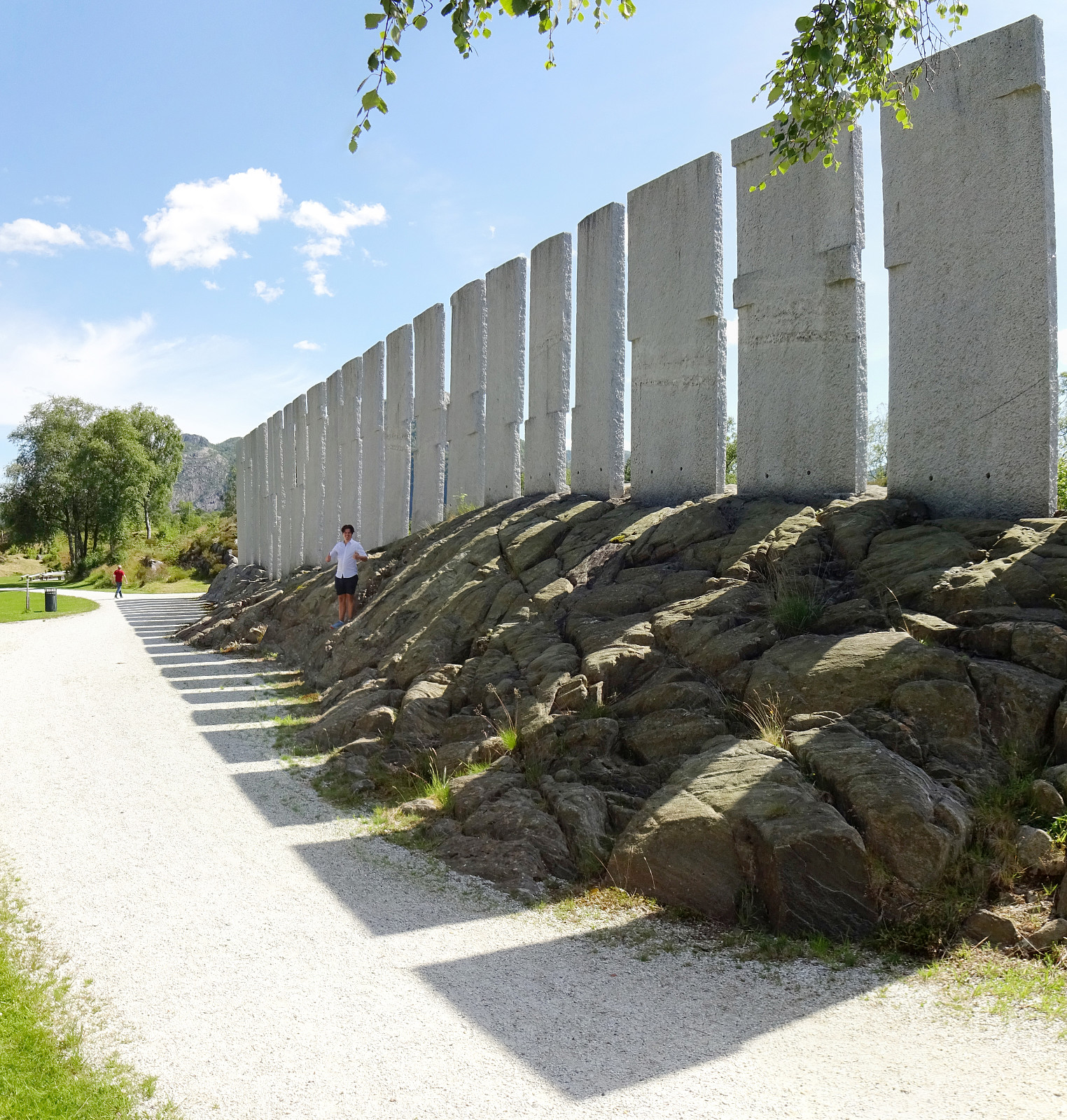 On our way northwards through Gulen, we stopped by Gulatinget near Eivindvik. Following road 605 from Nordgulen (and road 57 there) we stopped once near Guløyna and explored the park (Tusenårsstaden) and the monument of Bård Breivik (Tingveggen). We also enjoyed a nice chat with one person there, who was very kind to explain some of the related history to us! :-)
Selected photos are available as Google photo album .
See also the related FB-page Hiking around Bergen, Norway .
There's also an official web page of Gulatinget .
On our way northwards through Gulen, we stopped by Gulatinget near Eivindvik. Following road 605 from Nordgulen (and road 57 there) we stopped once near Guløyna and explored the park (Tusenårsstaden) and the monument of Bård Breivik (Tingveggen). We also enjoyed a nice chat with one person there, who was very kind to explain some of the related history to us! :-)
Selected photos are available as Google photo album .
See also the related FB-page Hiking around Bergen, Norway .
There's also an official web page of Gulatinget .
Vasstinden from Lauklineset
- Dato:
- 02.07.2023
- Turtype:
- Fottur
- Turlengde:
- 4:00t
- Distanse:
- 8,1km
 We estimated that there was enough time for another hike (before reaching our flight back from Tromsø). We drove towards Lauklineset on the north of Nordfjorden and parked a bit off from Lauklineset, where some parking place is set off for hikers (you pay a little for parking there, also). From this parking place, there's a marked trail up to Vasstinden. While still close to the road and Lauklineset, this trail is not very good (and one may prefer to walk the first meters along the road, instead). Once directly above Lauklineset, however, the trail is good, leading steeply upwards between the trees. At about 150masl, the trail levels out for a few meters before it gets steep again. At about 440masl, there's a sign that shows the hikers where the marked trail continues (towards the east, >>>
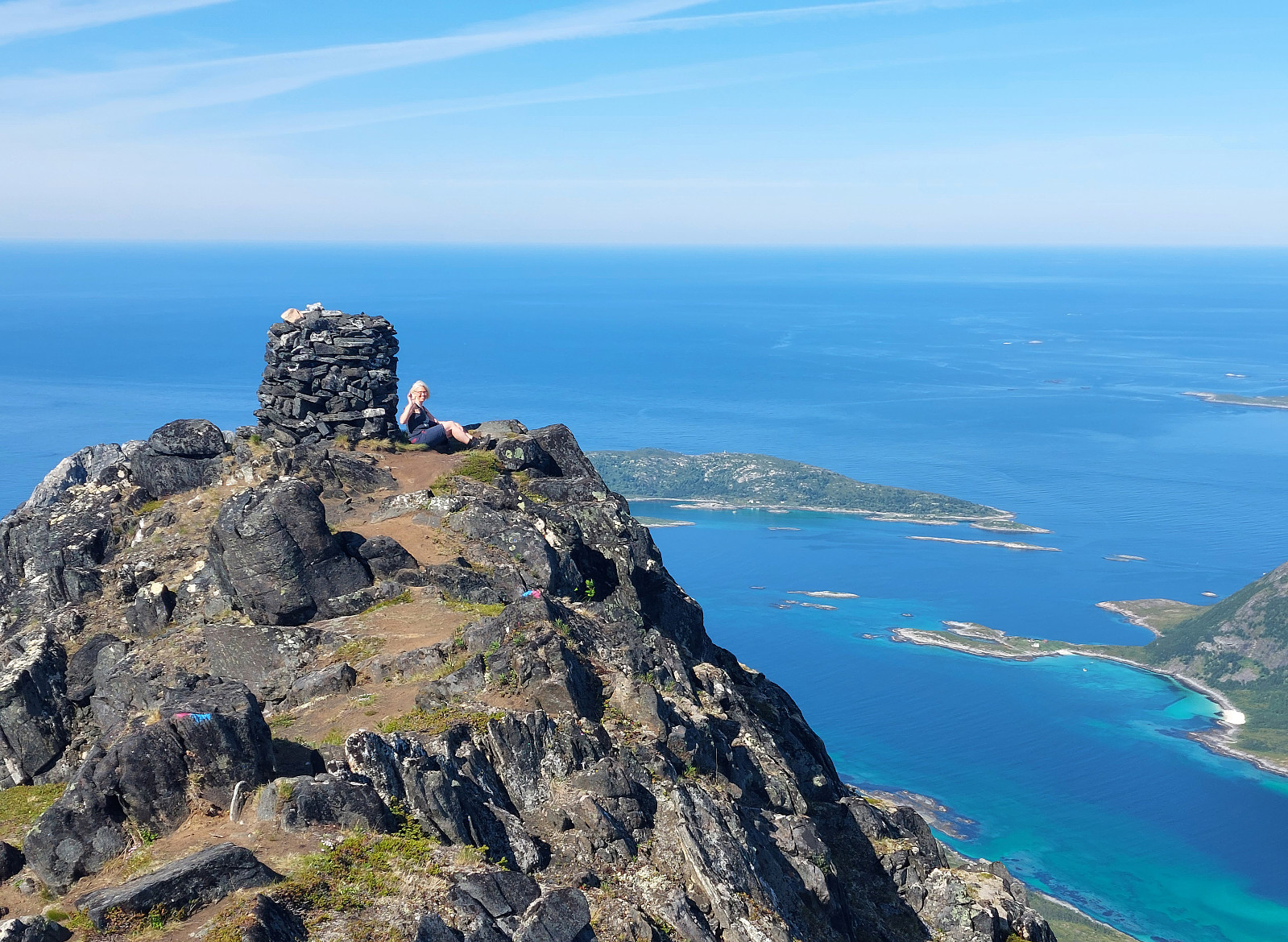
Buren (and an attempt to Rødtinden)
- Dato:
- 01.07.2023
- Turtype:
- Fottur
- Turlengde:
- 4:30t
- Distanse:
- 9,6km
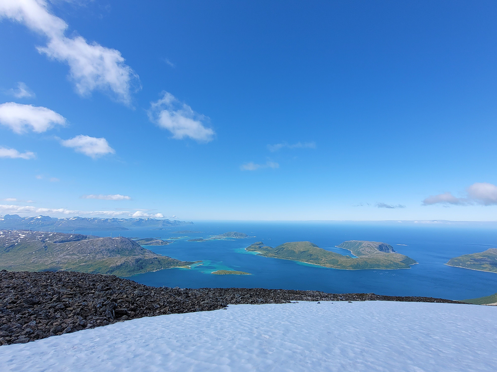
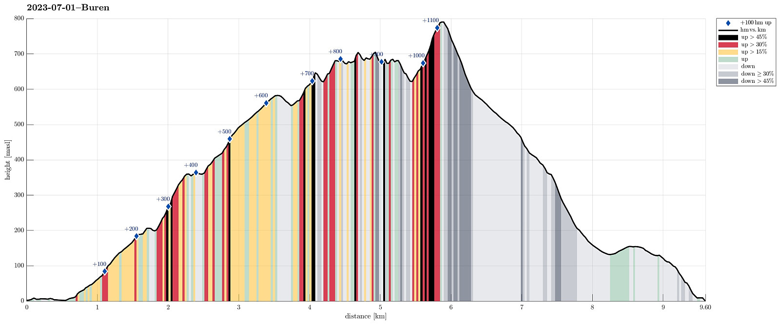 We had relocated ourselves from Senja to Kvaløya (to Ersfjordbotn -- as if there wasn't any Ersfjorden on Senja!). Also this day looked very promising and with wonderful mountains just "around the corner", the plan was to hike up to Buren (without driving). The hidden agenda for this hike was to also try an ascent to Rødtinden, if possible. Starting along Naustbuktvegen, I first walked along the coast into the direction of Gottberget. There, I found a trail that lead me up to a simple ridge which comes down from Skålhammaren (further up in the northeast of Gottberget). Also along this ridge, I could find a simple trail, leading me up to a nice viewpoint at about 200masl (also with a small cairn there). From there, however, I could not find any trail that would lead further >>>
Astritinden from Botnhamn
- Dato:
- 30.06.2023
- Turtype:
- Fottur
- Turlengde:
- 4:00t
- Distanse:
- 12,7km
 We had to catch a ferry from Botnhamn to Kvaløya and thus planned to hike Astritinden in the time given before the departure of "our" ferry. Right next to the soccer field of Botnhamn (near Mølnneset) we could park the car. The hike then starts with getting up to Sandbakkveihøgda, following one of the marked trails (eventually up right underneath the power line). Once up there, it's then "just" to follow the (long) ridge to Astritinden (steadily in northern / northwestern direction). Only a few kilometers into this hike, one puts in a significant ascent (up to Kvannaksla at about 500masl). There, the hike levels out, again, a little, before the actual ascent up to Astritinden follows a little later. While all of the hike to Astritinden is not really difficult, the >>>
Grytetippen and Keipen
- Dato:
- 29.06.2023
- Turtype:
- Fottur
- Turlengde:
- 4:30t
- Distanse:
- 10,2km
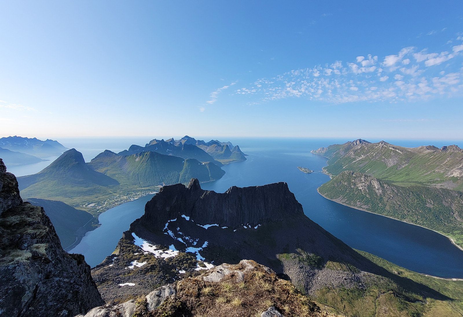 Another nice day on Senja, another chance for a nice hike! :-) We drove to Mefjordeidet, basically where Arnakkveien "disappears" into the tunnel down to Ørnfjorden, and parked there at the small parking place. We then started to follow a marked trail "straight up" (in northern direction) that lead us to Daven, a first little top (with nice views, though!). From Daven, it was then across a small saddle (in the east of Daven) and up to some intermediate heights in the south of Keipen (at about 525masl). Crossing over these intermediate heights, first, and then ascending (steeply) up, we arrived at the saddle between Grtyetippen (in the west) and Keipen (in the east / northeast) at about 730 masl. From there, we first included Grytetippen, enjoying fantastic views from >>>
