Arkiv - dato
Arkiv - aktivitet
-
Annen tur (1)
- Kajakkpadling (1)
-
Annen vintertur (4)
- Trugetur (4)
- Fottur (740)
-
Skitur (4)
- Fjellskitur (4)
-
Sykkeltur (137)
- Blandet sykling (51)
- Gatesykling (9)
Arkiv - Etter geografi
"Peakbookvenner"


Lister jeg samler etter
-
Bergen ≥ 50m pf. og ≥ 100 m.o.h.
(87/89)
 97%
97% -
Most dominating tops of the Bergen peninsula
(68/75)
90%
-
Utvalgte topper og turmål i Bergen
(316/350)
90%
-
Alle topper i Bergen
(357/398)
89%
-
Opptur Bergen
(100/113)
88%
-
De syv fjell rundt Bergen
(6/7)
85%
-
Sund ≥ 50m pf.
(14/18)
77%
-
Os ≥ 50m pf.
(25/34)
73%
-
Søyler (fastmerker) i Bergen
(68/100)
68%
-
Fjell ≥ 50m pf.
(21/32)
65%

Luxembourg (and back via the Plateau de Kirchberg)
- Dato:
- 03.06.2025
- Turtype:
- Fjelltur
- Turlengde:
- 5:00t
- Distanse:
- 9,1km
 Starting with a nice and interesting guided tour through the historic city of Luxembourg, this walk was ended with a late evening return to the hotel via the Plateau de Kirchberg. Places visited: Pont Adolphe, Place de la Constitution, Chemin de la Corniche, Place Guillaume II, Place d'Armes, Montée de Clausen, Fort Obergrünewald, Fort Thüngen, Philharmonie Luxembourg, and the Plateau de Kirchberg.
Selected photos are available as Google photo album .
See also the related FB-page Hiking around Bergen, Norway .
Starting with a nice and interesting guided tour through the historic city of Luxembourg, this walk was ended with a late evening return to the hotel via the Plateau de Kirchberg. Places visited: Pont Adolphe, Place de la Constitution, Chemin de la Corniche, Place Guillaume II, Place d'Armes, Montée de Clausen, Fort Obergrünewald, Fort Thüngen, Philharmonie Luxembourg, and the Plateau de Kirchberg.
Selected photos are available as Google photo album .
See also the related FB-page Hiking around Bergen, Norway .
Luxembourg via the Plateau de Kirchberg
- Dato:
- 01.06.2025
- Turtype:
- Fjelltur
- Turlengde:
- 3:00t
- Distanse:
- 11,6km
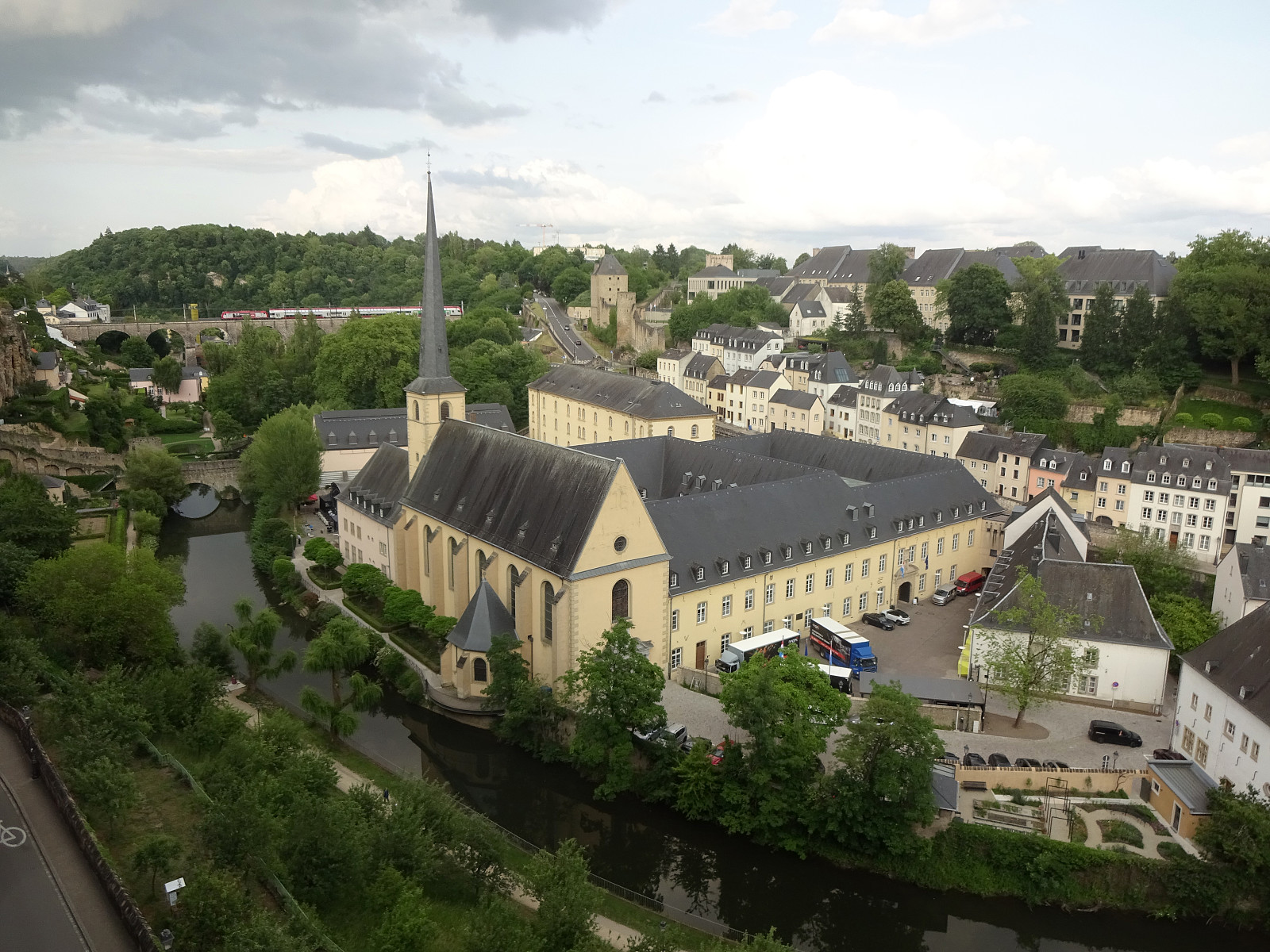
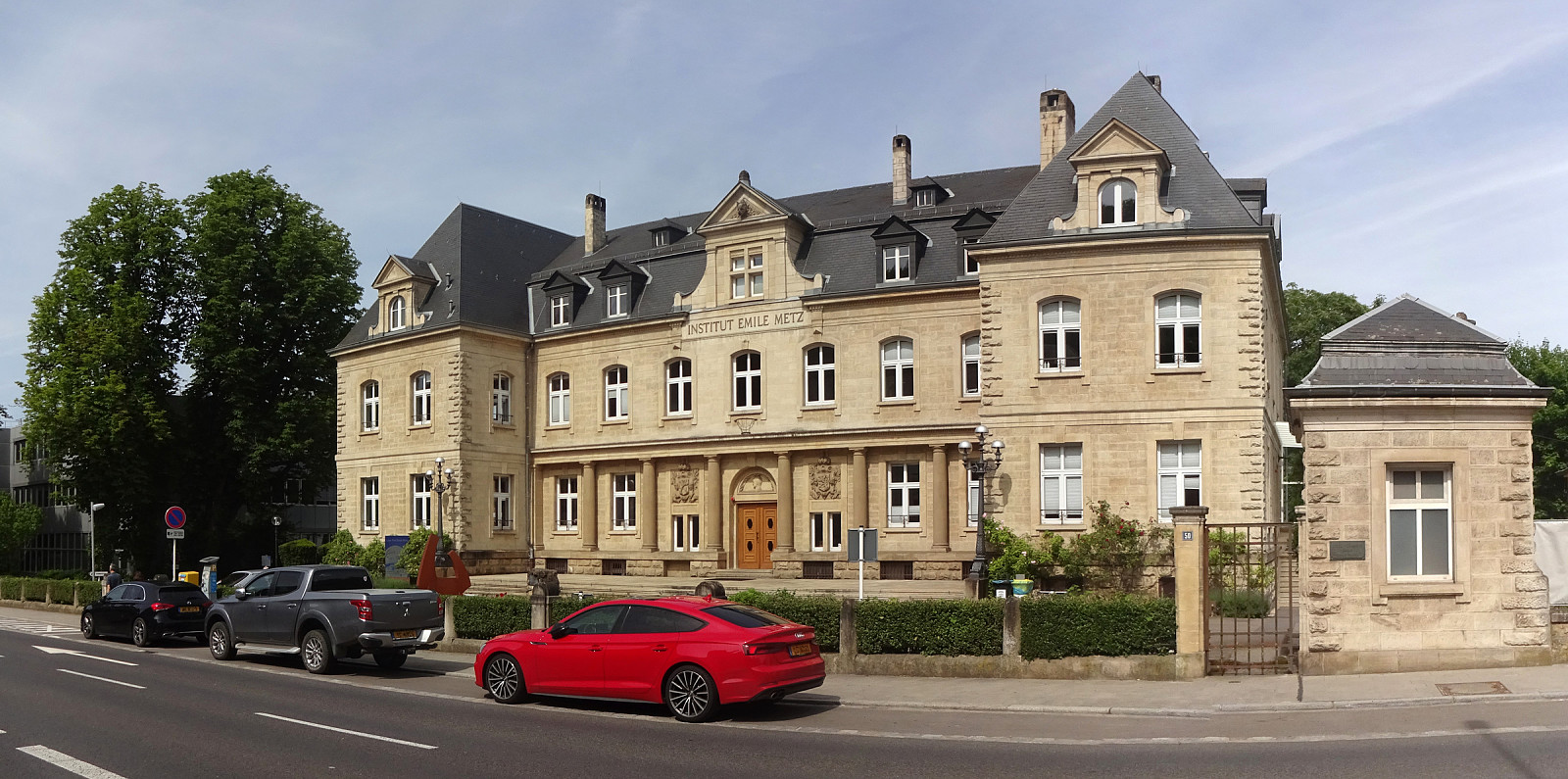
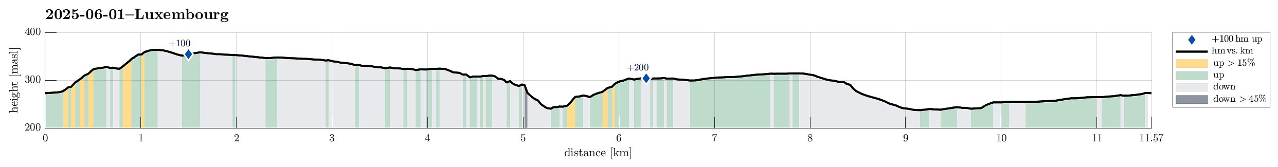 Evening walk to downtown Luxembourg. I started from Parc Hotel Alvisse and ascended first the Plateau de Kirchberg at op de Schleed. I then headed to the still relatively newly built up area at the Plateau de Kirchberg. There, I then passed by the Philharmonic Hall of Luxembourg. I then walked through the fortifications at Fort Thüngen to descend into the valley of the Alzette. On the other side, I found a way to get up to the Plateau Altmünster. From there, I used the Montée de Clausen to get into the city of Luxembourg. After walking across both the Place Guillaume II and the Place d'Armes, I then decided that it was time to head back to the hotel. Near the Rue des Bains, I got onto the Avenue de la Porte-Neuve, which I then followed until I got on the Rue des Glacis. Where this >>>
Dommeldange (and back via Kuebebierg)
- Dato:
- 01.06.2025
- Turtype:
- Spasertur
- Turlengde:
- 1:30t
- Distanse:
- 5,5km
 Just a short afternoon walk from Parc Hotel Avisse to "downtown" Dommeldange. Back, I then took a short detour via Kuebebierg.
Selected photos are available as Google photo album .
See also the related FB-page Hiking around Bergen, Norway .
Just a short afternoon walk from Parc Hotel Avisse to "downtown" Dommeldange. Back, I then took a short detour via Kuebebierg.
Selected photos are available as Google photo album .
See also the related FB-page Hiking around Bergen, Norway .
Mixed excursion to Frotveit
- Dato:
- 31.05.2025
- Turtype:
- Blandet sykling
- Turlengde:
- 5:00t
- Distanse:
- 61,0km
 Given the nice Saturday, it was just to get some fresh air! I took my bike and started in southern direction. After passing Steinsvik, I then connected to Lagunen. My attempt to continue further towards Nesttun from there, was inhibited by some road work, making me cycle around Apeltunvatnet, instead. From Nesttun, I then connected to Øvsttun, where I explored the highest point. Thereafter, my goal was to bike up to Totland to do some more exploration. I left my bike at the parking lot at the end of Totlandsvegen and ascended to the hill in the west of it. Once up there, I decided that I could simply traverse the heights in order to get via Kollifjellet tp Ytstafjellet. After doing that, I returned via the forest road that apparently is used as a skiing track in winter. Once down to >>>
Exploring the south of Turøyna
- Dato:
- 30.05.2025
- Turtype:
- Fjelltur
- Turlengde:
- 2:00t
- Distanse:
- 5,2km
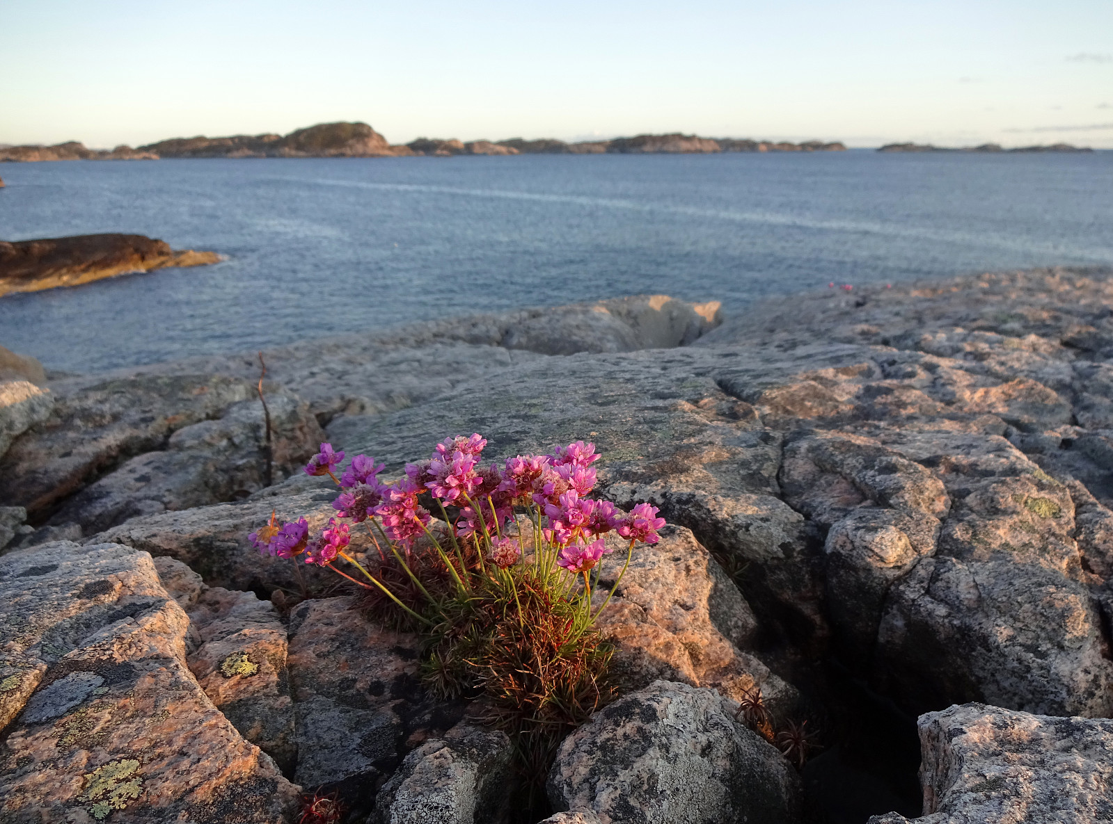 The day was just too nice to not escape in the evening for a short exploration of the south of Turøyna. We parked near the central roundabout at Turøyna and tried to find a good entry point from Kalderasvegen to start our exploration. We first left the road prematurely and then, after getting back we tried again a few meters further in the southwest. The trail head is basically invisible from the road, but we found it anyway (at the second attempt). From there, the trail is barely visible and one quickly gets in a pretty wet forest just a few meters from the road. Navigating some minor ups and downs, we then made it to the northern ridge of a small hill south of Kalderasvegen. We then made it through another small valley to get to the next hill, a bit further to the SSW. After crossing >>>
Lyderhorn
- Dato:
- 24.05.2025
- Turtype:
- Fjelltur
- Turlengde:
- 1:30t
- Distanse:
- 2,9km
 We had something like two hours available and thus aimed at "just" Lyderhorn in the neighborhood. Always nice to hike up and down this little mountain with nonetheless impressive views! :-)
Selected photos are available as Google photo album .
See also the related FB-page Hiking around Bergen, Norway .
Petter Bjørstad has a useful page about Lyderhorn and also web page WestCoastPeaks.com provides useful information about Lyderhorn and Ørnafjellet .
We had something like two hours available and thus aimed at "just" Lyderhorn in the neighborhood. Always nice to hike up and down this little mountain with nonetheless impressive views! :-)
Selected photos are available as Google photo album .
See also the related FB-page Hiking around Bergen, Norway .
Petter Bjørstad has a useful page about Lyderhorn and also web page WestCoastPeaks.com provides useful information about Lyderhorn and Ørnafjellet .
Melderskin from Grønestølen (via Store Laurdalen)
- Dato:
- 17.05.2025
- Turtype:
- Fottur
- Turlengde:
- 12:00t
- Distanse:
- 11,4km
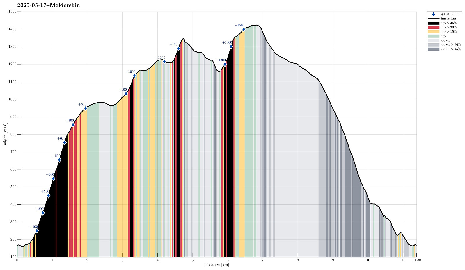 For quite a while we had talked about hiking Melderskin one day. Would we have guessed that our window of opportunity to do so would open up exactly on May 17? With an excellent weather forecast in our hands, we decided on rather short notice that we would leave Bergen after work on May 16, taking the fast ferry to Rosendal. We then stayed at Grønestølen over night -- what a nice place?! From there, we then started our hike to Melderskin in the morning of May 17. Our plan was (first) to try getting up to Store Laurdalen in the northwest of Laurdalselva (without a trail). We had studied the map in quite some detail to support our assessment that this should be possible (even though the terrain is certainly very steep there in places). From there, we had (first) in mind to continue the >>>
Vallaheiane via Larsaberget from Tranevatnet
- Dato:
- 11.05.2025
- Turtype:
- Blandet sykling
- Turlengde:
- 4:30t
- Distanse:
- 40,2km
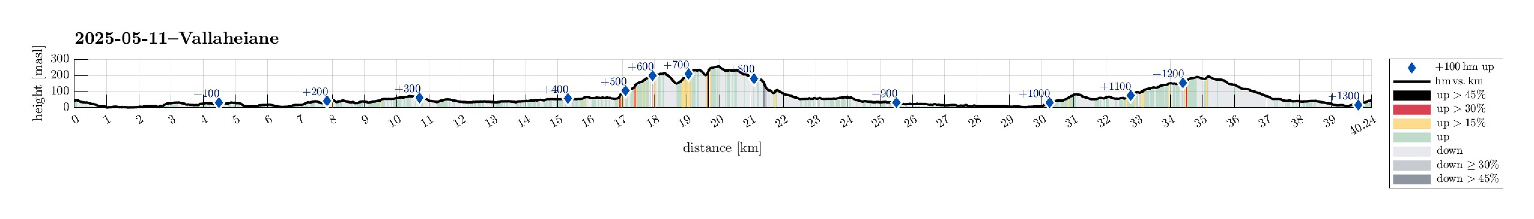 The main idea was to get some fresh air. I thus took the bike and started with the idea to explore Vallaheiane from Tranevatnet. I first biked south and crossed the partially closed off bridge at Straume. I then continued towards Steinsvik, where I left the "main road" to take a look at Ospåsen, a bit further south. The matter of fact that there's also a golf course in this area does not make getting around easier. Back on my bike, I continued, crossing over Flyplassvegen, to the sports arena next to Grimseidvegen. After a short bio-break at Lagunen, I continued around Apeltunvatnet, then to Iglavatnet, and further to Tranevatnet. I then parked my bike along the gravel road on the south side of Tranevatnet to start my exploration on foot from there. I first found a good way >>>
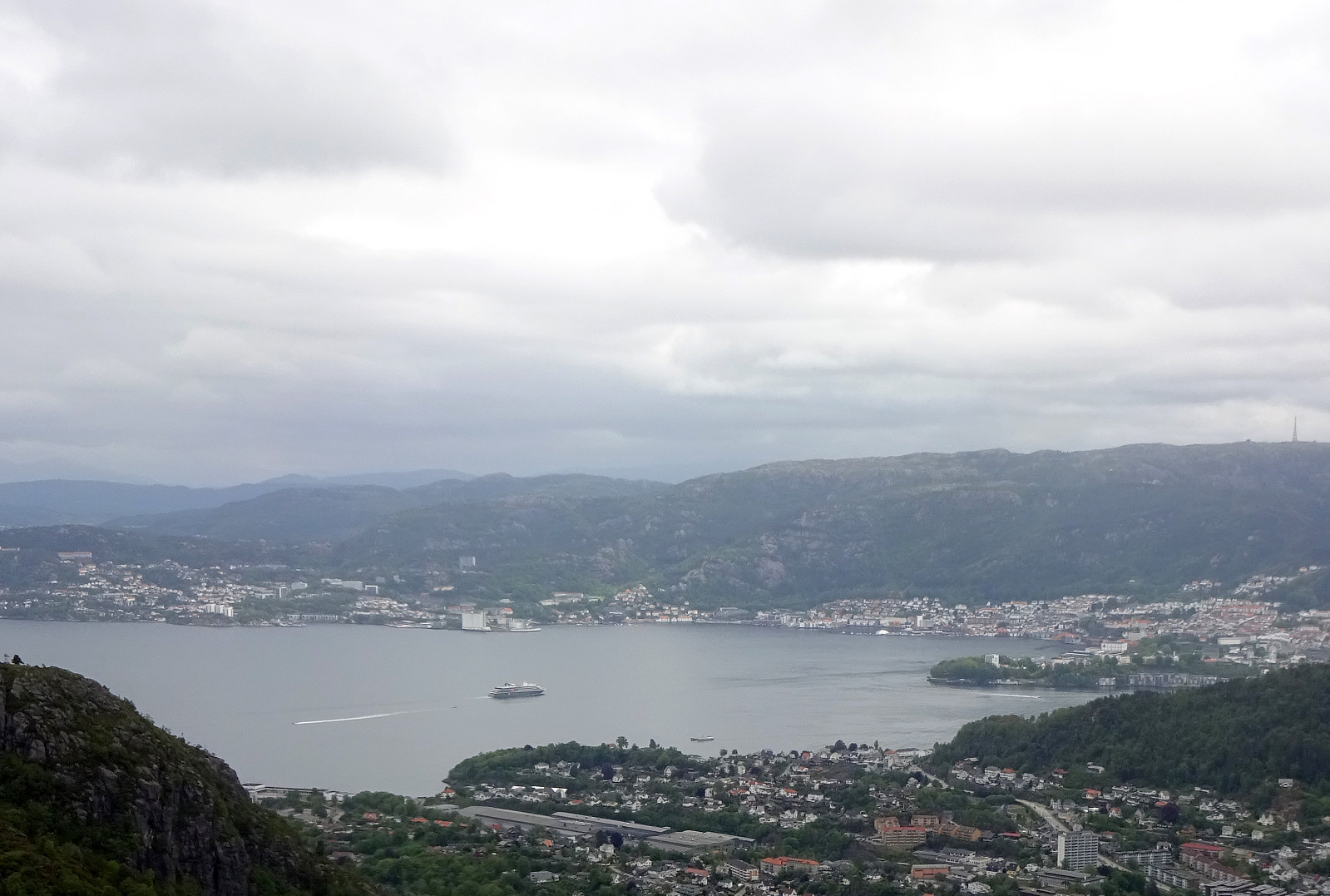
Herlandsfjellet via Geitaryggen
- Dato:
- 04.05.2025
- Turtype:
- Fottur
- Turlengde:
- 3:15t
- Distanse:
- 7,9km
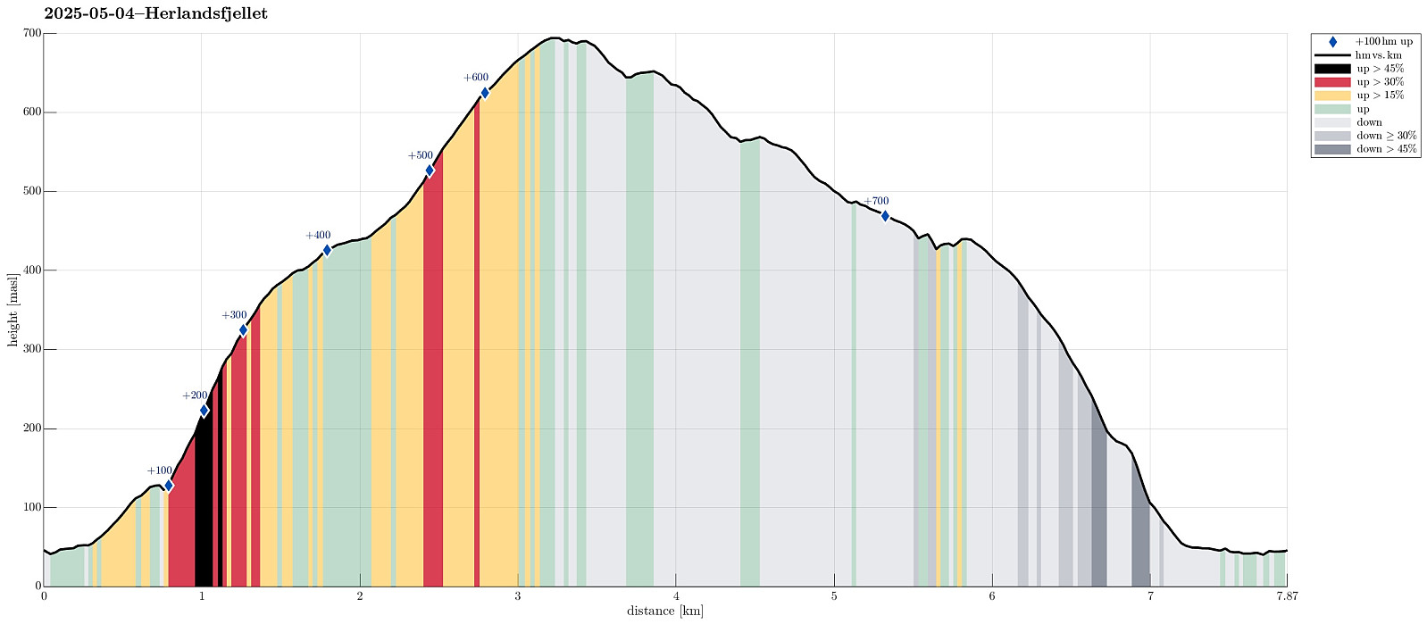 I wished to explore a new ascent route to Herlandsfjellet, as well as a new descent route, also. I drove eastwards out of Bergen to connect with E16 at Indre Arna. Right next to the large bridge to Osterøy, I parked the car and started my hike. After only walking a few meters in westerly direction, I passed a few houses at Geila in order to find a connection to Geitaryggen. Indeed, it was well possible and quite enjoyable to cross over to Tverrelva, basically following the traverse where also a water pipe is laid for the houses at Geila. Quickly, I had made it to Tverrelva and crossing over it was also no problem at all. In the southwest of Tverrelva, I then started my ascent to Geitaryggen "for real" (no trail, but very well possible to ascend via this ridge -- yes, it's a >>>
Knappen
- Dato:
- 01.05.2025
- Turtype:
- Fjelltur
- Turlengde:
- 1:00t
- Distanse:
- 4,4km
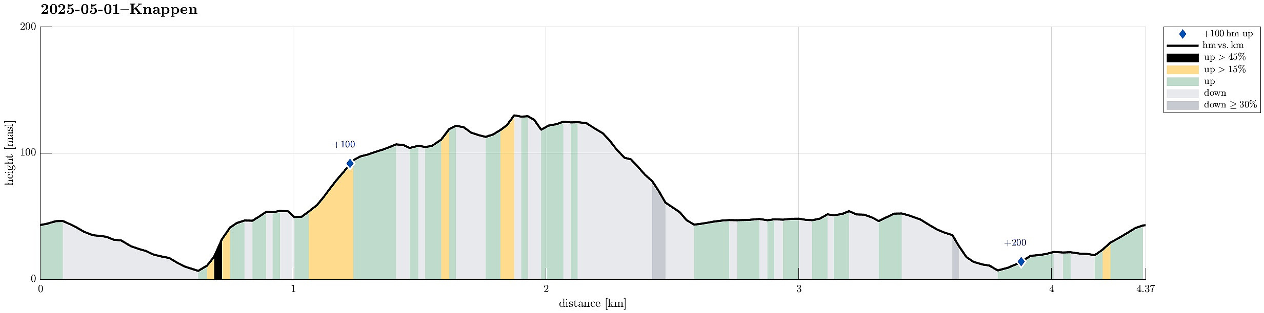 With only little time at our hands (or feet?), we did only a quick excursion to nearby Knappen. Nice! :-)
Selected photos are available as Google photo album .
See also the related FB-page Hiking around Bergen, Norway .
With only little time at our hands (or feet?), we did only a quick excursion to nearby Knappen. Nice! :-)
Selected photos are available as Google photo album .
See also the related FB-page Hiking around Bergen, Norway .
