Arkiv - dato
Arkiv - aktivitet
-
Annen tur (1)
- Kajakkpadling (1)
-
Annen vintertur (4)
- Trugetur (4)
- Fottur (740)
-
Skitur (4)
- Fjellskitur (4)
-
Sykkeltur (137)
- Blandet sykling (51)
- Gatesykling (9)
Arkiv - Etter geografi
"Peakbookvenner"


Lister jeg samler etter
-
Bergen ≥ 50m pf. og ≥ 100 m.o.h.
(87/89)
 97%
97% -
Most dominating tops of the Bergen peninsula
(68/75)
90%
-
Utvalgte topper og turmål i Bergen
(316/350)
90%
-
Alle topper i Bergen
(357/398)
89%
-
Opptur Bergen
(100/113)
88%
-
De syv fjell rundt Bergen
(6/7)
85%
-
Sund ≥ 50m pf.
(14/18)
77%
-
Os ≥ 50m pf.
(25/34)
73%
-
Søyler (fastmerker) i Bergen
(68/100)
68%
-
Fjell ≥ 50m pf.
(21/32)
65%

Prozor from Arapovac
- Dato:
- 10.07.2024
- Turtype:
- Fjelltur
- Turlengde:
- 2:00t
- Distanse:
- 2,4km
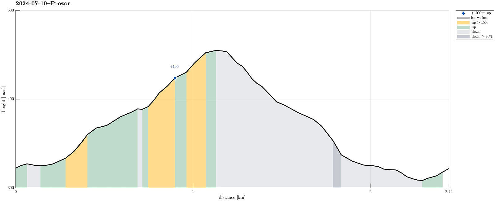 We were up for a short hike, given the quite hot weather. From Arapovac, we made our way up to Prozor, mostly without any trail. To get back to Arapovac, we chose another route, also (partly) without any (proper) trail. Hiking in those parts, which are covered by some older forest, was nice and without challenges; hiking through newer forest, however, was challenging due to the extra-dense vegetation! :-)
Selected photos are available as Google photo album .
See also the related FB-page Hiking around Bergen, Norway .
We were up for a short hike, given the quite hot weather. From Arapovac, we made our way up to Prozor, mostly without any trail. To get back to Arapovac, we chose another route, also (partly) without any (proper) trail. Hiking in those parts, which are covered by some older forest, was nice and without challenges; hiking through newer forest, however, was challenging due to the extra-dense vegetation! :-)
Selected photos are available as Google photo album .
See also the related FB-page Hiking around Bergen, Norway .
Visiting the caves of Barać
- Dato:
- 09.07.2024
- Turtype:
- Spasertur
- Turlengde:
- 2:00t
- Distanse:
- 1,0km
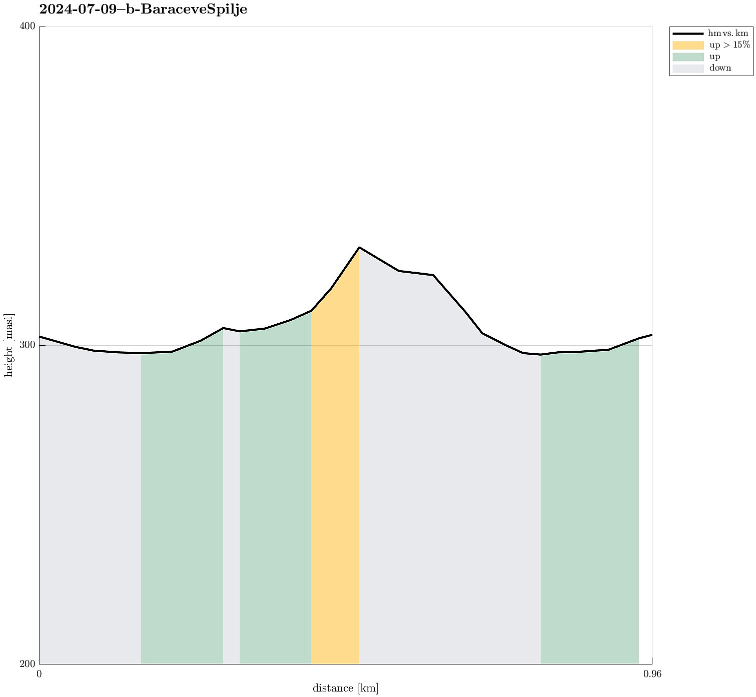 As a nice early evening program, we made a detour to see the caves of Barać. After parking at the parking lot, we walked into the "cave area" and got thoroughly impressed by the amount of effort that someone had put into setting up everything and making the whole area nice! :-) Since none else was about to take a tour, we eventually, after a bit of waiting, got a tour of the upper cave just for the four of us -- that was nice (we were told that at other times, some groups would be as large as 50, which clearly sounded too large for this cave). Our tour guide showed us around in the cave and gave us ample time to shoot our photos (since photographing was only allowed without flash, it usually took a few tries before one photo came out reasonably). After visiting the cave, we returned >>>
Visiting Kotlac near Slunj
- Dato:
- 09.07.2024
- Turtype:
- Spasertur
- Turlengde:
- 1:00t
- Distanse:
- 0,7km
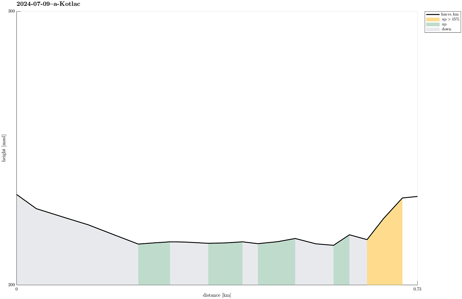 Given the warm day, we made a short excursion to Kotlac near Slunj to cool down (a little) in the lovely Korana river.
Selected photos are available as Google photo album .
See also the related FB-page Hiking around Bergen, Norway .
Given the warm day, we made a short excursion to Kotlac near Slunj to cool down (a little) in the lovely Korana river.
Selected photos are available as Google photo album .
See also the related FB-page Hiking around Bergen, Norway .
Exploring the city center of Sopron
- Dato:
- 05.07.2024
- Turtype:
- Spasertur
- Turlengde:
- 1:00t
- Distanse:
- 2,7km
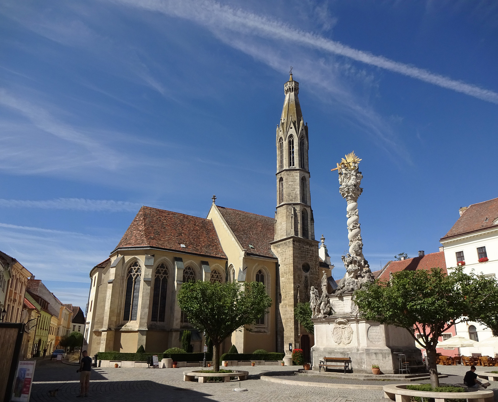 We had some spare time in Sopron, Hungary, which we used to walk around the historic center of the town. This brought us by mighty city walls, long out of their original use, the central square, as well as some unexpected sights (such as Fekete Elefánt cégér). Visiting Sopron can be recommended, even though making many height meters is difficult there! :-)
Selected photos are available as Google photo album .
See also the related FB-page Hiking around Bergen, Norway .
We had some spare time in Sopron, Hungary, which we used to walk around the historic center of the town. This brought us by mighty city walls, long out of their original use, the central square, as well as some unexpected sights (such as Fekete Elefánt cégér). Visiting Sopron can be recommended, even though making many height meters is difficult there! :-)
Selected photos are available as Google photo album .
See also the related FB-page Hiking around Bergen, Norway .
