Arkiv - dato
Arkiv - aktivitet
-
Annen tur (1)
- Kajakkpadling (1)
-
Annen vintertur (4)
- Trugetur (4)
- Fottur (740)
-
Skitur (4)
- Fjellskitur (4)
-
Sykkeltur (137)
- Blandet sykling (51)
- Gatesykling (9)
Arkiv - Etter geografi
"Peakbookvenner"


Lister jeg samler etter
-
Bergen ≥ 50m pf. og ≥ 100 m.o.h.
(87/89)
 97%
97% -
Most dominating tops of the Bergen peninsula
(68/75)
90%
-
Utvalgte topper og turmål i Bergen
(316/350)
90%
-
Alle topper i Bergen
(357/398)
89%
-
Opptur Bergen
(100/113)
88%
-
De syv fjell rundt Bergen
(6/7)
85%
-
Sund ≥ 50m pf.
(14/18)
77%
-
Os ≥ 50m pf.
(25/34)
73%
-
Søyler (fastmerker) i Bergen
(68/100)
68%
-
Fjell ≥ 50m pf.
(21/32)
65%

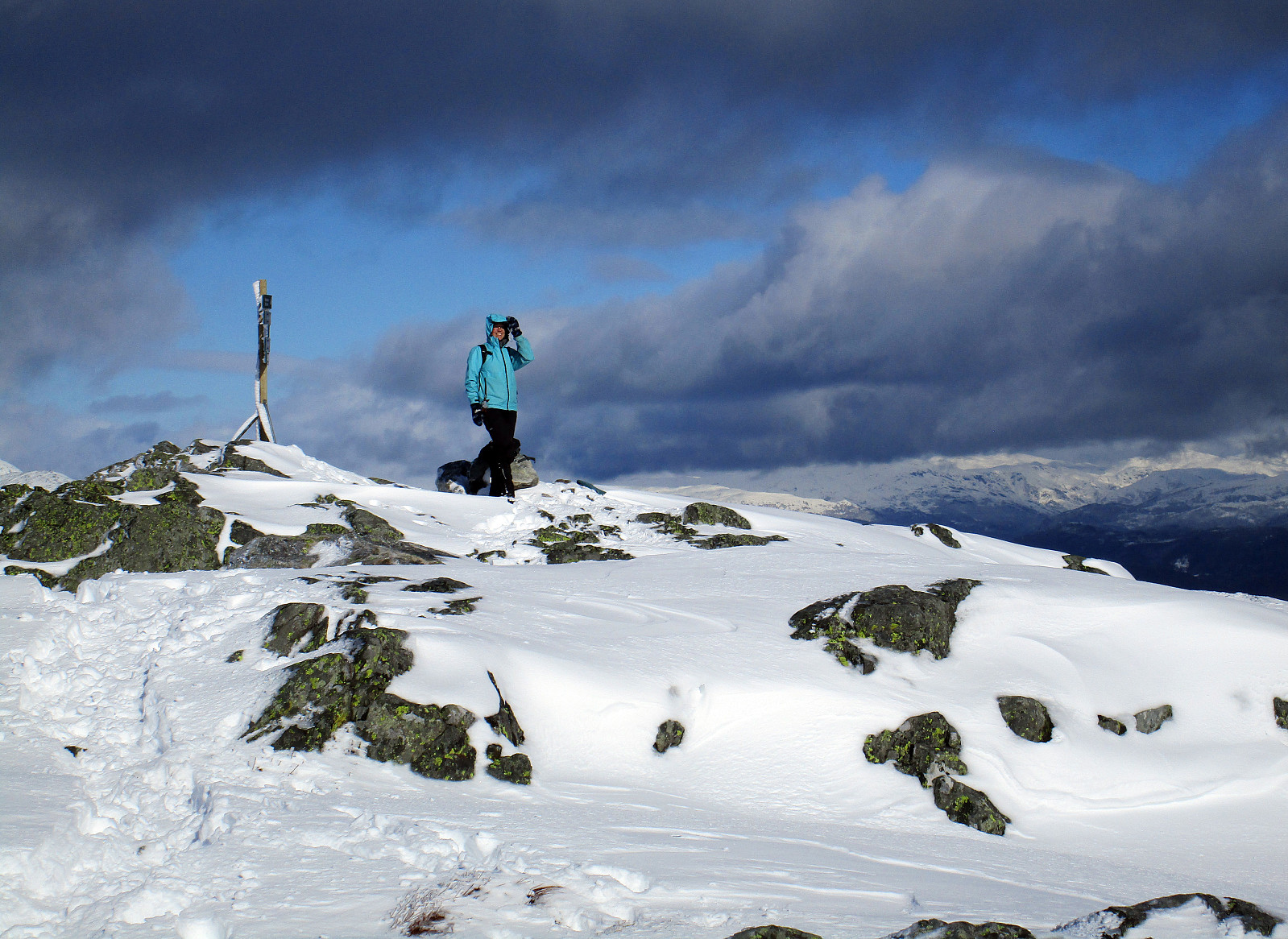
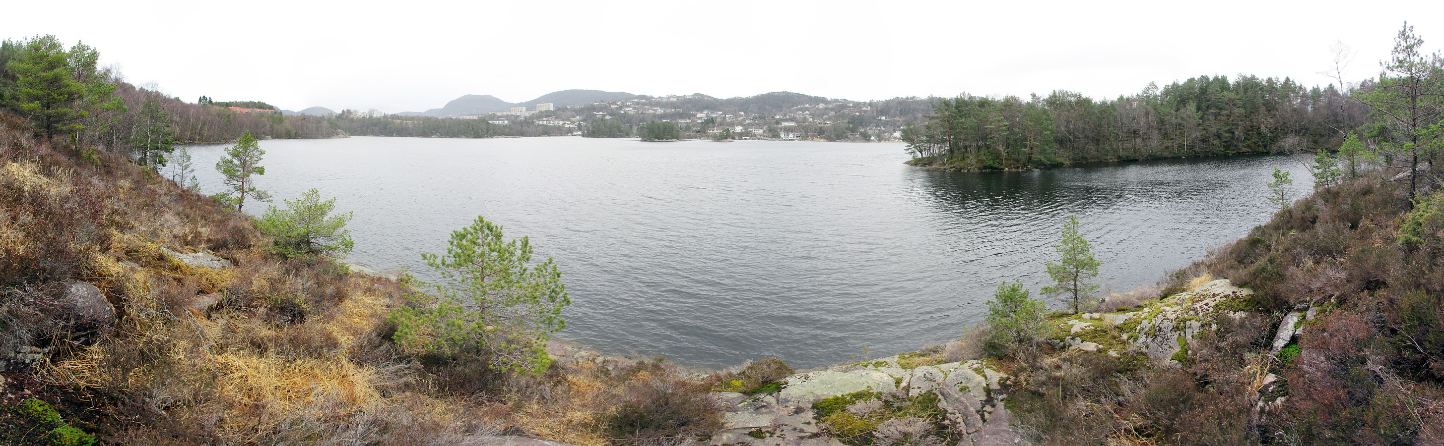
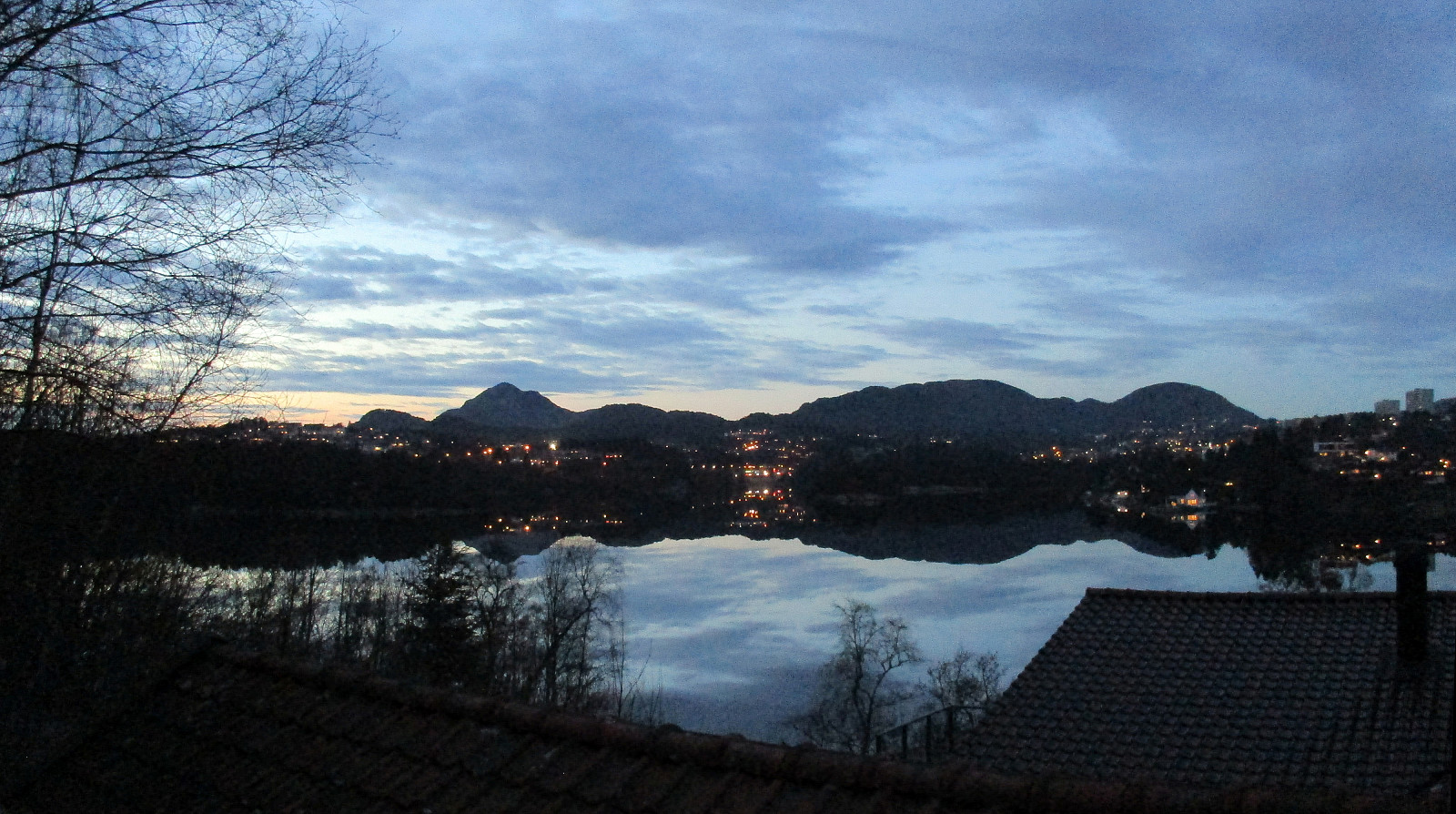
Wet Litlesotra (very wet!)
- Dato:
- 25.03.2017
- Turtype:
- Fjelltur
- Turlengde:
- 3:00t
- Distanse:
- 8,5km
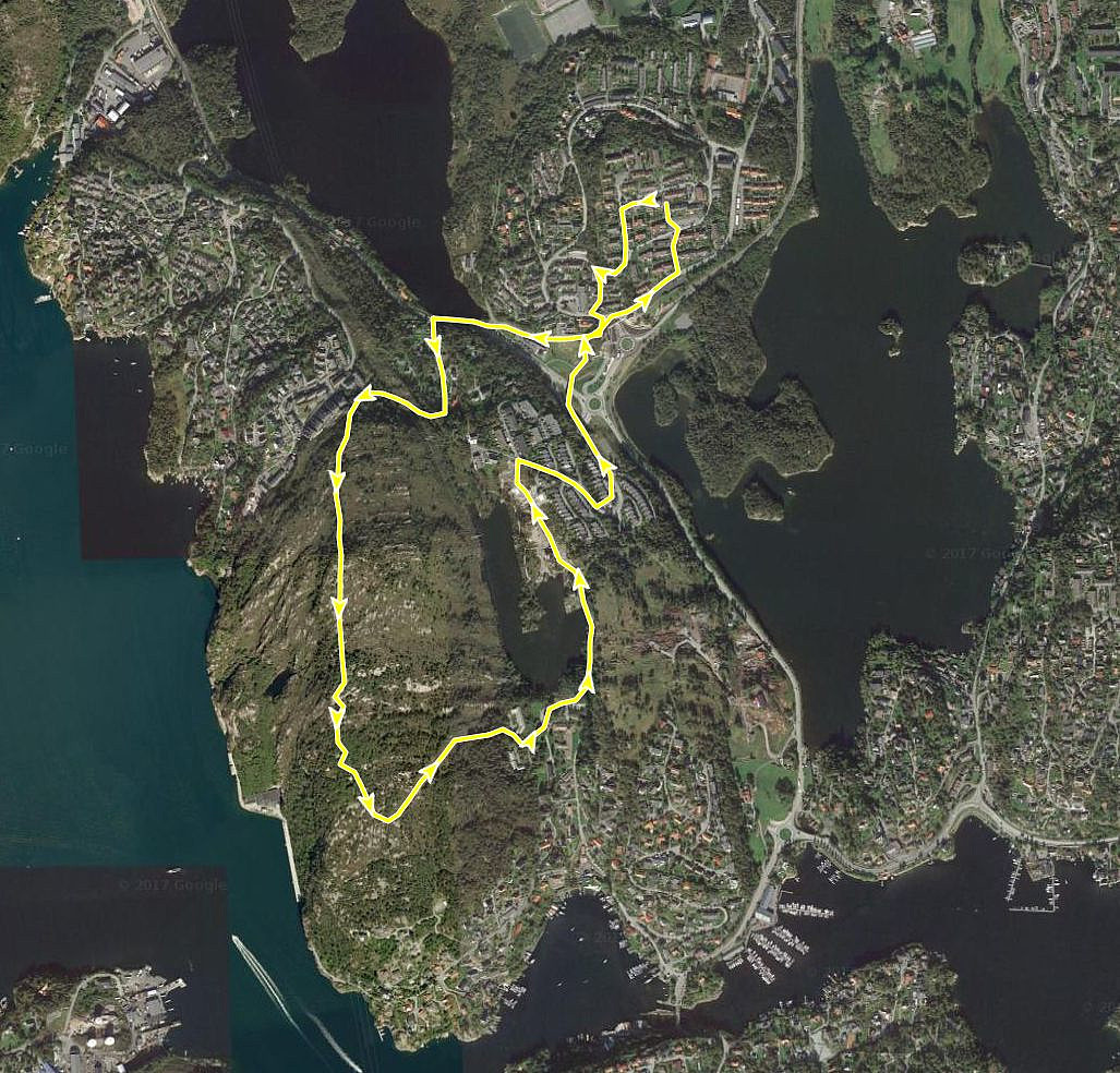
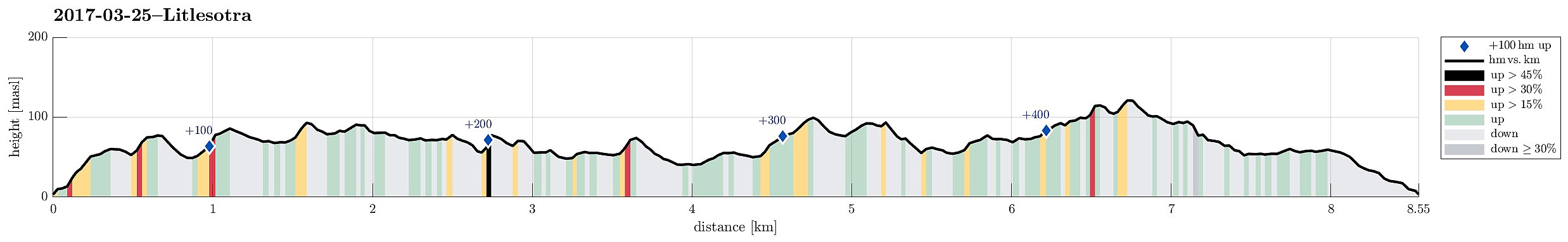 I took the car along road #555 towards the west from Bergen, crossing the Sotra-bridge to Litlesotra. There, I continued to Straume (where also the Sator Center is), and followed the small road #209 towards the north from there. I passed the places, where one could drive to Foldnes and to Anglavik, later, and arrived in a small place called Vågo shortly after.
I left the car in Vågo and started my hike in southern direction. Very soon, I had to leave the path, which I had started on, and continued through the wild (as expected from studying the map in advance). The first (nearby) target was Storanipa, just south of Vågo. On its western side, there are steep cliffs, but ascending to it from any of the other directions is straight forward. Next, I had already planned to cross over (in >>>
I took the car along road #555 towards the west from Bergen, crossing the Sotra-bridge to Litlesotra. There, I continued to Straume (where also the Sator Center is), and followed the small road #209 towards the north from there. I passed the places, where one could drive to Foldnes and to Anglavik, later, and arrived in a small place called Vågo shortly after.
I left the car in Vågo and started my hike in southern direction. Very soon, I had to leave the path, which I had started on, and continued through the wild (as expected from studying the map in advance). The first (nearby) target was Storanipa, just south of Vågo. On its western side, there are steep cliffs, but ascending to it from any of the other directions is straight forward. Next, I had already planned to cross over (in >>>
Møsnuken from Tveit
- Dato:
- 18.03.2017
- Turtype:
- Fjelltur
- Turlengde:
- 3:15t
- Distanse:
- 5,5km
 Via Fana, we first drove to Osøyro, before we continued along road 137 (in northeastern direction). We passed Heggland and continued to Tveit, where we parked the car near to the point, where the street passes over Spannsteigselva, coming down from Gjemdalsskaret (at the end of our hike, we should come down exactly there, too).
Our plan was to ascend towards Møsnuken via Tveitaberget. To do so, we first found a little forest road, which departs from Hegglandsdalsvegen a little southwest of where we parked (i.e., back along the street, which we had come there). This forest road leads upwards (mostly in western direction) and brings one conveniently to a height of about 150mosl. There, after an extended left swing, the road splits into a somewhat more prominent part, leading upwards in northern >>>
Via Fana, we first drove to Osøyro, before we continued along road 137 (in northeastern direction). We passed Heggland and continued to Tveit, where we parked the car near to the point, where the street passes over Spannsteigselva, coming down from Gjemdalsskaret (at the end of our hike, we should come down exactly there, too).
Our plan was to ascend towards Møsnuken via Tveitaberget. To do so, we first found a little forest road, which departs from Hegglandsdalsvegen a little southwest of where we parked (i.e., back along the street, which we had come there). This forest road leads upwards (mostly in western direction) and brings one conveniently to a height of about 150mosl. There, after an extended left swing, the road splits into a somewhat more prominent part, leading upwards in northern >>>
Along Sælevatnet
- Dato:
- 12.03.2017
- Turtype:
- Spasertur
- Turlengde:
- 0:45t
- Distanse:
- 2,3km
 I started from Varden and got down from Vardeveien to Fyllingsdalsveien near the bridge, which crosses over Fyllingsdalsveien from Vardeveien (and over to Skitnakastet). After crossing Fyllingsdalsveien, I quickly descended towards Sælevatnet. Then, I followed the shoreline, first in southern direction, following the outer edge of this small peninsula, separated from "the rest of the world" by Fyllingsdalsveien. After having completed this surrounding, I got back to Skitnakastet, where I took the small bridge back to Vardeveien. From there, it was then only a few meters back to the start.
Selected photos are available as Google photo album .
See also the related FB-page Hiking around Bergen, Norway .
I started from Varden and got down from Vardeveien to Fyllingsdalsveien near the bridge, which crosses over Fyllingsdalsveien from Vardeveien (and over to Skitnakastet). After crossing Fyllingsdalsveien, I quickly descended towards Sælevatnet. Then, I followed the shoreline, first in southern direction, following the outer edge of this small peninsula, separated from "the rest of the world" by Fyllingsdalsveien. After having completed this surrounding, I got back to Skitnakastet, where I took the small bridge back to Vardeveien. From there, it was then only a few meters back to the start.
Selected photos are available as Google photo album .
See also the related FB-page Hiking around Bergen, Norway .
Home via Løvstakken
- Dato:
- 06.03.2017
- Turtype:
- Fjelltur
- Turlengde:
- 2:45t
- Distanse:
- 12,0km
 After a day with an important deadline (and the according stress) as well as teaching in the afternoon, I decided that it was time to get out into the fresh air. Even though already 16h30 in the afternoon, I thought that walking home via Løvstakken could be an option!
I left Høyteknologisenteret in Bergen, crossed the new pedestrian bridge "Småpudden", and then headed for a quick connection to Løvstien. Following Damsgårdsveien a bit into southeastern direction brought me to a place, where some stairs lead upwards (to Michael Krohns gate). Crossing Michael Krohns gate, I found new stairs on the other side, leading further upwards (first to Lien and then to Nordre Skogveien). There (on Nordre Skogveien), I had to walk back (in southeastern direction) a little, before entering >>>
After a day with an important deadline (and the according stress) as well as teaching in the afternoon, I decided that it was time to get out into the fresh air. Even though already 16h30 in the afternoon, I thought that walking home via Løvstakken could be an option!
I left Høyteknologisenteret in Bergen, crossed the new pedestrian bridge "Småpudden", and then headed for a quick connection to Løvstien. Following Damsgårdsveien a bit into southeastern direction brought me to a place, where some stairs lead upwards (to Michael Krohns gate). Crossing Michael Krohns gate, I found new stairs on the other side, leading further upwards (first to Lien and then to Nordre Skogveien). There (on Nordre Skogveien), I had to walk back (in southeastern direction) a little, before entering >>>
Knappen
- Dato:
- 05.03.2017
- Turtype:
- Fjelltur
- Turlengde:
- 1:00t
- Distanse:
- 4,6km
 We started at Varden, walking down Marineveien and further on Bjørgeveien, where we turned left into Sandeidbrotet, leading steeply upwards (in the direction of Knappatjørna). At "the top", where the street makes a sharp turn to the left, a hiking path leaves to the right (only a few meters above another side-road, which only connects to a private place). Following the hiking path (into northwestern direction) brings one nearby Røstafjellet, i.e., another residential area north of Knappen and slightly elevated above Bjørgeveien. Before actually entering this area, another hiking path leaves to the left and upwards, first in western direction, but then, following the ridge, turning more and more into southern direction. Once on the ridge, the path follows the heights up to >>>
