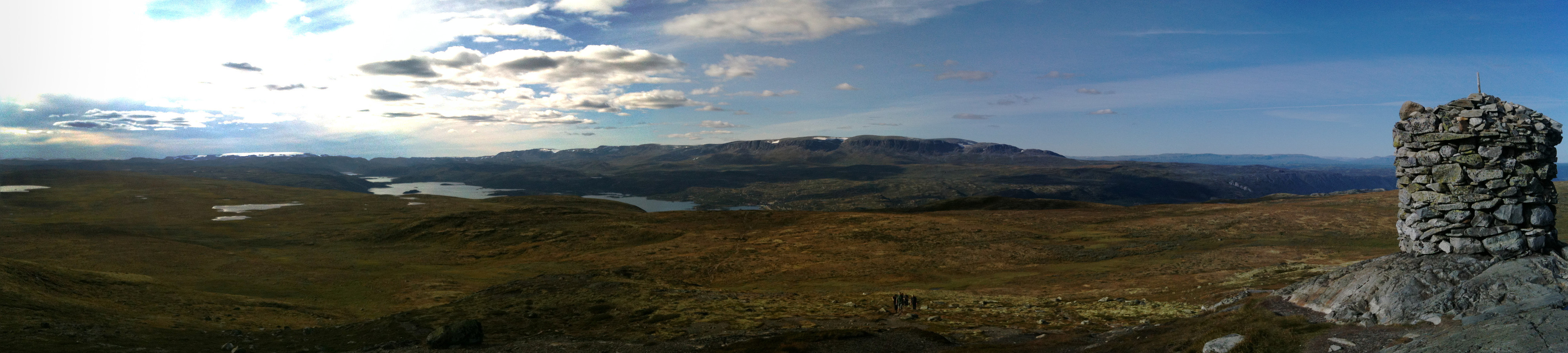
Ustetinden (15.08.2013)

| Startsted | Ustaoset (988moh) |
|---|---|
| Sluttsted | Ustaoset (988moh) |
| Turtype | Fjelltur |
| Turlengde | 4t 00min |
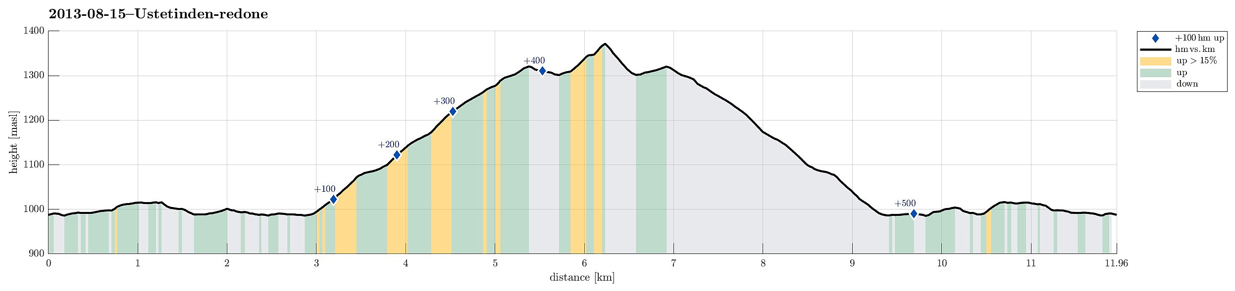
| Distanse | 12,0km |
| Høydemeter | 555m |
| GPS |
|
| Bestigninger | Ustetind (1376moh) | 15.08.2013 |
|---|
Note that this track has been created a posteriori, i.e., from memory, not automatically recorded.
Trip Summary
Nice and easy tour from Ustaoset to Ustetinden (and back) -- the top stands out surprisingly from its surrounding, still this enjoyable hike is very easy!

Kommentarer