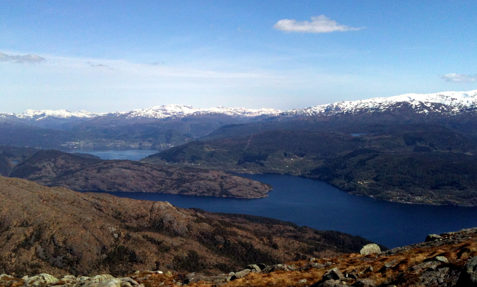
Sveningen (27.04.2014)

| Startsted | Parking place at the end of Haugsdalen (95moh) |
|---|---|
| Sluttsted | Parking place at the end of Haugsdalen (95moh) |
| Turtype | Fjelltur |
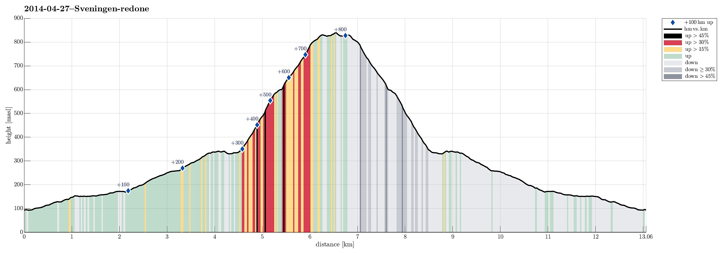
| Turlengde | 3t 00min |
| Distanse | 13,1km |
| Høydemeter | 851m |
| GPS |
|
| Bestigninger | Sveningen (842moh) | 27.04.2014 |
|---|---|---|
| Andre besøkte PBE'er | Hausdalen parkering (94moh) | 27.04.2014 |
Note that this track has been created a posteriori, i.e., from memory, not automatically recorded.
Trip Summary
This time, we took a new route to the top: from Brekkjedalen -- that's actually very attractive and rewarding!
Useful Resources
Web page WestCoastPeaks.com provides useful information about Sveningen, Søtefjellet, Sauskolten, Rindafjellet, and Midtsæterfjellet
and also Petter Bjørstad has a useful page about Sveningen.

Kommentarer