Evening attempt to reach Mt. Inasa (26.06.2025)

| Startsted | Nagasaki Central Railway Station (5moh) |
|---|---|
| Sluttsted | Inasajido Park (25moh) |
| Turtype | Spasertur |
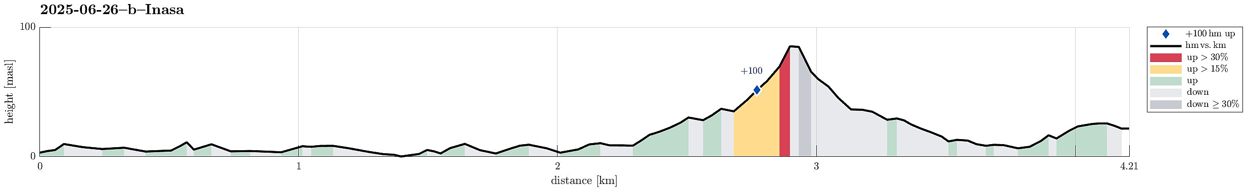
| Turlengde | 1t 30min |
| Distanse | 4,2km |
| Høydemeter | 165m |
| GPS |
|
| Bestigninger | Isanayama (333moh) | 26.06.2025 12:00 |
|---|---|---|
| Andre besøkte PBE'er | Inasa Bridge (5moh) | 26.06.2025 |
Trip Summary
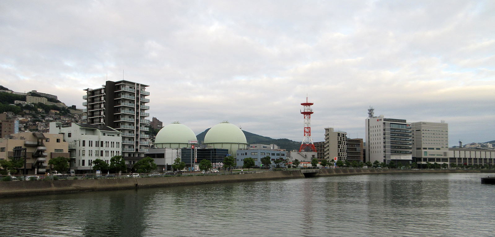
After first visiting the Atom Bomb Museum and Peace Park, earlier the same day, we then thought that it would be nice to take night looks at Nagasaki from Mt. Inasa. We first walked along Uragami River northwards, in order to find a trail that we had spotted on OpenCycleMap and which was supposed to bring us up to Mt. Inasa from the Fuchimachi part of Nagasaki. After walking around the Mitsubishi Industries near the valley station of the Nagasaki Ropeway, we then aimed at the road leading up to Fuchimachi. At this highest-most point of a side-road, however, we had to understand that finding a trail there was too optimistic. Also a local resident made it clear to us that there was no way further up from there! We thus retreated back down and instead connected to a bus stop to get up to Mt. Inasa. Given that it then was pitch black, already, when we finally arrived at the top, we concluded that it was right not try harder from Fuchimachi! We anyway enjoyed the amazing night-time views from Mt. Inasa for quite a while then! :-)
Photos
Selected photos are available as Google photo album.
Useful Resources
See also the related FB-page Hiking around Bergen, Norway.

Kommentarer