Lauvåsen in Jordalen (19.01.2025)

| Startsted | Varden (45moh) |
|---|---|
| Sluttsted | Varden (45moh) |
| Turtype | Blandet sykling |
| Turlengde | 5t 00min |
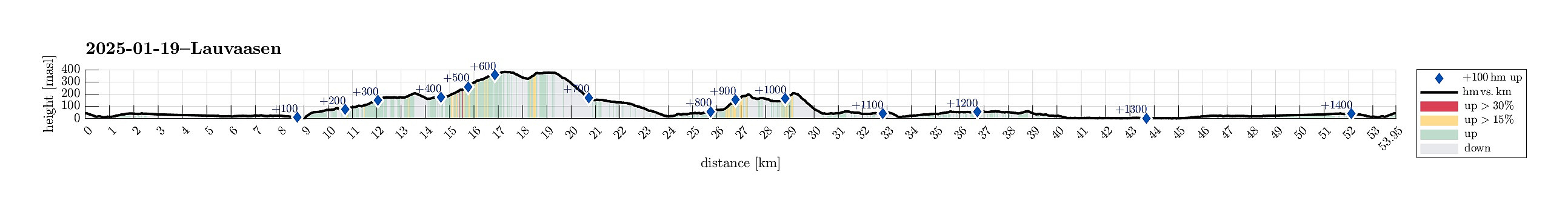
| Distanse | 54,0km |
| Høydemeter | 1454m |
| GPS |
|
| Bestigninger | Lauvåsen (198moh) | 19.01.2025 |
|---|---|---|
| Andre besøkte PBE'er | Bryggen i Bergen (1moh) | 19.01.2025 |
| Fyllingsdalstunnelen - Kristianborgsiden (18moh) | 19.01.2025 | |
| Fyllingsdalstunnelen - Oasensiden (34moh) | 19.01.2025 | |
| Grindarasten (375moh) | 19.01.2025 | |
| Jordalsveien p-lomme (40moh) | 19.01.2025 | |
| Ishuset ved Langevatnet (127moh) | 19.01.2025 | |
| Regnhytten (359moh) | 19.01.2025 | |
| Stallane (207moh) | 19.01.2025 | |
| Sælen kirke p-plass (15moh) | 19.01.2025 | |
| Vannverkshus i Skiveien (244moh) | 19.01.2025 | |
| Vinddalsveien p-lomme (160moh) | 19.01.2025 |
Trip Summary
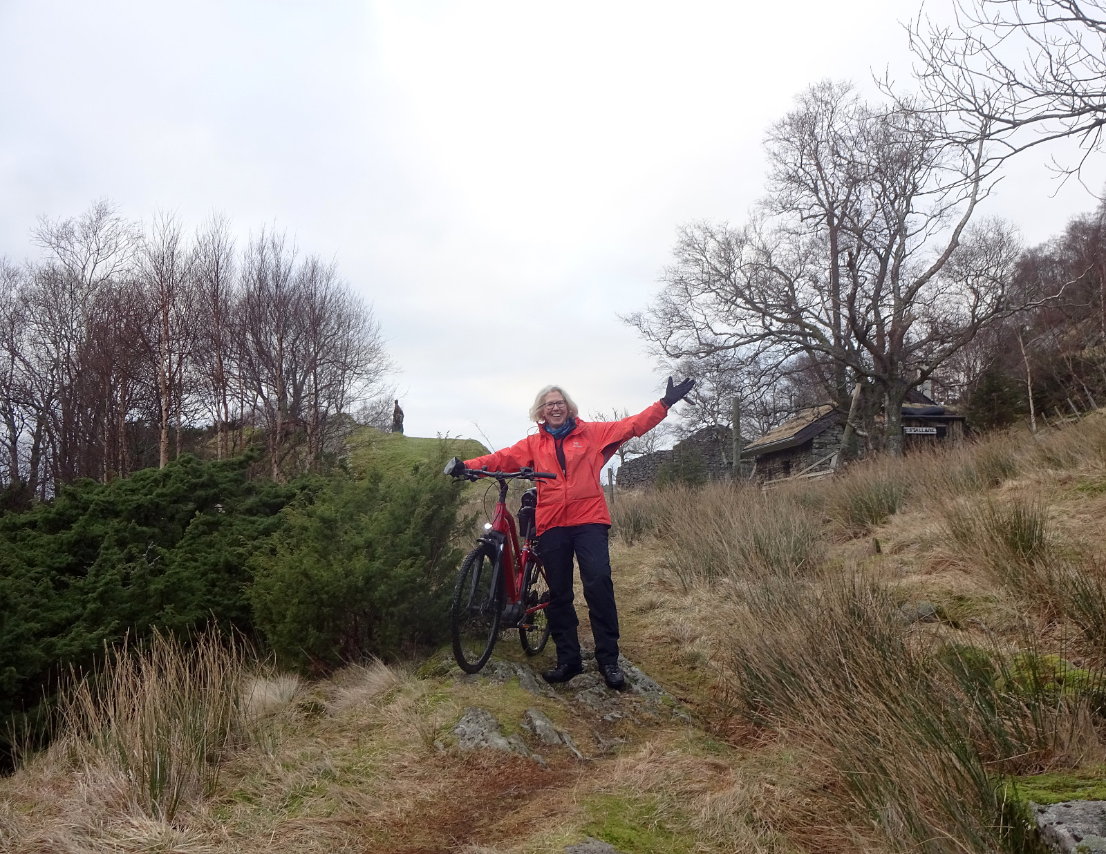
We had discussed a possible hike up to Storsåta, northeast of Jordalen. The first qualification that happened was our decision to approach Jordalen with our bikes. All this worked nicely and smoothely, using the bike-tunnel between Fyllingsdalen and Minde. The next qualification then was to cross over to Munkebotn via Fløyfjellet. After checking out two options to do so that did not work out (at Lappen and Knatten we read that cycling is not allowed on Søre Kamvei!), we took a route up from Skansemyren. Passing by Skomakerdiket, we then quickly crossed over Fløyfjellet before making it further to Storevatnet and then further down to Munkebotn (the descent from Fløyfjellet down to Munkebotn is quite steep, though). At Munkebotsvatnet, we made a short break to enjoy our packed lunch. Before remounting our bikes, we then had another round of discussion regarding the remainder of this adventure and decided that we anyway would not go for Storsåta. To still make this round a bit interesting, we instead decided to attempt a round around Jordalsvatnet, knowing that the southeastern end of Jordalen is not suited for biking (especially the path down from Stallane to Jordalen). After biking down Munkebotn and crossing over, we used Selvikveien to bike into Jordalen. After biking up the quite steep Vinddalsveien, we parked our bikes at the point, where hikers can start to hike up Kløvet. Instead of doing this, though, we made a quick exploration of Lauvåsen in the southwest. Even though Lauvåsen indeed is a minor hill, it still offers some quite nice views across Jordalsvatnet! :-) After returning to our bikes, we headed further inwards in Jordalen with our next goal being Stallane. Pushing our bikes up the access road, we soon arrived at Stallane (also a nice place!). Next came our descent from Stallane to the southeastern end of Jordalsveien much further down. We knew that biking would not be possible on this stretch, requiring some careful pushing of our bikes, instead. Once down on Jordalsveien, we then biked out towards Eidsvåg. From there, we followed the main bike route into Bergen, which first rounds Eidvågsneset a bit further into the northwest. After returning home using major bike paths, we found ourselves satisfied, even though we had skipped Storsåta! :-)
Photos
Selected photos are available as Google photo album.
Useful Resources
See also the related FB-page Hiking around Bergen, Norway.
Bergen kommune offers information about cycling in Byfjellene.

Kommentarer