Kyrkjenibben etc. (23.12.2024)

| Startsted | Fjell (10moh) |
|---|---|
| Sluttsted | Fjell (10moh) |
| Turtype | Fottur |
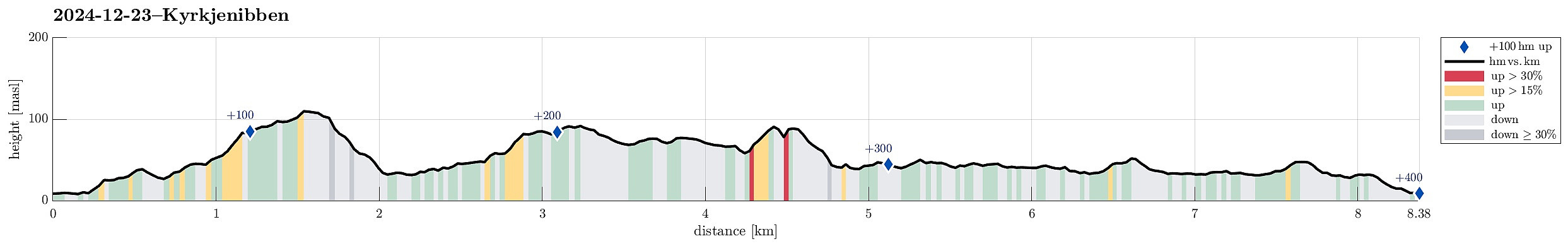
| Turlengde | 3t 00min |
| Distanse | 8,4km |
| Høydemeter | 322m |
| GPS |
|
| Bestigninger | Gardafjellet (112moh) | 23.12.2024 |
|---|---|---|
| Øst for Kyrkjenibben (96moh) | 23.12.2024 | |
| Andre besøkte PBE'er | Bekkebruna (39moh) | 23.12.2024 |
| Fjell kyrkje parkering (8moh) | 23.12.2024 |
Trip Summary
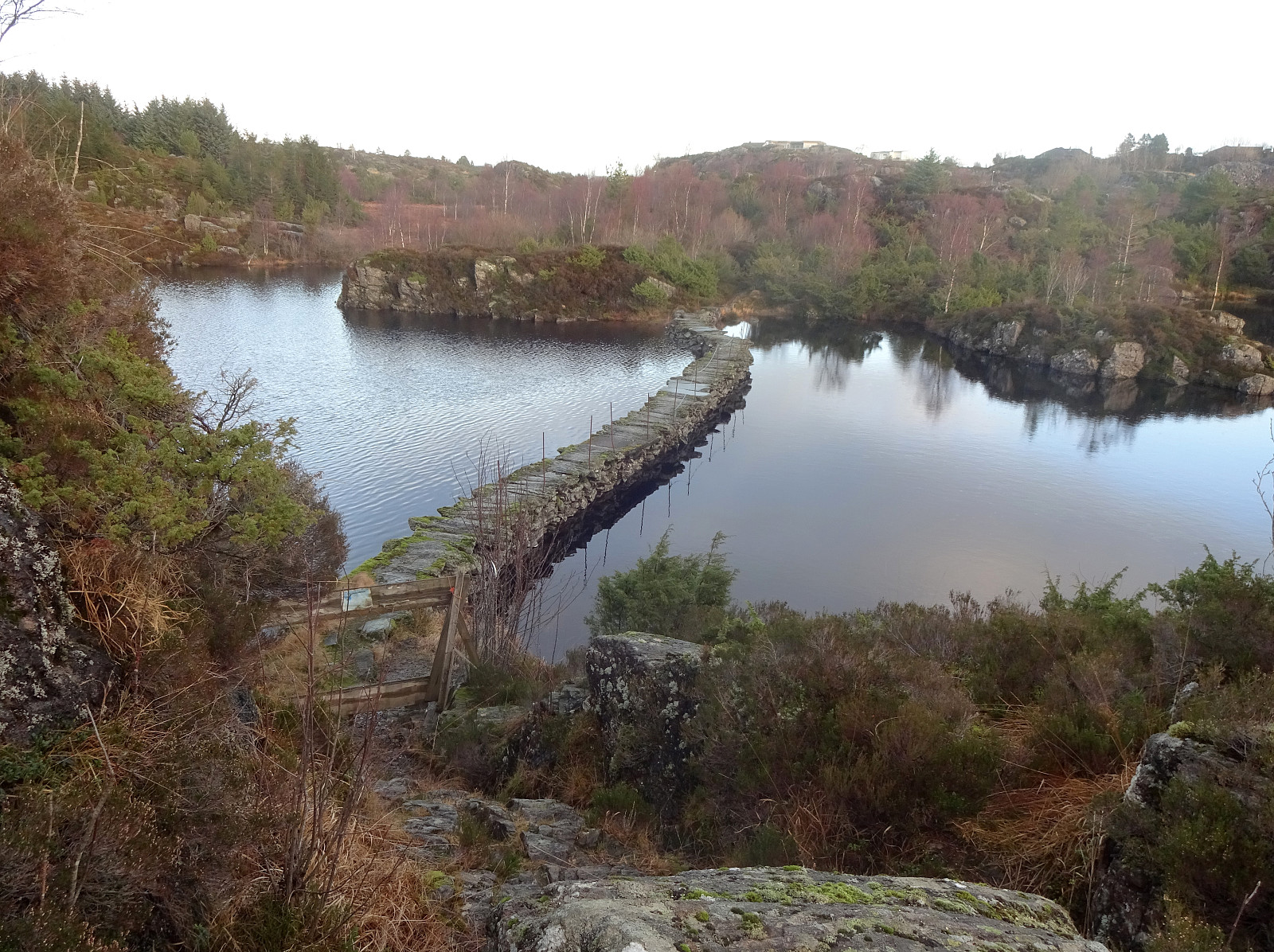
We expected the higher tops to be covered with clouds and thus decided to instead head towards the coast for a simple hike. We knew that one should be able to find a historic connection between Morland and Fjell, kyrkjevegen, which apparently was used by the people of Morland to get to the church in Fjell previously. We started near the church in Fjell and followed kyrkjevegen until we came to the south end of Eidesvatnet. Instead of following kyrkjevegen further northwards from there, we had already decided that we wished to include a detour to Gardafjellet a bit further west. Following a trail around Kvernhaugen (around the south of Liavatnet) brought us to the trail up to Gardafjellet (in northwestern direction). At Gardafjellet we enjoyed some nice views, before continuing -- then in northeastern direction (to get back to kyrkjevegen). Following the trail, we found the right spot to cross over the south-end of Midtvatnet without getting all too wet. We then continued a short stretch on kyrkjevegen (into the direction of Morland), before changing to a trail (again in northeastern direction) that heads towards Kolltveit. Instead of following this trail for a longer stretch, however, we soon left it and continued off-trail (in northern direction) to explore the heights in the east of Morland (including Kyrkjenibben). Eventually, this exploration brought us into the vicinity of Nubben and Nubbavatnet in the west of Mjåvatnet. From Nubben, one again has some views in various directions. We then descended into eastern dircetion from Nubben to see the elevated trail that separates Storavatnet from Nordravatnet. After inspecting this interesting construction, enabling a connection to Kolltveit with comparably dry shoes, we started our hike back to Fjell -- this time a bit further east. To do so, we followed a trail that leads along the western side of Storavatnet (but east of Mjåvatnet) southwards. At Søre Vassenden (the south end of Storavatnet), we then chose a continuation in the east of Eidesvatnet, including also a visit to Tredjavasstoppen. South of Tredjavasstoppen, we then stepped across some truly impressive old dams -- apparently built more than 100 years ago to raise the waters in Halvgjevatnet by almost ten meters. From there, it was then only a few meters back to Fjell. While it was definitely interesting to visit several historic sites in this area, the landscape is not the most exciting one to visit (it's quite OK, though)...
Photos
Selected photos are available as Google photo album.
Useful Resources
See also the related FB-page Hiking around Bergen, Norway.
Web page UT.no from the Norwegian Trekking Association recommends a similar hike.

Kommentarer