Bike-hiking Milde and Hordnesskogen (31.08.2024)

| Startsted | Varden (45moh) |
|---|---|
| Sluttsted | Varden (45moh) |
| Turtype | Blandet sykling |
| Turlengde | 5t 00min |
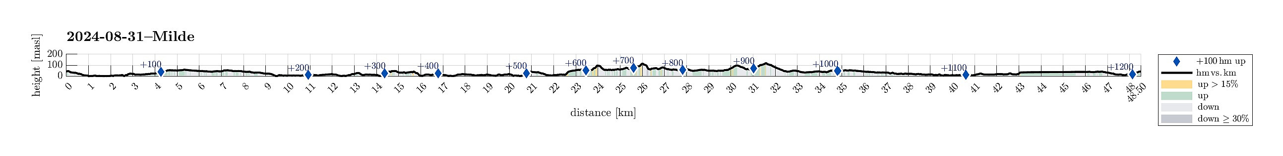
| Distanse | 48,6km |
| Høydemeter | 1226m |
| GPS |
|
| Bestigninger | Råvarden (120moh) | 31.08.2024 |
|---|---|---|
| Sauhaugen ved Skeisåsen (116moh) | 31.08.2024 | |
| Slettåsen (50moh) | 31.08.2024 | |
| Storåsen i Hordnesskogen (99moh) | 31.08.2024 | |
| Andre besøkte PBE'er | Fyllingsdalstunnelen - Kristianborgsiden (18moh) | 31.08.2024 |
| Fyllingsdalstunnelen - Oasensiden (34moh) | 31.08.2024 | |
| Hordneskogen parkering (51moh) | 31.08.2024 | |
| Håsteinen (45moh) | 31.08.2024 | |
| Grønneviken p-plass (10moh) | 31.08.2024 | |
| Botanisk hage p-lomme (5moh) | 31.08.2024 | |
| Straume bro (5moh) | 31.08.2024 | |
| Sælen kirke p-plass (15moh) | 31.08.2024 |
Trip Summary
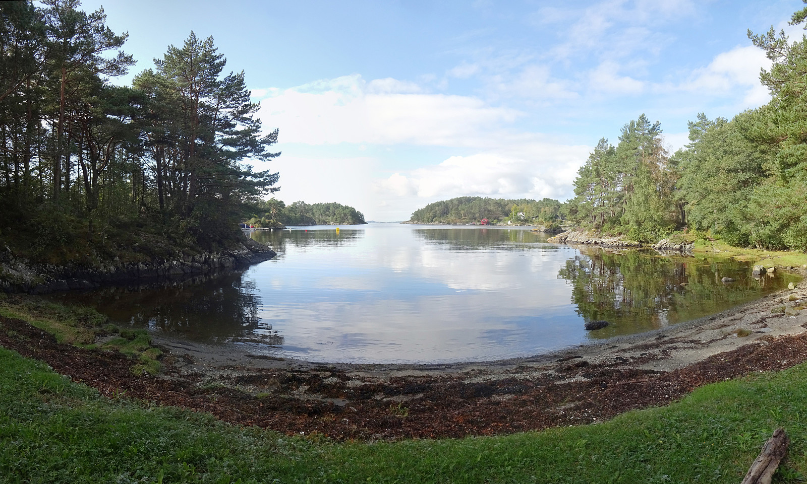
With a nice Saturday at my hand (and foot), I decided to explore the southwest of Milde. I thus mounted my eBike and cycled southwards, passing by Straume and biking along Ytrebygdsvegen, then continuing into the direction of Hjellestad/Milde. While biking by the Arboretet at Milde, one of the spokes on one wheel snapped -- not good. I still continued further southwards, aiming at Skipanesvegen in the south of Mildevatnet. Near Steingardsvikane, I left my bike behind and continued to do a short hike. I first walked along a trail that leads over to Okshammarsvika from Steingardsvikane. At the first nice bay, north of Steingardsvikane, I then found a trail that suggested to bring me up to Slettåsen. While this trail was easy to follow, first, it became less clear near the "top" of Slettåsen. With a bit of back and forth, however, I could find the highest point there (which is not at all worth visiting, while neither a problem to visit). I had read about Håsteinen in the northwest of Slettåsen and decided to also include this hill. In fact, Håsteinen is the nicer spot to visit as it offers some nice views (towards Sotra etc.). On my way back to Steingardsvikane, I then avoided the cabins (or houses, even?) in the northeast of Okshammarsvika. This meant to get through some wet terrain with mentionable vegetation. South of Slettåsen, I reconnected with the trail that I had taken up. Back on my bike, my main goal was to aim at the bike repair shop at Fjøsangerveien to get a new spoke. After passing by Arboretet, again, now northwards, I then continued along Grimseidvegen in northeastern direction. Since I was about to pass by Hordnesskogen anyway, this way, I decided to also include Storåsen and Sauhaugen, which I had not visited before. A mix of biking and hiking made this happen. While I mostly walked along trails up and down Storåsen, I was mostly off-trail while doing the Sauhaugen-loop. I even chose a descent from Sauhaugen, which was steeper than necessary, requiring a bit of care. Next en route to Fjøsangerveien, I saw a chance to also include a short visit to Råvarden. While getting up to Råvarden is very simple, it was more challenging to actually find a good connection between Hordnesskogen and Råvarden. Thereafter, it was mostly "just" biking along the bike paths further northwards. At the bike repair shop, I then got a new spoke -- unfortunately, as I just found out later at home, not the right one for my bike! Not nice. Nonetheless, this trip caused from good exposure to fresh air and nice weather. So that's definitely good! :-)
Photos
Selected photos are available as Google photo album.
Useful Resources
See also the related FB-page Hiking around Bergen, Norway.

Kommentarer