Søtefjellet from Hausdalen (20.07.2024)

| Startsted | Hausdalsvegen (70moh) |
|---|---|
| Sluttsted | Hausdalsvegen (70moh) |
| Turtype | Fottur |
| Turlengde | 6t 30min |
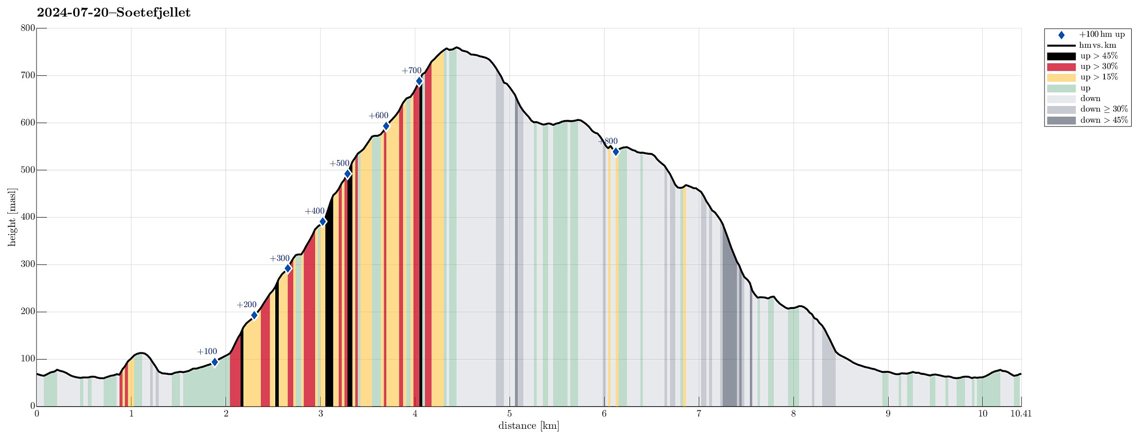
| Distanse | 10,4km |
| Høydemeter | 882m |
| GPS |
|
| Bestigninger | Søtefjellet NV (762moh) | 20.07.2024 |
|---|---|---|
| Nord for Ulvvatnet (118moh) | 20.07.2024 | |
| Andre besøkte PBE'er | Gapahuk ved Sagelva (66moh) | 20.07.2024 |
Trip Summary
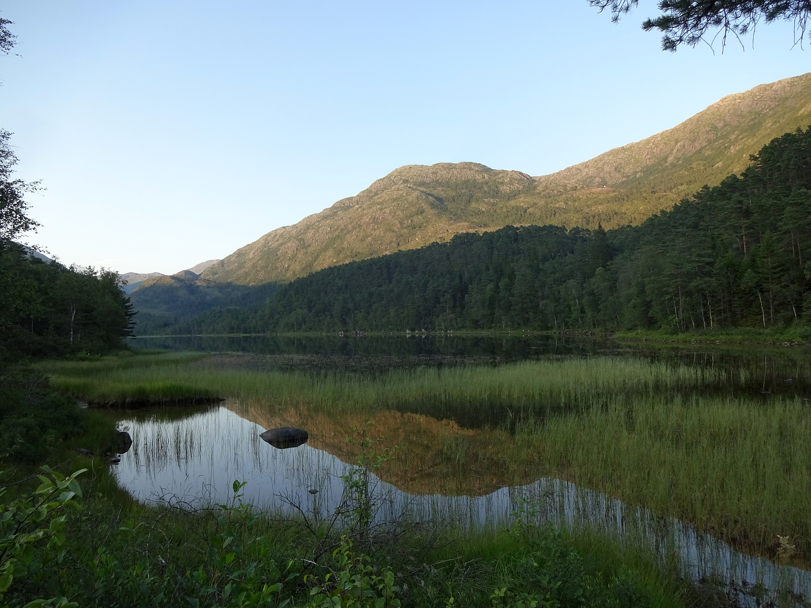
We wished to use the nice weather on this warm Saturday afternoon and headed for Hausdalen in the southeast of Bergen. Driving Hausdalen in for a little less than 7km, we parked in the southwest of Tømmervika (Samdalsvatnet), where a forest road forks off Hausdalsvegen into the direction of Straumsrinden. Following this forest road, we passed by Samdalsvatnet in its southwest, heading for the southwestern ridge of Søtefjellet, starting at Hisbotn. Just because others have described their ascent to the small hill in the north of Ulvvatnet (and even though they did not recommend to visit it -- or maybe because of their according comments :-)), this hill was included as a prelude to the ascent to Søtefjellet. Back on the forest road, and "around some corners in the northeast of Ulvvatnet, we then started our ascent to Søtefjellet, following the trail that follows the main southwestern ridge of Søtefjellet. Given the pretty warm temperatures and the direct sun on this ridge, completing this ascent required some extra-efforts. After making it to the top of Søtefjellet (its northwestern, slightly lower top, to be accurate), we continued in norther direction to visit one of the lakes in the north of Søtefjellet. After enjoying a nice break there, we then got ready for our descent. Already back home, the map had suggested that it should be possible to traverse Søtefjellet's northwestern flank "diagonally" from this lake, following a secondary (and much less expressed) ridge, which runs in parallel to the main ridge, which we had stepped up, first, in its northwest. From the lake, we first followed a pleasant ledge that brought us to the first (small) challenge, i.e., to cross a little stream that heads down from Søtefjellet into Tømmerdalen. Stepping carefully was enough to (quite easily) get to the other side. There, we again followed a pleasant ledge (just below 550 masl), which eventually became steeper and steeper. Once below 500 masl, it actually got a little tricky (quite steep, etc.). Once down to about 460 masl, however, making progress became easy again (another ledge towards the southwest). At about 465 masl, from the southwestern end of the ledge, this other, secondary southwestern ridge of Søtefjellet starts (with a small stream on its southeastern side). Stepping down this ridge was then fine (some careful steps were required, of course). This brought us down to about 230 masl, where the little stream between the two ridges forms a wet area behind a small hill. From there, we then headed mostly southwards, first reaching another wet area at about 210 masl. To eventually reconnect with the trail that we had taken up the main ridge, first, was then only a matter of a few minutes (in southern direction). Once back on the trail, walking back out was again easy and straight-forward, following the trail and then the forest road. Just a few meters before crossing Sagelva, where it enters Samdalsvatnet, a very short visit to the Gapahauk Samdalen was included, also. All in all, we returned highly satified from this nice hike up and down Søtefjellet.
Photos
Selected photos are available as Google photo album.
Useful Resources
See also the related FB-page Hiking around Bergen, Norway.
Web page WestCoastPeaks.com provides useful information about Sveningen, Søtefjellet, Sauskolten, Rindafjellet, and Midtsæterfjellet
and also Petter Bjørstad has a useful page about Sveningen.

Kommentarer