Astritinden from Botnhamn (30.06.2023)

| Startsted | Botnhamn idrettsbane (30moh) |
|---|---|
| Sluttsted | Botnhamn idrettsbane (30moh) |
| Turtype | Fottur |
| Turlengde | 4t 00min |
| Distanse | 12,7km |
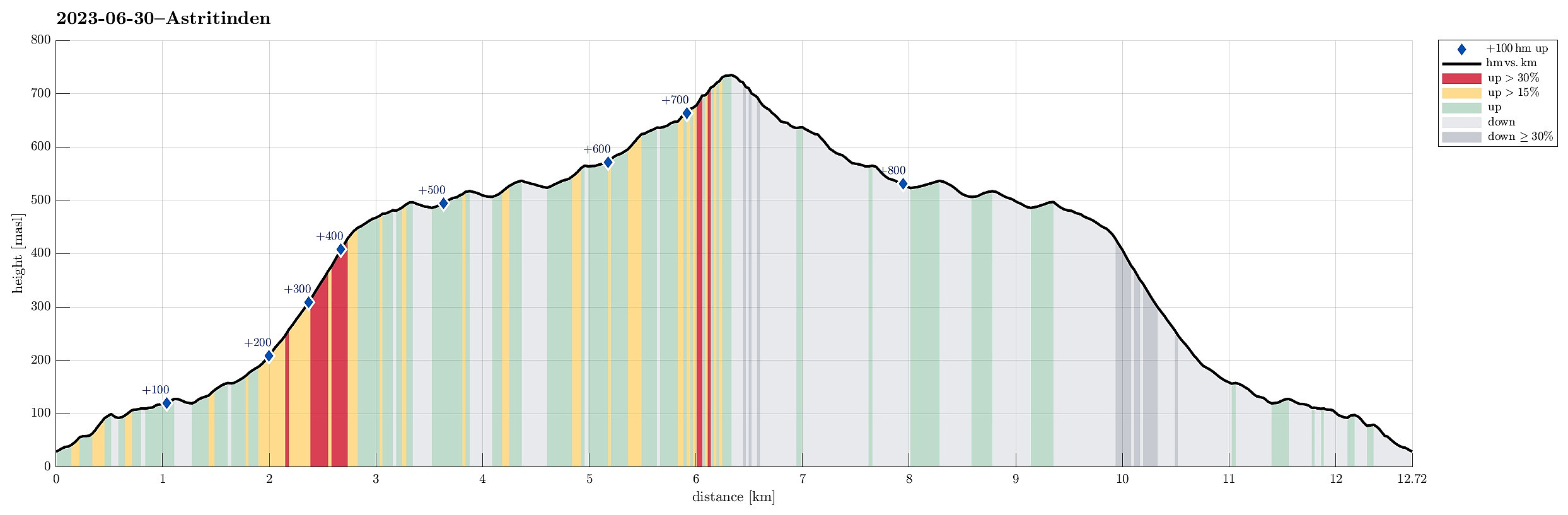
| Høydemeter | 862m |
| GPS |
|
| Bestigninger | Astritind (742moh) | 30.06.2023 |
|---|
Trip Summary
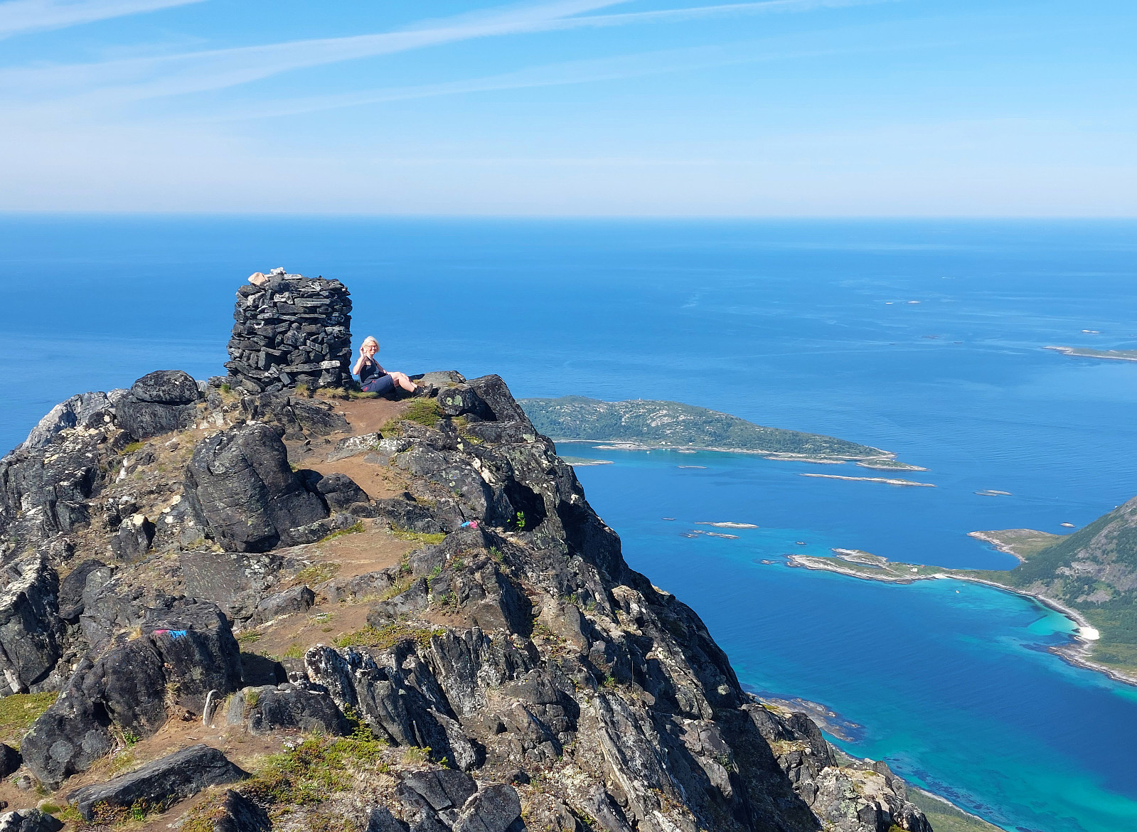
We had to catch a ferry from Botnhamn to Kvaløya and thus planned to hike Astritinden in the time given before the departure of "our" ferry. Right next to the soccer field of Botnhamn (near Mølnneset) we could park the car. The hike then starts with getting up to Sandbakkveihøgda, following one of the marked trails (eventually up right underneath the power line). Once up there, it's then "just" to follow the (long) ridge to Astritinden (steadily in northern / northwestern direction). Only a few kilometers into this hike, one puts in a significant ascent (up to Kvannaksla at about 500masl). There, the hike levels out, again, a little, before the actual ascent up to Astritinden follows a little later. While all of the hike to Astritinden is not really difficult, the last stretch up to Astritinden is not recommended, if you are afraid of heights. Repeatedly, also, you will use your hands in addition to bridge over some steeper / exposed sections. The views from Astritinden (in all directions!) are really worth the slightly longer hike, though, especially also towards the northwest / north / northeast. After some good time on the top, we then returned, following the same trail down that we had taken up first. All timing was good and we "caught" a place on the targeted ferry as planned. :-)
Photos
Selected photos are available as Google photo album.
Useful Resources
See also the related FB-page Hiking around Bergen, Norway.

Kommentarer