Lyderhorn in significant snow (11.03.2023)

| Startsted | Kjøkkelvikveien (60moh) |
|---|---|
| Sluttsted | Kjøkkelvikveien (60moh) |
| Turtype | Fottur |
| Turlengde | 1t 30min |
| Distanse | 3,0km |
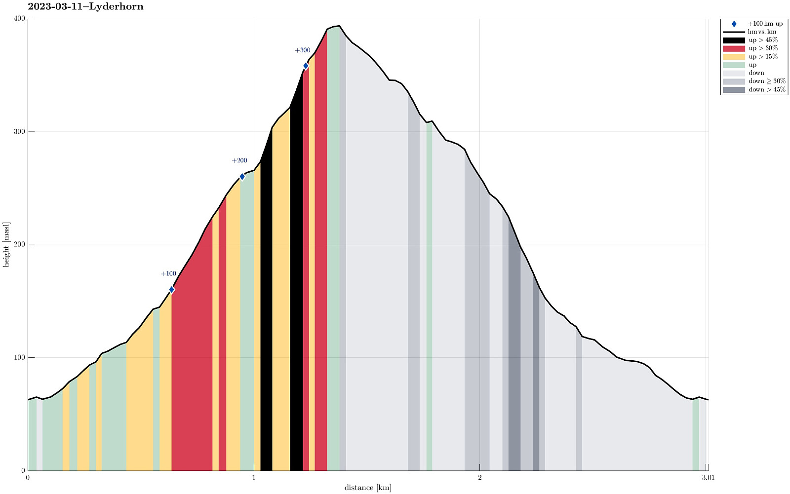
| Høydemeter | 347m |
| GPS |
|
| Bestigninger | Lyderhorn (396moh) | 11.03.2023 |
|---|---|---|
| Andre besøkte PBE'er | Lyderhornhytten (lokalitet) (396moh) | 11.03.2023 |
Trip Summary
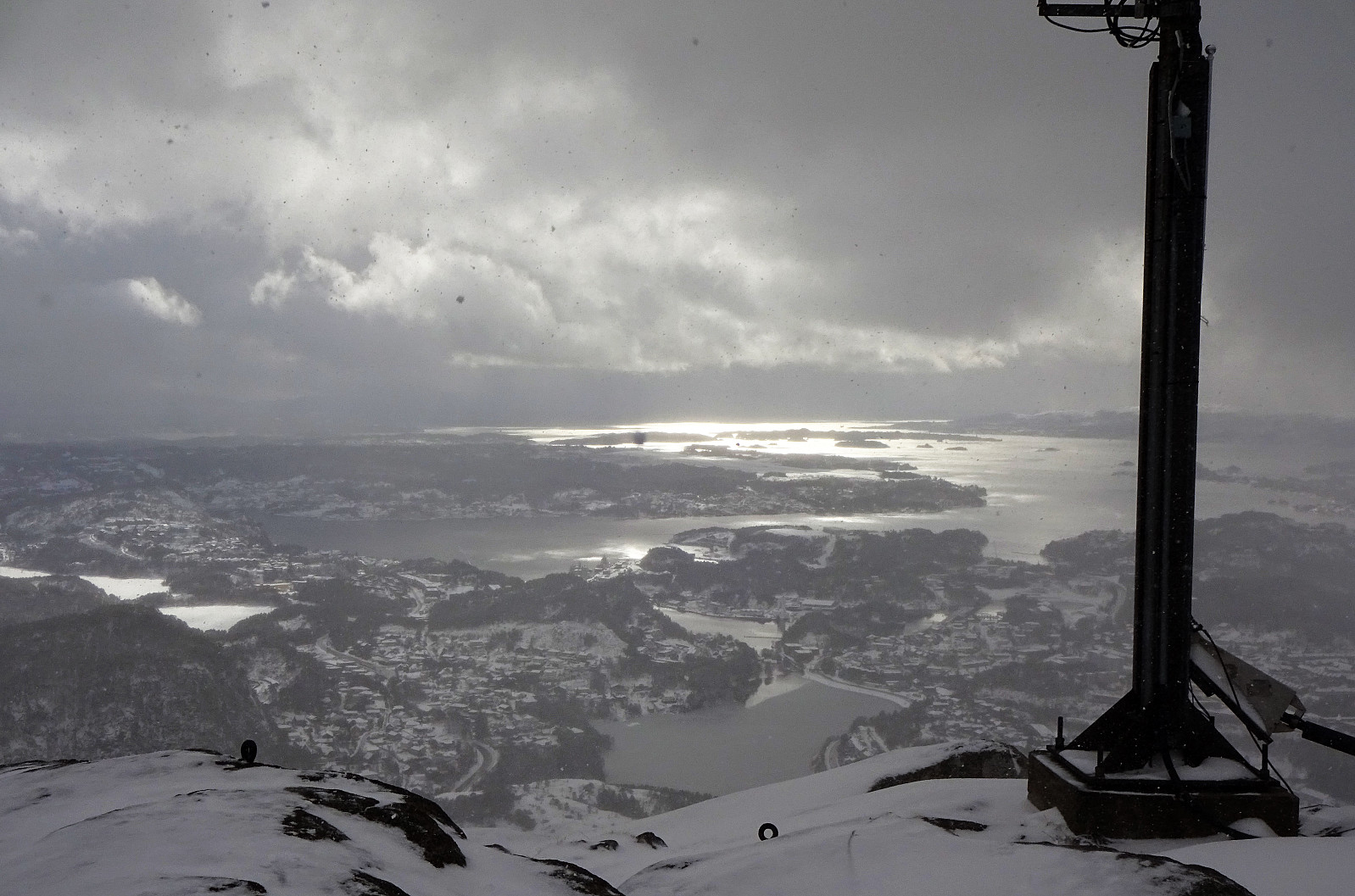
Given all the snow and also the varied weather forecast, we decided to do something not so long. Being not so far away, and always a nice hike, we decided to hike up and down Lyderhorn. We parked on the western side (along Kjøkkelvikveien) and headed towards the trail up to Små-Lyderhorn (first) through Olderdalen. Very quickly it became clear that this hike would be different from what we usually experience (due to all the snow!). At first, some steps of another person could be still recognized in the snow, but this person had decided about half-way up to turn around, apparently. Continuing further upwards was then a nice challenge, breaking quite a bit into the deep snow at every step. Up at the saddle next to Små-Lyderhorn, we then decided to put on brodders ("light form of crampons") and clearly this was a good decision. The southern flank of Lyderhorn is also steep without any snow and even then for the first 20 or 30 height meters in the northeast of Små-Lyderhorn one sometimes appreciates the use of the hands in addition. With no steps to see and quite a bit of snow on all the rocks, it definitely required a bit of extra-care to step up. While making it all the way up to Lyderhorn was more of a challenge than originally thought, it at the same time was fun and also very nice with all the untouched snow around! :-) Additionally, we started to get some sun exactly when making it up these last 100 to 150 height meters! :-) This, however, changed immediately as we arrive at the top, with the sunny weather turning into a snow storm within a few minutes. With limited vision, we tried to be extra-cautious when descending towards the north of Lyderhorn. All in all, we had thought to take "the second trail" down to Kjøkkelvikveien. At about 350masl, we then wondered whether we had descended too much, already. After making a couple of steps to the left (west), we understood that this was not the case. But, instead of going back, we decided to nonetheless "short-cut" down towards the trail in northwestern direction. One needs to descend across several terrain steps that are a bit steep, if one decides to take this "short-cut", so this "short-cut" is not really recommended; at least not as a way to be faster. At about 315masl, we then reconnected with the trail (not really visible, though, because of all the snow). Since we had taken this trail up and down before, we could still follow it (even though it was completely hidden under quite a bit of snow). Finding the right route down was then not difficult anymore, but stepping down through the relatively deep snow, not knowing what's underneath, was still a challenge. Back down on Lyderhornslien, we clearly had the impression that we had experienced an adventure -- even though it "just" was Lyderhorn! :-)
Photos
Selected photos are available as Google photo album.
Useful Resources
See also the related FB-page Hiking around Bergen, Norway.
Petter Bjørstad has a useful page about Lyderhorn and also web page WestCoastPeaks.com provides useful information about Lyderhorn and Ørnafjellet.
Web page UT.no from the Norwegian Trekking Association recommends a similar hike.

Kommentarer