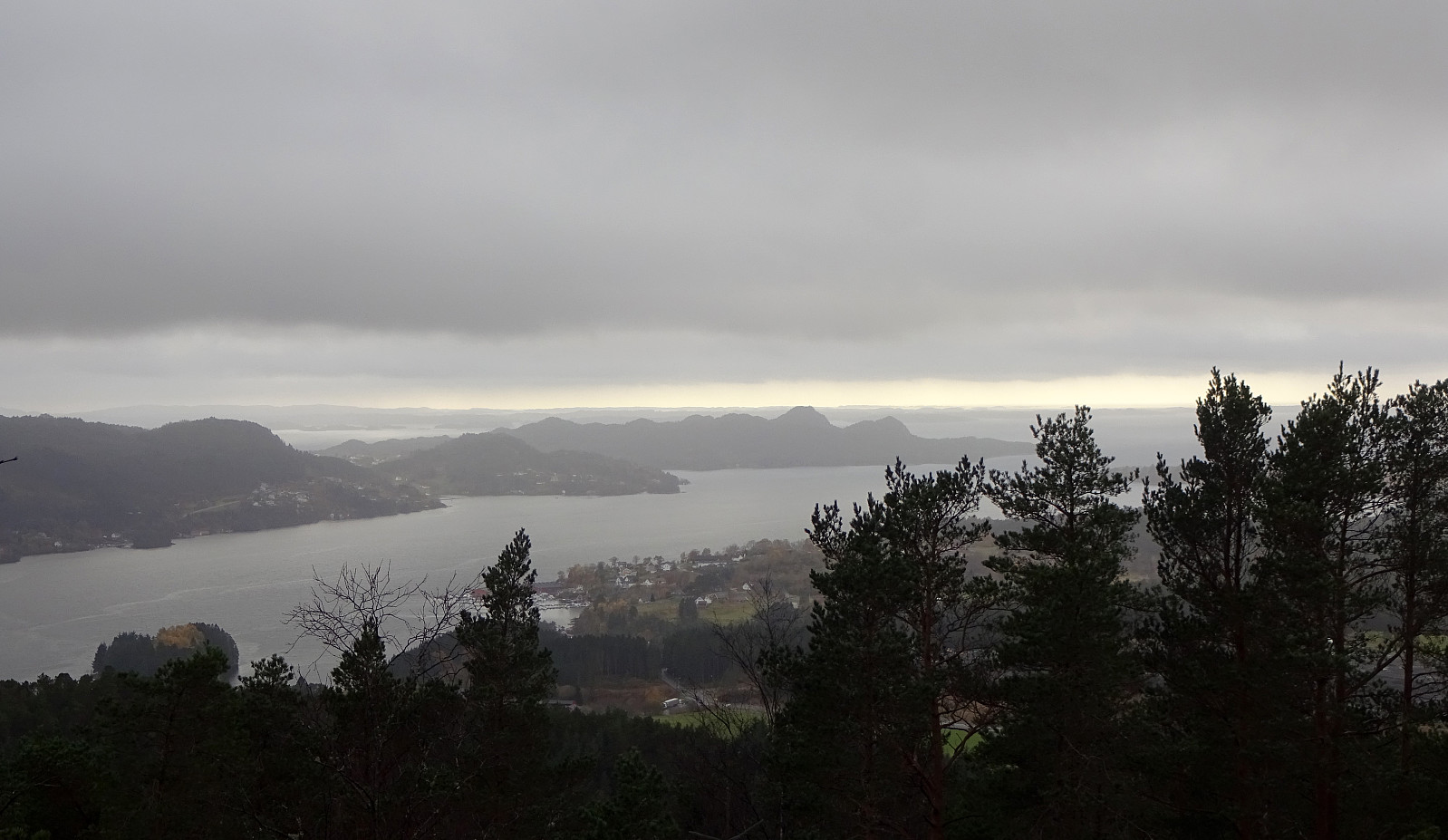
Stendafjellet from the north (29.10.2022)

| Startsted | Øvre Krohnåsen (120moh) |
|---|---|
| Sluttsted | Øvre Krohnåsen (120moh) |
| Turtype | Fottur |
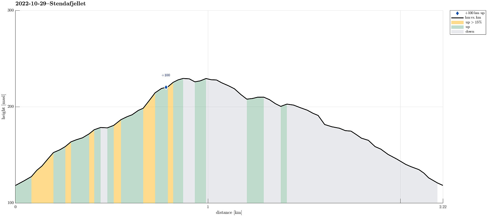
| Turlengde | 1t 00min |
| Distanse | 2,2km |
| Høydemeter | 127m |
| GPS |
|
| Bestigninger | Stendafjellet (232moh) | 29.10.2022 |
|---|---|---|
| Andre besøkte PBE'er | Krohnåsen søyle (207moh) | 29.10.2022 |
Trip Summary
Even though it all looked (and was!) a rainy day, we still wished to get some fresh air. Since we had something else to do nearby, we decided to just quickly include a short detour up and down Stendafjellet (from the north). Driving up Øvre Krohnåsen, we found a spot to park near the playing ground at the upper end of this road. From there, we started our short hike towards the "top" of Stendafjellet, choosing a route through the forest (without a trail). All this was straight-forward and without any difficulties (at about 200masl, there's a little cliff, which is easy to get around, though). On Stendafjellet, we visited the lookout point, looking down to Fanafjorden from there, before then returning (along a similar, but still a bit different route). All in all, this was a rather short, but still refreshing excursion in the rain.
Useful Resources
See also the related FB-page Hiking around Bergen, Norway.

Kommentarer