An attempt to Slettefjellet via Eikemostølen (20.07.2022)

| Startsted | Treshaugen (95moh) |
|---|---|
| Sluttsted | Treshaugen (95moh) |
| Turtype | Fottur |
| Turlengde | 2t 00min |
| Distanse | 4,4km |
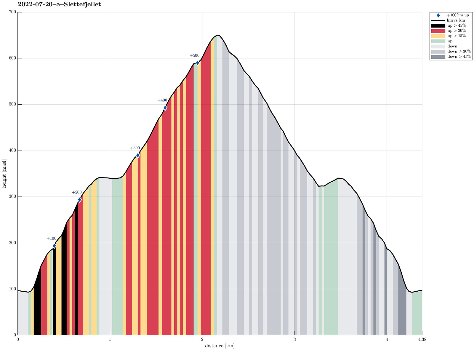
| Høydemeter | 586m |
| GPS |
|
| Andre besøkte PBE'er | Eikemostølen (344moh) | 20.07.2022 09:00 |
|---|
Trip Summary
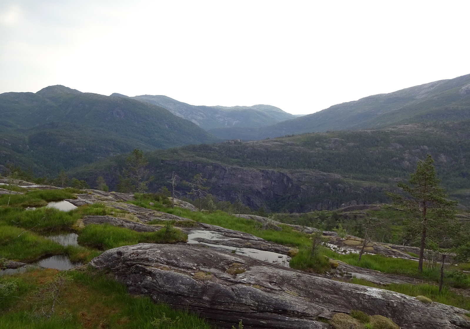
The weather forecast was not really promising, but we decided to still give it a chance. Driving down Eksingedalen and passing by the tunnel to Modalen, we soon came to Treshaugen near Eikemo, where we parked the car right next to the road. We had read up front that we should be able to locate a (steep) trail up to Eikemostølen from there and indeed we could find some blue marks on a couple of trees right next to the road near the northern bend of Ekso (in the northeast of Eikemo). Still, finding the "trail" did then require a lot of imagination (yes, a good number of trees were marked on the way up to Eikemostølen, but the "trail" was hard to see, or not, and partially covered fully with vegetation like high grass or farns). Nonetheless, it was then without major difficulties to get up to Eikemostølen (the route is indeed quite a bit steep, though!). Eikemostølen itself is only a ruin by now and seemingly not in use for a longer time. From there, we then continued our ascent up the quite steep mountain side in northwestern direction (without a trail), more or less parallel to the major cliff of Hodnafjellet in the north. When reaching a height of about 650mosl, however, it started to rain and a thunderstorm was approaching with thunder to be heard already nearby. After briefly considering our situation up the mountain and even though we thought that completing our ascent to Slettefjellet would not have taken us a lot longer, actually, we still decided that turning around and descending to Eikemostølen, again, was the right decision (the idea of experiencing some lightning strikes on Slettefjellet did not excite us sufficiently to continue our ascent). Even tough the rain contributed to making the mountain side a bit more slippery, we still managed to safely and quickly descend back down in southeastern direction to about 325mosl. There, it became clear that we had actually descended already a bit too much, passing by Eikemostølen in its north. Within a few minutes, however, we connected by to Eikemostølen and to the trail down to the road. With special care, we then followed the steep trail down to the road and back to our car. All in all, and even though it was a bit sad to not reach the top of Slettefjellet, this hike was still quite impressive; mostly due the steep terrain (and the somewhat exciting weather condition).
Photos
Selected photos are available as Google photo album.
Useful Resources
See also the related FB-page Hiking around Bergen, Norway.
Petter Bjørstad has a useful page about Slettefjellet and also web page WestCoastPeaks.com provides useful information about Slettefjellet.

Kommentarer