Kongevegen and Kvinnestigen (13.06.2021)

| Startsted | Oppheim (340moh) |
|---|---|
| Sluttsted | Oppheim (340moh) |
| Turtype | Fjelltur |
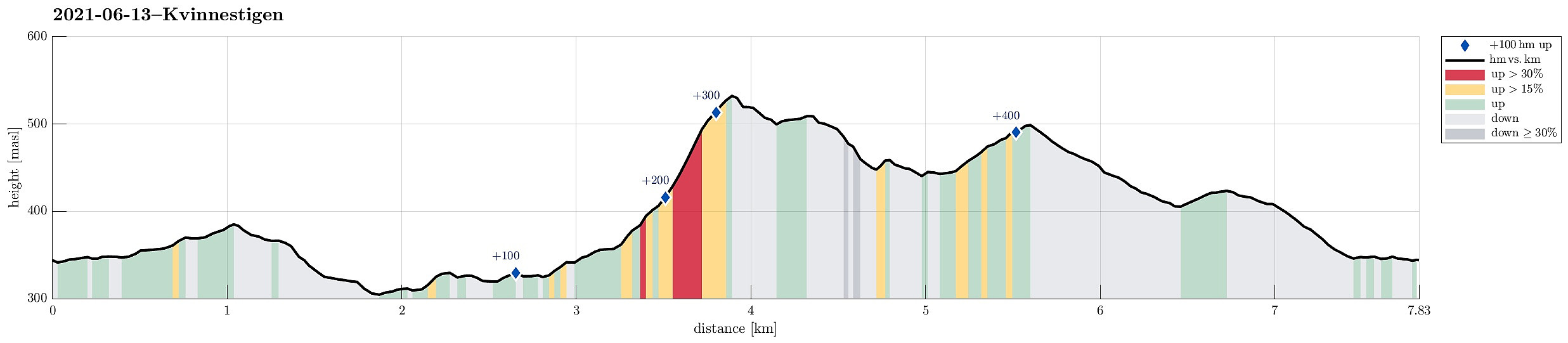
| Turlengde | 2t 30min |
| Distanse | 7,8km |
| Høydemeter | 438m |
| GPS |
|
Trip Summary
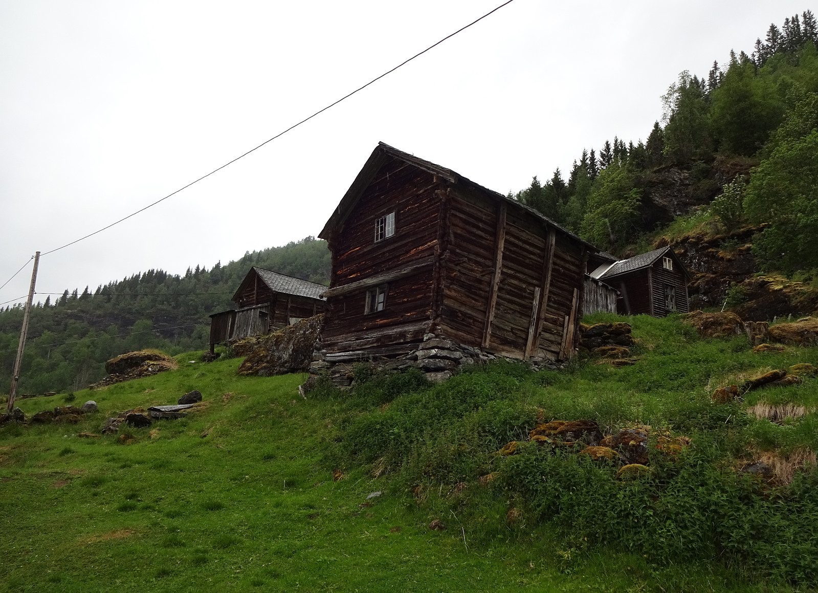
Given another rather wet day and limited time, we decided to do another "low lands" walk, exploring some local history. This lead to starting in Oppheim and following the historic Kongevegen down to Vinje (kind of "parallel" to E16 lower down in Vinjadalen, after first "short-cutting" Høgåsen on its northern side). Once arrived in Øvre Vinjo, a little above Vinje, we decided to connect "on a higher level" to Kvinnestigen. Once we arrived there (at about 400mosl), we turned right (in northeastern direction) and started the relatively steep ascent along Kvinnestigen (on a good trail!). Once above approximately 500mosl, the trail flattens out a little, and soon later we came to another trail-crossing, where we turned right, again, in order to follow a trail along the mountain side to connect "back" to a farm named Finne, not far from Bidne. Even though there were short stretches, where it was not 100% clear of where the trail actually continued, we still made it to Finne without any difficulties, enjoying some nice places with some nice spring flowers on lovely mountain meadows. After then walking down Bidnevegen a little, we connected to Sundsvålsvegen using another short stretch of a trail. After walking down Sundsvålsvegen, we returnd to where we had started within a few minutes.
Useful Resources
See also the related FB-page Hiking around Bergen, Norway.

Kommentarer