Skåldalsfjellet via Hjelterinden (24.12.2020)

| Startsted | Gullfjellsvegen (200moh) |
|---|---|
| Sluttsted | Gullfjellsvegen (200moh) |
| Turtype | Fottur |
| Turlengde | 3t 00min |
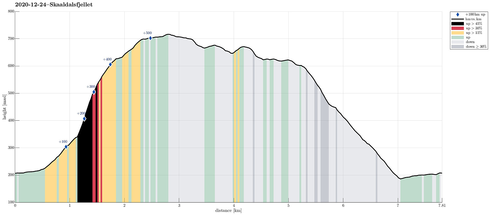
| Distanse | 7,8km |
| Høydemeter | 593m |
| GPS |
|
| Bestigninger | Grøna (680moh) | 24.12.2020 |
|---|---|---|
| Skåldalsfjellet (718moh) | 24.12.2020 | |
| Skåldalsnipa (603moh) | 24.12.2020 | |
| Andre besøkte PBE'er | Torvhus Sælingane (640moh) | 24.12.2020 |
Trip Summary
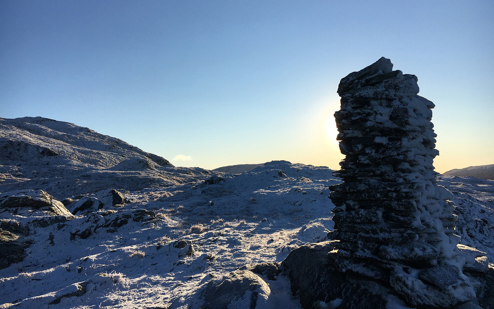
The weather forecast promised some blue skies over Bergen! :-) So the goal was to welcome the sun somewhere in the (not too deep) snow. After a bit of discussing different options, we landed on a hike up to Skåldalsfjellet (not at the least because of its chances to catch some sun). Since we've developed a taste for stepping up relatively steep mountain sides, recently, we chose an ascent via Hjelterinden, in the (steep) south of Skåldalsfjellet. Leaving the Bergen valley from Nesttun via Helldal and along Grimevatnet, we drove to Haukeland, first, before there leaving road #587 and then following the narrow road to Unneland. From there, we then drove up Gullfjellsvegen until we came to the saddle that leads into the valley with Skåldalselva. We parked (right at the saddle) and continued per pedes along Gullfjellsvegen until we crossed Skåldalselva using a small bridge that brings one over to Skåldalen. We first walked along the narrow road that winds steeply up in Skåldalen until we reached about 250mosl. There, a simple field road diverges to the north (while the "main road" in Skåldalen swings back into a southwestern direction). This secondary road then crosses Styggegjelselva, that comes down there through Skåldalen, and continued further northwards (and in parallel to Styggegjelselva) up to about 300mosl. Continuing along a simple tractor road, winding further up the steep mountain side there, we made it basically all the way up over the open parts of this side of the valley (up to about 385mosl). From there, we then found our own "way", stepping steeply upwards through a sparse forest, heading basically in northeastern direction with the goal to connect to Hjelterinden. A little above 500mosl, then, after crossing some slightly steeper stretches, that asked for using also our hands to hold on, we the stepped out into the open at Hjelterinden, enjoying some terrific views back and out across Haukelandsvatnet and Grimevatnet. We then followed the ridge further up, crossing over some (low) bushes. Soon after, we arrived at Setstølen (about 590mosl), which by now is no more than a pile of ruins. From Setstølen, we then started to divert "diagonally" from Hjelterinden, heading more directly towards Skåldalsfjellet in the northeast. By then, we already bathed in sun while walking over a little bit of snow -- how wonderful, really?!! :-) Above Setstølen, also, we had left the steepest part of our ascent behind us, already, and thus our hike had become even more enjoyable! When reaching the very top of Skåldalsfjellet (north of Storeborddalen), we then started to feel some remarkable wind from the north (not exactly warm!). This let us decide to not stop at Skåldalsfjellet for much longer than just taking a few pictures, but instead turn around there and start our walk back (first towards Skåldalsnipa). Walking over the heights, we first made it to Grøna, where we turned "right" (in northern direction) to go around Djupedalen. Before then going down to Skåldalsnipa rather directly, we made a short detour to a nice cairn in the north of Skåldalsnipa with great views towards Vidden and Arna. From there, we then headed towards Skåldalsnipa and from there down via Storerinden to road Moldamyrane that is basically following Skåldalselva on its northern side. This descent from Skåldalsnipa follows a major trail, which apparently is used quite a bit. Once back on the road, it was then only only a few minutes until we had conneced back to our car. All in all, it was really VERY good to do this excursion into snow and sun! Wow!! :-)
Photos
Selected photos are available as Google photo album.
Useful Resources
See also the related FB-page Hiking around Bergen, Norway.
Petter Bjørstad has a useful page about Skåldalsfjellet and also web page WestCoastPeaks.com provides useful information about Skåldalsfjellet, Herlandsfjellet, Repparåsen (Tunesfjellet), and Arnanipa.
Web page UT.no from the Norwegian Trekking Association recommends a hike up to Skåldalsnipa.

Kommentarer