Visiting Kavlane from Kallestad (11.07.2020)

| Startsted | Grindahuset Kallestad (40moh) |
|---|---|
| Sluttsted | Grindahuset Kallestad (40moh) |
| Turtype | Fottur |
| Turlengde | 5t 00min |
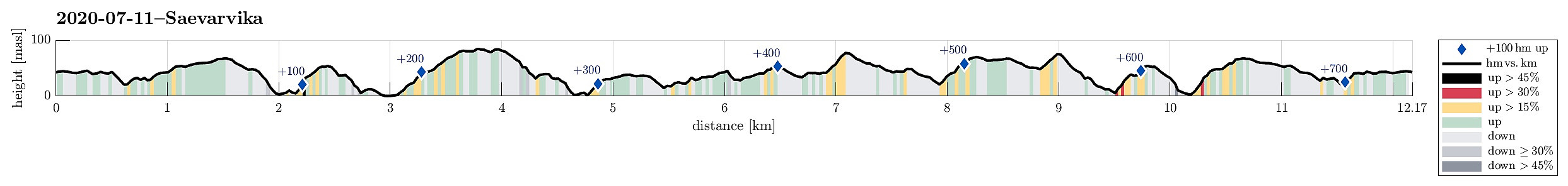
| Distanse | 12,2km |
| Høydemeter | 734m |
| GPS |
|
| Bestigninger | Brotavarden (87moh) | 11.07.2020 |
|---|---|---|
| Nipa (81moh) | 11.07.2020 |
Trip Summary
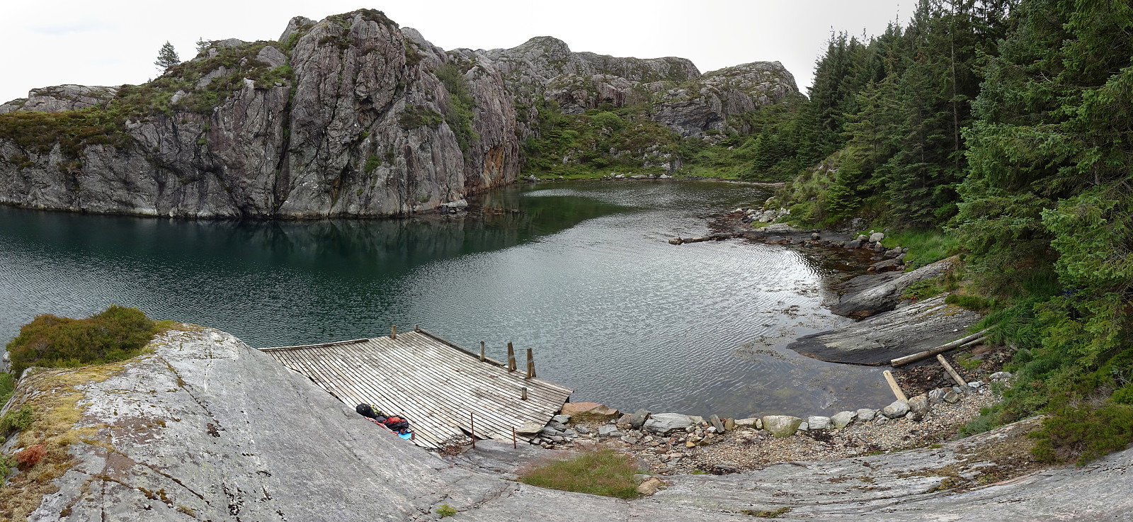
Hoping for a bit of OK weather, we aimed at the islands in the west of Bergen. Road 555 brought us to Sotra, where we turned south. Passing by Fjell and continuing along road 555 into the direction of Hammarsland, we turned right after Dalseidet, taking road 203 towards Kallestad. There, we parked right next to Grendahuset, starting our hike from there, passing by a few of the houses of Kallestad before getting "out into the wild", west of Kallestad. While the first meters past the last house are still on a kind of gravel road, this quickly changes into a nicely marked trail (Nordsjøløypen), which passes by Stølstjørna (in its southwest), then turning westwards, again, leading through a minor valley to Kjereidet. There, Kørelen (in the south) empties into Kjereidosen (in the northeast) and a little bridge eaeses the procedure towards Ryggjastykket on the other side. This time, we did not make the little detour to the "top" of Ryggjastykket, "only" passing by it on our way to Brotet. Back down to sealevel again there, we enjoyed this place for a moment, before continuing to Brotavarden. There, right next to the nice cairn on top of Brotavarden, we had a short break, enjoying a well-tasting slice of bread with pålegg! :-) After having made good use of the proper trail from Kallestad to Brotavarden, the somewhat more adventurous part of this hike started. We continued over the top of Brotavarden, in northwestern direction, aiming at descending towards Sævarvik "through the wild". The terrain north of Brotavarden is indeed a bit challenging with quite a few cliffs (not more than a few meters high -- still enough to be an obstacle, though!). With a bit of left-and-right, we made it down to the very southern end of Sævarvika, enjoying the really nice place there! In fact, half way "out" Sævarvika (on its western side), one can find a little platform (usually approach with a boat), which offers a really nice place for another break. From there, we then crossed the gentle "heights" west of Skora in northern direction to take a look at the isthmus at Kavlane -- the only place, where one (possibly) could get over to Roksneset (when not using a boat). At this moment, the weather had started to change (to rather rainy and non-warm). We quickly conlcuded that these were not the conditions under which we wanted to do an extended exploration of Roksneset. We confirmed our expectation (visually) that crossing the isthmus at Kavlane does not come without challenge, before turning back and starting our hike back. Instead of going the same way back, we decided to go a little "round", passing by Nipa, first, and then connecting to a trail that we knew from before south of it. Even though the rain did not bother us too much, we still found it "logical" to rather directly proceed towards walking back to Kallestad, once back on the trail. This brought us back to Brotet (passing by Brotavarden in its south), from where we then followed the same trail back that we had taken out first (Nordsjøløypen). This world of islands (and peninsulae), west of Kallestad (and north of Telavåg) is really nice. Quite a bit wild, with a significant bit of up and down, even though one never gets above 100mosl!
Photos
Selected photos are available as Google photo album.
Useful Resources
See also the related FB-page Hiking around Bergen, Norway.

Kommentarer