Ternneset from Kausland (21.03.2020)

| Startsted | Kausland (35moh) |
|---|---|
| Sluttsted | Kausland (35moh) |
| Turtype | Fjelltur |
| Turlengde | 3t 15min |
| Distanse | 11,8km |
| Høydemeter | 507m |
| GPS |
|
| Bestigninger | Keipen (60moh) | 21.03.2020 |
|---|

Trip Summary
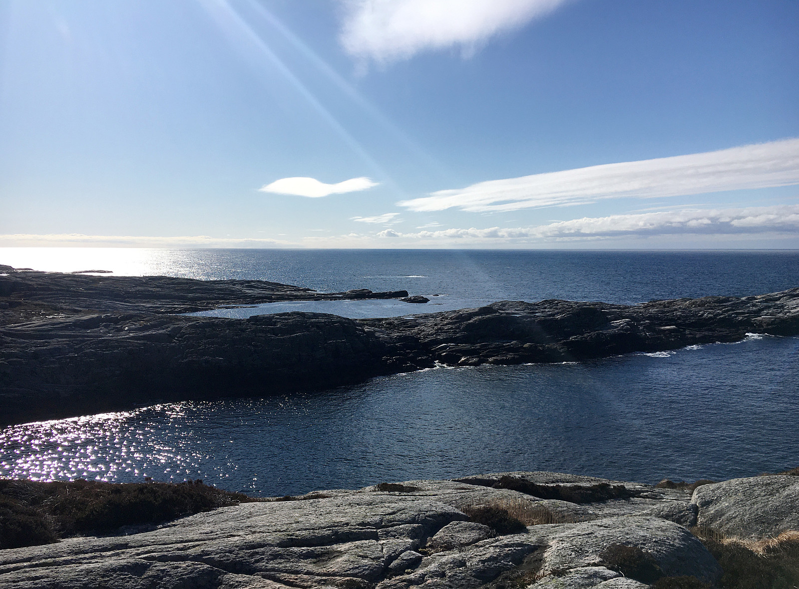
Once again, we aimed at using a nice weekend day for getting some fresh air. Since we will had fond memories of our recent hike to Brotavarden from Telavåg, we decided to once again aim for the outer islands. This time, we planned for a hike from Kausland, just a bit north of Glesvær. The idea was to connect to Goltasundet (from the east) and then hike out towards the North Altantic along it's northern shore. On Sotra, we headed towards Glesvær. Near Kausland, we then left Glesnesvegen to the right (west), before parking only a few hundreds of meters down this little side road. From there, we followed a very clear trail (more like a gravel road in the beginning), leading us westwards. Soon after, we approached Goltatjørna from its north. We first tried to round it on a "tight route", but soon understood that this did not work. Instead walking a little further around proved to work much better. The main reason for passing by Goltatjørna (on its western side) was to get to the southeast of Hølshaugen, which we had intended to include (even though we could not see any trail up there). Near Hølen, just a little south of Goltatjørna, we then left the trail and started our ascent to Hølshaugen (only a few meters up, after all). The terrain is a bit challenging, but altogether it's really no problem to get to the "top"). From Hølshaugen, as expected, one can have some nice views in all directions! Next, we wished to "collect" three little bumps just a little north of Goltasundet, including Litlehaugen and Keipen. The original idea was to try and descent from Hølshaugen in southwestern direction (through a narrow and steep gully). After inspecting the situation from close by, we however decided that this descent looked too challenging, after all. So instead, we followed a higher route (further north) and connected to our next goals without any challenges only shortly after (if meeting a snake is a "challenge", then we had this one along the way). After making a small detour to Keipen, which is a small landmark, we reconnected with the main trail towards Ternneset. This trail is nice and easy to find and we ended up at the outer end of Ternneset within short time. There, we really enjoyed some very nice views, feeling the wild North Atlantic very close. Next, we followed the trail (now in northern direction), descending steeply from Ternneset only about 100m north of the outermost point. Back down, north of Ternneset, we continued and found ourselves within Slumpen after only a short hike. Following Slumpen out towards the sea, with close cliff-sides on either side, is a special feeling. The idea that more water could come in, for example, due to high tide or wind, is not fully comfortable (knowing that one cannot get out easily). Also, the trail trough Slumpen is not perfectly marked, so at times one is wondering to which extent one must follow this trough out (and it's quite a bit, maybe 200m). Once on the other, northern side of Slumpen, we continued further northwards (into the direction of Grunnevågen). There, we then started to turn around and start our hike back, diagonally into the direction of Goltatjørna. Before really starting into this diagonal trail back, we first enjoyed from very nice moments near Sanvikvatnet! Since time was short, however, we then proceeded quickly and crossed back southwards rather rapidly. Along the way, we came by some quite old telephone line posts that were accompanied with a little info plate telling their story from the beginning of the 20th century. Not far from them, we then came by Lauvvatnet (at Vassvika), enjoying some nice views (in particular of Lauvholmen in the middle of Lauvvatnet). From there, it was then quick (and easy) to get back to our car. After all, we really were very satisfied with this wonderful day (lots of sun and wild nature).
Photos
Selected photos are available as Google photo album.
Useful Resources
See also the related FB-page Hiking around Bergen, Norway.
Web page UT.no from the Norwegian Trekking Association recommends a similar hike.

Kommentarer