Lyderhorn (01.03.2020)

| Startsted | Lyderhornslien (100moh) |
|---|---|
| Sluttsted | Lyderhornslien (100moh) |
| Turtype | Fjelltur |
| Turlengde | 1t 30min |
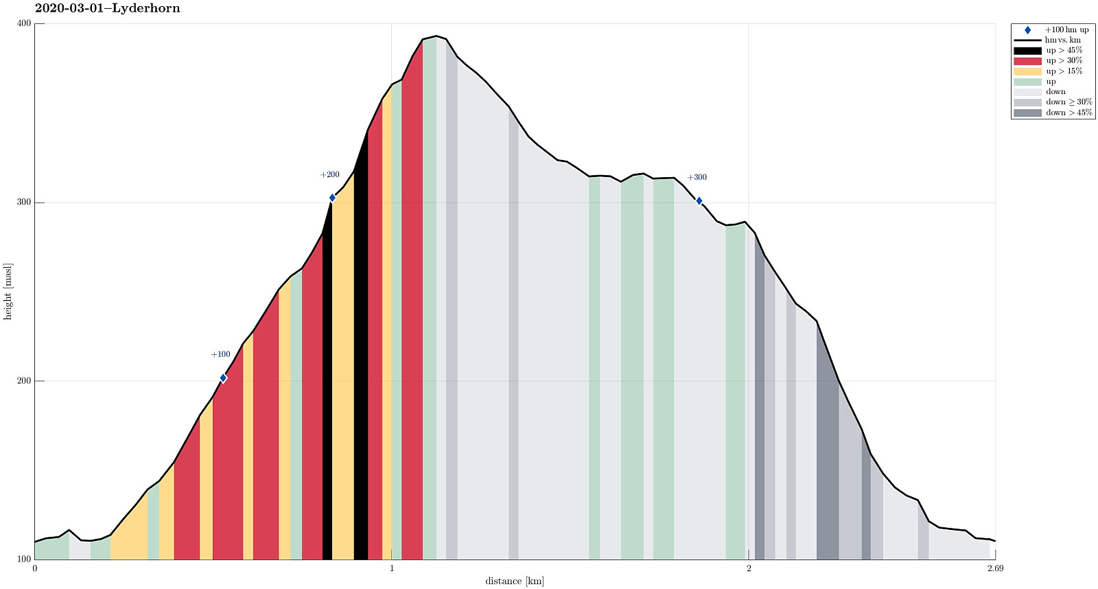
| Distanse | 2,7km |
| Høydemeter | 307m |
| GPS |
|
| Bestigninger | Lyderhorn (396moh) | 01.03.2020 |
|---|
Trip Summary
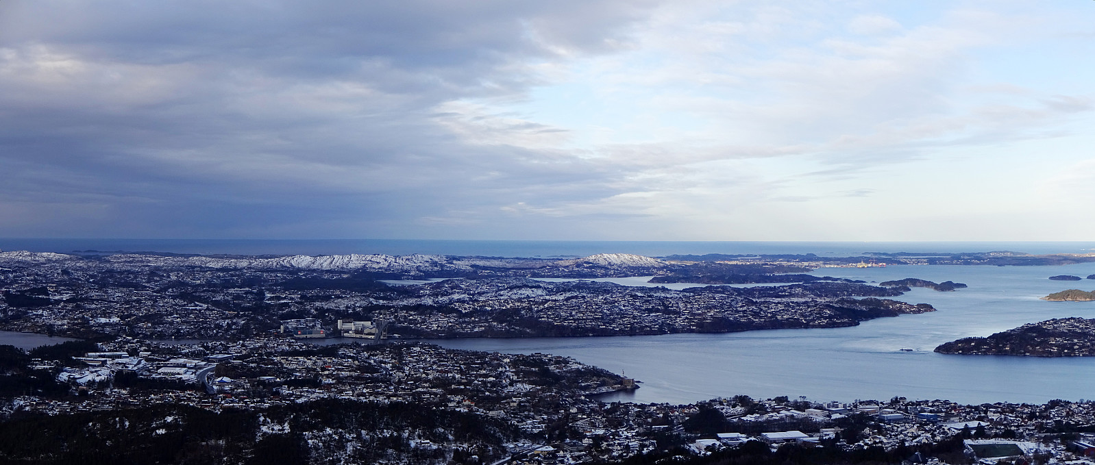
We needed some fresh air and since time was limited, we chose a nearby goal: Lyderhorn! We parked near Kjøkkelvik school and followed the main trail upwards from there (along a minor ridge which lead into southeastern direction, towards Små-Lyderhorn. From this intermediate point, it's then straight upwards (in northern direction up the steep side of Lyderhorn). Due to low temperatures (and limited time), we continued more or less directly across the top of Lyderhorn, aiming at the other, minor path down to where we started. As already once (at least) before, we missed, however, the point, where this minor path deviates from the main trail (towards north from Lyderhorn) -- the matter of fact that "everything" was covered by snow did not help to see, where this trail left. Something like 150m to far north (and understanding that we had missed the trailhead) we decided to see whether we could not connect back to this trail from where we were. There are some pretty steep sides at the western side of Lyderhorn, so some caution is recommended. Fortunately, no really difficulty occurred and within a few minutes we were "back on track". Still, it was good to (at least from there!) remember, where the trail went (since it wasn't really to see under all the snow). All in all, it was good to get out and to inhale some fresh winter air on Lyderhorn! :-)
Photos
Selected photos are available as Google photo album.
Useful Resources
See also the related FB-page Hiking around Bergen, Norway.
Web page WestCoastPeaks.com provides useful information about Lyderhorn and Ørnafjellet
and also Petter Bjørstad has a page about Lyderhorn.
On Bergentopp 200 there is a page (in Norwegian) about Lyderhorn.

Kommentarer