Along Sælevatnet (12.03.2017)

| Startsted | Varden (45moh) |
|---|---|
| Sluttsted | Varden (45moh) |
| Turtype | Spasertur |
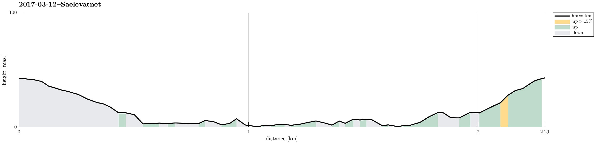
| Turlengde | 0t 45min |
| Distanse | 2,3km |
| Høydemeter | 82m |
| GPS |
|
| Andre besøkte PBE'er | Skitnakastet (0moh) | 12.03.2017 |
|---|
Note that this track has been created from memory, i.e., it was not recorded automatically.
Trip Summary
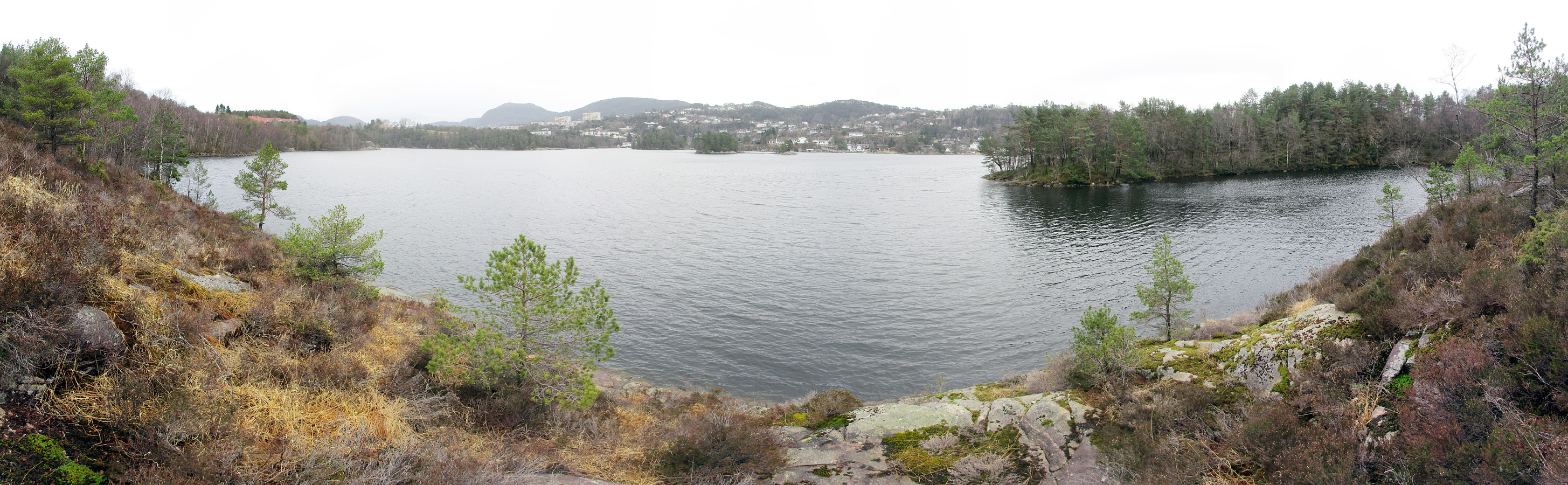
I started from Varden and got down from Vardeveien to Fyllingsdalsveien near the bridge, which crosses over Fyllingsdalsveien from Vardeveien (and over to Skitnakastet). After crossing Fyllingsdalsveien, I quickly descended towards Sælevatnet. Then, I followed the shoreline, first in southern direction, following the outer edge of this small peninsula, separated from "the rest of the world" by Fyllingsdalsveien. After having completed this surrounding, I got back to Skitnakastet, where I took the small bridge back to Vardeveien. From there, it was then only a few meters back to the start.
Photos
Selected photos are available as Google photo album.
Useful Resources
See also the related FB-page Hiking around Bergen, Norway.

Kommentarer