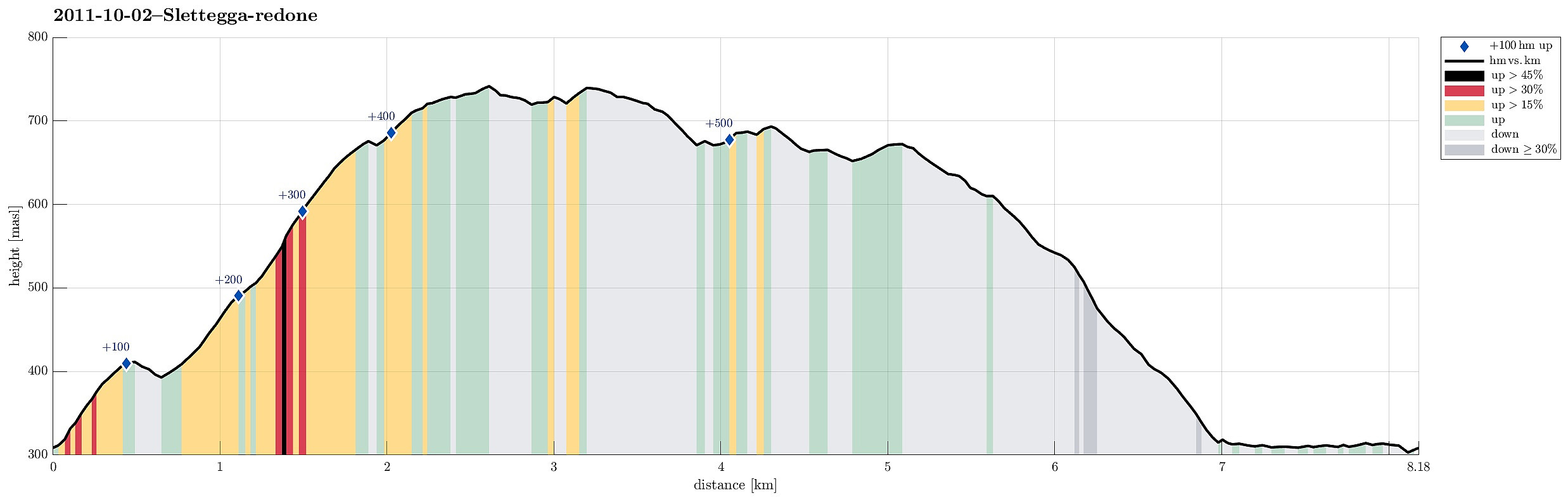
Slettegga (02.10.2011)

| Startsted | Gullfjellsvegen (310moh) |
|---|---|
| Sluttsted | Gullfjellsvegen (310moh) |
| Turtype | Fjelltur |
| Turlengde | 3t 00min |
| Distanse | 8,2km |
| Høydemeter | 568m |
| GPS |
|
| Bestigninger | Slettegga (742moh) | 02.10.2011 |
|---|---|---|
| Andre besøkte PBE'er | Heniehytten (ruin) (313moh) | 02.10.2011 |
| Osavatnet p-plass (kr) (310moh) | 02.10.2011 |

Note that this track has been created a posteriori, i.e., from memory, not automatically recorded.
Trip Summary
Nice trip up to Slettegga (and down again).

Kommentarer