Olsokfjellet, Damsgårdsfjellet, and Gravdalsfjellet (06.06.2015)

| Startsted | Betanien (90moh) |
|---|---|
| Sluttsted | Betanien (90moh) |
| Turtype | Fjelltur |
| Turlengde | 1t 40min |
| Distanse | 5,8km |
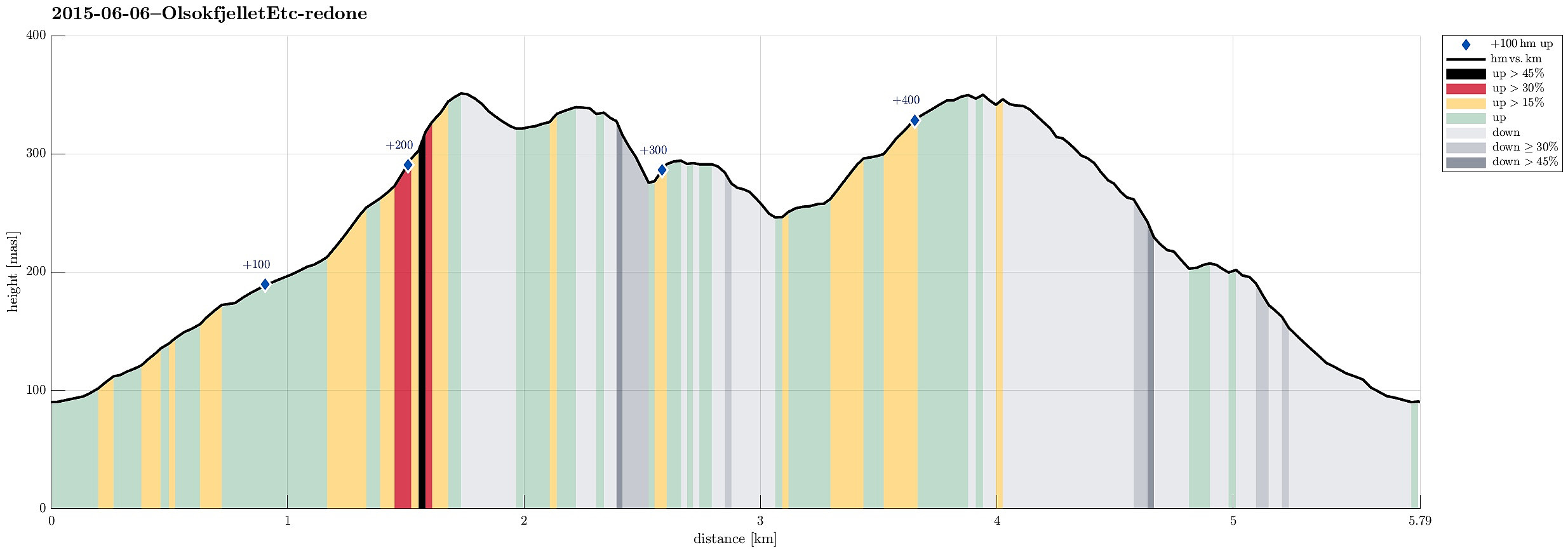
| Høydemeter | 453m |
| GPS |
|
| Bestigninger | Damsgårdsfjellet (344moh) | 06.06.2015 |
|---|---|---|
| Gravdalsfjellet (353moh) | 06.06.2015 | |
| Olsokfjellet (353moh) | 06.06.2015 | |
| Andre besøkte PBE'er | Brattheim (266moh) | 06.06.2015 |
| Furuly (ruin) (188moh) | 06.06.2015 | |
| Byste C. G. Sundt (210moh) | 06.06.2015 | |
| Lykkero (ruin) (200moh) | 06.06.2015 | |
| Nordnæsdalen parkering (192moh) | 06.06.2015 | |
| Steinhytten (ruin), Kanadaskogen (220moh) | 06.06.2015 | |
| Viggohytten (305moh) | 06.06.2015 |
Trip Summary
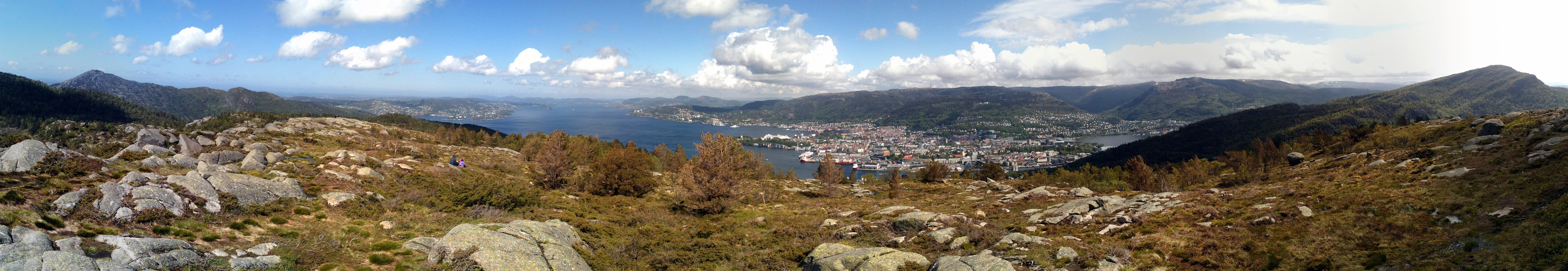
Starting from Betanien, we first connected to Nordnæsdalsveien (via Jonstadveien), before we turned right, shortly after passing the boom, then following a nice path that lead us up to Olsokfjellet (from the south). From Olsokfjellet, we connected to Damsgårdsfjellet, and from there we continued in a westerly direction, descending (steep!) to Skaret. Up on the other side, we crossed Holefjellet and continued towards Nygårdsnipa. Changing more and more into a southerly direction, we ascended Gravdalsfjellet (from the north). Continuing our round, we passed by Viggohytten -- or what remains now, after the hut burned down, recently! From there, mostly heading eastwards, we quickly connected back to Vestlund and to Betanien. All in all, a nice easy hike in beautiful summer weather! :-)
Useful Resources
Web page WestCoastPeaks.com provides useful information about Løvstakken as well as useful information about Olsokfjellet, Gravdalsfjellet, and Damsgårdsfjellet.

Kommentarer