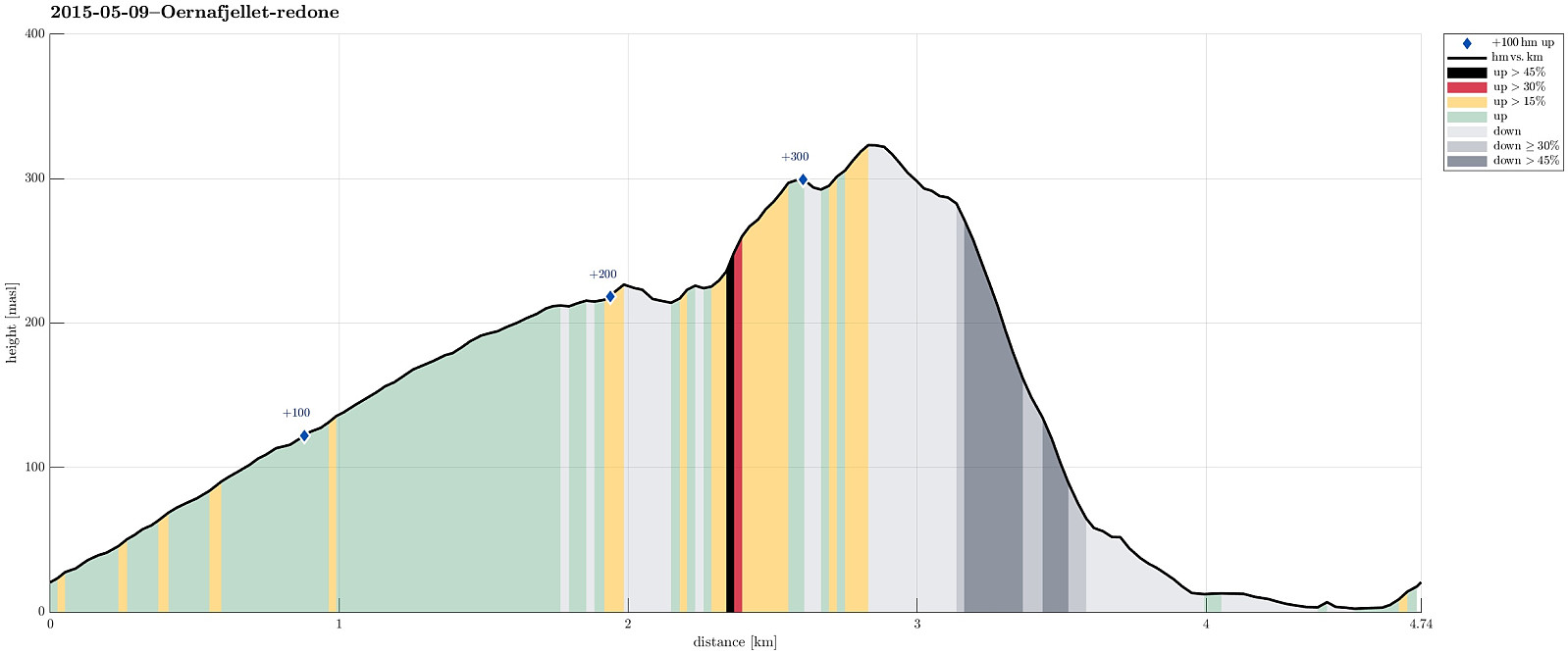
Ørnafjellet i Bergen (09.05.2015)

| Startsted | Nutec (20moh) |
|---|---|
| Sluttsted | Nutec (20moh) |
| Turtype | Fjelltur |
| Turlengde | 2t 00min |
| Distanse | 4,7km |
| Høydemeter | 366m |
| GPS |
|
| Bestigninger | Ørnafjellet (329moh) | 09.05.2015 |
|---|---|---|
| Ørnafjellet Nord (304moh) | 09.05.2015 |
Trip Summary
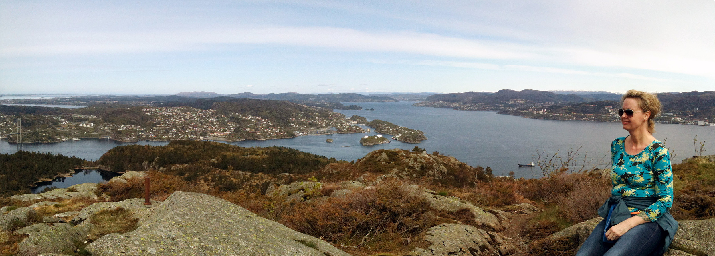
We parked north of Gravdal (near Nutec) and followed the road up the northern slope of Lyderhorn (until where it enters the military area). We then followed the path along the southern fence of this area, heading southeast towards Ørnafjellet. From the top of Ørnafjellet, we enjoyed the views over Byfjorden (to the north) and to Lyderhorn and Damsgårdsfjellet (to the south and east). We then aimed at finding the path down the eastern slope of Ørnafjellet, directly to Gravdal, but we left the path, which we had taken up Ørnafjellet much too early. This made us descend through a moderately steep forest (without any path). While doable, this part was not most enjoyable and it should be recommended to follow the actual path downwards. Once down in Gravdal, we returned to the car along the road. All in all, this was a short but nice little hike! :-)
Useful Resources
Web page WestCoastPeaks.com provides useful information about Lyderhorn and Ørnafjellet.
Web page SpillBy.com describes Ørnafjellet and
web page FotTurer.com describes a tour up Ørnafjellet.

Kommentarer