Tennebekksnipa (12.04.2015)

| Startsted | Lyderhornsveien (25moh) |
|---|---|
| Sluttsted | Lyderhornsveien (25moh) |
| Turtype | Spasertur |
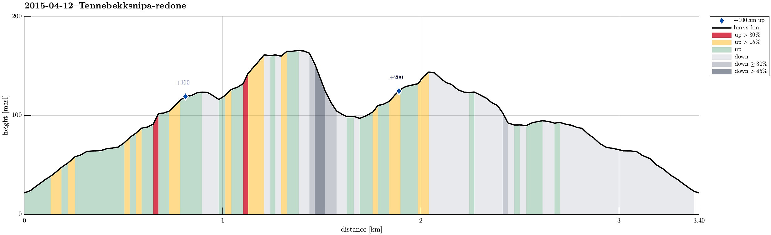
| Turlengde | 1t 00min |
| Distanse | 3,4km |
| Høydemeter | 232m |
| GPS |
|
| Bestigninger | Tennebekksnipa (169moh) | 12.04.2015 |
|---|---|---|
| Andre besøkte PBE'er | Tjørnagrind (96moh) | 12.04.2015 |
Note that this track has been created a posteriori, i.e., from memory, not automatically recorded.
Trip Summary
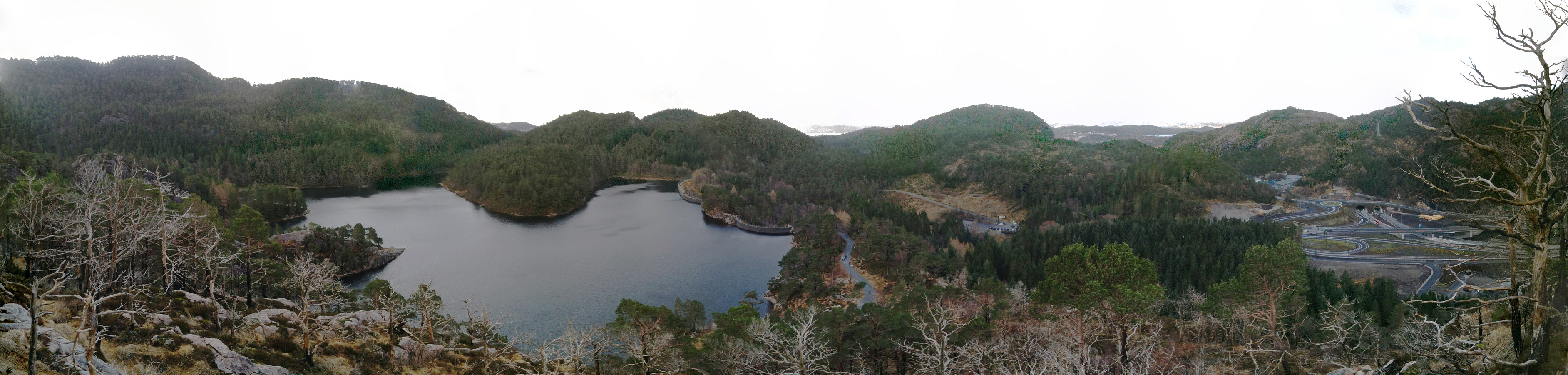
Starting from Lyngbø, we first walked up the street through Lyngbødalen, up to the dam of Skitnetjørna. From there, we followed the ridge, before we crossed over and ascended to Tennebekksnipa from north. We enjoyed nice views of Lyderhorn and Tennebekktjørna. We descended to Tennebekktjørna, before we returned, following the path through Trongedalane. Before going down, again, on this path, we turned right and up the ridge, again, from which we descended to see Skitnetjørna (which we followed on its western side, back to the dam). All in all, a "small is beautiful" tour! :-)
Photos
Selected photos are available as Google photo album.

Kommentarer